Mt. Ulap Traverse Dayhike Guide
Background
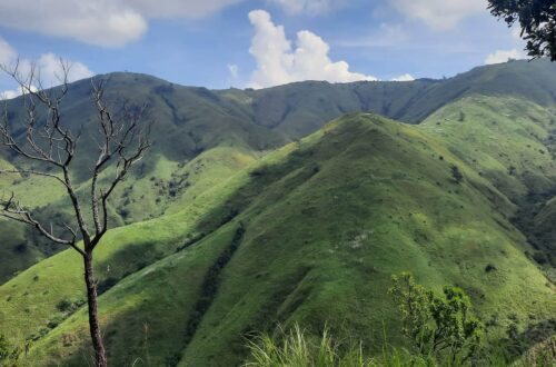
Mt. Ulap is located in Itogon, Benguet. It is one of the most visited mountains in the Philippines. It offers scenic views of the Cordillera mountain range and it is often called mini Mt. Ugo because it provides the same view of pine ridges similar to its counterpart. Mt. Ulap has a height of 1846 meters above sea level or 6056 feet. The jump-off point of Mt. Ulap is just 45 minutes drive from Baguio City and because of its closeness to Baguio City, it becomes a perfect day hike for hikers and mountaineers seeking peace of mind with mother nature.
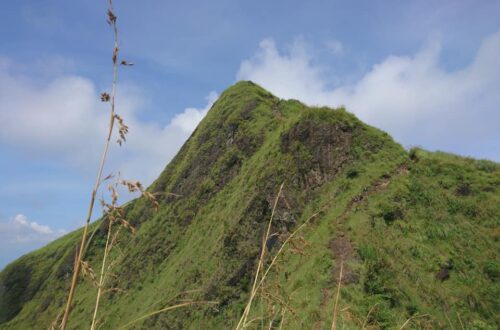
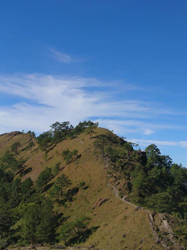
Mt. Ulap is one of the most photogenic mountains in the Philippines. The most famous spot in Mt. Ulap is the Gungal Rock Formation, it’s the rock formation with great views that made the mountain prominent for its picture-perfect shots. In addition, the mountain was called Mt. Ulap because, at the summit, the clouds literally kiss and touch the mountains. Hikers can feel and touch the sea of clouds at the top of the mountain. Hence Mt. Ulap is the name of the mountain.
In the past years, because the mountain has gone viral across social media platforms, Mt. Ulap got featured in popular travel shows such as Kapuso Mo Jessica Soho and Brigada. Also, Mt. Ulap’s cool weather and amazing beauty it showcases have also spread to other parts of the world.
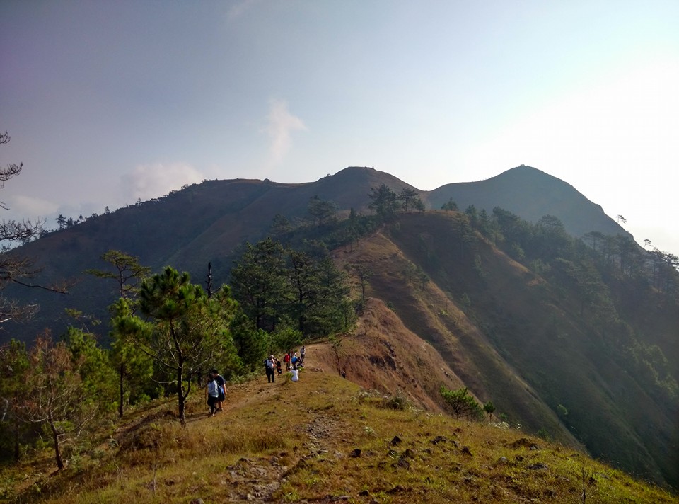
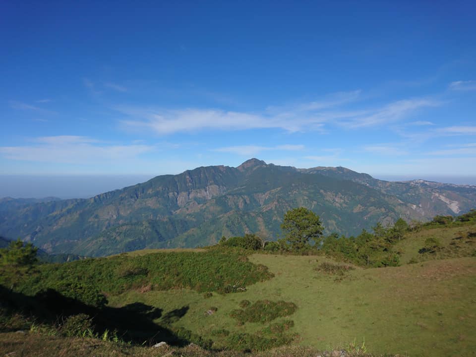
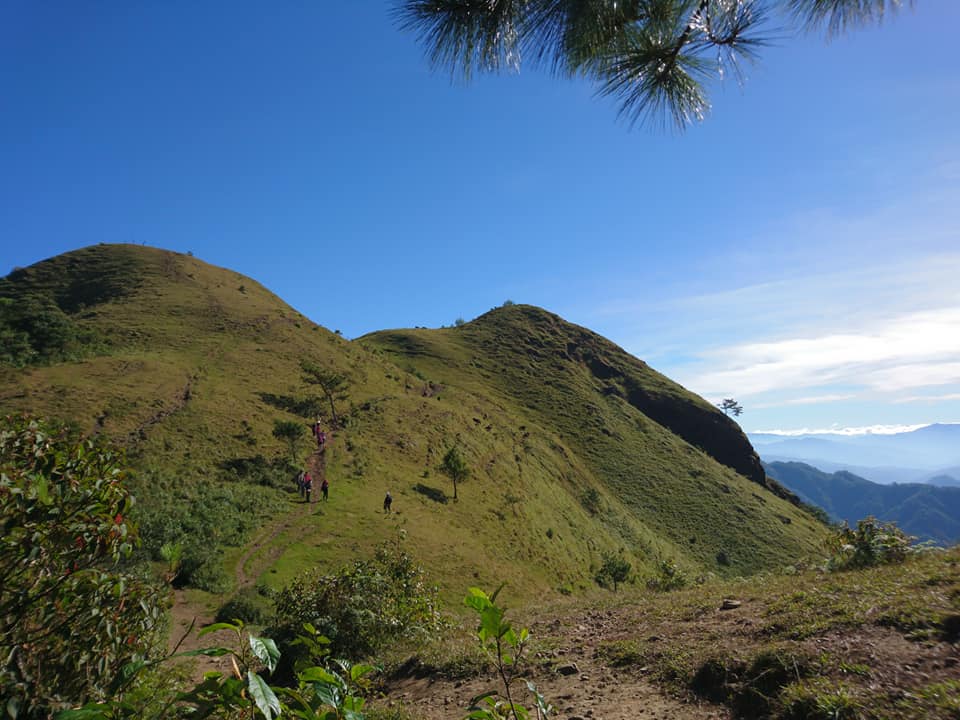
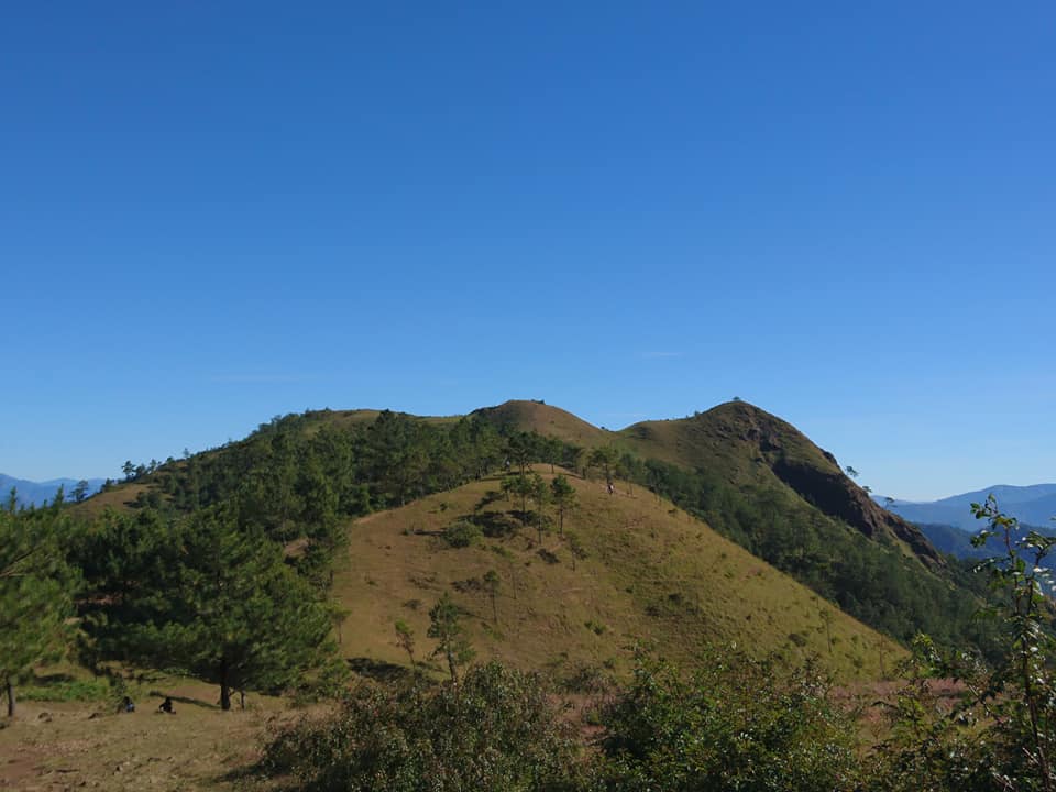
Mt. Ulap is a scalable mountain throughout the entire year and it has three well-known peaks. The first peak is Ambanao Paoay which has an elevation of 1788 meters above sea level. The second peak is Gungal Rock stands at 1814 meters above sea level and the third is the summit which has an elevation of 1846 meters. Ascend through its peaks and it will provide you breathtaking views of the sea of clouds, pine tree ridges, grassland slopes, burial caves, and mountain range in Benguet.
Name: Mt. Ulap
Difficulty: 3/9
Elevation: 1846 MASL
Hours to summit: 3 to 4 hours
Jump-Off: Barangay Ampucao, Itogon, Benguet
Exit point: Barangay Santa Fe, Itogon, Benguet
Features: Gungal Rock formation, pine ridges, rolling grassland, open trail, burial caves, hanging bridge, and the spectacular view of the Cordillera mountain range and landscape
My hiking adventure to Mt. Ulap
I was scrolling on my social media account when suddenly an image of the stunning rock formation with a picturesque mountain view appeared on my newsfeed. For this reason, I searched on the internet where is the image located and I found out it was situated in Mt. Ulap in Benguet province. Also, I’ve never been to Baguio before since I was a child.
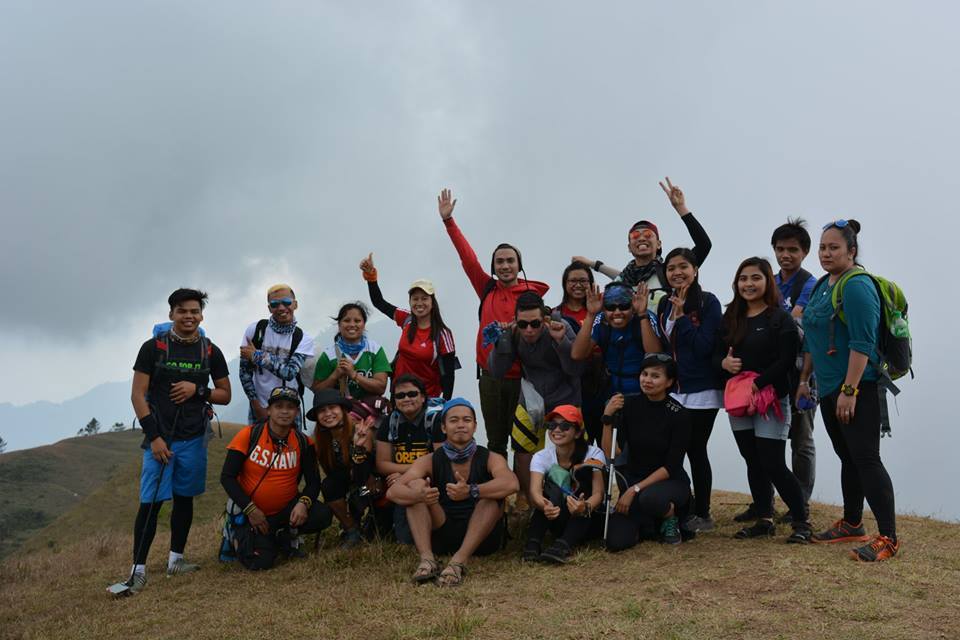
So one day, I decided to join an organized trip going to Mt. Ulap with a side trip to Baguio City. The organizer named Hannah gave me the whole itinerary and expense for the event and I immediately prepared the things that I will bring in the hike. This is actually the first time that I will join an organized trip and I don’t know if I will feel out of place during the whole trip. Nevertheless, I’m so delighted and excited about the upcoming trip.
I observed the itinerary in our group chat and I arrived at the assembly place at Jollibee Farmers Cubao at 11 pm. After all the members in the group chat finally arrived at the meeting place, our van left Cubao and headed to Benguet. At 2:30 am we have our stopover at the sought-after Leeza’s Restaurant. We have our early breakfast at the restaurant and I ordered some noodles and eggs for my breakfast.
Afterward, our van left Pangasinan and continue heading towards our destination which is Mt. Ulap. On our way, I wanted to sleep in the van but the feeling of seeing the night view of Baguio City again makes my body awake the whole time. Also, I found out that the other member I joined with is a solo-joiner so this is a good sign for me.
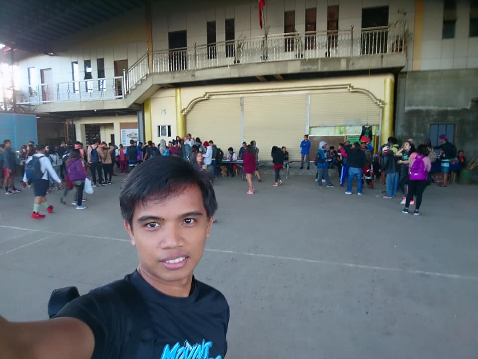
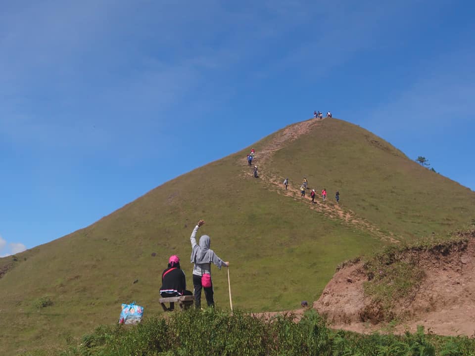
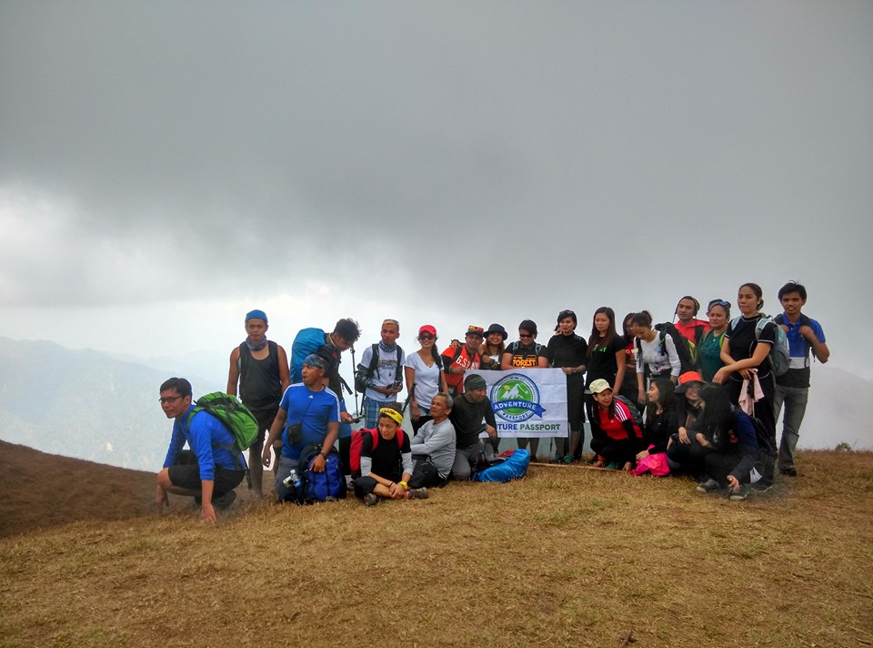
After five hours of smooth land travel, we arrived at Barangay Ampucao, Itogon, Benguet which is the main jump-off point of Mt. Ulap’s traverse hike. At the jump-off, I noticed that there were so many hikers and mountaineers who want to hike Mt. Ulap too. Our coordinator told us that on weekends and holidays the number of hikers can go up to 500 per day which is truly astounding.
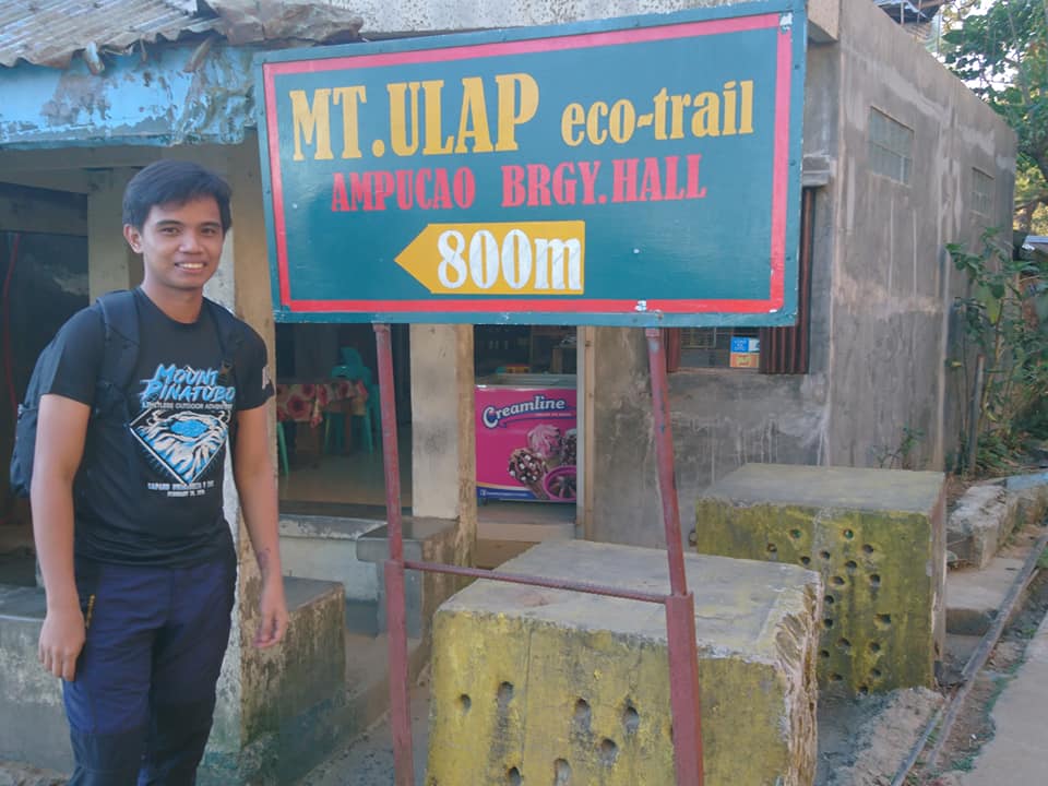
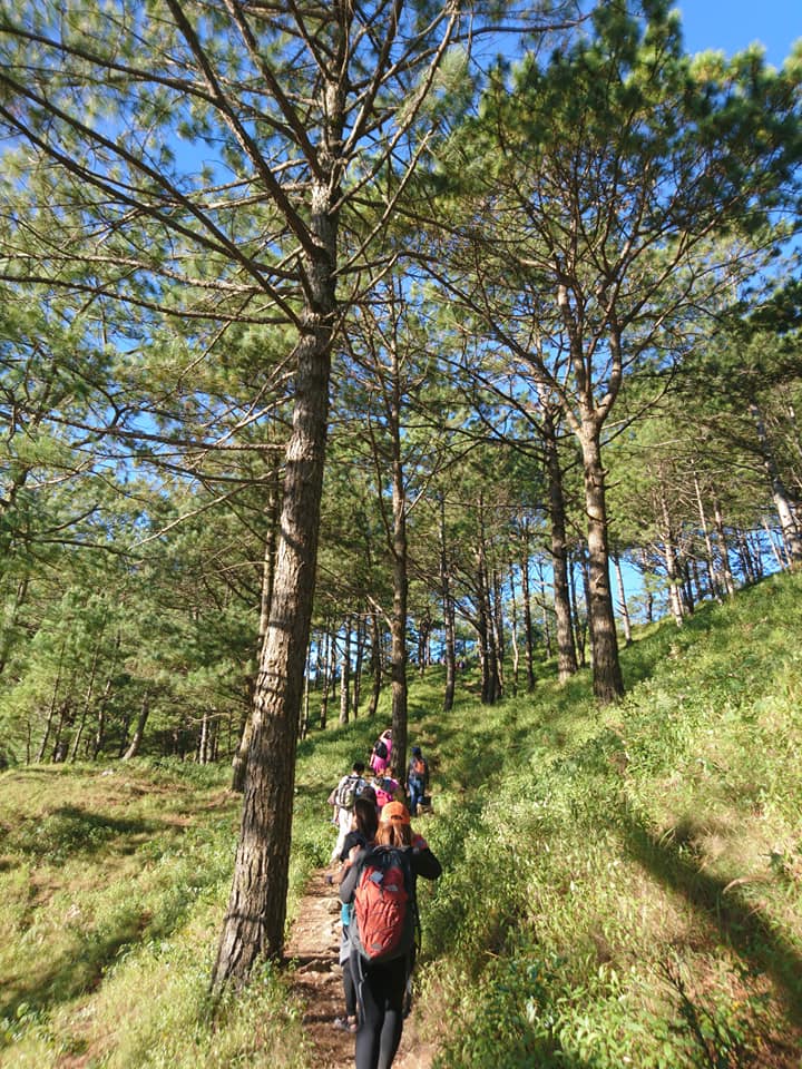
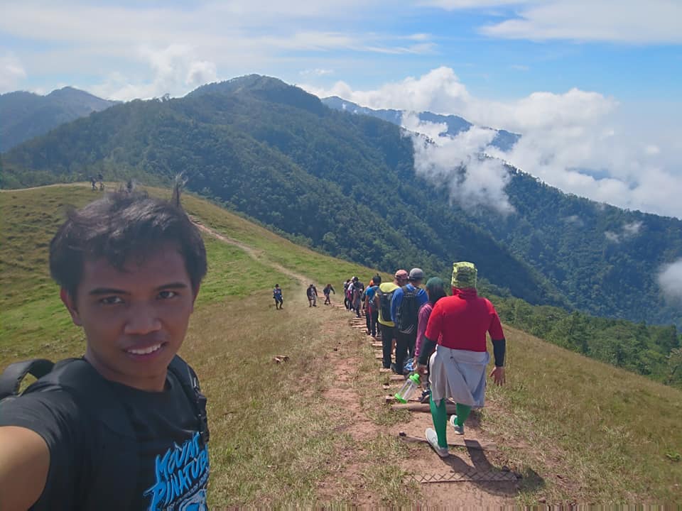
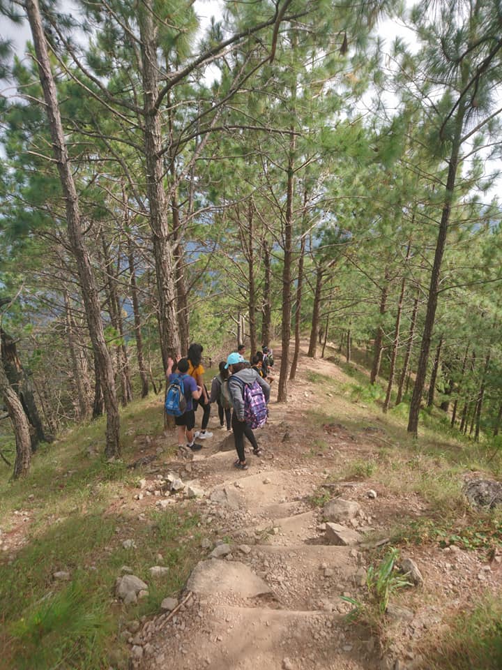
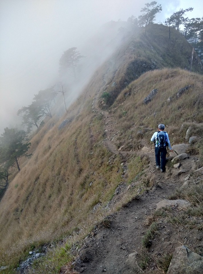
Then our group registered secured the guide, and have the mountain trail briefing. Moments later we started praying to God to guide us and we commenced the hike around 5:30 am. The place is still dark when we started hiking. From the barangay hall, the initial portion of the trail runs on a cemented pathway that leads to the forest. After twenty minutes of walking, we arrived at the viewpoint site.
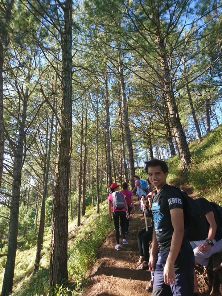
We take a quick rest and we snap photos of the scenic dawn sky. I love the view. Also at this place, souvenir items can be bought here so other members of the group don’t hesitate to buy key chains, t-shirts, and caps. As we continued our hike in the pine-forested trail, the weather becomes cooler and I can hear and feel the strong gush of the wind which makes the hike more refreshing. Our group had to stop along the trail to snap photos of the beautiful surrounding.
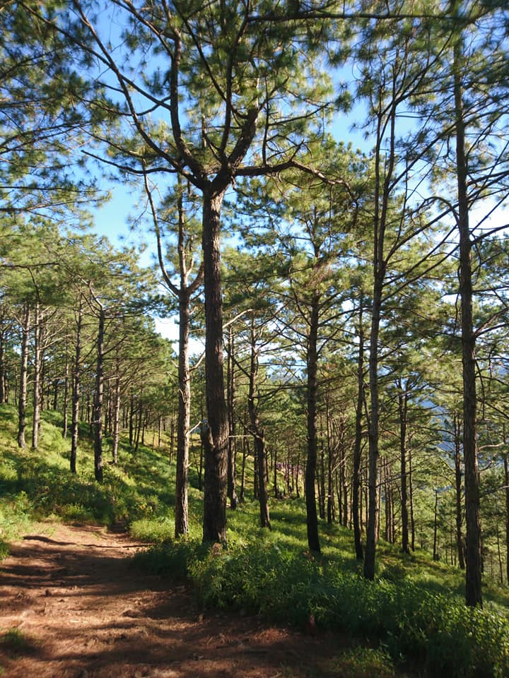
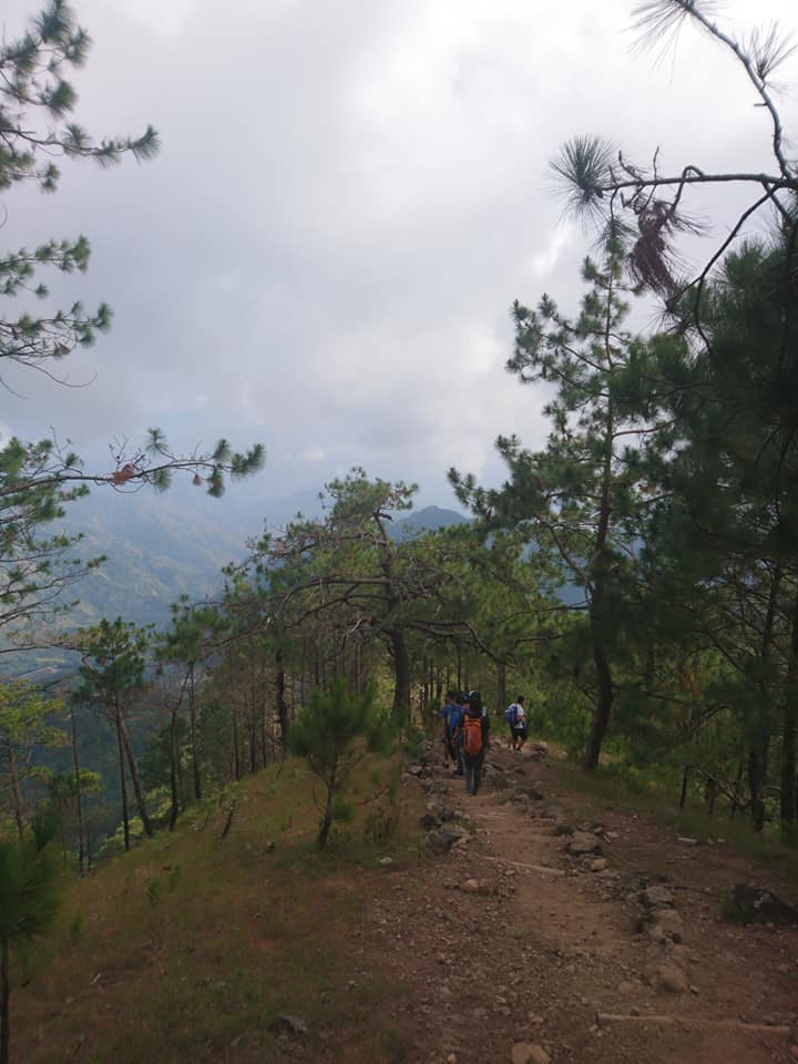
Then the sun continues to rise and gives a clear view of the landscape and mountain ranges. I was stunned by the beauty of nature. The view is magical. In any direction I look is an amazing view. It is one of the best sunrises I’ve ever witnessed. The bright ray of the sun passing through the tall pine trees is a spectacular sight to behold. Also, the breathtaking endless mountain view is amazing to witness with my own two eyes. As a result, I can stop taking so many photos as a souvenir of this majestic place.
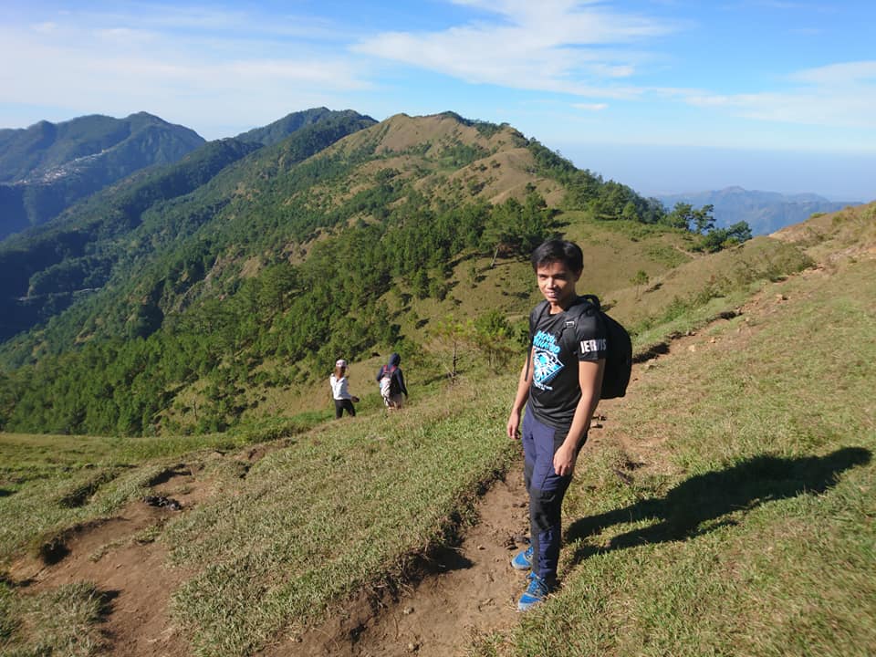
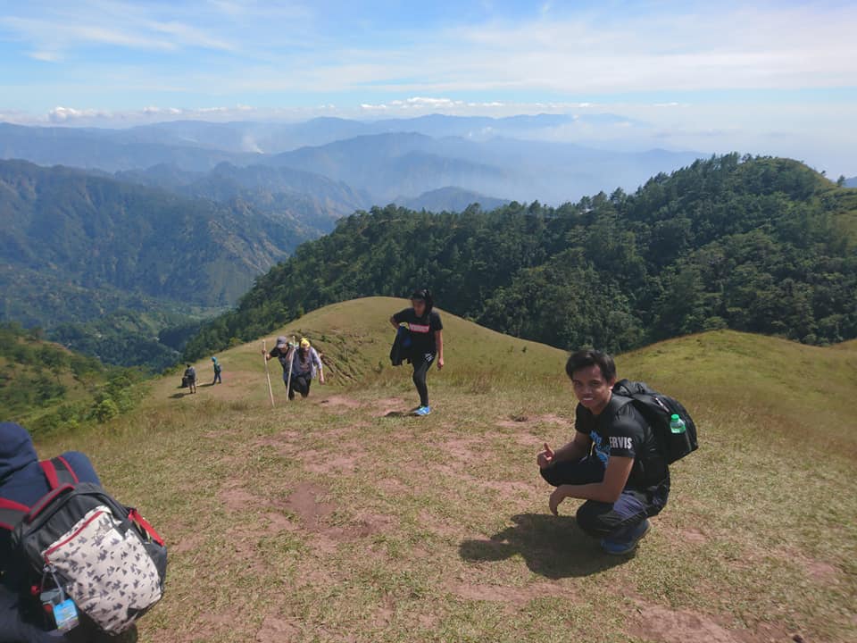
After everyone in the group was done taking pictures, we continue the hike going to the first peak named Ambanao Paoay. While hiking I felt the refreshing cool breeze blowing, as a result, I am not feeling tired throughout the trail. We reached the first peak after one hour and twenty minutes of hiking.
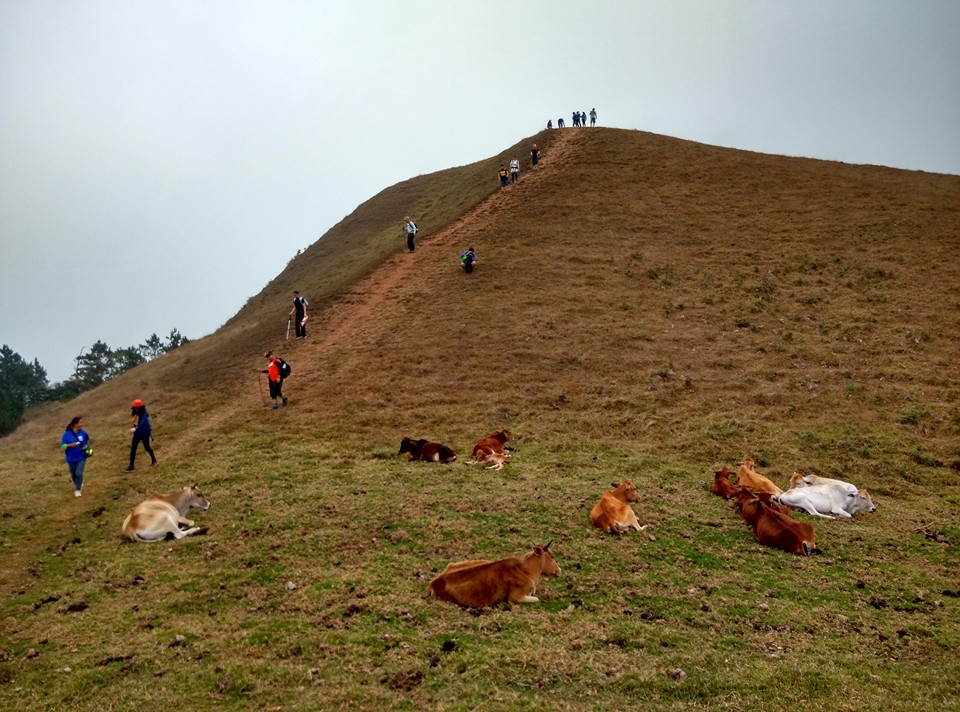
According to our local tour guide, Ambanao means broad and Paoay means grassland. He expound to us that early immigrants here were Kalanguya people, who arrived from Kalasan, a spot near the Ifugao province during the second world war. Definitely, our local guides are very informative to us. Then I noticed that the place does not only provide a beautiful wide grassland but a scenic view of mountains in the Cordillera region. On the other hand, we saw some foreigners hiking too.
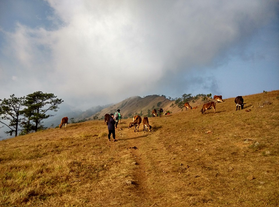
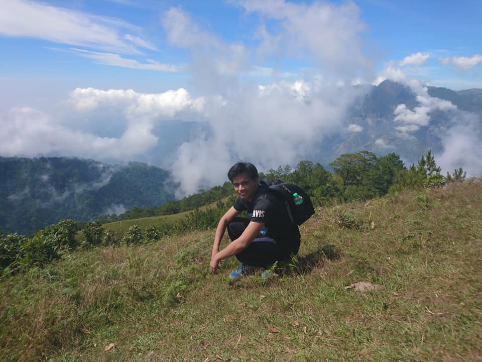
From this place, our group also encountered a flock of cows grazing in the vast grassland area. For this reason, I feel like I was in New Zealand because of the beautiful scenery and superb view. Then I recall the song in my head all things bright and beautiful, all creatures great and small, all things wise and wonderful the Lord God made them all, the sunset and the morning that brightens up the sky. Mt. Ulap is simply fascinating. Also from this viewpoint, I can see the well-known San Roque Dam.
In my opinion, this is the perfect place to chill and relax while connecting yourself to mother nature. It is super worth it. After thirty-five minutes of chilling and enjoying the view, we resume our hike. The sun is already high at that time so some members of the group open their umbrellas and start wearing caps to protect themselves from the scorching heat of the sun. In spite of few trees to offer us shade, we keep walking at a moderate face under the blistering heat until we finally reach our next destination.
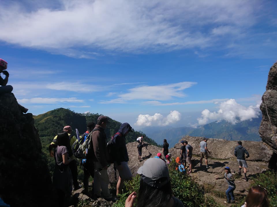
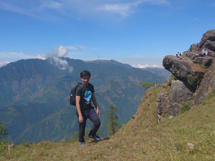
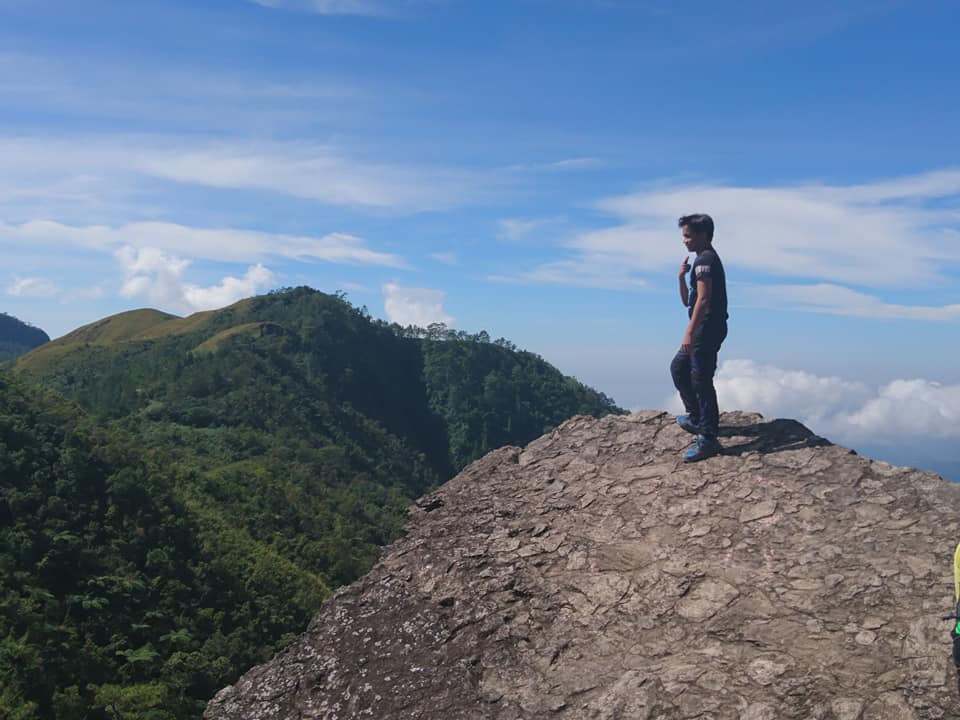
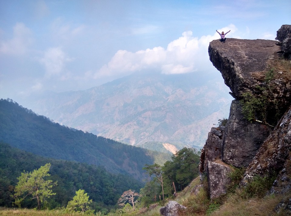
Then at 10 am we reached the famous Gungal Rock formation. We can see lots of hikers waiting for their turn to take pictures at the Gungal Rock. Then our local tour guide told us that we need to wait for our turn. For this reason, some of the members eat their snacks, snap photos of the surroundings and take a nap while waiting for our turn. Furthermore, I just noted myself never hiking Mt. Ulap again on weekends because it’s too crowded. The queuing lines are quite long already.
Also while resting I noticed that some hikers couldn’t stand on the edge of Gungal Rock formation, some are nervous and have a fear of heights. Also, one member of the group flew his drone to capture the vast area of Mt. Ulap.
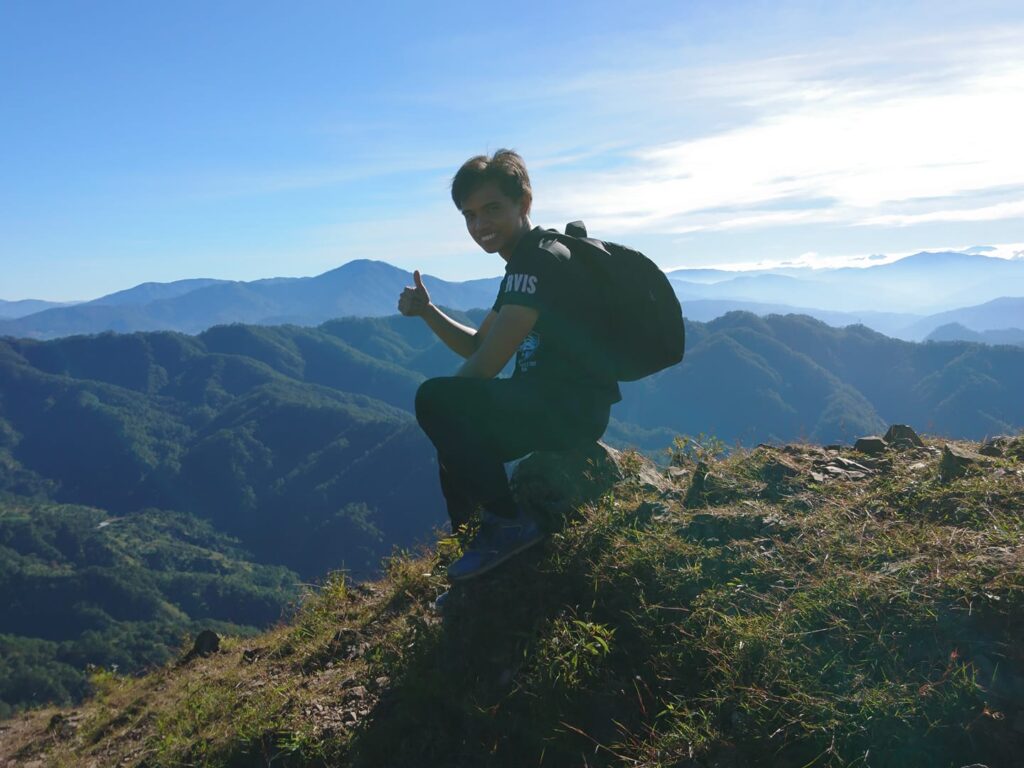
Then after forty-five minutes of waiting, we finally have a chance to take individual photos at the rock formation. The feeling of standing on the Gungal Rock formation is incredible. It was first a fantasy but has now become a reality. However, it took us only several minutes to take photos and videos because there is a timer set but we are fortunate enough to have a wonderful clearing. Without a doubt, hiking is the best exercise and adventure.
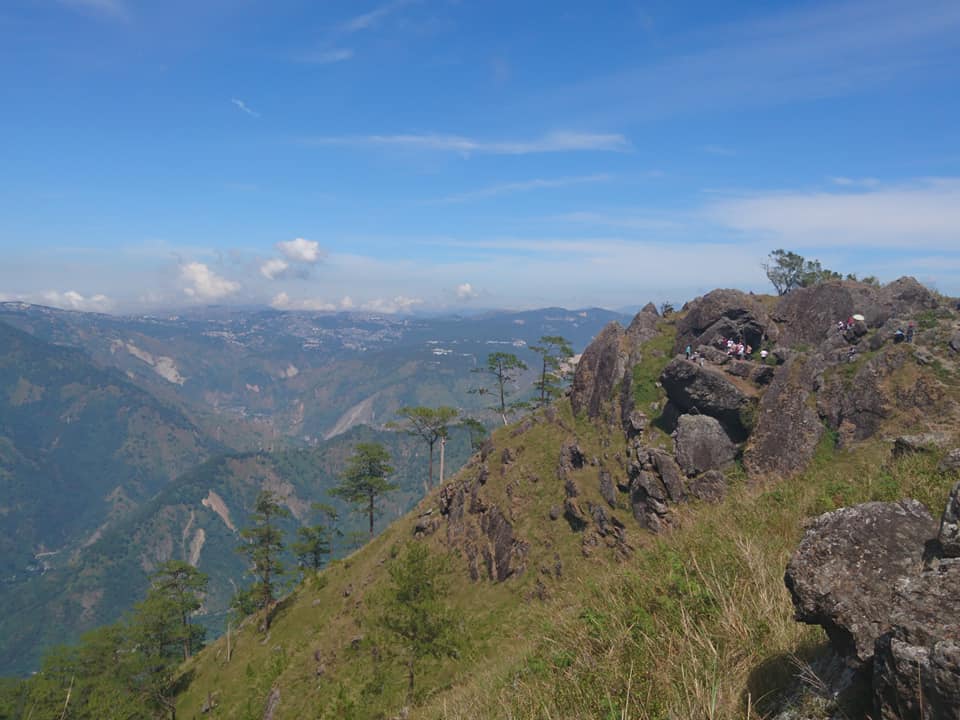
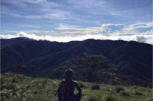
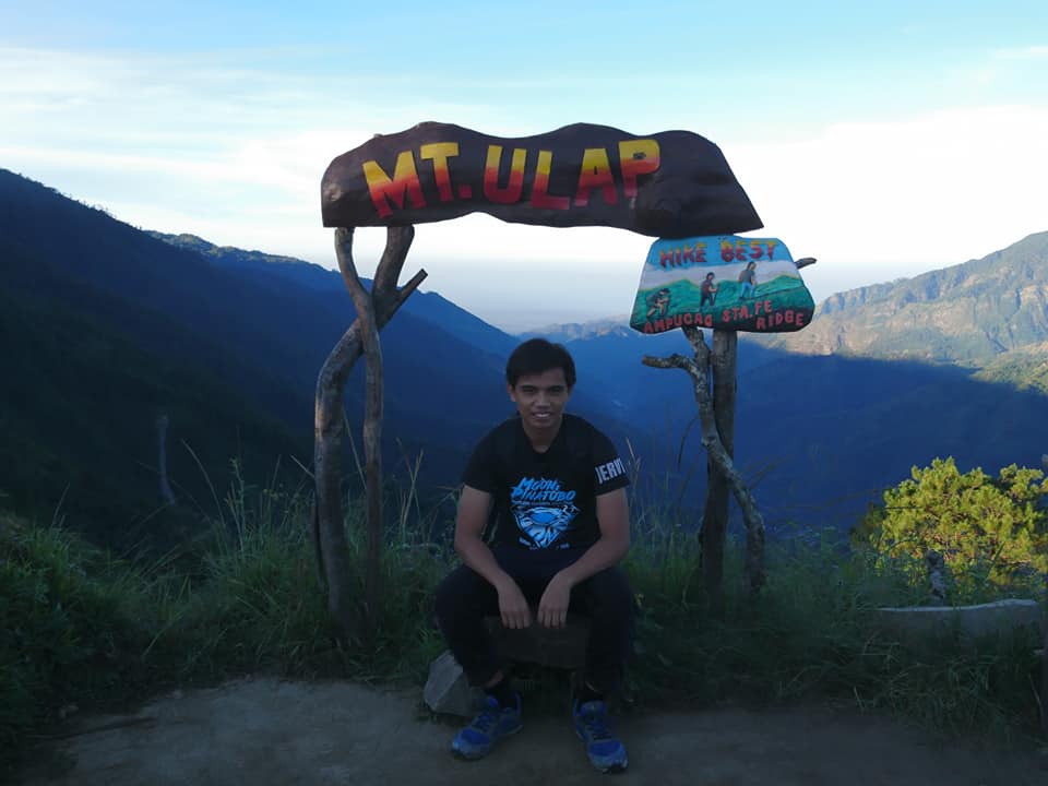
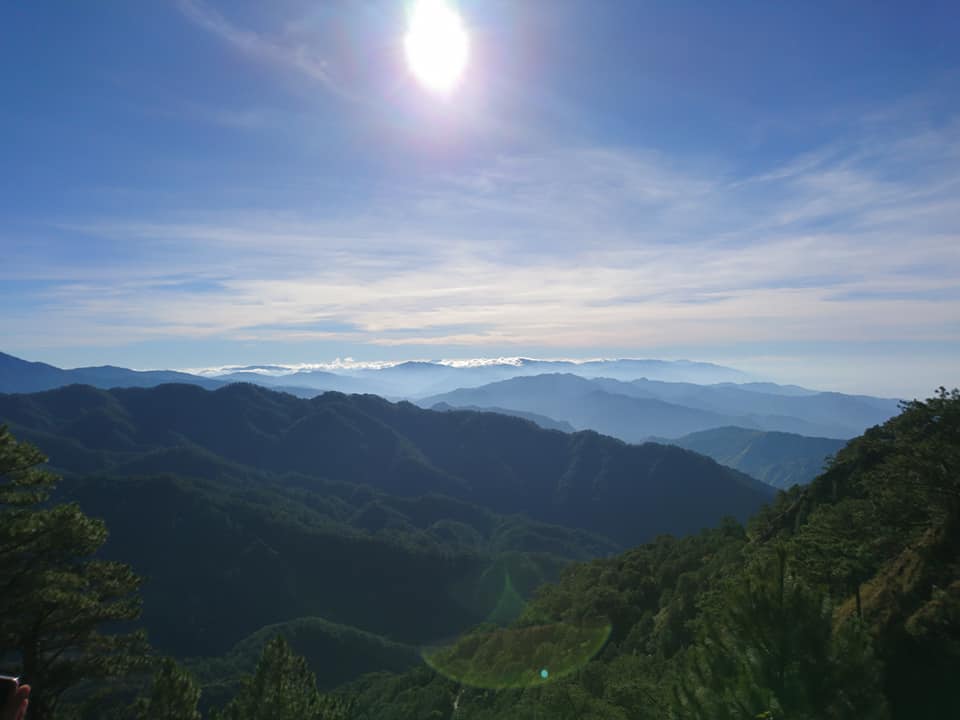
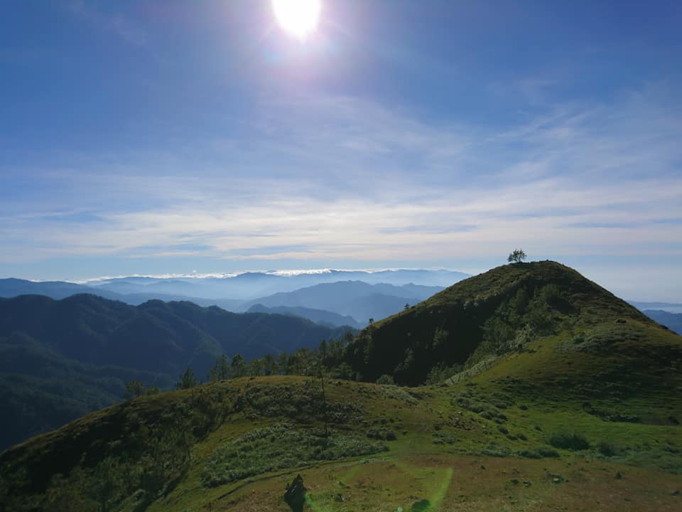
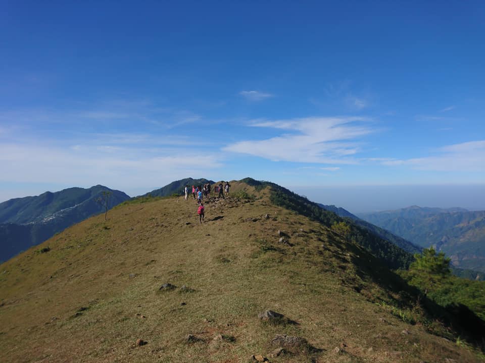
After done taking individual pictures at the rock formation, we continue the hike. From the Gungal Rock formation, the summit is within reach. It took us thirty minutes of continuous ascending to reach the summit of Mt. Ulap. We are so lucky because we have a good clearing all the way to the summit. There are no hindrance from the clouds and it was a clear sunny day. For this reason, the view at the top of the mountain is surreal. Every spot is instagrammable. Mother nature at its finest. It is a 360-degree view of the province of Benguet.
I can see Mt. Ugo, Mt. Pulag, Mt. Arayat, and the Baguio City. We enjoy the moment and the place while relaxing. I feel like I’m in another dimension. The scenery is wonderful. Also at the summit, I lift up my eyes to the sky and said to myself from where does my help come. I told myself that my help comes from God, who made heaven and earth. We wanted to stay longer at the summit but we need to follow our itinerary.
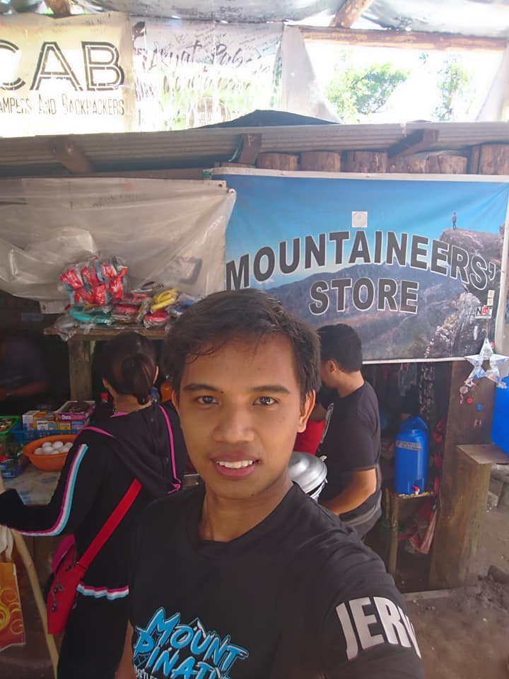
So we descent from the summit and a few minutes later we reach the Mountaineers store. I found my comfort place. It feels like home. It’s a perfect time for lunch. We buy some food and cold drinks and we take our lunch. Also, we refill our empty bottles. Then we share some thoughts about hiking this mountain. Our group stayed in the Mountaineers store for almost one hour. In my opinion, the store is situated perfectly just below the summit. Hikers can take a long rest and eat their favorite food after a demanding hike.
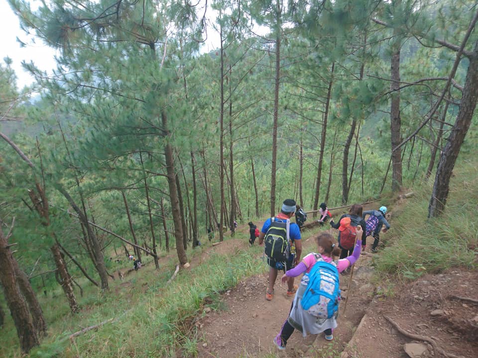
After our lunch, we started to descend on a steep slope. At some point, my knee is trembling as I go down the steep slope of the mountain, and some members are already giving up. Sometimes we need to hold hands in order for us not to get stumble on our way down. On the other hand, I saw kids between the ages of seven to ten years old descending confidently and smiling along the trail.
Furthermore, I look around, and again there are more picturesque and fantastic views along the trail. We breathe the fresh air and I decided to take many pictures again. I said to myself truly the works of God are great, studied by all who have pleasure in them.
Moreover, the pine-forested descent is very similar to my first major climb in Mt. Ugo traverse. Then we shared some mountains that we hike before and we shared some nice stories. As we are near the endpoint of the traverse, we pass some long hanging bridges, local houses, and the dogs welcomely bark at us.
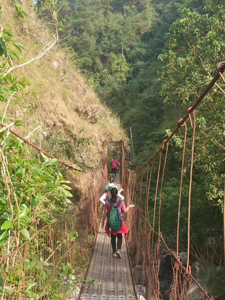
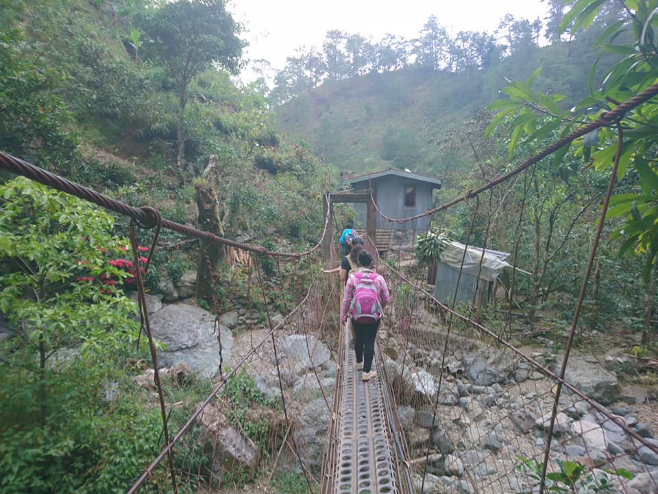

We reached Barangay Santa Fe after three hours of descending passing through steep cliffs, pine trees, rocky terrain, and hanging bridges. At the cemented road some locals warmly greeted us. From the summit of Mt. Ulap, all the way to the traverse jump-off point is a very steep 2.5-kilometer stretch. The descent is a little bit harder compared to the ascend earlier. In my point of view, Mt. Ulap is more challenging compared to Mt. Pulag Ambangeg trail because of the steep descent and super exposed open trail just before the summit.
Nevertheless, our group successfully completed the Mt. Ulap traverse hike in nine hours, including waiting time and various stops. We started ascending around 6 am and completed the hike at 3 pm. I have so many unforgettable moments and memories. Also, I really enjoyed the experience of hiking in this photogenic mountain. Majestic scenery all around and great views can be seen everywhere.
Then we tidy up at Barangay Santa Fe and I realized that the water coming from the faucet is super freaking cold. Nevertheless, I manage to take a quick bath and I think this is one of the most memorable showers I had taken.
After all the members were done resting and taking a bath. We go inside the van and the van heads to Baguio City. Additionally, inside my head, I wish I can do overnight camping at Mt. Ulap to be able to capture the dreamlike sunset and sunrise. Maybe this is one reason for me to come back to this mountain again.

At 7 pm we have our dinner at Good Taste Café & Restaurant in Otek street which is one of the most famous restaurants in Baguio City. On the whole, their food menu is good for budgetary people like us and they offer huge servings at an affordable price. For this reason, we ordered many meals to satisfy our cravings.
We stayed at the restaurant for one hour and twenty minutes. In my opinion, visiting Baguio City will not be perfect without dining in at this famous Chinese restaurant. After done eating, we go inside the van again and the van departs Baguio City around 8:30 pm. In the van, I have a good sleep and after five hours of road travel, our group finally arrived in Manila.
Later we came home safely. I thank God for another unforgettable hiking experience in the province of Benguet and for keeping us safe in our adventure. Indeed, Mt. Ulap is a must-visit place for those who want to be with nature. Mt. Ulap is one of the most awesome places I’ve ever been. Therefore, I would definitely go back to this mountain again, God-willing. Special thanks to the Adventure Passport group for this awesome trip. For more hiking-related events, please check their Facebook page group.
In general, my adventure to Mt. Ulap sums up with this great quote “Every climb is a blessing. Appreciate it, adore it, and treasure it because not everyone has the luxury of time to climb.”
Things to bring on your visit to Mt. Ulap:
Jacket
Flashlight
2 liters of bottled water
Extra clothes, cash, and slipper
Trail food or packed lunch with spoon and fork
Garbage bag for your trash
Personal medicine
Hygiene kit
Power bank and camera
Toiletries
Alcohol
Valid ID
Sun protection like cap, umbrella, sunblock, and sunscreen (optional)
Trekking Pole (optional)
Neck pillow for the long trip (optional)
Tent and cook set if you’re doing an overnight climb
Poncho and raincoat during the rainy season (optional)
Sample 1 Day itinerary to Mt. Ulap (Dayhike)
Day 0
9:30PM – Assembly at a designated location, finalize the things needed for the hike
10PM – Departure to Benguet
Day 1
1:30AM – Stopover at Sison, Pangasinan
2AM – Resume drive going to the jump-off point
3:30AM – Arrival at Barangay Ampucao, Itogon, Benguet, cr break, proceed to the registration area, briefing and securing local guide
4AM – Hike towards the first peak Ambanao Paoay
6AM – Sunrise viewing at Peak 1 Ambanao Paoay, pictorials
6:30AM – Resume hiking going to second peak Gungal Rock formation
8AM – Gungal Rock, waiting time, rest, take snacks, and snap photos
9:30AM – Resume hiking going to the summit of Mt. Ulap
10AM – Summit of Mt. Ulap, photo-ops
10:45AM – Arrival at the sari-sari store campsite, lunch
12PM – Start descent, resume hiking
2PM – Arrival at Barangay Santa Fe, wash-up, rest, and buy souvenirs
3PM – Departure going to the side trip in Baguio City
6PM – Dinner at Good Taste Café & Restaurant or at 50’s Diner
8PM – ETD going back to Metro Manila
1AM – ETA Metro Manila
Sample 2 Day itinerary to Mt. Ulap (Overnight)
DAY 0
10PM – Meetup
11PM – ETD going to Benguet
DAY 1
5AM – ETA jump-off point of Mt. Ulap, registration and briefing of the mountain trail
5:30AM – Start trekking
9AM – Arrival at Gungal Rock formation
12PM – At the summit, take lunch, photo-ops
4PM – Campsite, set up camping tent
5PM – Preparation of meal
6PM – Dinner and social
10PM – Sleeping time
DAY 2
5AM – Wake up call, sunrise viewing
8AM – Break camp
8AM – Start to descend
10AM – Wash up, tidy-up
12PM – Going to Baguio City or to another side trip
5PM – Going back to Manila
11PM – ETA Manila, home sweet home
Note: this sample itinerary is just a basis and not absolute or will not be 100% perfect due to many factors such as delay, weather conditions, and group pacing of the members.
How to Go to Mt. Ulap
By commute
- From Cubao bus station, ride a Victory Liner bus bound to Baguio City.
- From Baguio Public Market, ride a jeep or a taxi going to the registration site in Barangay Ampucao.
Note: Victory Liner bus going to Baguio cost 576 pesos. The roundtrip fare is 1,152 pesos.
By private car
- Take the North Luzon Expressway (NLEX).
- Then take exit 85 right into Subic-Clark-Tarlac Expressway (SCTEX) and drive via Tarlac.
- Take the Tarlac exit and proceed to MacArthur Highway. Then drive straight going to Pangasinan until you reach Rosario, La Union.
- From the Rosario junction, turn right going to Kennon Road. Then drive all the way to Baguio City.
- From Baguio, take the Philex Road in Itogon and finally make a left turn going to Barangay Ampucao.
Note: The approximate travel time from Manila going to the jump-off point is 4 to 6 hours but it depends on the speed of your vehicle and various stops along the way.
Reminders and Tips:
- Mt. Ulap is only a minor climb and it’s highly recommended for beginners in the hiking scene. It has a beginner-friendly trail with some steep slopes and it’s a perfect hiking destination if you want to keep close to nature. For first-timers do some leg and cardio exercises prior to the event.
- The best time to hike Mt. Ulap is during the weekdays to avoid waiting for a long time just to take pictures at the famous spot and to avoid crowds that might ruin your pictures.
- Registration is required and securing a local guide is mandatory. Proceed first to the Barangay Hall of Ampucao before starting to hike. Walk-ins are highly discouraged. No pre-registration is no climb. Please bring the accomplished Pre-registration form.
- Parking spaces and restrooms are available at the jump-off point. The main jump off-point of Mt. Ulap is located at Barangay Ampucao, Itogon, Benguet.
- Mt. Ulap is open for all hikers and campers who want to visit the mountain. Just bring the necessary requirements like a valid ID.
- Please follow the set standard health protocols at all times. Observe social distancing.
- Do not bother the animals along the trail. Also do not wander away from the designated trail unless you have asked permission from the local tour guide.
- Respect the local culture there.
- There are sari-sari stores just below the summit of Mt. Ulap so no need to worry about food.
- I’m not favored with the risky shot or putting your life in danger. So please be very careful when taking pictures, especially at the edge of Gungal Rock formation. Negligence can be fatal and can result in accidents and injuries. Take note that there were reported accident cases in this rock formation. Hike at your own risk. Moreover, prepare your signature pose when it is your turn to have your picture taken at this famous spot.
- Camping is possible in some areas near the summit.
- Pack light as much as possible. Heavy stuff inside the bag may affect and slow you.
- From the jump-off point going to Gungal Rock Formation which is the second peak is a 5.4-kilometer hike. From the jump-off point going to the summit of Mt. Ulap is a 6.4-kilometer hike. The hike to the summit of Mt. Ulap takes about four hours at a moderate pace and with several stops. Some can finish it in three hours. The total hours to and from the summit could take up to seven hours.
- If you’re going for a day hike, it is advisable to start the hike as early as 4 am for you to be able to see the remarkable sunrise and sea of clouds.
- Mt. Ulap traverse has a total of 9-kilometer trail length from Barangay Ampucao to Barangay Santa Fe. Mt. Ulap is ideally hiked on a 1-day itinerary but an overnight hike is more rewarding because it gives you more time to adore the dazzling beauty of this mountain. Also, it gives you more chances to witness the stunning sunrise, sunset, and view of the Milky Way Galaxy.
- Please bring a plastic bag for your own trash and dispose of your waste properly. This is very essential. It’s good to keep the mountain clean and to preserve the beauty of nature. Also, always follow diligently the Leave No Trace principle. Plan ahead and prepare. No picking of flowers or plants and do not litter. Do not vandalize stones and trees, or other items. Respect wildlife and leave what you find. Minimize campfire impacts and be considerate to others. Last but not least, take nothing but pictures, leave nothing but footprints, kill nothing but time.
- You can stay overnight at the mountain, just inform the local barangay office to lead you and mentor you on the rules and instructions regarding the overnight stay. Bring thermal jackets and thick clothes when you’re staying overnight in the mountain as the weather during the night can get super cold.
- There is an available water source in the lower part of the communities just before finishing the traverse hike.
- Drones are allowed in the mountain.
- Wear appropriate hiking attire and comfortable footwear.
- Cellphone signal is limited to some spots.
- If you are tired and out of breath let the tour coordinator or local guide know that you need a break from hiking to avoid ending up dizzy. Same thing if you are injured, please let the local guide or tour coordinator know so they can take actions to help you.
- If you’re coming from Manila or Southern Luzon provinces, I highly recommend getting a packaged tour when you plan to visit Mt. Ulap for comfort, amenity and to lessen your expense. Don’t DIY (Do it yourself). Included in the Mt. Ulap package day tour is round trip private van transfer from Manila to Benguet and vice versa, tour coordinator fee, local guide fee, drivers fee, toll fee, parking fee, and registration fee. On the other hand, excluded from the package tour are personal food and shower fees.
- Above all, please add Mt. Ulap Eco-Trail to your next bucket list. It is one of the most stunning mountains in the Cordillera region that offers some of the most breathtaking views that you will ever look at. So prepare your hiking shoes and join an organized tour.
Notable Fees:
- The entrance fee or registration fee is 100 pesos per person.
- The local guide fee for a day hike is 600 pesos good for 7 people.
- The guide fee for overnight camping is 1,000 pesos.
- The campsite fee for overnight camping for a group of 10 people and below is 800 pesos.
- The porter fee for a day hike is 500 pesos (maximum of 15 kilos) while the porter fee for overnight camping is 800 pesos.
- The protected area entrance fee is 30 pesos per person.
- The parking fee for a day hike is 50 pesos while the parking fee for overnight is 70 pesos per vehicle. Note: Organizers and tour coordinators are not exempted to pay the fees.
Travel as much as you can, as far as you can, and as long as you can. Life is not meant to be lived in one place. Overall, I hope this Mt. Ulap traverse day hike guide has been beneficial to you and motivated you to try visiting the mountain. Also, don’t forget to share this with your groups, friends, loved ones, and colleagues if ever you plan on doing Mt. Ulap day hike too. I wish to see you on the trail. God bless you in all your hiking adventures. Moreover, a pleasant day to you. Stay safe and thank you for taking the time to read my blog.
Jervis Ergino
Hi! I’m Jervis Ergino, the digital content creator behind Hike to Mountains, a travel and hiking blog in the Philippines. This blog is dedicated to helping people know more about the best hiking and tourist destinations in the Philippines.