Mt. Pinatubo Sapang Uwak to Delta V Dayhike Climb Guide
Introduction
Mt. Pinatubo is one of the most beautiful tourist destinations in the Philippines. It is located in Central Luzon between the provinces of Zambales, Tarlac, and Pampanga. Mt. Pinatubo has an elevation of 1486 meters above sea level or 4875 feet.
Mt. Pinatubo 1991 eruption is considered the second-largest eruption in the 20th Century. It caused widespread devastation in Central Luzon, 722 deaths are recorded, 100,000 people became homeless, towns were destroyed and billions worth of properties and crops were covered in lahar.
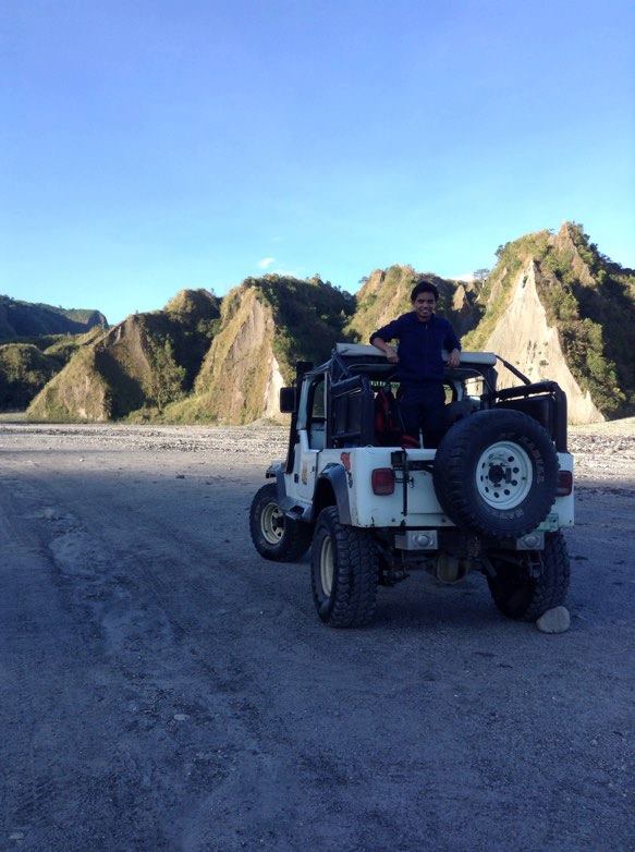
After its historic 1991 eruption, Mt. Pinatubo is now considered to be the most beautiful hiking destination in the Philippines. It becomes a place worth traveling to especially for the adventure seeker. Moreover, it has a mesmerizing crater lake and a landscape filled with lahar formation and boulders. In general, there are three known trails of Mt. Pinatubo, first is the most visited and the easiest, the Santa Juliana jump-off point in Capas, Tarlac where you will board a 4 x 4 vehicle. The second is the Delta V trail, third is the Sapang Uwak or CM50 Trail that is located in Porac, Pampanga.
Name: Mt. Pinatubo
Jump-off: Barangay Pidpid, Porac, Pampanga
Elevation: 1486+ MASL
Difficulty: 8/9, Major climb
Hours to crater: 10 to 14 hours
Features: Tropical forest, rivers, and picturesque view of the Mt. Pinatubo crater
My trip to Mt. Pinatubo Sapang Uwak to Delta V trail
I’ve been to Mt. Pinatubo once and it’s a 4 x 4 ride. When I saw a post on the Facebook group community about Mt. Pinatubo Sapang Uwak to Delta V trail, I got curious about the trail. So I searched on the internet about Mt. Pinatubo Sapang Uwak to Delta V trail, I was shocked because it has a difficulty of 8/9. They said every accomplishment starts with the decision to try. It’s my first try that I will be doing a major climb dayhike with a difficulty of 8/9.
I’ve never done any major climb with a difficulty of 8/9 but I did major climbs before so I consider myself well prepared for this kind of hiking. I also want to see Mt. Pinatubo from a different view so I joined an organized tour by Rabas Outdoors Travel and Tours. As part of the requirement, I took a picture of one of my valid IDs and give it to the organizer prior to the climb.
I followed the itinerary in our group chat and I arrived at the meetup place at Greenfield Mcdo at 10 pm. Then, I bought some food in 7 11 for breakfast and lunch. Our van left Greenfield at 11 pm and heads toward our destination Barangay Sapang Uwak, Porac, Pampanga. I wanted to sleep in the van but I couldn’t sleep because my body was used to the night shift work schedule, and later I wanted to see the road going to Porac, Pampanga.
It was a smooth ride going to Pampanga via NLEX (North Luzon Expressway) and SCTEX (Subic–Clark–Tarlac Expressway) and there are two various stops along the way because we pass by some military checkpoint asking for our valid ID and permit to climb. We reach the jump-off at Barangay Sapang Uwak, Porac, Pampanga around 2 am.
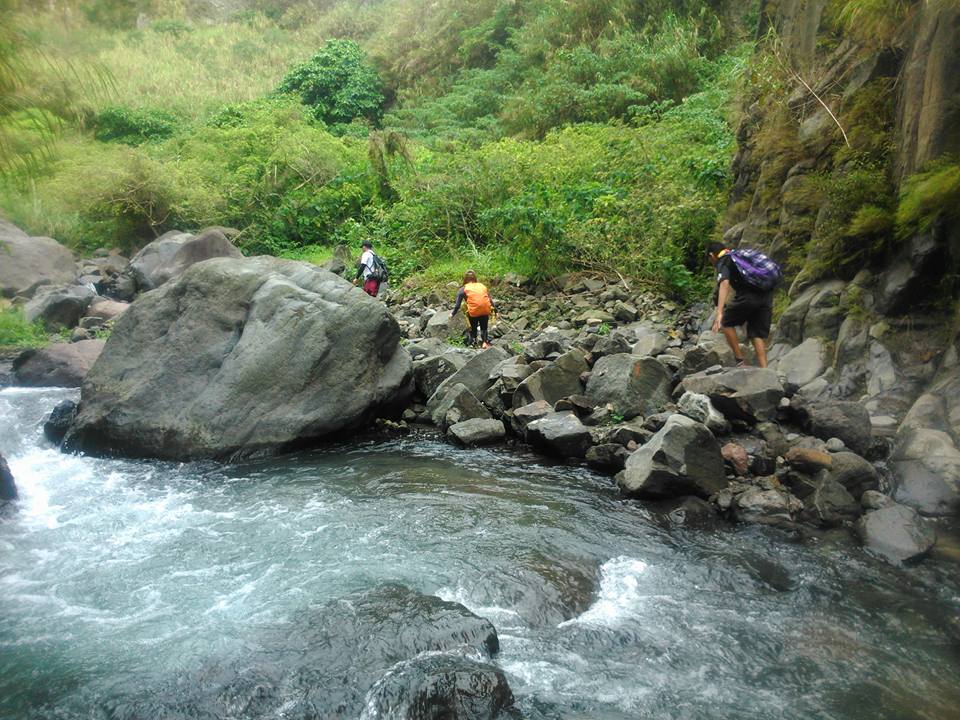
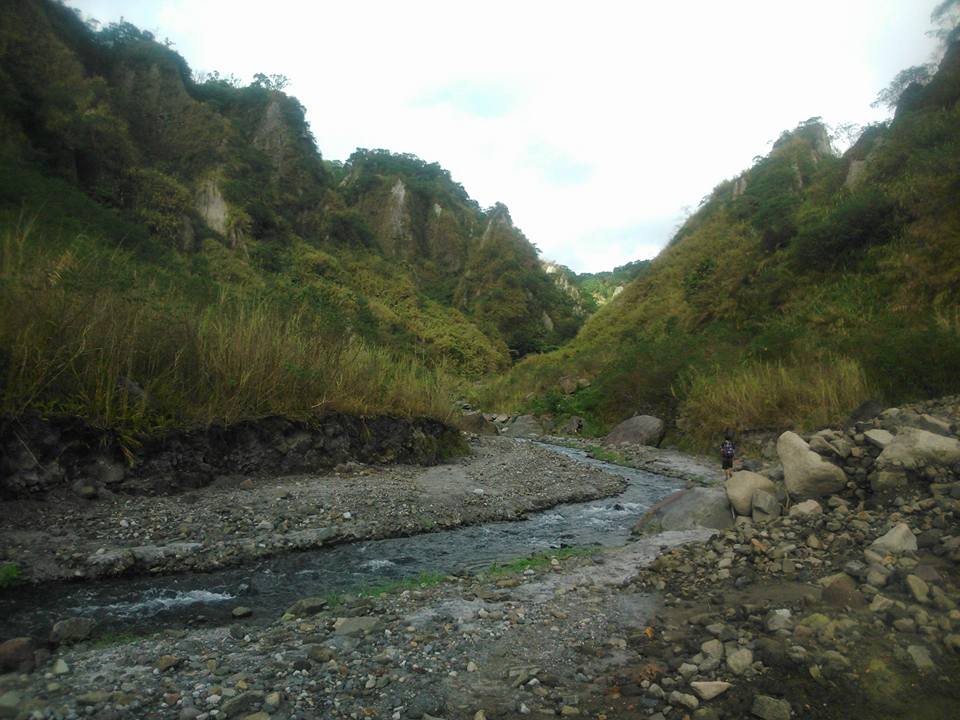
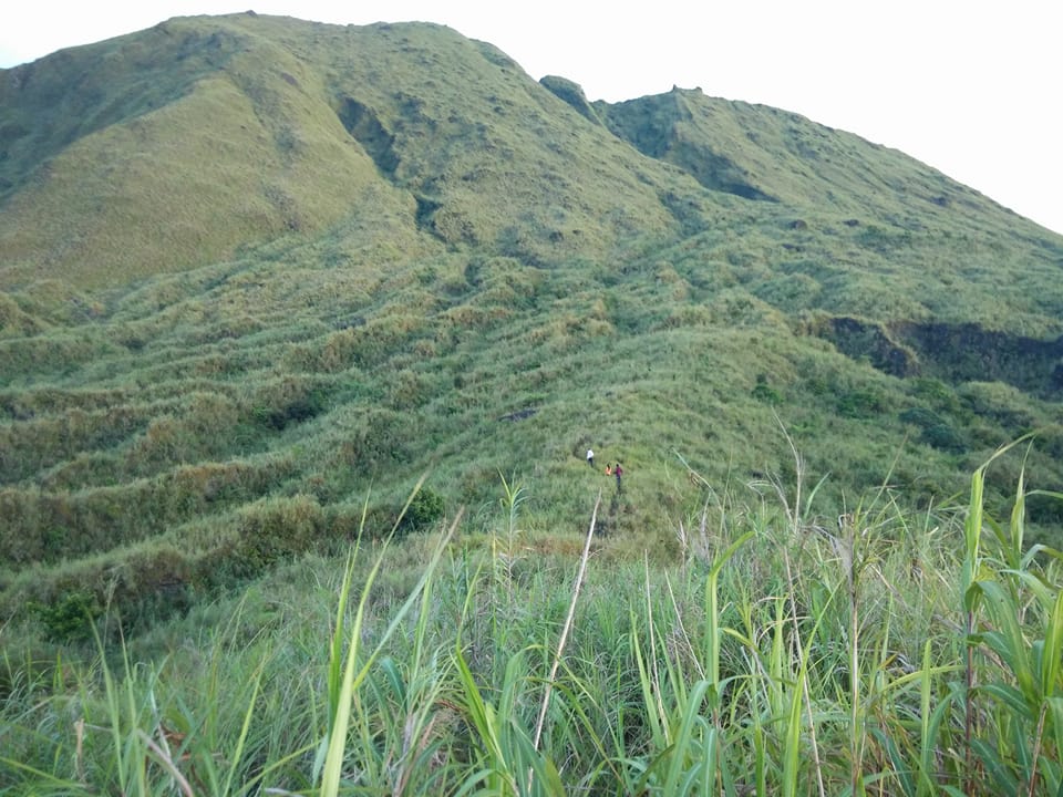
It was so cold there. We secure our guide and we have a short briefing of the mountain trail. After that, we leave in the van the things that we don’t need inside our bag. We pack light and then our group circled to have a prayer. Later we open our flashlights and headlamps then we started to walk in an open grass-covered and well-established trail at 2:45 am. The first part of the trail is easy. It’s a very long uphill and downhill trail. For this reason, we hike for three hours on this kind of trail and at the end of the trail, there’s a portion of the rope segment to be able to reach the part of the river below.
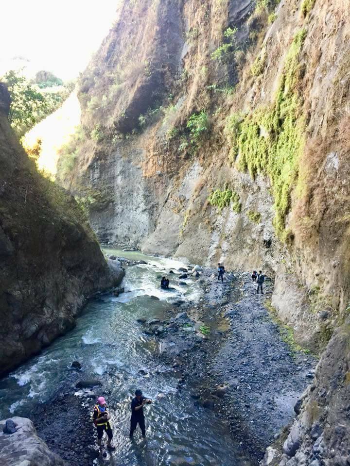
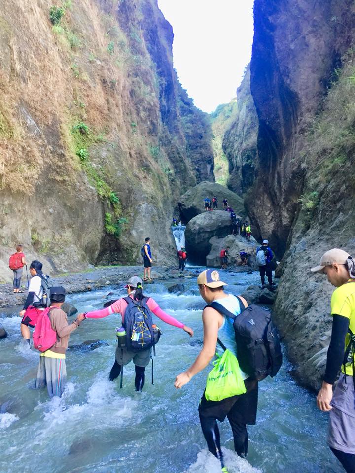
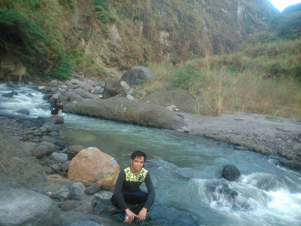
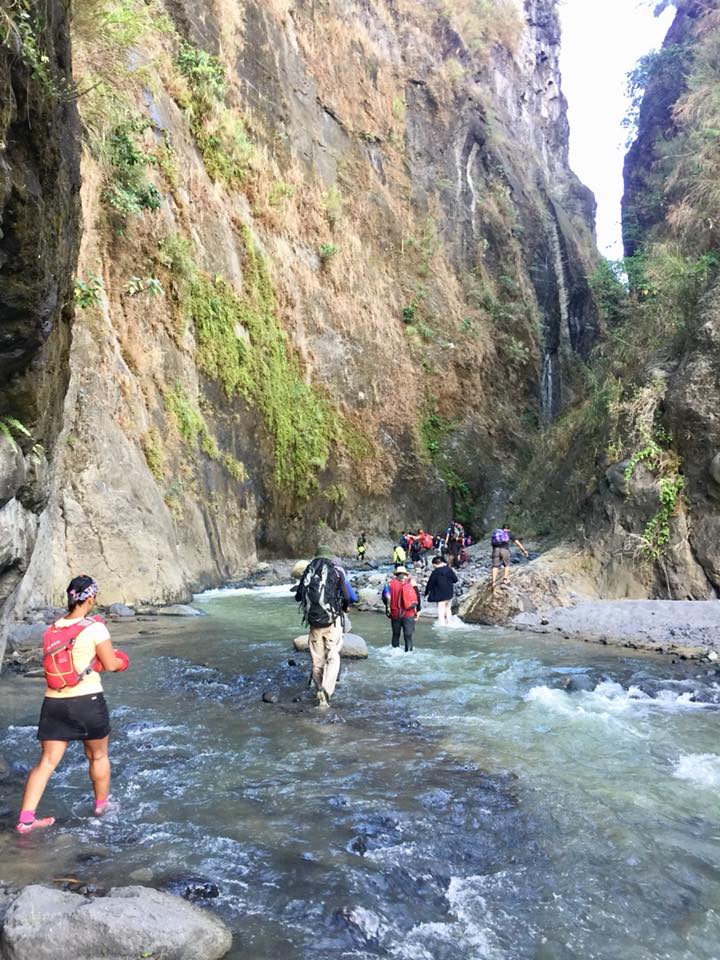
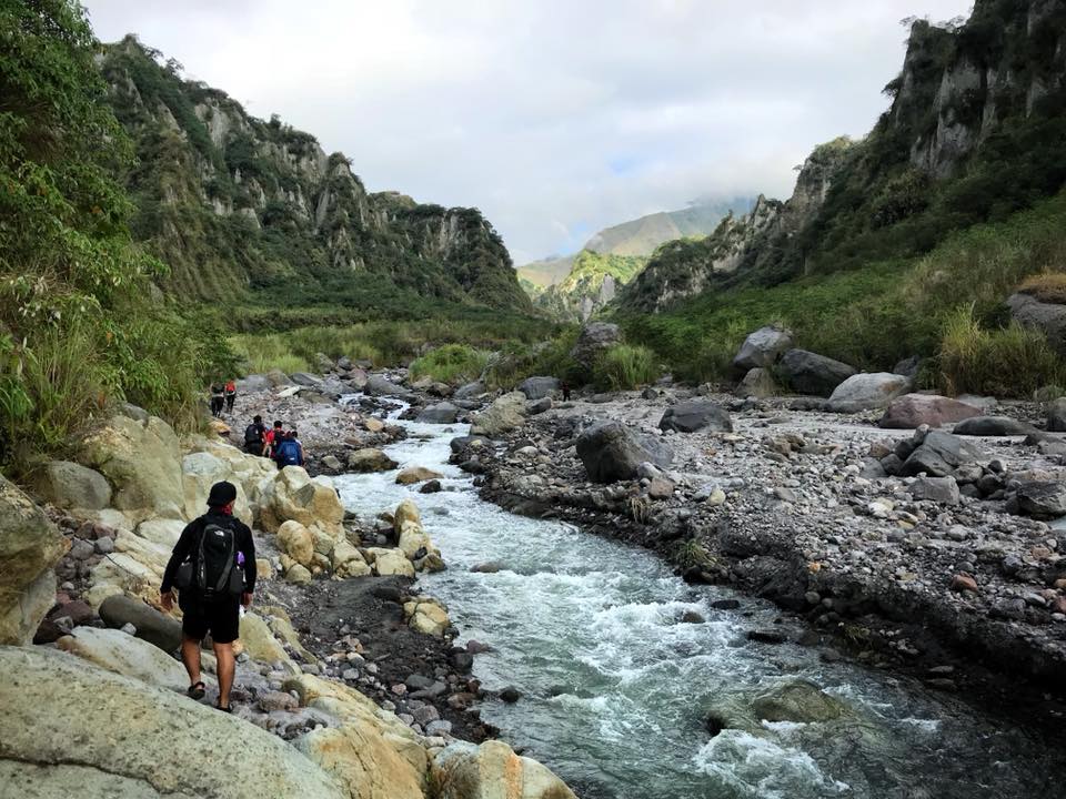
We reached the Delta V river at 5:35 am. We take a rest, eat our breakfast and take pictures of the beautiful sunrise and surroundings. After our rest, some of the group members changed their footwear to sandals and we resumed our hiking. The trail now is called Delta V trail. For the most part, It was a series of river crossings for a longer period of time.
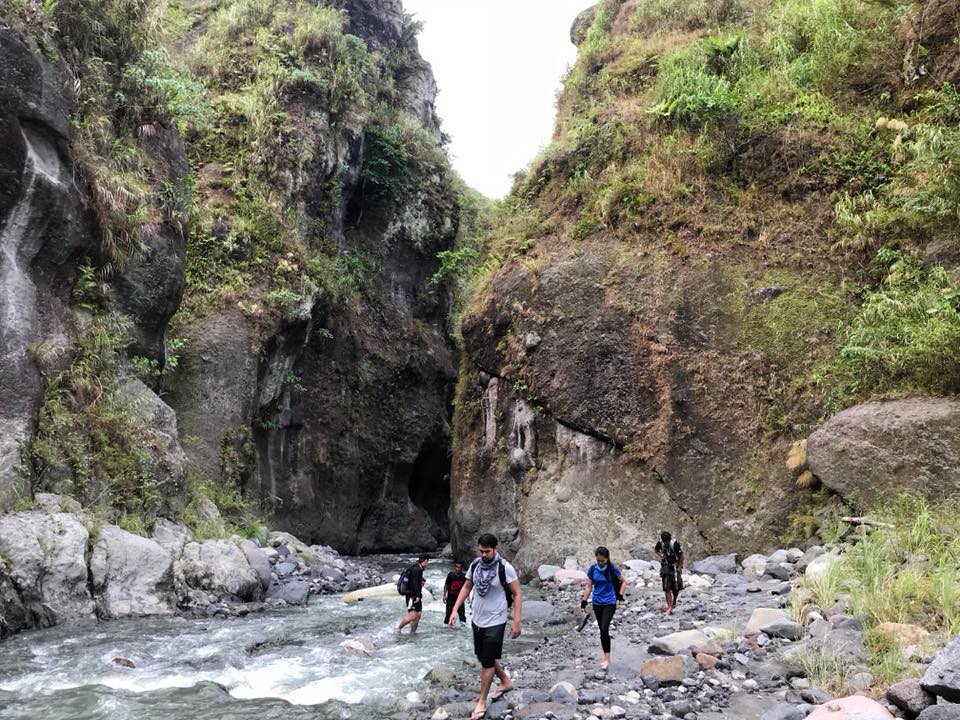
We go through some river crossing and later climb through a big boulder of rock to be able to pass on the other side of the river. We are thankful because there is a guide and a rope to assist us to go through.
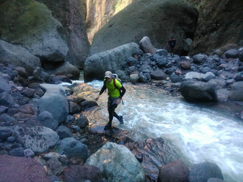
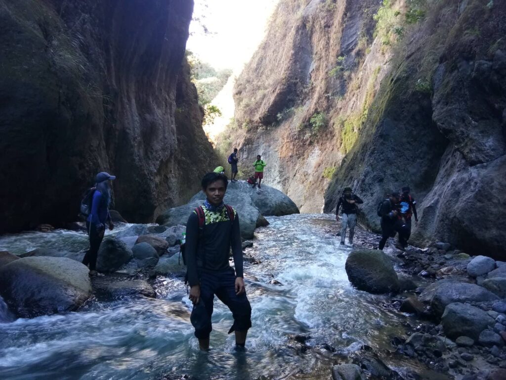
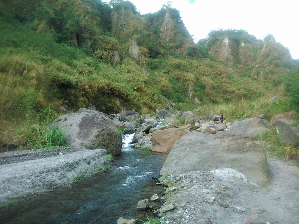
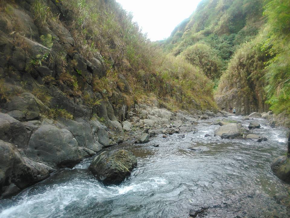
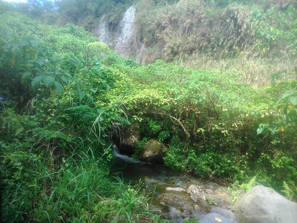
We continue to do river crossing as we go along. The view is magnificent. The water is cool and mostly shallow, knee-deep only. Also, it’s a good and refreshing shift from hours of walking on dry sand. Then we walk on an open trail with no trees at all. However, the sun was already high at that time and we need to walk faster.
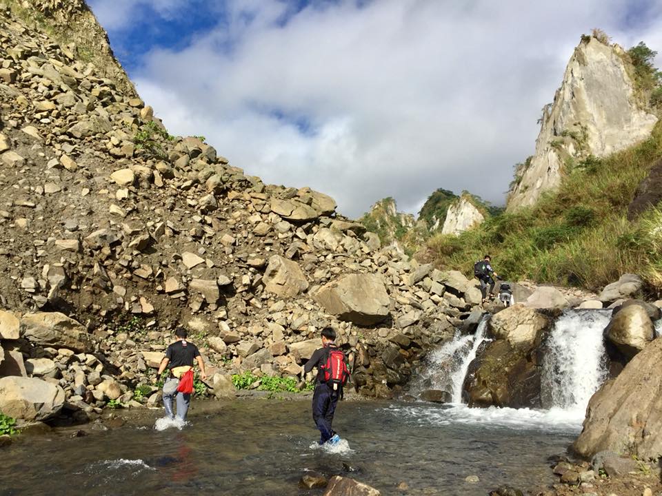
We keep pushing ourselves forward under the scorching heat of the sun until we finally reach the Apo Mallari Waterfalls, where we have a quick photo-ops. It is a single flowing waterfall plunging down to an estimated 30-meter drop.
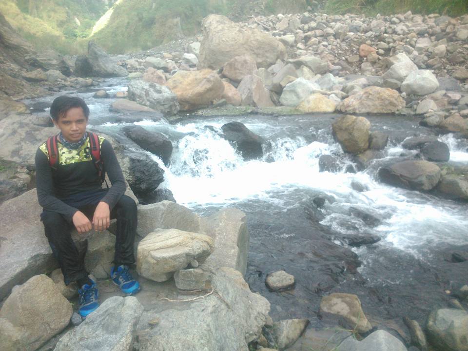
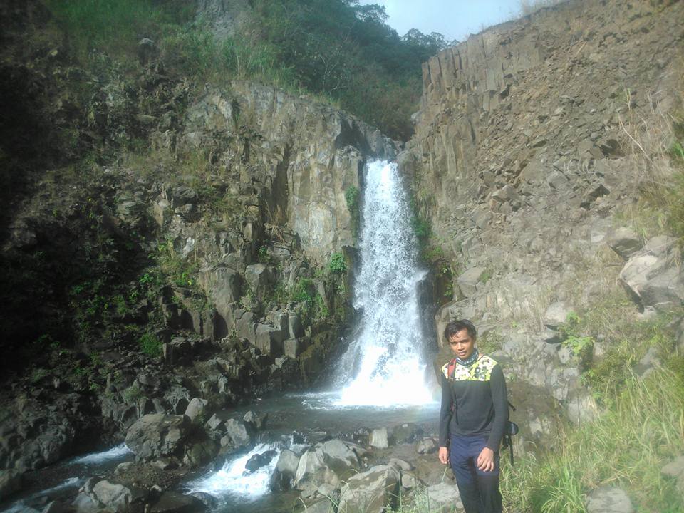
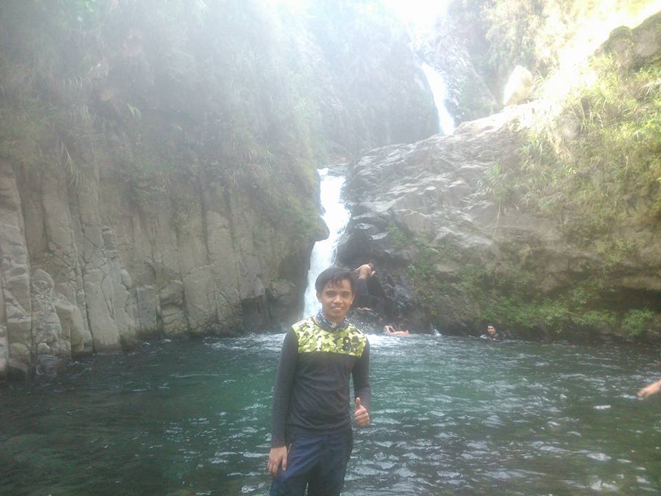
Then we continue hiking and saw the Mt. Pinatubo twin falls. The twin cascade is tucked inside the mountain where cool water flows down into a gentle stream. We take pictures of the beautiful twin falls.
Some of the group members climb atop the waterfalls, take a quick dip, and refresh themselves. The falls that we saw along the trail reduced our fatigue from very long walks. I love waterfalls as it calms my senses. According to our guide, despite being badly damaged by the Mt. Pinatubo 1991 eruption, waters still flow strongly from the mountains to the basin.
After our quick rest, we resumed our hiking towards the crater of Mt. Pinatubo which is still 2 hours away. The trail is now covered with lots of trees. After our long walks, we saw the last water source before going to Mt. Pinatubo crater. Then, we refill our bottles and continue to walk.
However, after several minutes the trail becomes steeper and continuously ascending. We experience rock bouldering and rope segment to get to the top of the slope. We kept asking the guide if the summit is still far away as we go along. He said we are near.
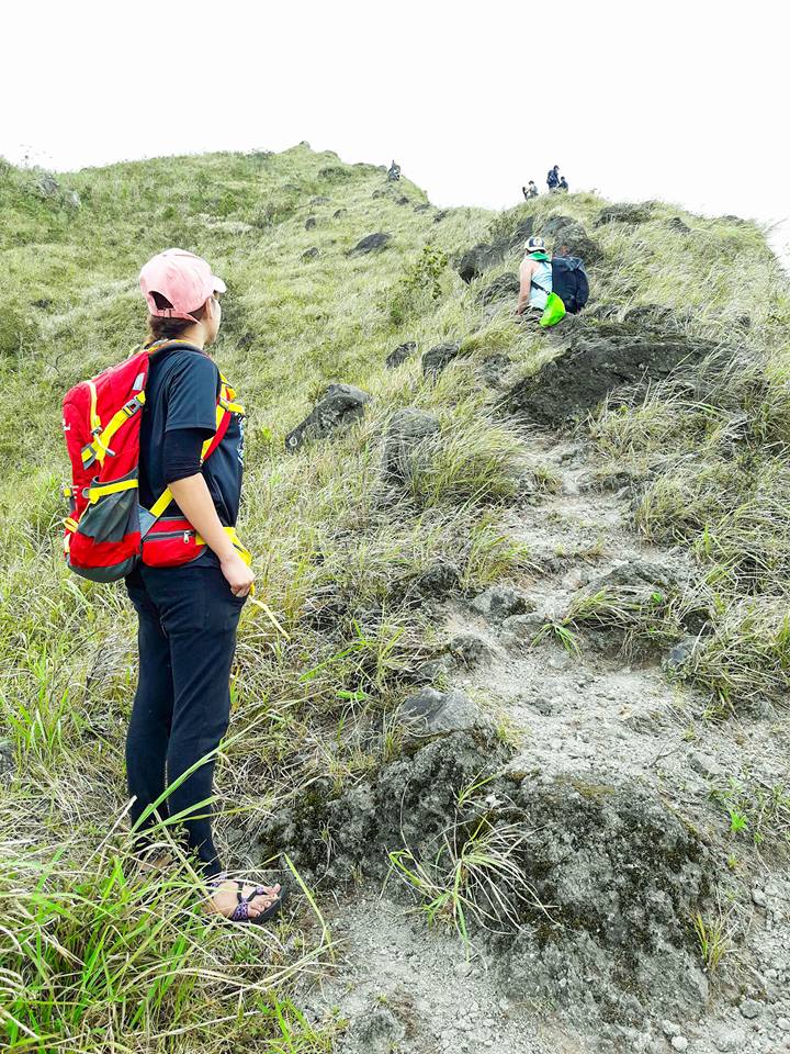
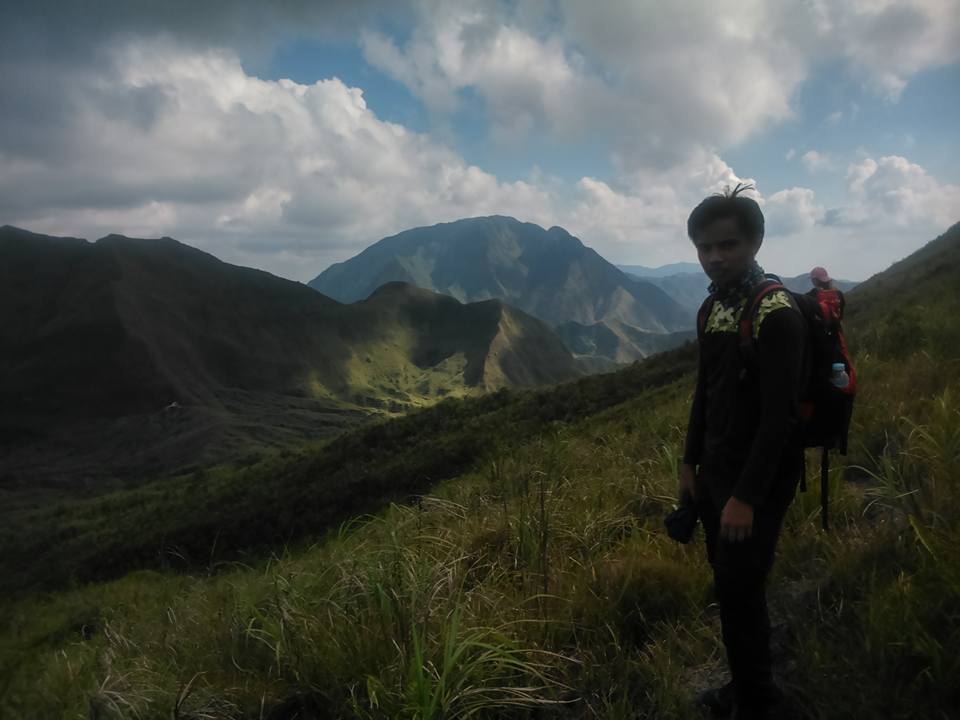
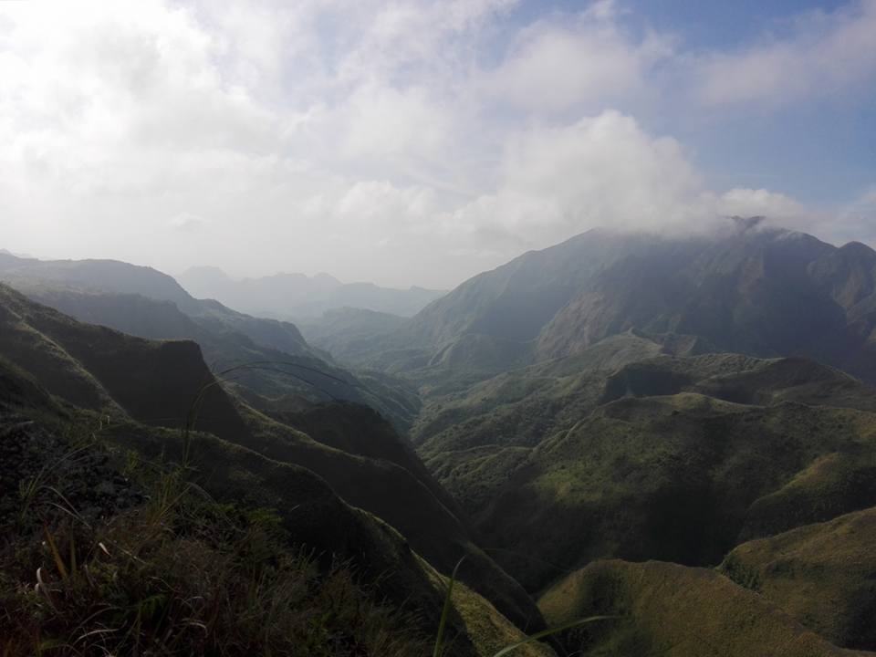
As we ascend to the crater of Mt. Pinatubo, the trail becomes very windy and very steep with no covering at all but the view is stunning. The terrain going to the summit was ringed with lush mountains. Also, we can see the surrounding valleys and mountains inside the Cabusilan Mountain Range. As we go up, the weather favored us because it was cloudy.
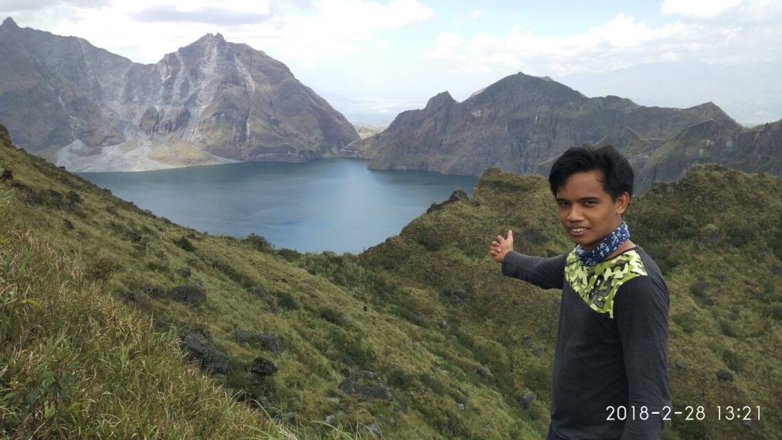
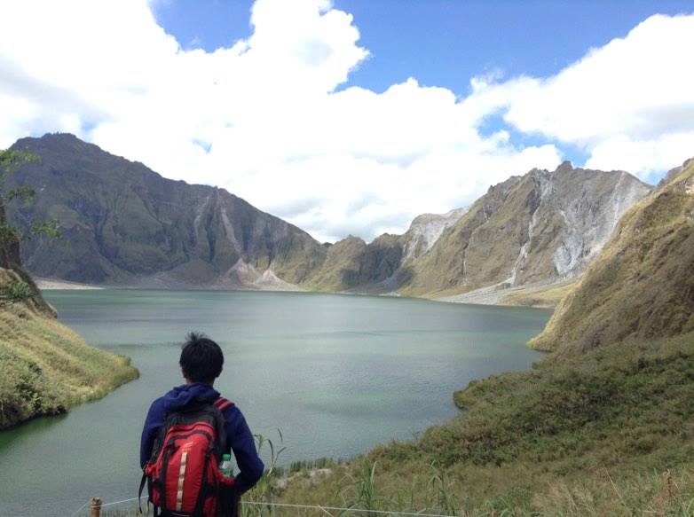
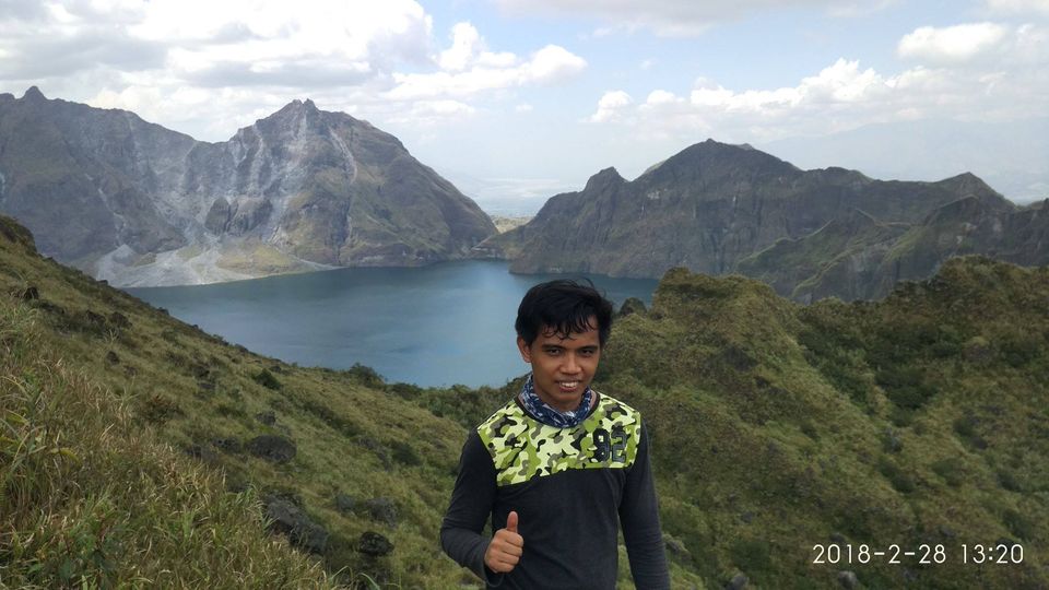
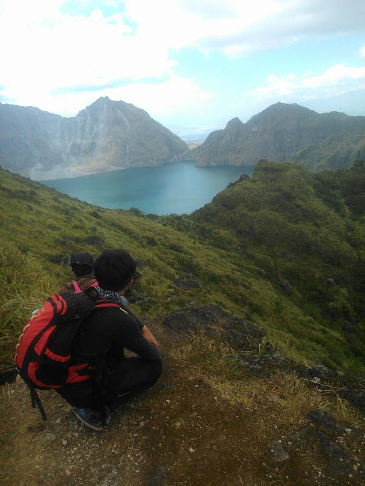
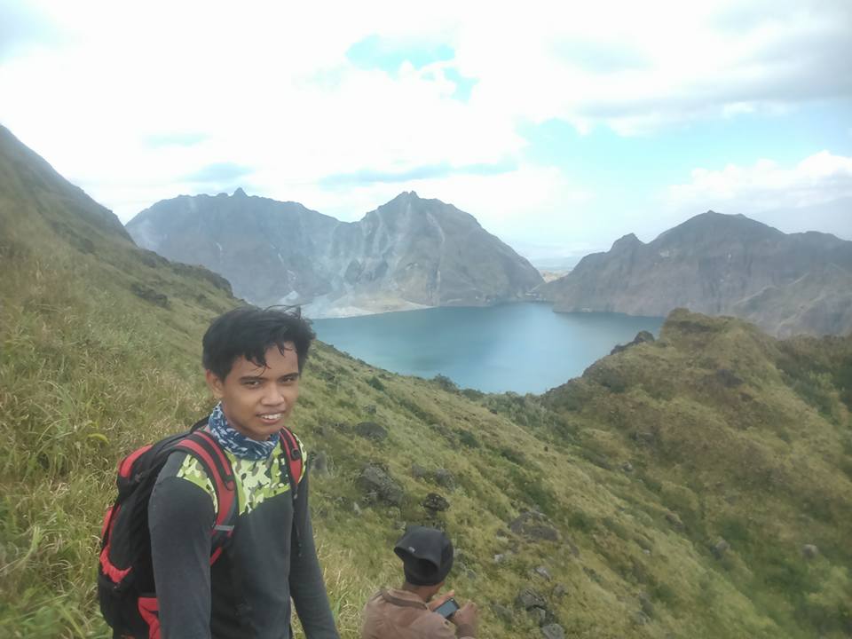
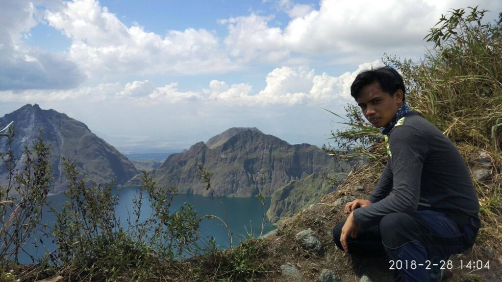
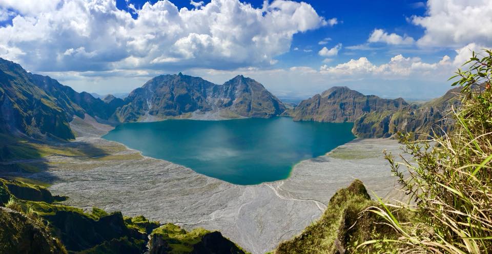
It was around 1 pm when we finally reached the summit of Mt. Pinatubo after almost eleven hours of hiking. All that hours of endless walk paid off big time. Without a doubt, it was a sweet reward after long walks. I finally set my eyes upon the whole crater of Mt. Pinatubo. Furthermore, I was completely mesmerized by the beauty of the crater lake and the surrounding. Indeed, it is out of this world scenery.
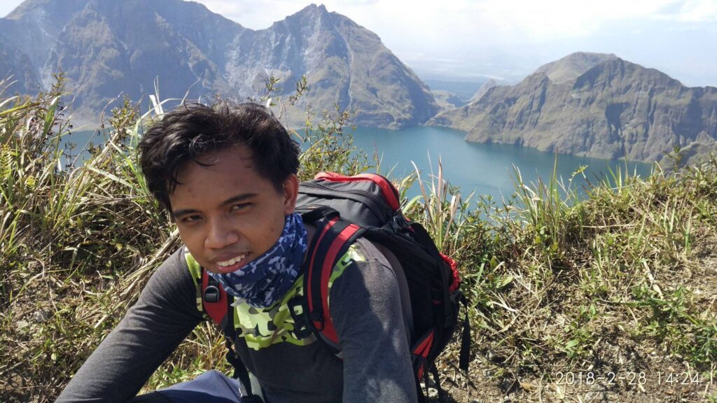
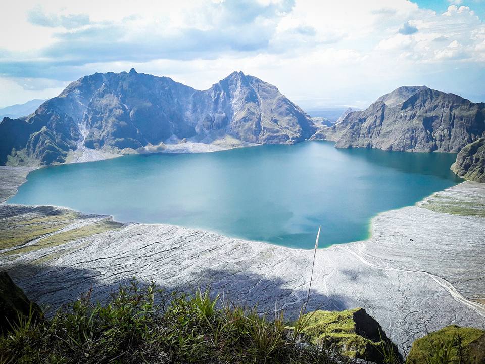
The view at the top is so amazing. It is one of the most beautiful sights I have ever seen in my life. The spectacular formations surrounding the lake is the Caldera arise from the ashes of the volcanic eruption. Also, the crater lake spans almost 3 kilometers wide. Mt. Pinatubo is indeed a beautiful disaster. After some photo-ops, we take our lunch at the top of the mountain. Then we stayed there for 45 minutes.
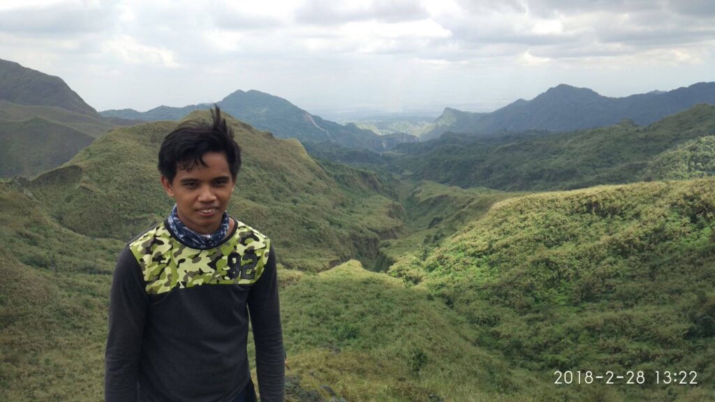
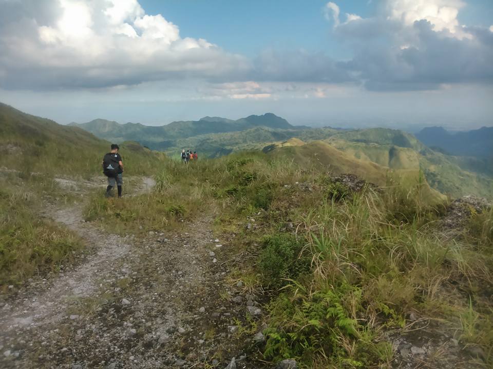
After our lunch, we took a little time appreciating the beauty of Mt. Pinatubo crater lake. Then we continued our hiking at 2 pm because our guide told us that we need to reach Mt. Mcdonald by 4 pm. I was shocked because we still need to climb another mountain for the traverse.
We can see the summit of Mt. Mcdonald on the other side. Our guide told us that it was called Mt. McDonald because former President Gloria Macapagal Arroyo landed there via helicopter to distribute a McDonald’s meal for an outreach program for the Aeta communities.
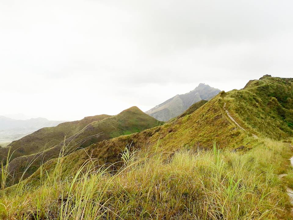
The initial trail is rolling hills then later becomes a 90 degree uphill climb to reach the summit of Mt. Mcdonald. For the most part, the assault part of Mt. Mcdonald is too narrow and too steep. One wrong step and you will fall.
We are super exhausted and breathing heavily as we go up the mountain. As a result, we take several take five rest. Then we ask ourselves why we are here, we should just be at the house or mall resting and relaxing.
After several minutes we arrived at the summit of Mt. Mcdonald at 5 pm. The view is worth it. It is surreal. We rested there for a longer period of time as we wait for the other members of the group on the trail. We eat our last food in our bag. At the summit, we saw the wide gap that separates Mt. Mcdonald from Mt. Pinatubo. It is a beautiful landscape. After that much-needed rest, we then continued walking.
Some of the members of the group trail run but others walk slowly because we are already exhausted after the steep ascent of Mt. Mcdonald. We saw the spectacular sunset later on the trail. It was so beautiful. However, the night came and darkness enveloped the whole area with only our flashlights as the source of light. Then we continue to walk forward in an open trail.
Going down from Mt. Mcdonald is very tiring. The guide told us that it’s a twenty-plus kilometers terrain on our way back. It is an endless trail or zombie trail. We run out of water on the way down. Also, we underestimate the endless trail. We didn’t refill our water very well in the last water source. As a result, we are just like walking dead just to find a water source. I don’t know how many times we say to our guide, is it still far and how many more hours will it be to reach the jump-off?
It seemed like an endless forested trail going back and forth in the junction. In this case, I keep looking at the time on my cellphone. We keep taking take 5 rests every thirty minutes because it is so tiring. Also, as we continued walking in the middle of the night, the rain pour on us. It adds to our thrilling adventure on our way back to the jump-off point.
We got out of the forested trail at 12 am. It took us seven hours of hiking from the summit of Mt. Mcdonald going in the middle of nowhere. Undoubtedly, we don’t know where we are at that point and we cannot see the lights from the community. We just continue walking. We were so drained and exhausted from the endless trail. Luckily, we saw a tricycle and our mood suddenly turned ecstatic.
It was around 1:30 am when we ride a tricycle for the remaining three kilometers of the trail. If we did not ride a tricycle, another 2-hour walk for us. Finally, we reached the jump-off around 2 am. We didn’t wash up because we are so tired already. We go inside the van and the van departs at 2:30 am going back to Manila. Thank God we made it and come back home safely. We conquered Mt. Pinatubo Sapang Uwak to Delta V Rosary Circuit trail. It’s probably one of my most unforgettable dayhike ever and the most challenging trails I encountered so far.
50 kilometers trail, twenty-three hours of hiking, and a day in the wilderness. As a result, it was my longest day hike ever. I will miss this one-of-a-kind hiking. It was so tiring but one of the best memorable experiences I had.
Our lead team finished the hike 18 to 19 hours, The mid team is 20 to 21 hours and the sweep team is 23+ hours.
After the hiking event, some of the group members chatted in the group chat that they will not repeat the Mt. Pinatubo Dayhike Sapang Uwak to Delta V trail again because of the broken knee they suffered. They cannot walk properly for two days and some of them are absent from their work the following days.
I learned from this climb that it’s not always the mountain I conquered but conquering oneself. Breaking my own misperception that I cannot even do it. It is also not the summit of the mountain that I value most but the gratification of reaching it.
Furthermore, I learned to enjoy small luxuries in life. A draining five hours of hiking in the middle of nowhere and I stop for a water break. It is the best water I have ever tasted in my life. Sometimes, we overlook the small things in life that we take for granted, like water.
Overall, my trip to Mt. Pinatubo Sapang Uwak to Delta V trail sums up with this quote: “It is not the mountain we conquer but ourselves.”
Mt. Pinatubo Sapang Uwak to Delta V day hike was my sixth major climb. A once in a lifetime adventure. My first climb of the year and it was a major climb with 8/9 difficulty. Indeed, it was an achievement for me and the rest of the group. 50-kilometer distance, river crossing (Delta V trail), rolling hills, open trail, trekking under the heat of the sun almost 35 degrees Celsius, rope segment, rock bouldering, endless Zombie trail especially going down from Mt. Mcdonald (walking dead just to find a water source) and trekking under the rain at midnight.
Reasons why it took almost 24 hours on Mt. Pinatubo Sapang Uwak to Delta V Rosary Circuit trail
1. Firstly, the mistake of organizing the event. Even beginners in hiking or the ones who will be doing their first major climb are included in the event. On the other hand, Mt. Pinatubo Sapang Uwak to Delta V Rosary Circuit trail should be only for those with experience in major climbing. Also, the long trail is very difficult for beginners. As a result, the other beginners I climbed with, never climbed a mountain again after they took the Sapang Uwak to Delta V trail.
2. The group leader and the guide should be strict in implementing take five rest, so the group pace is fast. When the group leader says take five, it really just take five. All the members should follow it. Not sleep, not taking a lot of pictures, or taking a long break.
3. Super-long trail and injuries happened.
4. Prior to the climb, some of the group member’s work schedules are on the night shift. It’s a little bit hard doing hiking if your work schedule is night shift before the climb.
5. Above all, some of the group members are not well prepared for the climb and they do not pack light.
Sample itinerary to Mt. Pinatubo Sapang Uwak to Delta V Dayhike
Day 0:
9PM – Assembly/Meetup
10PM – ETD Manila to Sapang Uwak, Porac, Pampanga
Day 1:
12:30AM – ETA Sapang Uwak jumpoff, register, prepare and pray
1AM – Start hiking
6AM – Arrive at Delta V trail. Breakfast
9AM – First waterfalls
12PM – Mt. Pinatubo summit, Photo-ops, Lunch
1PM – Resume trek going to Mt. Mcdonald
2:30PM – Arrival at Mt. Mcdonald
3PM – Start descent going back to the jump-off point
9PM – Arrival at the jump-off point. Wash up.
10PM – ETD going back to Manila. Dinner along the way.
Note: this sample itinerary is just a basis and not absolute or will not be 100% perfect due to many factors such as weather condition, traffic, emergency, group pacing, etc.
Sample 2 Day itinerary to Mt. Pinatubo Sapang Uwak to Delta V
Day 0
10PM – Assembly
11PM – ETD going to Porac, Pampanga
Day 1
1AM – ETA Sapang Uwak jumpoff
2AM – Start hiking
7AM – ETA Delta V trail
9AM – ETA first water falls
12PM – ETA last water source
1PM – Resume hiking
3PM – ETA Mt. Pinatubo summit
4PM – Resume hiking
6PM – ETA Mt. Mcdo summit and campsite
7PM – Dinner and socials
9PM – Lights out
Day 2
6AM – Wake up call, breakfast
8AM – Start descent
12PM – Lunch
2PM – ETD Sapang-Uwak
5PM – ETA Tourism Office
7PM – Dinner
9PM – ETD going back to Manila
Things to bring on your visit to Mt. Pinatubo Sapang Uwak to Delta V trail:
Flashlight or Headlamp
Valid ID
2 to 3 Liters of water
Trail Food and Packed Lunch
Trash bag or plastic bag for your waste (Leave No Trace Principle)
Toiletries
Extra sandals, clothes, and money
Camera
Personal Medication
Arm Sleeves (optional)
Umbrella/Cap (optional)
Poncho/Raincoat (optional)
How to Go to Mt. Pinatubo Sapang Uwak to Delta V trail
By Commute
- Ride a bus in Cubao bus station terminal going to Dau Bus Terminal, Pampanga.
- From Dau Bus Terminal, ride a jeep going to Angeles, Pampanga that passes by SM Clark.
- Then drop off at the SM Transportation Terminal, and ride a jeep going to Porac, Pampanga, drop off at Alviera.
- From Alviera, ride a tricycle going to Barangay Sapang Uwak.
By Private Vehicle
- From Manila, take the North Luzon Expressway (NLEX) to Subic-Clark-Tarlac Expressway (SCTEX) route and exit at Porac, Pampanga.
- Then turn right at the Alviera Land and turn right again at the Tunnel
- Then turn left until you reach the checkpoint of Sapang Uwak.
Reminders and Tips:
- Mt. Pinatubo Sapang Uwak – Delta-V trail is not good for beginners, it’s a major hike with a difficulty of 8/9. Before you hike this trail, you need proper training. Do not climb when you are not physically and mentally fit.
- I recommend getting a packaged tour when you plan to visit Mt. Pinatubo Sapang Uwak to Delta V trail for ease and convenience. Inclusion in the package tour is a private van roundtrip, tour guide fee, driver’s meal, gas/parking fee, environmental fee, event bag tag, climb certificate, ancestral domain fee, and registration fee.
- Pay attention to the weather forecast and announcement before you visit the mountain.
- Bring your own garbage bag or plastic bag. Do not leave your trash. Bring your own trash when u go down. Keep the mountain and rivers clean.
- Make sure to bring your own flashlights/headlamps and be ready with appropriate clothing if ever you plan on staying overnight at Mt. Mcdonald campsite because it’s really cold there according to the locals.
- Respect the place and respect the locals. Mt. Pinatubo is the home of the Aetas and we are only there to visit the mountain.
- The golden rule of traveling – Leave No Trace (LNT). Take nothing but photographs, leave nothing but footprints, and keep nothing but memories.
- The best time to hike Mt. Pinatubo Sapang Uwak to Delta V trail is between February to April. Summer season.
- The crater rim is heavily eroded, and from this viewpoint, one should exercise caution.
- Permits from Tourism and Environment are needed prior to the hiking events.
- Mt. Pinatubo Sapang Uwak to Delta V trail is very challenging and it will surely test your patience and perseverance. It has a very long and open trail. Start hiking as early as 2 am in the morning if you want to do a day hike.
- Bring your sandals if you do not want your shoes to get wet when crossing the Delta V trail or the river crossing portion. On the Delta V trail, expect super long walks.
- Always follow the guidelines set by the local guide.
- The best advice I can give you is to bring lots of water, hydrate well and pack light. This is very important. Bring only the things you need for the climb. Also, refill your water bottles in the last water source, make sure it is full.
- Last but not least, if you’re a seasoned hiker and want to try another route going to Mt. Pinatubo crater, I suggest you take on the Inararo backtrail. Mt. Pinatubo Inararo trail has a total distance of 40 kilometers and it will take hikers eight to nine hours to reach the crater. Moreover, the Inararo trail has a difficulty level of 7/9 and a trail class of 1 to 3.
Do more of the things that make you happy. Just travel. Your money will return but your time won’t. I hope this Mt. Pinatubo Sapang Uwak to Delta V climb guide and reference has been helpful to you. Don’t forget to share this with your friends, companions, and groups if ever you plan on doing the Mt. Pinatubo Sapang Uwak to Delta V day hike. Hope to see you on the trail. Till the next mountain. Thank you for taking the time to read my article.
Jervis Ergino
Hi! I’m Jervis Ergino, the digital content creator behind Hike to Mountains, a travel and hiking blog in the Philippines. This blog is dedicated to helping people know more about the best hiking and tourist destinations in the Philippines.