Mt. Arayat Traverse Day Hike: North Peak to South Peak
Introduction
Mt. Arayat is located in the province of Pampanga, in the middle of the Central Luzon or Region 3 in the Philippines. It has an elevation of 1026 meters or 3366 feet. It offers scenic views of Central Luzon plain, rice paddies, and the Pampanga River. The southern half of the mountain lies within the municipality of Arayat, Pampanga, while the north half and the mountain summit lie within Magalang, Pampanga. The Mount Arayat National Park was established in 1933.
Mt. Arayat in the past is considered volcanic but as the years and decades have passed, it can’t be considered a volcano now because it hasn’t had an eruption for decades, Mt. Arayat is now an inactive volcano.
According to its past history, during the Philippine Revolution against the Spanish rulers, the Filipino revolutionaries retreated on Mt. Arayat after the breakdown of the first Cry of Nueva Ecija in September 1896 when the Spanish forces counter-attacked at the municipality of San Isidro. Afterward, Mt. Arayat was once a recreation area of President Manuel Quezon during the Commonwealth of the Philippines. In 1933 Mt. Arayat has proclaimed a National Park because of its wonderful refreshing surroundings. The national park has a total area of 3715 hectares or 37.15 square kilometers. It is one of the most reachable parks in the Central Luzon region. Then in 1942, Mt. Arayat is the hiding place of the Hukbalahap or Filipino communist guerrilla movement against the mighty Japanese forces during the Second World War. As of today, Mt. Arayat is the dwelling place of 49 species of plants and trees including two species of endemic tree (fire tree and chamberlain’s pitogo), 86 species of birds, 14 species of mammals, and 11 species of reptiles.
Name: Mt. Arayat
Difficulty: 5/9
Jump-Off: Barangay Ayala, Magalang, Pampanga
Exit point: Barangay Juan Bano, Arayat, Pampanga
Features: Tropical Forest and Marvelous view of the Central Luzon
My trip to Mt. Arayat
One of my dreams is to hike Mt. Arayat in Pampanga because I always see the mountain every time I go to the Northern parts of Luzon and pass through the NLEX (North Luzon Expressway) road. It is the only giant and the most visible mountain that I saw while traveling NLEX road. I know the view from above would be great as no other mountains near Mt. Arayat.
One day, someone posted an event in the Facebook group – Mt. Arayat traverse day hike, I immediately joined that group. I have already done my first major climb on Mt. Ugo but it’s an overnight hike. So this will be the first time that I will do a major climb on a day hike only. I’m excited.
We are nine of us in the group. As part of an organized hike, the original itinerary is to start hiking at 5 am. However, due to an unexpected turn of events, the van arrived late at Magalang, Pampanga because the driver drop off the group in Barangay Juan Bano at 5am instead of Barangay Ayala, Magalang, so we circled back again and because of traffic, we arrived in Magalang at 7 am, two hours late than the original plan.
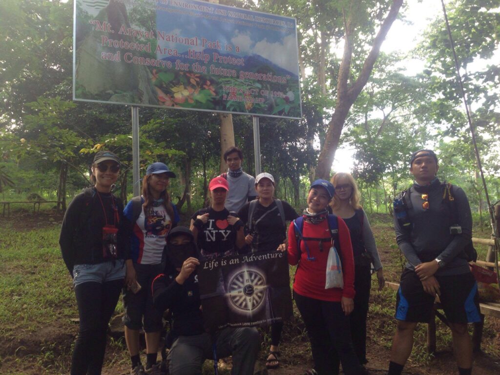
The path to the jump-off is a known place for pilgrims during the Holy Week season. There are statues that serve as the markers for the “Stations of the Cross”. Near the 7th Station is where the DENR Registration Area is located. After registration, securing our guide, paying the fees, and having breakfast, we have a short briefing on Mt. Arayat. Then the group circled and started praying to God to guide our footsteps, give us strength, have good weather, and come back home safely. For the last time we pack up and we started the hike at 7:45 am.
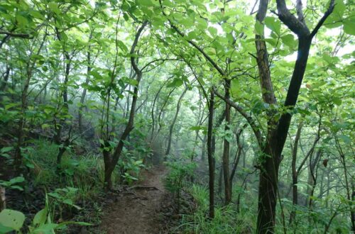
The initial part runs on the trail of the Station of the Cross that leads to a forest. As the sun was already high up when we started the hike, I noticed that most parts of the trail are covered with trees, good for us, so we don’t have to worry about the sun’s heat. Also the trail is well-established. We arrive at White Rock at 9 am, it’s a scenic rock formation within the mountain and we take some pictures there.
Then we continue hiking, as the trails become more continuously ascending, and we felt there is no wind at all inside the mountain, we were tired and sweaty already even though the entire hike had just started. The heat is rather extreme even though you are under the tree canopy for most of it. We take a little rest, drink water, and eat our trail foods.
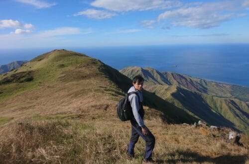
While resting we saw some monkeys above the tree. I can hear their calls even on the last leg of the trail going to North Peak. Mt. Arayat has two peaks called the North and the South Peak. First, we need to go to North Peak then later on traverse South Peak.
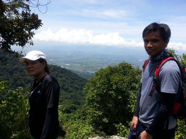
They said that this Mt. Arayat traverse is comparable with the Makiling traverse in Laguna in terms of difficulty, trail, and the overall hiking experience. The trail from Magalang to North Peak is on a constantly ascending path. There are many assault trails going to North Peak but we take our time and enjoy the hike. I have a good company of people who loves hiking.
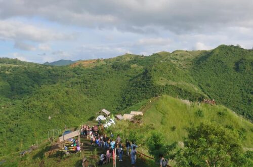
We reached the North Peak, the actual summit of Mt. Arayat around 10:30 am. We didn’t see any other people or groups during that entire three hours of hiking going to the North Peak. At the North Peak campsite, finally, we saw some groups that do an overnight traverse. Our group decided to have our lunch on the North Peak too.
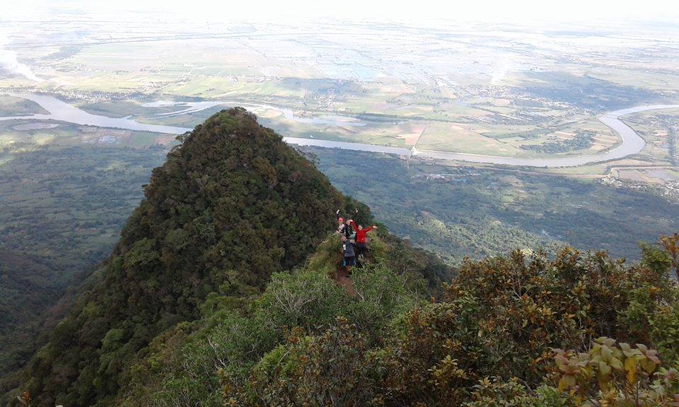
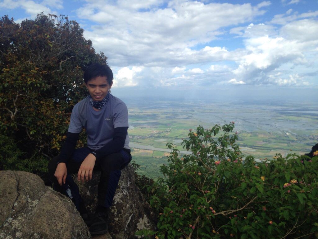
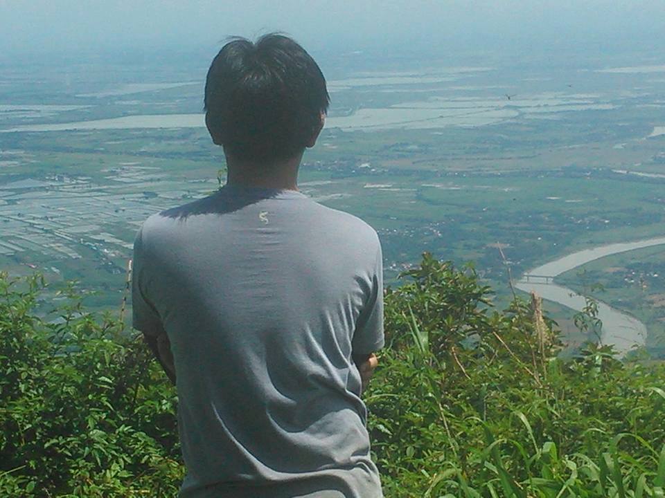
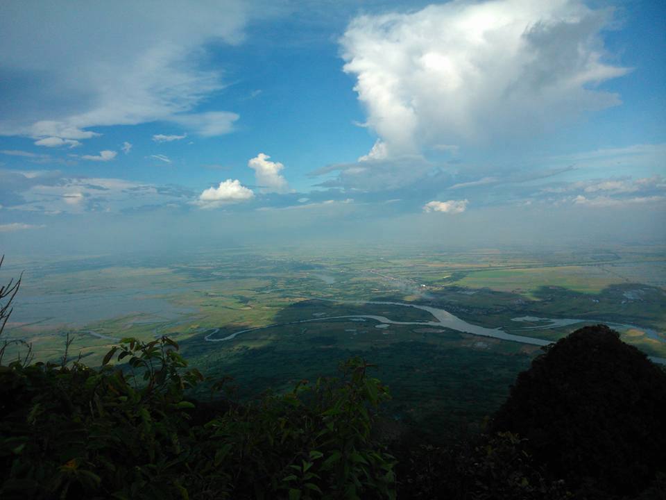
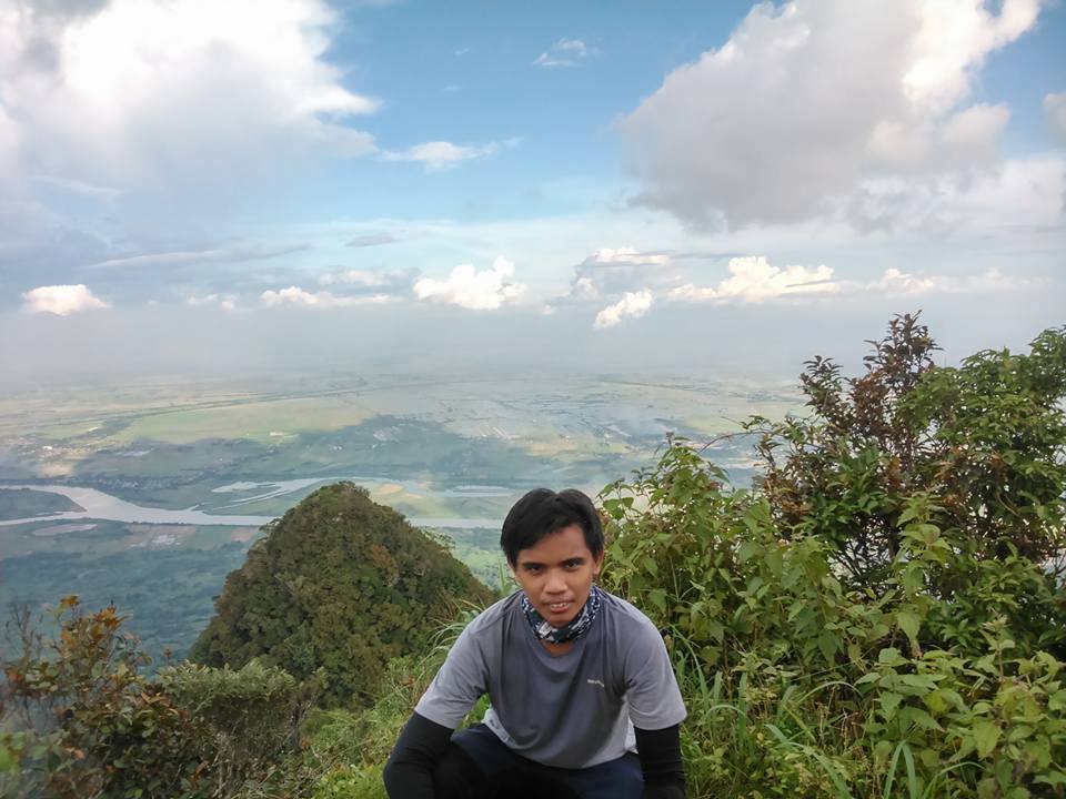
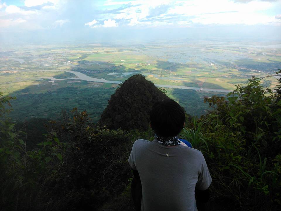
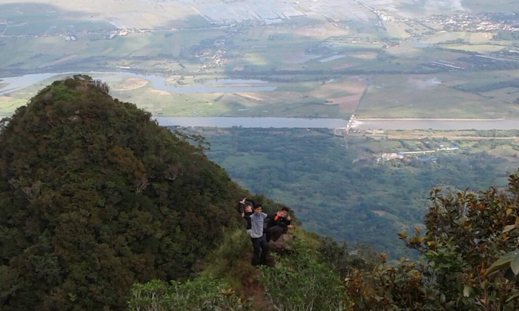
The view from the North Peak is awesome, 270 degrees that encompass mostly the Central Luzon provinces of Pampanga, Nueva Ecija, and Zambales. We take pictures and we stayed in North Peak for an hour. Some of the group members took a nap to gain more strength and energy for the challenging assault on South Peak. Between these 2 peaks is a ridgeline between the North and the South Peaks where much of the difficulty of the traverse lies.
After our lunch, we decided to resume our trek going to South Peak at 11:45 am. The beginning of the trail from North to South Peak is descending, it’s easier and also forested making it a cool and refreshing hike. But the ascending part going to South Peak is the most challenging part of the entire hiking in Mt. Arayat, it’s a pure endless assault. The trail is very steep and in some areas, there is a fixed rope to aid our ascent. Vertical clay rock walls with rope segments, steep and longer ascents make this technically a major climb and not easy after all.
The hike became more difficult as we advanced with the trail consistent on the steep ascent all the way through. The assault towards the South Peak requires both 2 legs and 2 arms for gripping as the trail runs on a steeply inclined slope. We were already exhausted, we took several breathers, some of the members said they are giving up but we need to push through in order for us to reach the South Peak summit. The final ascent to the summit was the steepest a 90-degree then later a few more walks on flat ground and we were finally at the summit.
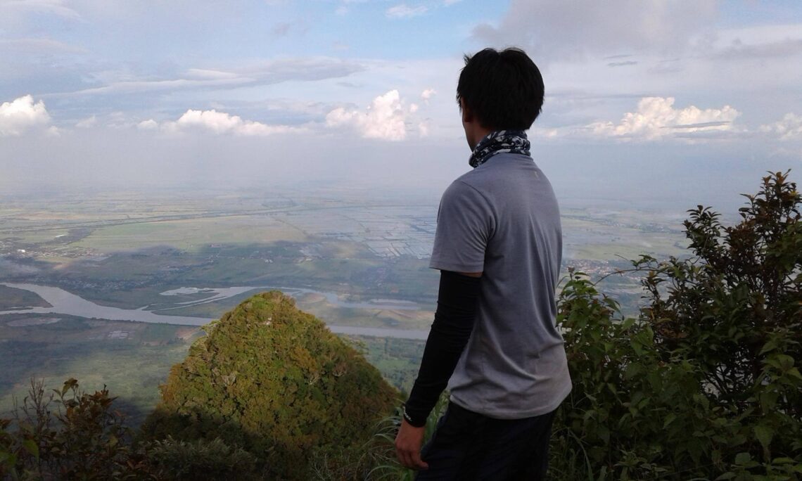
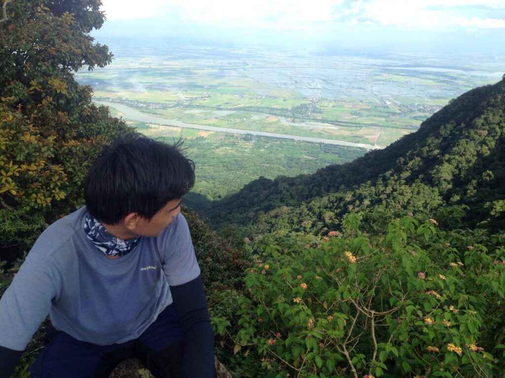
The hike to South Peak lasts 3 hours with ample rest. It requires patience and perseverance. We reached the South Peak at 2:15 pm. All the way to the summit was very exhausting, assault to assault to another assault but the site was indeed amazing, overlooking the Central Luzon plain, rice fields, and Pampanga River. Awesome!

Hiking up gives a grand view of the area. We can see the view of Central Luzon, Pampanga valley, and the river. Definitely worth the exhausting of almost 3 hours of hiking from North Peak to reach the South Peak summit. Finally, I conquered Mt. Arayat, my dream climb has come true.
We spent nearly 1 hour on South Peak. We had clearing so we enjoyed the view from above and we take a lot of pictures of the amazing view. The viewing deck of South Peak is much better compared to North Peak in my own opinion. It offers a view of Mt. Arayat’s horn, as well as the vast plains of Central Luzon with the Pampanga River, a snake-like pattern as the river flows across a fairly flat valley floor. We eat our trail food there, share thoughts and rest for a little while before descending.
We resume our trekking going down the mountain around 3:30 pm. It’s now a cooler hike. The first part of the trail has lots of rocks then followed by a pristine tropical forest with lots of Balete trees all the way down, similar to Peak 2 of Mt. Arayat until it gives way to open, grassy slopes. Our descent from the South Peak wasn’t easy, but the view was still amazing.
We have to be very careful with every step of our feet so that we would not be injured, get bruises and have scratches on our way down. Some of the group members have muscle cramps, so the group takes it little by little all the way down, the group leader and the guide assist the member who is suffering from cramps. By 5:30 pm it was raining already, but fortunately, we had our own umbrella inside our backpack.
The night catches up with the group on the trail, but fortunately, we had our own flashlight too. We reached the open plains and cement road on Juan Bano’s side at 7:15 pm in the evening, where the van is waiting for us. It takes us almost four hours to descend because of the circumstances.
All in all, we spent 12 hours on this traverse hike of Mt. Arayat being dropped on one side of the mountain and being picked up on the other side at the end of the day. What an adventure!. It was an unforgettable experience.
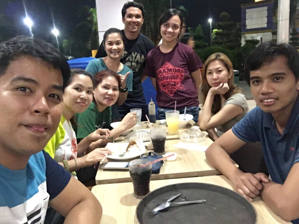
We were so tired and exhausted after the climb. Then we have our late dinner on a stopover at Chowking on the way back to Manila. Later we come back home safely. Praise God for guiding us and keeping us safe. Mt. Arayat is my second major climb.
We all have our reasons why we keep on reaching those summits and one of my reason is to “Climb mountains not so the world can see you, but so you can see the world.”
Sample 1 Day itinerary to Mt. Arayat
12:30AM – Assembly
1AM – ETD to Magalang, Pampanga
3AM – Buy pack lunch, water, breakfast, etc.
5AM – Arrival at Mt. Arayat, register, secure guide, breakfast, last-minute pack up, and briefing of the mountain
5:30AM – Start hiking
8AM – Arrival north peak, picture, rest
8:45AM – Resume hiking
11AM – Arrival at South peak, lunch, rest
1:30PM – Start the descent to Mt. Arayat exit point at Barangay Juan Bano
5:30PM – Arrival trail end, wash up
7PM – ETD to Manila
11PM – ETA Manila
Note: this sample itinerary is just a basis and not absolute or will not be 100% perfect due to many factors.
Things to bring on your visit to Mt. Arayat:
Flashlight/Headlamp
Medkit
Extra Clothes
Extra Money
Rain Coat
Trail food
3-4 liters of Water
Insect repellent
Whistle (optional)
Reminders and Tips:
- Mt. Arayat is not good for beginners, it’s a major climb. It has challenging trails with long steep ascents and descents so prepare yourself physically and mentally conditioned if you’re doing a traverse day-hike. The traverse hike is no easy task. If you’re going for a day hike, it is advisable to start the hike as early as 5 AM. A tour guide and registration are required at a minimal cost.
- Make sure to bring your own flashlights/headlamps even if it’s a day hike only, it’s good in case the night catches up with you on the trail.
- The golden rule of traveling – Leave No Trace (LNT). Take nothing but photographs, leave nothing but footprints, and keep nothing but memories.
- Always be a responsible hiker/camper and bring your own trash when u go down. Respect the locals and respect the place.
- Mosquitoes, flies, and other insects abound in Mt. Arayat so off lotion, and mosquito repellent is a must.
- Bring lots of water as there are only a few water sources inside the mountain. Also water discipline is a good skill to have on this mountain.
- The guide fee for three peaks is 1,800 pesos while the guide fee for two peaks only is 1,500 pesos. The registration fee is thirty pesos.
- If you’re an experienced hiker and you want a more challenging climb then you can choose the Mt. Ayarat Pinnacle trail (Pinnacle to South Peak) which has a difficulty of 7/9, a trail class of 1 to 4, and has a trail length of 8 kilometers. The trail is straightforward and mostly forested until you arrive at the viewpoints leading to Pinnacle Peak. On the other hand, you may climb Mt. Arayat Quad Peak in twelve to fourteen hours on a forested trail. The hardest part of Quad Peak is the solid assault trail on rugged cliffs approximately seventy-five to eighty-five degrees with no flats in between.
- Last but not least the mobile signal in Mt. Arayat is super weak.
How to Get to Mt. Arayat
By Commute
Ride a bus in Cubao Victory Liner bus station going to San Fernando, Pampanga.
Drop-off at SM City Pampanga then ride a jeep going to Arayat town proper then ride a tricycle going to Magalang. Tell the tricycle driver that you’re hiking Mt. Arayat and they know it.
Sometimes all we need is a short break to enjoy a moment of life. In general, I hope this Mt. Arayat travel guide and reference has been helpful to you. Don’t forget to share this with your friends, classmates and groups if ever you plan on doing the Mt. Arayat Traverse day hike too. God bless you in all your future travels and hiking adventures. Until next time. Thanks for reading.
Jervis Ergino
Hi! I’m Jervis Ergino, the digital content creator behind Hike to Mountains, a travel and hiking blog in the Philippines. This blog is dedicated to helping people know more about the best hiking and tourist destinations in the Philippines.