Mt. Pigingan Dayhike Guide
Introduction
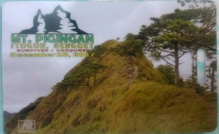
Mt. Pigingan is located in Brgy. Dalupirip, Itogon, Benguet. It has an elevation of 1328 meters or 4356 feet. Mt. Pigingan almost crosses the borders of Nueva Vizcaya and Benguet. Moreover, it’s a 21-kilometer trek from the registration area to the summit and vice versa. Also, Mt. Pigingan is a more serious hike than Mt. Ulap. It’s good for hikers looking for a more challenging day hike near Baguio.
Mt. Pigingan means slanted. Pigingan came from the local Ibaloi word “piging” which means “slanted”. It was said that the mountain was named as such due to the descriptive outline of its peak. Although Mt. Pigingan is not a very popular mountain in the Cordillera Region and does not attain the grandeur of Mt. Pulag or Mt. Napulauan nor their high elevation, however, the trail offers a beautiful view of the scenic landscape of the Cordillera Region.
Undoubtedly, its neighbors Mt. Ulap and Mt. Ugo are already popular hiking destinations. On the other hand, Mt. Pigingan serves as an alternative to this hiking destination. Also, it’s one of Benguet’s hidden gems. At the same time, possibilities for a traverse to Mt. Ugo are possible for longer hiking adventures. Furthermore, the abundance of pine trees would still remind you that you are still in the Cordillera region, and the long trail is still a welcome challenge for hikers looking for a more serious day hike in Benguet province.
Name: Mt. Pigingan
Difficulty: 4/9 (Pinoy Mountaineer)
Jump-Off: Barangay Dalupirip, Itogon, Benguet
Features: Grassland and pine ridges, scenic views of Benguet Mountains, knife-edge summit, and highland villages
My trip to Mt. Pigingan
Let’s get away from the traffic, from the crowds, from the pollution, and shrug off all the negativity. The weather is perfect, blue skies above, cool winds blowing, happy hearts, and the promise of great adventures. This is what was on my mind in the past days before I decided to go to the Mt. Pigingan Dayhike event.
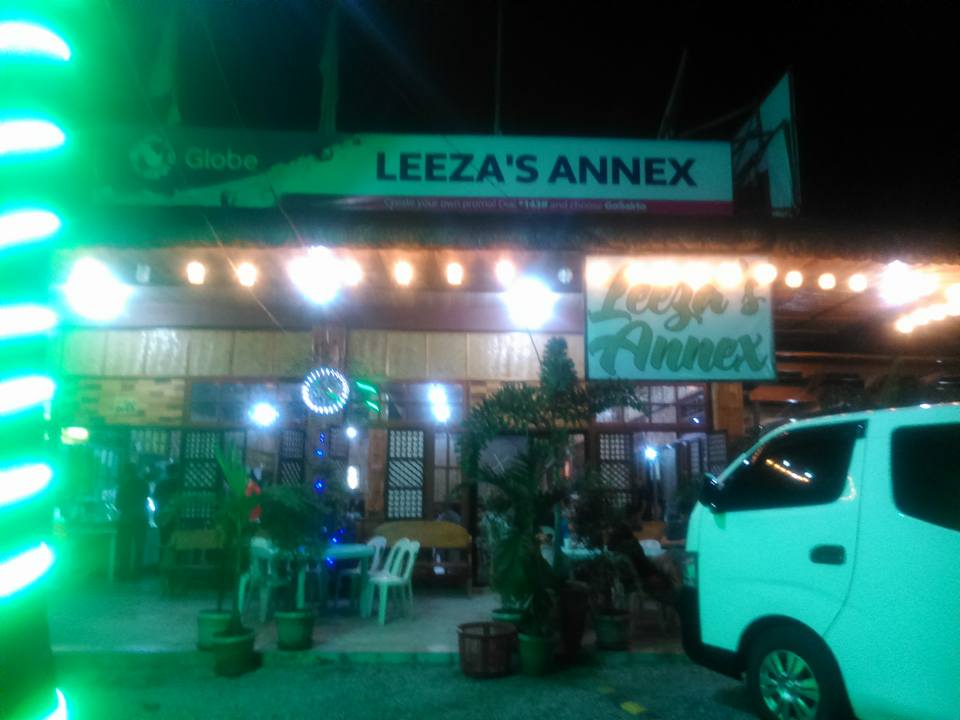
My adventure started when I joined an organized tour going to Mt. Pigingan. I met the group at Greenfield Mcdo and once everyone was complete, our van headed toward Itogon, Benguet. Then we have our stopover at Leeza’s Restaurant in Sison, Pangasinan at 2:30 am in the morning. Because I was a solo joiner, I ate alone with rice, chicken, and soup in front of me.
Then our van headed towards Baguio City. I’m excited and never sleep again in the van to see the beauty of the city along with the beautiful sunrise. We arrived in Baguio at 5 am, we passed by a junction where to our right leads to the famous Mt. Ulap, while to the left goes straight to Barangay Dalupirip, Itogon.
The road going to Barangay Dalupirip, Itogon is comparable to Halsema Highway as we’re braving a narrow road with unending, steep cliffs on the left side. It took us one hour on the road to get to Barangay Dalupirip, we arrived at 6 am.
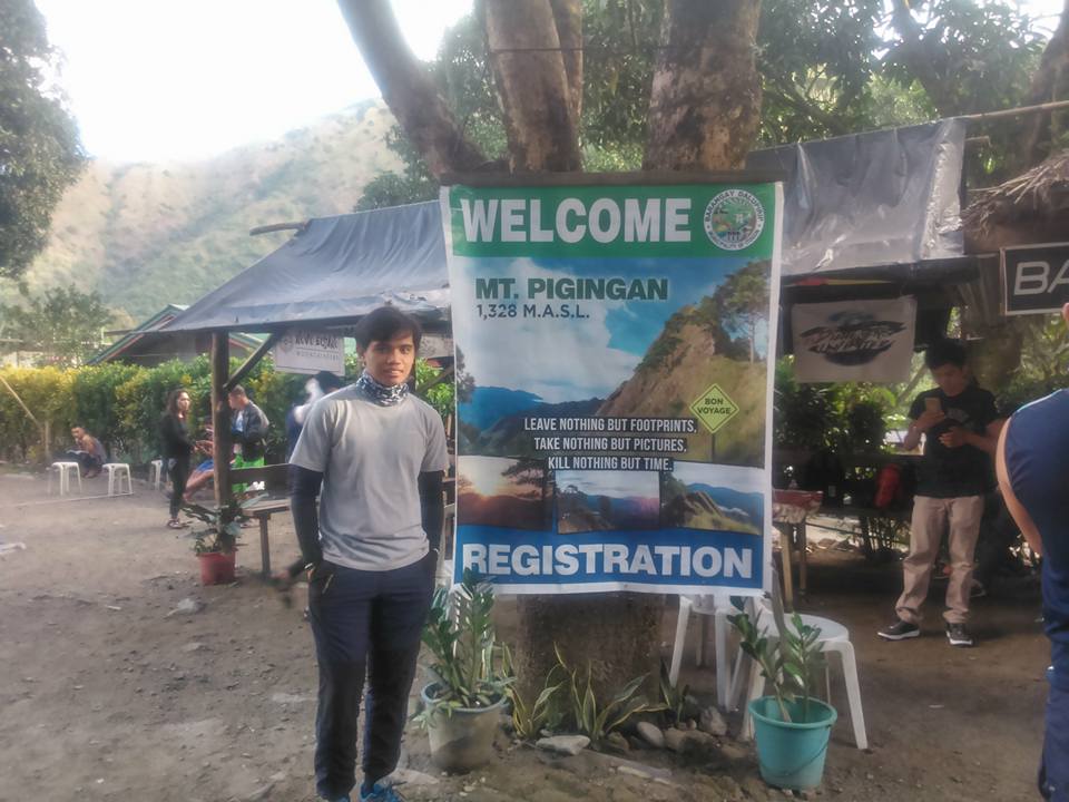
Mt. Pigingan registration area is situated in Sitio Balucoc in Barangay Dalupirip, Itogon, Benguet. We registered there, have a quick breakfast, and have an orientation about the trail and the mountain. Then after the group prayer and final pack up, the hike going to Mt. Pigingan started.
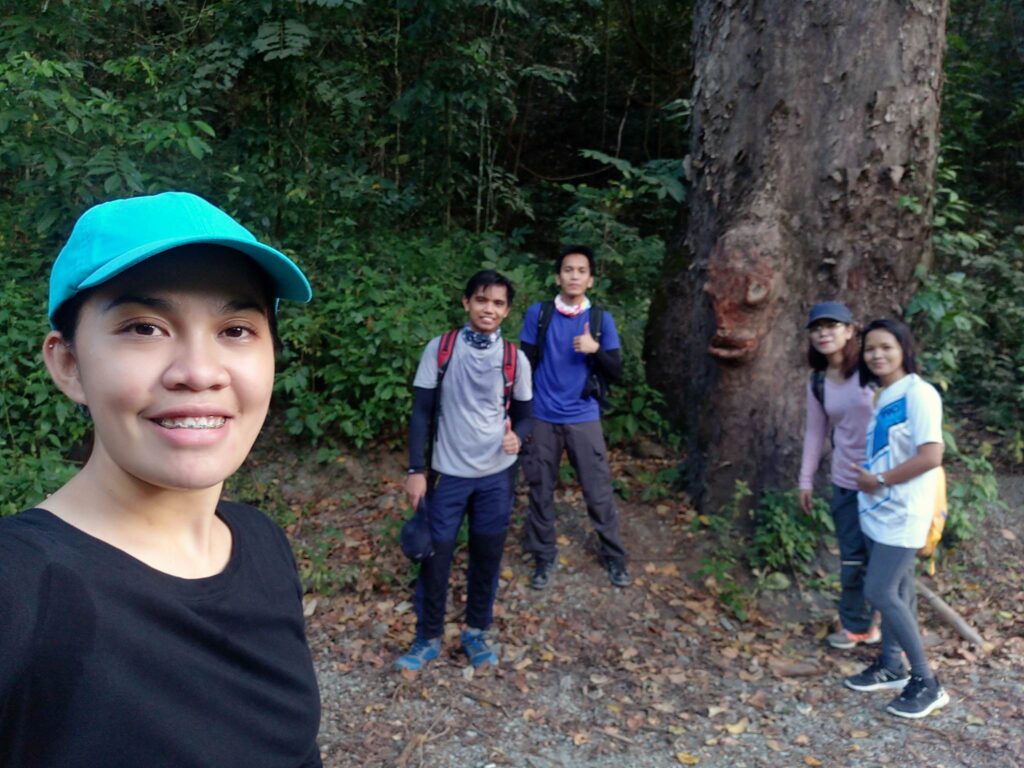
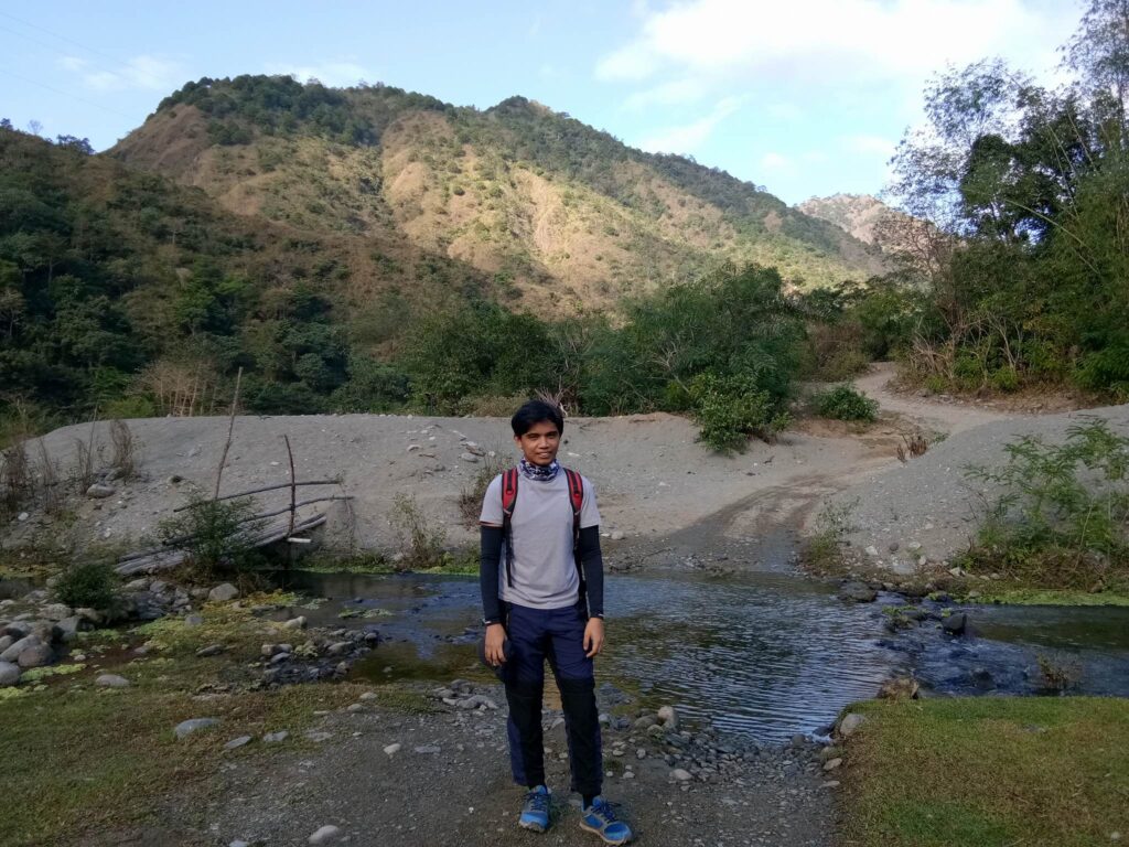
The hike starts at the site of the Agno River before beginning with the main trail some thirty-five minutes later. While walking I noticed that I was not the only solo joiner in the group, most of us are solo joiners. The road going to the trailhead was a very narrow cemented pathway that follows the river.
To our left side view, we can see the clear and beautiful Agno River. It is a river located in the Northern Luzon, traversing the provinces of Benguet and Pangasinan. Agno River is over 200 kilometers long, originating in the province of Benguet, and empties into the West Philippine Sea through the Lingayen Gulf in the province of Pangasinan. The river is long, making it the sixth-longest river in the Philippines.
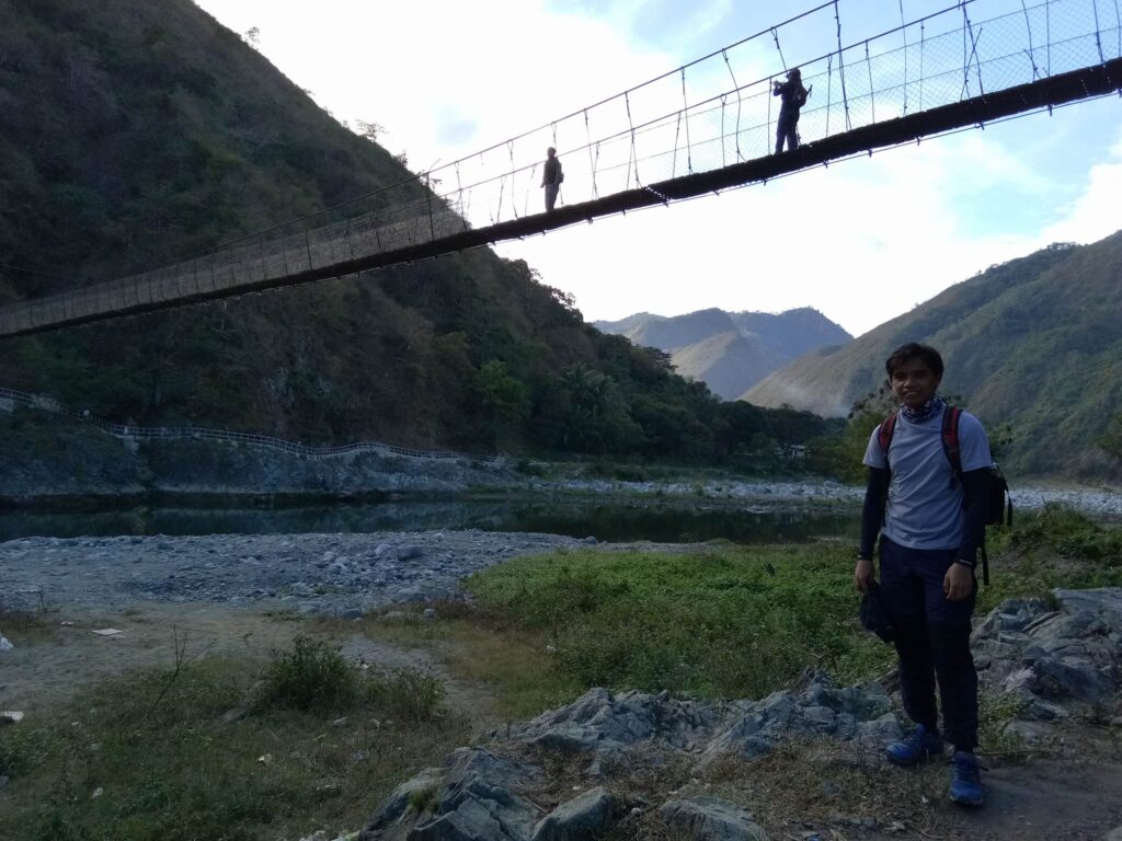
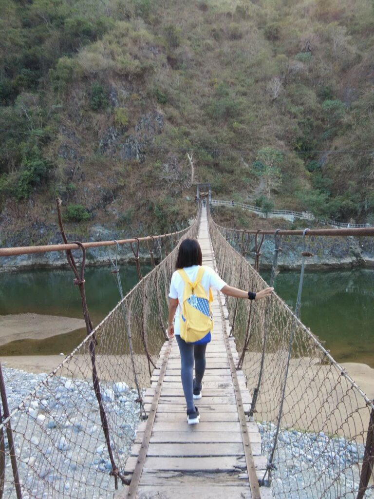
After thirty minutes of walking, we pass a hanging bridge spanning the Agno River that lets us cross to another side of the river. We took some photos below the hanging bridge because the view of the hills framing the river is amazing.
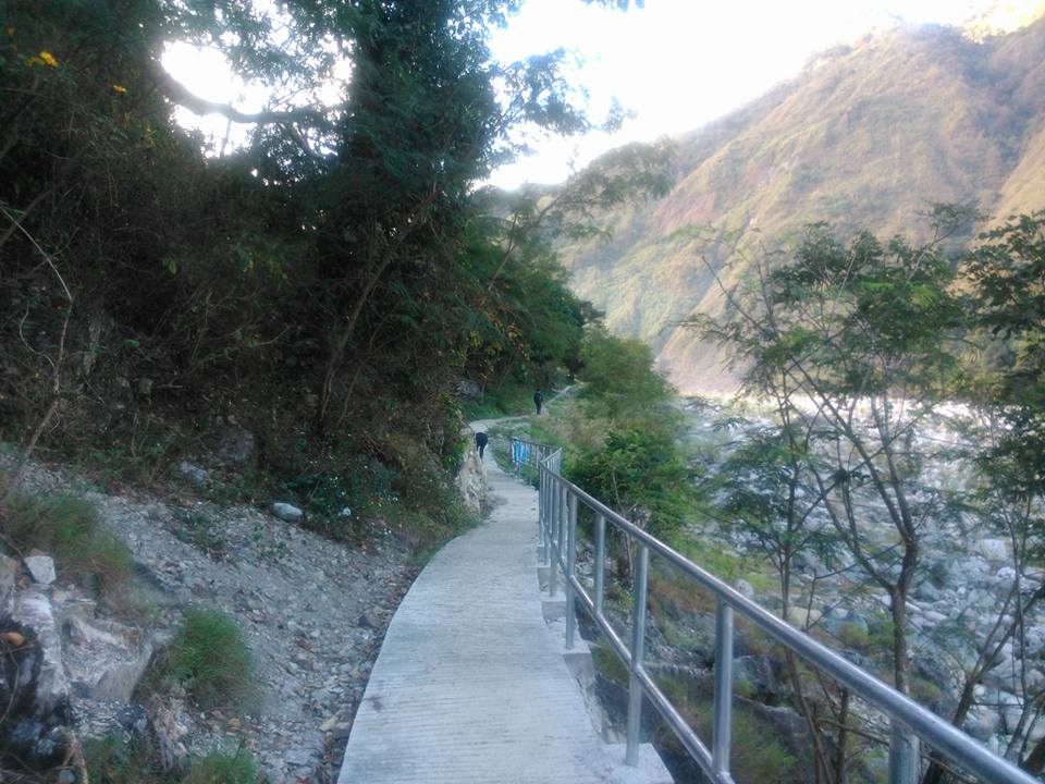
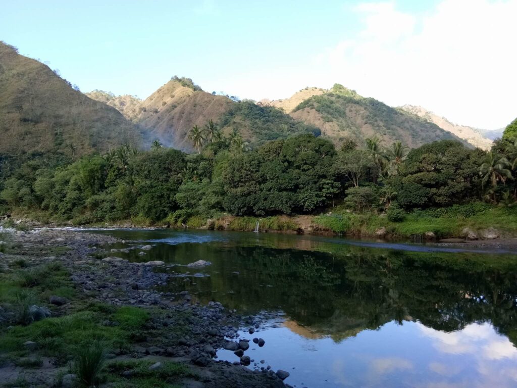
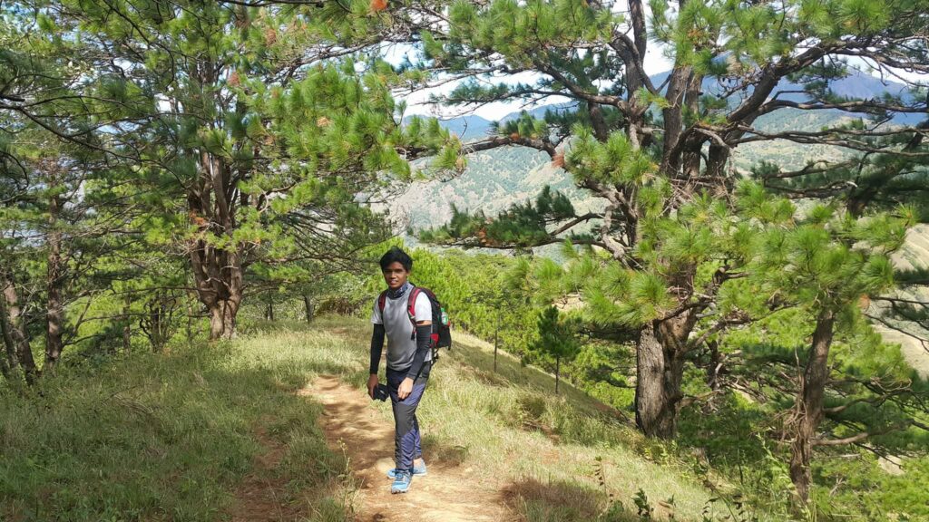
Then at 6:45 am, we arrived at the main trail, which was at the dried riverbed parts of Agno River. The first part of the hike is mostly on a flat trail following the Agno River. We walked on this long and snaky road beside the river.
Then the trail becomes gradual and moderately ascending at the side of the mountain, which becomes steeper as you ascent. The trail in this part of the hike is mostly composed of soil and some loose sand. Along the trail, there’s a water resource coming from a natural spring.
As the morning sun is high and the trail is wide open not shaded with a lot of trees, we are already sweating because of the heat and the humid temperature. We saw some bulldozers at the trail, we think they were paving the road to be cemented for ease of transportation in the future.
After almost two hours of continuous ascent on several mild slopes, we finally arrived at the junction where a sari-sari store is found, we rested there, have snacked, and share some thoughts about the mountain we climb in the past years. The junction serves as a resting area and marks the real ascent towards the Mt. Pigingan summit.
We saw lots of goats and cows at the junction. The marker at the junction points to the direction of different places you can go from there. The guide told us that there’s a trail from Mt. Pigingan to Mt. Ugo traverse from this junction. I was shocked. I never thought about it.
After we rested, we resumed our trekking at 9:30 am. The real ascending starts at this point of the junction. The trail after the junction is the final one hour and thirty minutes assault going to the campsite and summit.
With the sun already up high in the sky and not many trees to protect us from the harsh sun, we started the hot ascent in the exposed slopes of Mt. Pigingan. We noticed that some parts of the trail are composed of loose soil but mostly are the sturdy decent paths. There were barely any shades at all because the trails were mostly open. The sun was furiously gleaming on us. We are sweating badly as we climbed. We took several breathers.
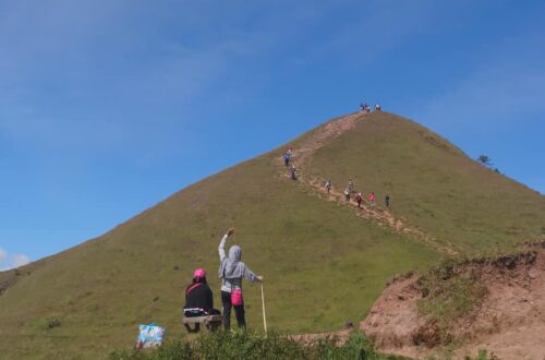
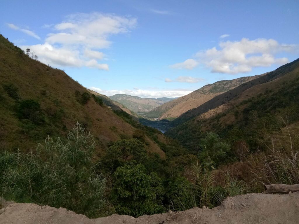
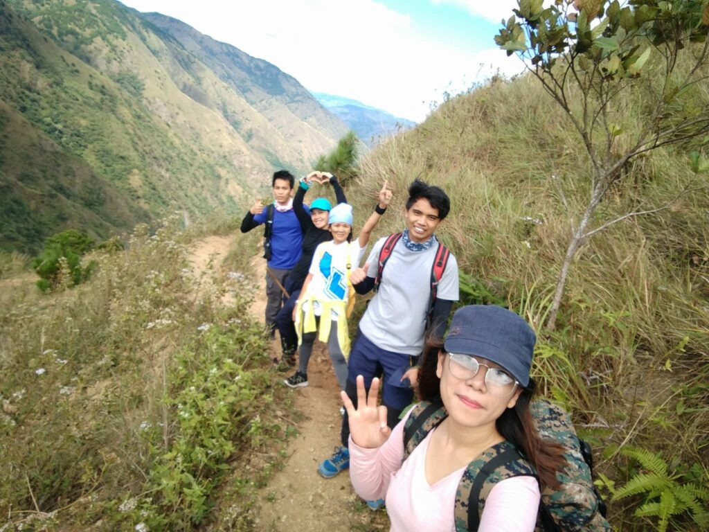
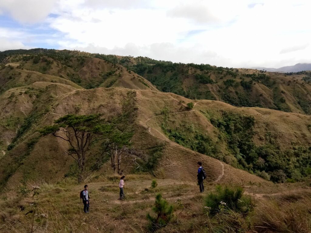
The ascending trail is a somewhat snakelike or a zigzag trail from left to right then right to left. The final left turn reveals a wide-open grassland viewpoint where we saw the pristine Agno River from a distance and a scenic view of the overlooking mountains and grasslands.
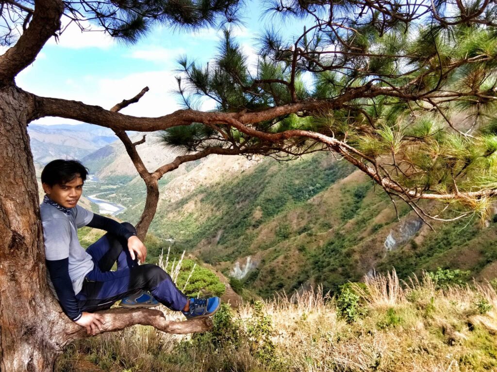
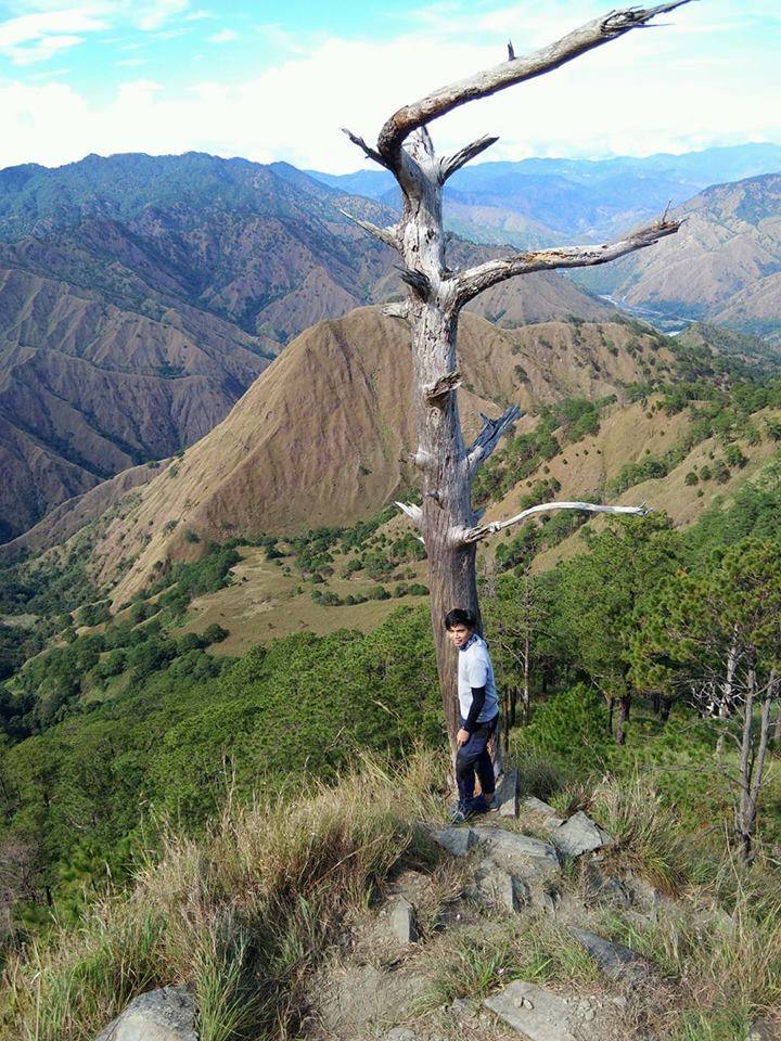
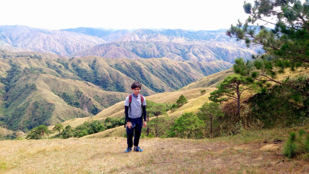
After one hour of continuous ascending, we rested again and take pictures at the picturesque tree with the beautiful Agno River and mountains in the background. While we are resting, I feel the strong wind blowing. The cool wind blowing every now and then made the heat bearable as we relaxed and sat down on the grass. As a result, it gives us some relief. From this point, the view is awesome. I was also amazed at the distance we just covered in a span of hours of hiking.
Then, we continued the long ascent towards the campsite of Mt. Pigingan at a fast face so the heat of the sun won’t punish us long but later, luckily the weather becomes cloudy and it favored our group.
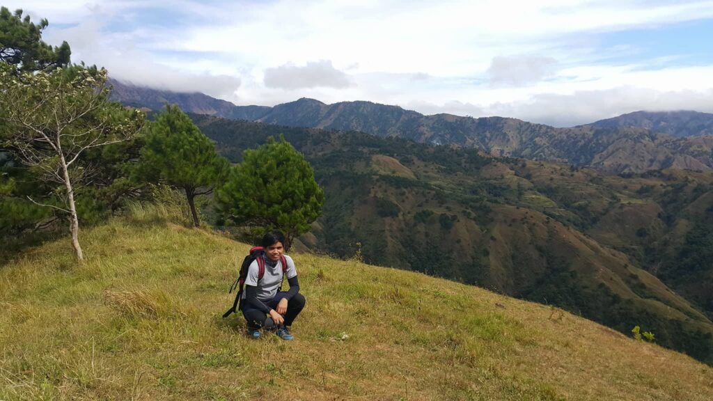
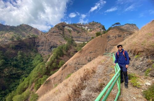
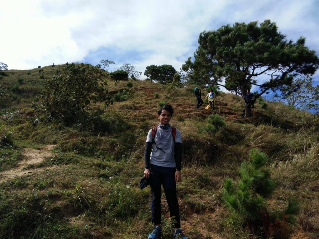
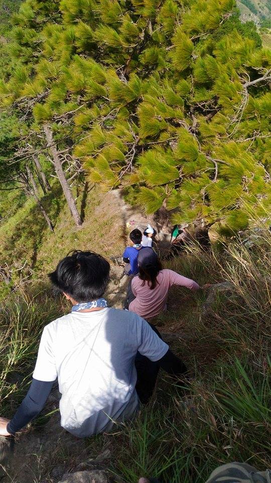
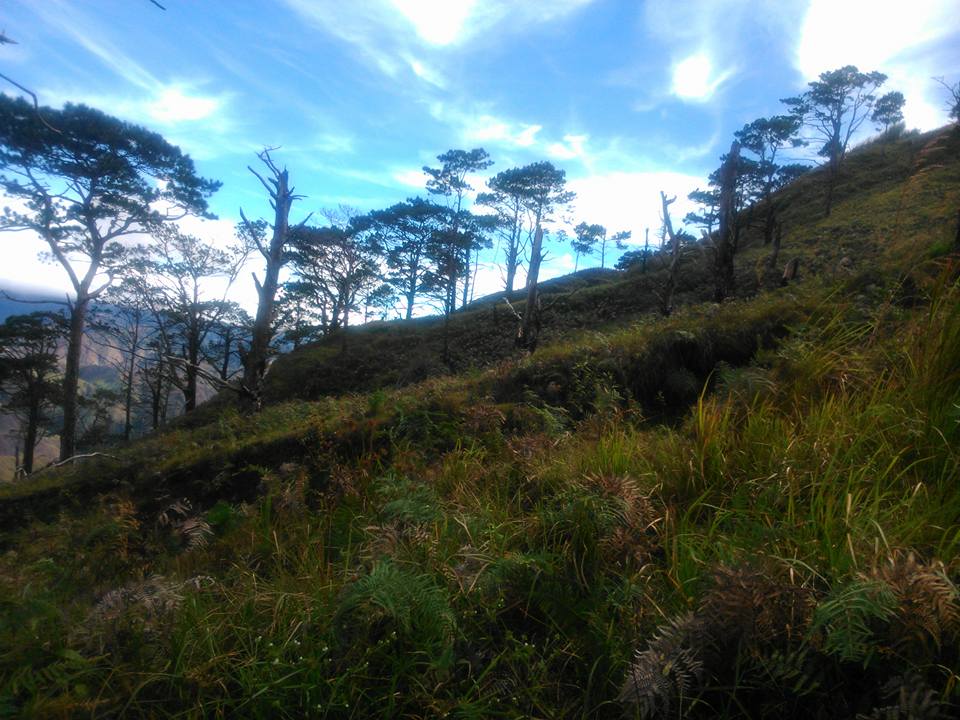
As we reached the upper reaches of the slope, the trail becomes flat with tall pine trees, and scenic views of the Benguet mountains. The abundance of pine trees reminds our group that we are still in the Cordillera region. Also, the cold breeze coming in provided respite from the heat.
I am used to seeing mountains every now and then since I fell in love with hiking, but the beauty of the Cordillera mountain ranges far beyond was just jaw-dropping. Young pine trees are still growing. This portion of the trail was reminiscent of my first major climb at Mt. Ugo’s mesmerizing pine-forested trails. I was taken aback by the scenery while we were walking.
From here, the trail has a gradual ascent and slowly we were gaining elevation. As we were nearing the campsite, I saw the first glimpse of Mt. Pigingan’s summit. It was an indication that we were near the summit so we hurried up. Then after several minutes of walking on a flat pine-forested trail, we reach the campsite, we saw other groups of hikers who are resting in the area, the campsite is so wide.
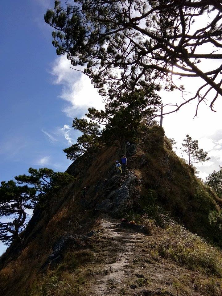
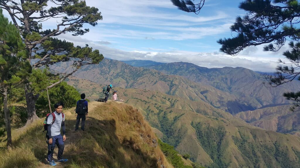
From the campsite is another forty minutes hiking to the summit of Mt. Pigingan. Then after thirty minutes of hiking, we reached the ridge of the mountain going to the summit. To our left and right side is a dangerous drop. To our front is the Mt. Pigingan knife-edge summit.
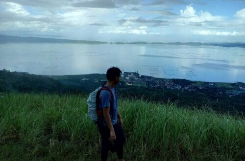
Then our guide told us that there is another group at the summit so we waited for our turn. We rested and have our lunch just below the summit of Mt. Pigingan covered with beautiful pine trees. The view there is fantastic. I can see the highland villages, Binga Dam, and the beautiful mountains of Benguet province such as Mt. Ugo and Mt. Ulap. We take a lot of pictures there.
The wind at the top is so strong. I lost my tiredness with the strong wind and my sweat dried up. After thirty minutes of lunch and a quick rest, we went on to get to the summit. The final assault to the summit is the most challenging part, with the wind blowing while the grass is singing, this is such an awesome experience for us.
The trek to the knife-edge summit requires rock scrambling and the trail is so narrow that one could easily fall on both sides of the mountain. One wrong step and you could end up falling off the crag with an unrecognizable face. Also, we needed to wait for each other turn. Fortunately, the railing has been installed to assist and support hikers in climbing the very steep assault.
The last ten-minute climb to the summit was the most challenging for me because I was literally crawling on a slim ridge while trying not to look down on the steep ravine to my left. Also, the wind is blowing with full force. This made the climb precarious.
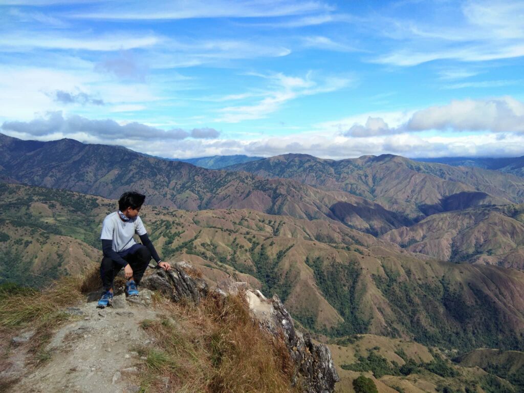
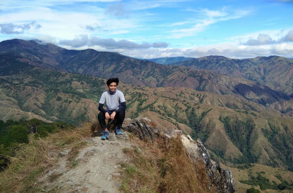
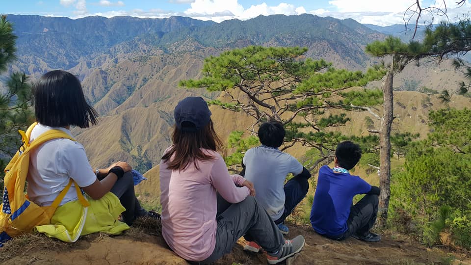
We reached the summit of Mt. Pigingan at 11:30 am. I easily noticed that the summit really occupies just a small area but the views are more stunning with the surrounding mountains. The summit can only accommodate four to eight people at one time. The wind was howling at the summit which is really amazing. I thought that the winds were blowing stronger because it was late December. The views from the summit were magnificent. The weather is perfect, blue skies above, cool winds blowing, great adventures, and happy hearts.
In my point of view, you have to be there to truly appreciate the beauty of the place. Here are a few teaser photos from the mountain top. I say it again, you have to be there to truly appreciate the beauty of the place. These photos don’t do justice to the wonders of nature that surround you once you step foot on the summit ridge.
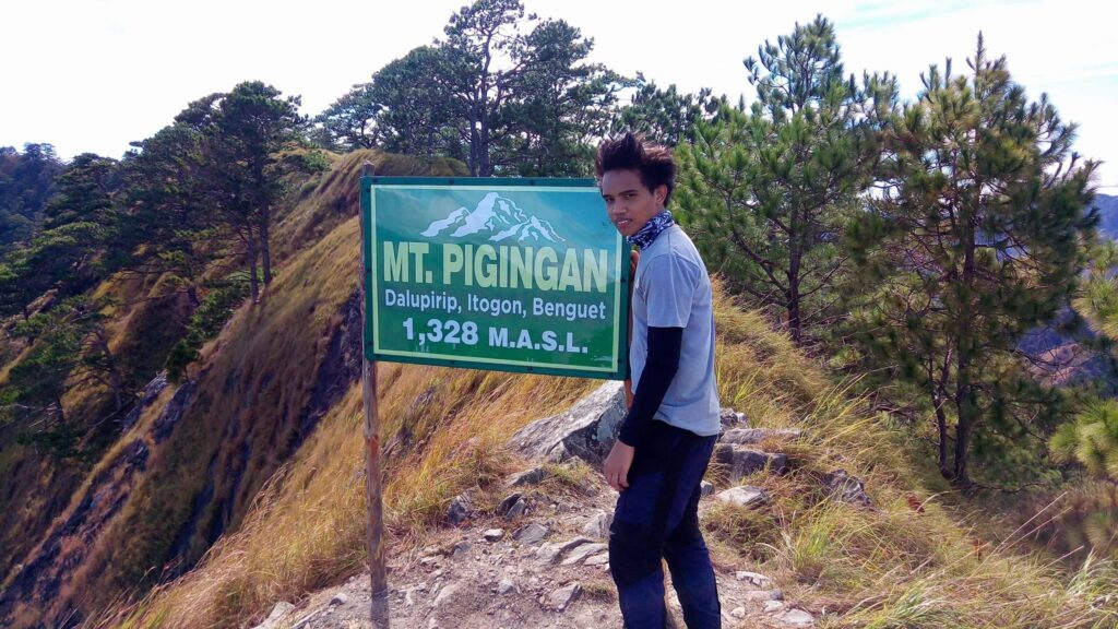
I really love the views at the summit. The elevation of the summit is not as high as compared to other popular mountains in Benguet but the view and the feeling of fulfillment as you stand on the top would be as great as the high mountains of Cordilleras. Moreover, we take a lot of pictures at the summit, especially the summit marker. It was an achievement of the group. Nature rewarded us with this stunning view and perfect weather.
I have climbed several mountains in Northern Luzon before and I never expected that hiking Mt. Pigingan would be a surprise with its natural beauty. Experiencing the trek to the knife-edge summit of Mt. Pigingan in Dalupirip, Itogon, Benguet is amazing, and witnessing the rolling hills located on the boundary of Itogon and Nueva Vizcaya is special. The mountain ranges are so delightful to see. It was so calming.
After our group has done taking pictures and savored the view, we decided to start our descent from the summit. We have to be very careful with our footsteps as the peak is quite steep and extra caution should be observed especially when going down and it’s windy. Going down is quite a toe killer for us as it is slippery because of the gravel surface.
Upon reaching the pine-forested trail, we slowly walk, took a breather, and later we decided to hurry up descending until we reached the junction. We ran the trail as fast as we can like a mad dash to avoid the heat of the sun.
When we reached the portion of the slopes of the mountain, we had an amazing view of the mountain slope in front of us but despite the furious heat of the sun, we take a few more photos of this scenic landscape and have some fun.
We reached the junction at 2 pm with minimal stops along the descending wide open trail, as usual, it doesn’t have many trees to shade the trail. We took a long rest there, eat snacks, drink water, and we shared some stories.
After our long rest of forty-five minutes, we continue our long descent. Then after one hour of descending without any rest, we were already at the base of the mountain and bank of the Agno River. The trail is still long from here going to the jump-off. We continued walking and along the trail, we saw a sari-sari store, we ordered some Halo-Halo there to quench our thirst.
Later in the afternoon, we crossed the hanging bridge on the other side where our van, other members of the group and the driver is waiting for us to arrive. We were back at the jump-off point at around 7 pm. We finished the hike well and in good condition. Thanks be to God.
Once we arrived in Barangay Dalupirip, Itogon, we immediately take a quick rest. Then later we wash up ourselves and have our dinner there. At 8 pm, our van left Dalupirip bound to Manilla. The next day we come back home safely and sound. It was a nice adventure.
Mt. Pigingan was such an enjoyable and relaxed major dayhike. I truly appreciated the beauty of this mountain. I also encountered hikers coming from different walks of life. It was a solid year-end hike. Overall, the climb was really worth it. Thanks, Mt. Pigingan for the almost twelve hours of hiking and for your amazing beauty. Thanks to thrilling assaults and long walks.
Special thanks to Lansoy and Gala-Eyranians travel group for organizing the event and for this awesome trip. For more travel and hiking events, please check their Facebook page group.
Mt. Pigingan is my fifth major climb. The trek is just gradual, up and down the hill, and has wonderful huge pine trees that lead to the summit. The trail going to the summit is easy but the peak is quite difficult since it was too steep. Definitely, Mt. Pigingan is one of those places that you should visit once in your lifetime. It was a trip worth remembering. Memories made in the mountains stay in our hearts forever.
Sample 1 Day itinerary to Mt. Pigingan
Day 0 :
10PM – Assembly/Meet-up
10:30PM – ETD to Dalupirip, Itogon,Benguet
Day 1
5AM – ETA Mt. Pigingan jump-off at Dalupirip, Itogon, Benguet, register, secure guide, and have a breakfast
6AM – Start hiking
8AM – Arrival at the Junction, take a rest
10AM – Campsite of Mt. Pigingan
11AM – Summit of Mt. Pigingan, lunch, rest, photo-ops
12:15PM – Start to descend backtrail
2PM – Arrival at the Junction, take a rest
2:30PM – Resume descent
5PM – End of hiking, wash up, dinner
6PM – ETD back to Manila
Note: this sample itinerary is just a basis and not absolute or will not be 100% perfect due to many factors such as weather, group pacing, emergency and etc.
Things to bring on your visit to Mt. Pigingan:
2 to 3 Liters of water
Trail foods
Headlight or flashlight
First aid kit
Arm sleeves
Extra clothes
Packed lunch
Camera
Extra money
Umbrella
Raincoat/ (optional)
Neck Pillow for the long ride (optional)
How to Go to Mt. Pigingan
By Commute
- From Manila, ride a bus at Cubao bus station or other terminal going to Baguio City. The travel time is six to eight hours depending on which part of Manila you’re coming from, which route the bus takes, and whether or not it makes a stopover along the way.
- Then from Baguio City, ride a jeep in Lakandula Street in front of Baguio Center Mall going to Barangay Dalupirip, Itogon, Benguet. Take note that the jeep usually leaves early in the morning at around 6 am. The travel time is approximately two to three hours.
By Private Vehicle
- From Baguio City, the registration at Mt. Pigingan can be reached in one and a half hours but it depends on the speed of the vehicle.
- To get there take the Loakan Road to Virac, Itogon until you reach the twin river.
- From there you will see two separate roads, take the left road going to Barangay Dalupirip, Itogon.
- Then follow the road going up to Sitio Balococ, the registration area. Signs are visible there, won’t be much problem driving or getting lost.
Reminders and Tips:
- The hike to the summit may take five to seven hours depending on the speed and pacing of the group.
- Mt. Pigingan is not good for beginners, it’s a major climb.
- Respect the mountain and respect the locals.
- Always follow the golden rule of traveling – The Leave No Trace (LNT) principle. Take nothing but photographs, leave nothing but footprints, and keep nothing but memories.
- Always be a responsible hiker and bring your own trash when you go down. Keep the mountain clean.
- It’s highly recommended that you climb the mountain early so you can descend early as well and you’ll be treated to a fiery sunrise and a great view of the rivers, hills, and mountains.
- The last water source is five minutes away from Camp 2.
- Cellphone signals are very limited.
- There is a parking space for vehicles at the registration area and there are sari-sari stores.
- The best time to visit Mt. Pigingan is from December to February when the temperature is really cold.
- Guides are available for 500 pesos/day for up to five persons.
- Last but not least, If you’re coming from Metro Manila or Southern Luzon, I highly recommend getting a packaged tour when you plan to visit Mt. Pigingan for ease and convenience. Inclusion in the package tour is Private Van round trip from Manila to Benguet and vice versa, Guide fee, Registration Fee, Driver’s Meal, Gas/Parking, Environmental fee, and Registration fee.
I also don’t know why I hike mountains but the fun that our mother nature brings is so different. I hope you try it too. On the whole, I hope this travel guide to Mt. Pigingan has been helpful to you. Don’t forget to share this with your friends or groups if ever you plan on doing the Mt. Pigingan day hike too. God bless you in all your travel and hiking adventures. Hope to see you on the trail. Thanks for reading.
Jervis Ergino
Hi! I’m Jervis Ergino, the digital content creator behind Hike to Mountains, a travel and hiking blog in the Philippines. This blog is dedicated to helping people know more about the best hiking and tourist destinations in the Philippines.