Mt. Ugo Traverse: My First Major Climb
Introduction
Mt. Ugo is a popular hiking destination located in the borderline province of Nueva Vizcaya and Benguet. It has an elevation of 2,200 meters above sea level or 7,217 feet. Mt. Ugo offers marvelous views of the surrounding mountains of the Cordillera region, pine forests, villages, and highland rice paddies.
Mt. Ugo was discovered in the year 1987 in the aftermath of a Philippine Airlines aircraft crash on one of Mt. Ugo’s slopes. Rescuers, including mountaineers and locals, found the wreckage of the plane 200 yards just below the summit. From the date of its discovery, many mountaineers have gone to explore the trail of the mountains. Furthermore, subsequent operations paved the way for establishing the trails, and soon become a new hiking destination in the Cordillera region. As of today, Mt. Ugo is a popular hiking destination in the Cordillera region.
Mt. Ugo came from “Ugoan” which is an Ibaloi word that means “to cut the neck”. It was said that the mountain was named as such due to the oral tradition that Mt. Ugo is the place where the invading Spaniards were killed. In spite of a somewhat violent etymology, Mt. Ugo can be seen as a monument to the fierce determination of its locals to defend their way of life.
The trail for Mt. Ugo traverse stretches from Kayapa, Nueva Vizcaya to the village of Tinongdan in Itogon, Benguet. Mt. Ugo traverse trail length total is 33 kilometers. It crosses two provinces, namely Nueva Vizcaya and Benguet. Undoubtedly, it is 16 kilometers up from Kayapa, Nueva Vizcaya and 17 kilometers down to Itogon, Benguet. Mt. Ugo is ideally hiked on a 2-day itinerary however on a fast pace group, Mt. Ugo can also be day hiked, usually thirteen to sixteen hours of hiking to complete the traverse.
Name: Mt Ugo
Jump-Off: Kayapa, Nueva Vizcaya
Exit Point: Barangay Tinongdan, Itogon, Benguet
Elevation: 2200 MASL
Difficulty: 5/9, Major climb
Features: Pine-forested trails, ridgeline, the sea of clouds, highland rice paddies, and village trails, stunning view of the Cordillera Mountain range.
My trip to Mt. Ugo
After many months of not traveling in the province and just staying in the city. I need a break from city life. I have done some minor climbs before but haven’t hiked any major climbs yet so I decided to give it a try. Luckily, one of my hiking buddies invited me to join a major climb and that is Mt. Ugo traverse.
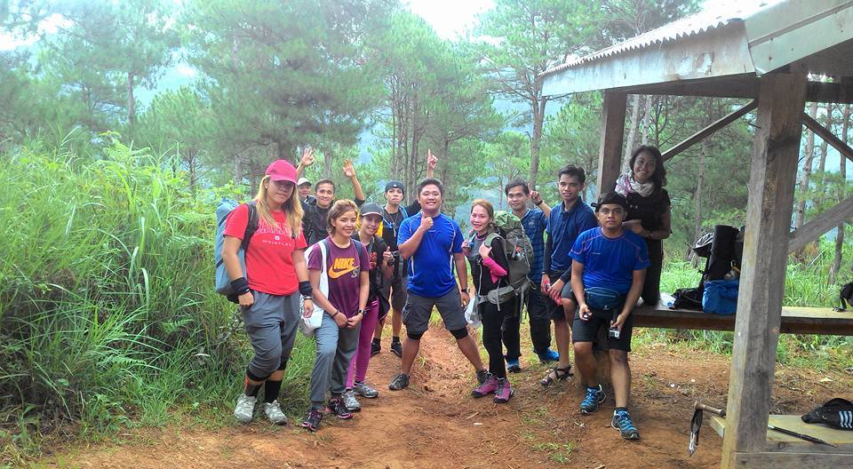
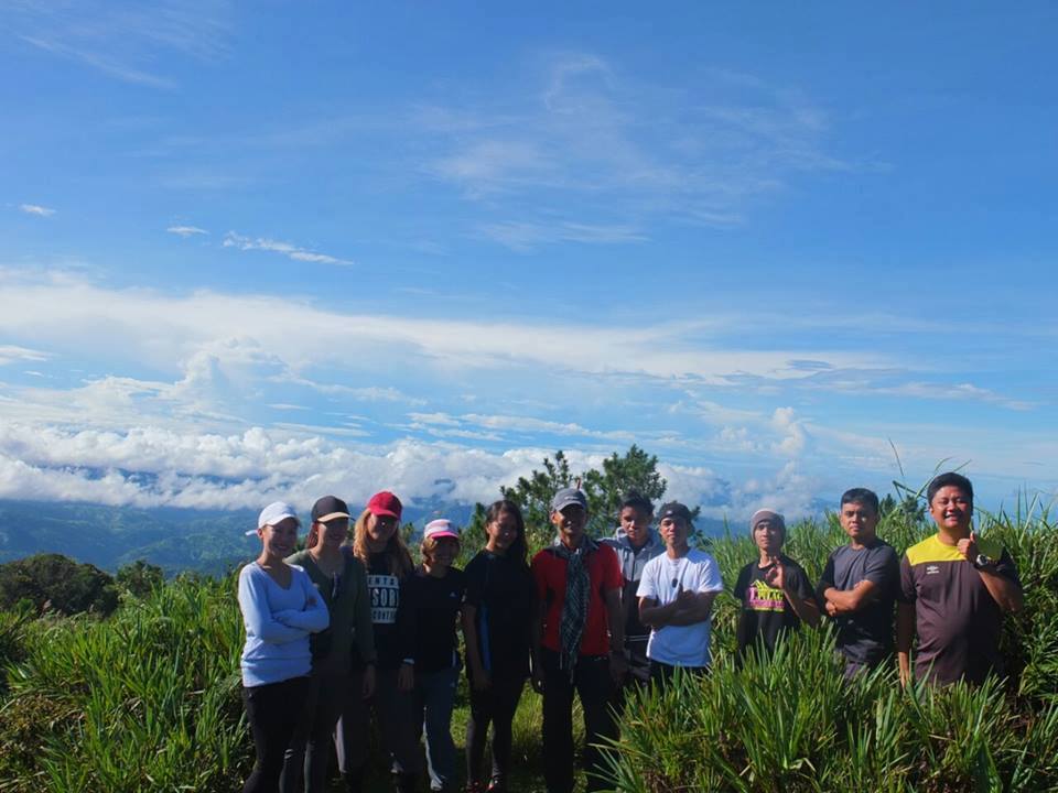
Mt. Ugo is not yet on my bucket list but I want to go to some places I’ve never been before. As a result, I accepted and join an organized tour, the group name is Trek Hunters. We are eleven in the group and some of the members are veteran hikers already but some members of the group including me will be doing a major climb for the first time. I research about the mountain and knowing Mt. Ugo has a very long trail, I prepared for the upcoming major climb by walking two kilometers a day and doing some push-ups for better cardio prior to the climb so that I am physically fit.
We don’t need to bring a tent anymore since the plan of the group is to stay overnight at Elementary School in Domolpos village and not camp at Mt. Ugo campsite. To do that our group leader Rommel contacted and asks the principal of that school and the principal requested donations like bath soaps, shampoo, notebooks, pencils, ballpen, and crayons to give to the twenty-five students of that school.

So we bring all of them during the trip. It’s a nice feeling because it is more blessed to give than to receive. Also, the donations we give come from our pure hearts and pure intentions to help. I’m very excited about the upcoming major climb.
I followed the itinerary/call time in the group chat and I went to Victory Liner Kamuning bus station to meet with the rest of the group around 10 pm then we board the bus bound to Nueva Vizcaya. Our group our heading for somewhere I’ve never been. The bus leaves at 10:45 pm and I tried to get as much sleep but I couldn’t because of my excitement. I think I only sleep for one hour.
After almost six hours of the bus road trip we arrived in Aritao, Nueva Vizcaya at 4:30 am and there we have our breakfast before going to Kayapa, Nueva Vizcaya by van.
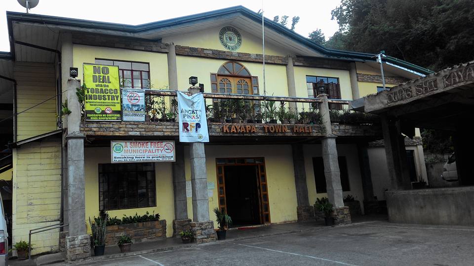
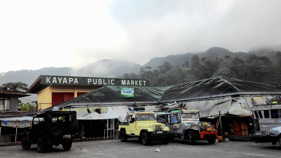
We arrived at Kayapa Public Market and Kayapa Town Hall at 6:15 am. While waiting for registration, we secure and arrange the things that we need to bring in our backpacks for the entire climb. After our registration, orientation, and our guides were introduced, the group members gather around in a circle and started praying to God to give us strength, guide all our footsteps, give us good weather, keep us all safe during our entire climb, and come back home safely.
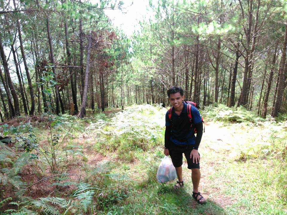
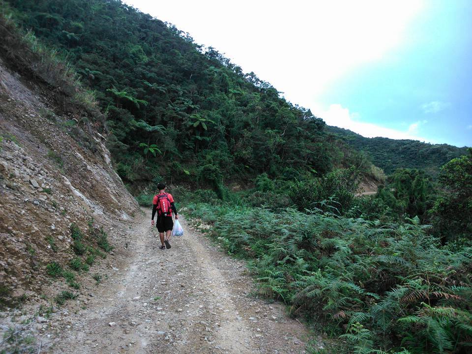
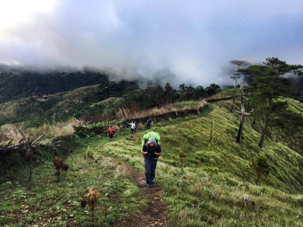
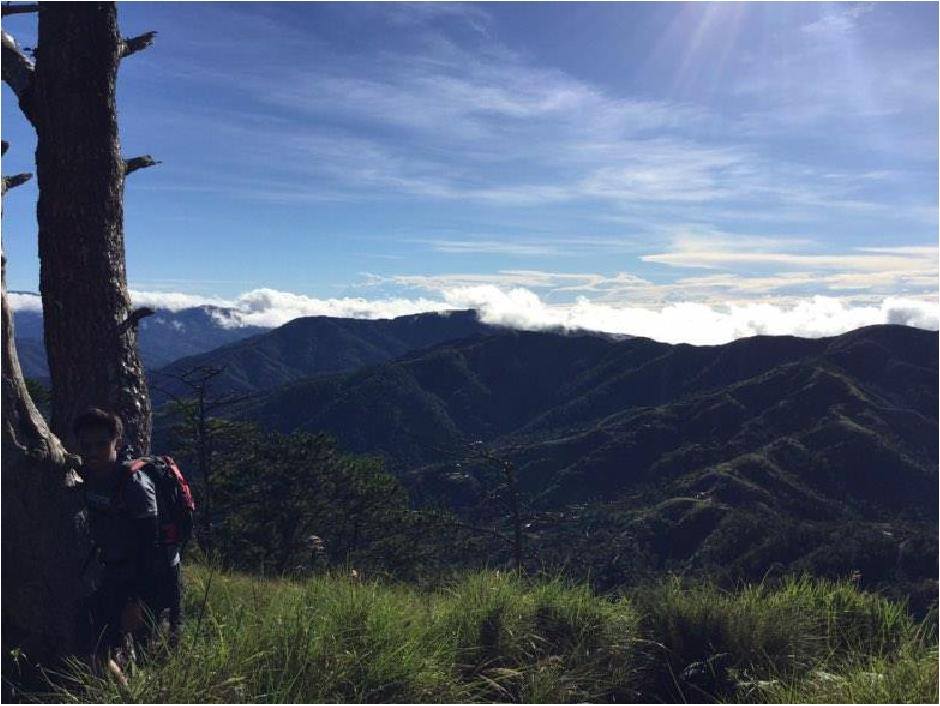
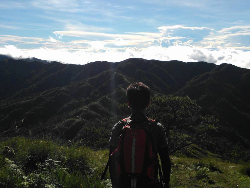
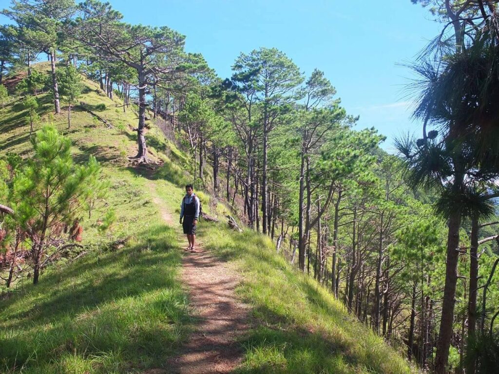
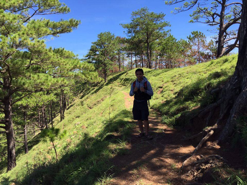
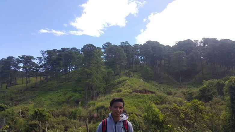
The hike begins around 6:45 am, we walked along an uphill concrete stairway road for fifteen minutes. We passed by some residential houses and the dogs’ barks greeted us. Then we turn left and reached the pathway going up to the trails of Mt. Ugo. The trail from Kayapa to Indupit village is constantly ascending in the pine-covered forest, all uphill with a few flat grounds in between the trail. The transition is distinct because our group can no longer hear the barks of the dogs in the residential houses.
On the higher portion, I can clearly see the Kayapa town market. The breeze is refreshing. Also as we go up on the trail, we could already see some adjacent mountains filled with clouds and reflections of the beautiful rays of the sun. Even so, I already catching my breath at that time.
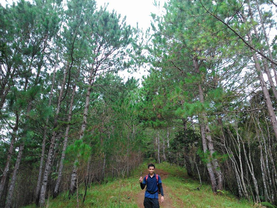
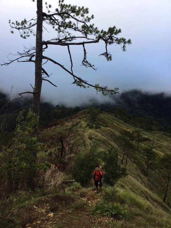
It was a challenging assault along with an endless pine tree view but this was great for first-time major hikers like me. The view is wonderful and pine trees dominated most of the scenery.
Indeed there is magic in this place. In this case, a man from Manila like me is easily overwhelmed by the sounds, sights and even smells of this mountain as I hike my way going to Indupit Village. It’s a feast for the senses of someone who loves greater heights, the sound of birds, the clearest blue skies as well as clouds blanketing green slopes and cool mountain air. Without a doubt, it is a promise of a great day and a great adventure ahead.
Along the trail, we always have time to admire nature’s beauty and ponder on gratitude for being part of the scene. Also we take ten minutes of rest, drink water, eat snacks, and take pictures for every hour of the assault.
As the trail becomes steeper, the weather became cooler and the views more astounding. As a result, we would tend to stop by and adore the beautiful surrounding. Furthermore, inhaling that sweet scent of unpolluted air breeze gave us motivation as we continued our Mt. Ugo traverse journey.
We take a quick rest in the waiting shed we saw along the trail. It took us four hours to reach the Indupit Village at 11 am. Nevertheless, we have to refill our water bottles and have our lunch in Indupit village. The one thing I noticed while passing the village along the trail going up Mt. Ugo are cute little kids.
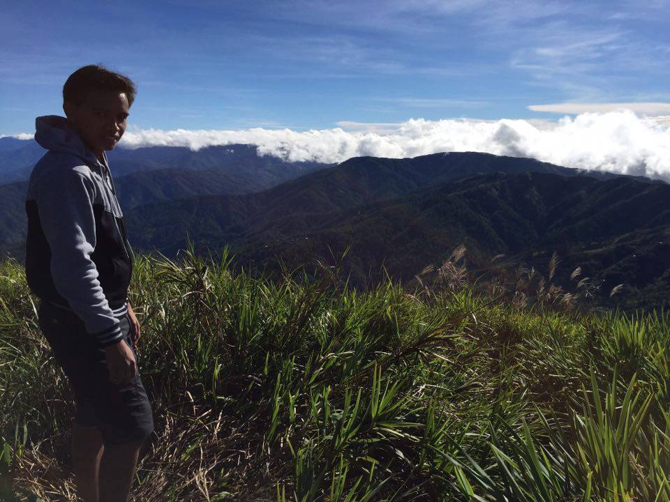
After our lunch, we took a thirty minutes nap and resume the trek at 12:30 pm. Also, the cloudy weather favored our group. From Indupit going to Domolpos village is a 12-kilometer-long walk on a flat road with no tree cover at all. However, it was the easiest part of the entire climb. We trek through long, dusty, and sun-drenched trails. Furthermore, a greater view of the mountain ranges in the area was in plain sight. It was truly exceptional.
We walk slowly, talk to each other and share some stories about why we climb mountains and the mountains we climbed before. It is a walk to remember. Furthermore, we don’t need to rush because it’s an overnight trip. On the other hand, we can see a lot of bicycles and four-car wheels passing by on this trail.
Our group reached the wooden seat and the waiting shed late in the afternoon. Undoubtedly, it serves as the boundary between the two provinces of Nueva Vizcaya and Benguet.
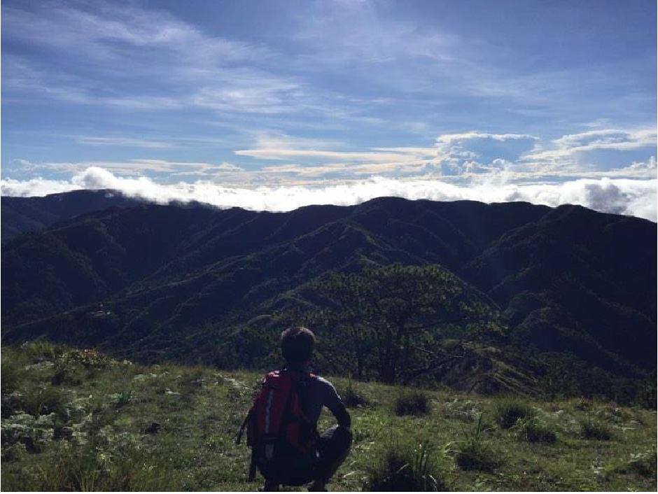
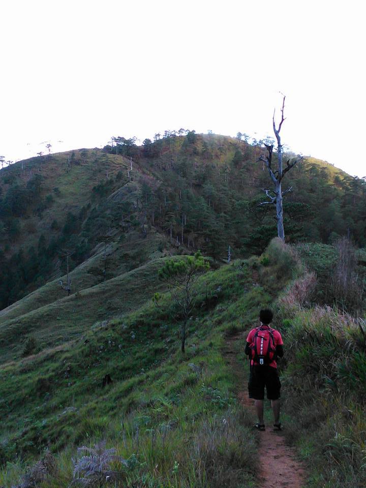
From distance, we can already see Mt. Ugo summit however it is farther than it looks. After that, we walked on a zigzag road. For the most part the long trail allowed me to marvel at the vastness of God’s creation and the beauty of the province. Indeed Mt. Ugo is one of the richest hiking destinations I’ve ever been to.
On the other hand as we spend time with ourselves on the trail, our perspective continuously expands and we can easily appreciate more varied landscapes. It took us nine hours including breaks and photo ops from the jump-off point in Kayapa going to the elementary school. Moreover, I was very surprised by the fact that a local village exists in the high mountain ranges. Also, the people of Domolpos village are very friendly.
Our group arrived at the elementary school in quiet Domolpos village around 5 pm. It was a very peaceful community and I felt the simplicity of their livelihood. Moreover, I can see a basketball court and they have a clean restroom. Rommel collects the donations that we carried along with us in the trail for the school children. Then our group leader cooked our meals and we have our dinner/socials later.
We slept around 8 pm. It was amazingly cold inside the elementary school, I have jackets but I don’t have a sleeping bag, that was my mistake. So I sleep in the chairs. Another mistake I made is I don’t bring trekking pants to protect my leg from mosquitoes, I only bring hiking shorts. At night I couldn’t sleep because there are many mosquitoes biting me. For this reason, I only sleep for two hours.
The assault going to campsite and summit of Mt. Ugo
We woke up at 3:30 am. Then we have our breakfast of corned beef with egg. After that, we prepare things for the final leg to the summit and left the school. From Domolpos village, the summit is just two hours away.
After done preparing all the things, we start the trek at 5:10 am going to the campsite and summit of Mt. Ugo. We were ascending at a moderate pace. The initial portion of the trail is gradually ascending on rolling hills, with no real challenge. Then later becomes a steep assault going to the campsite.
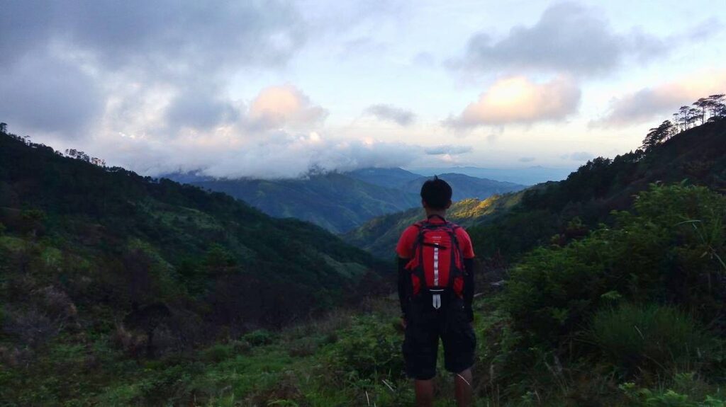
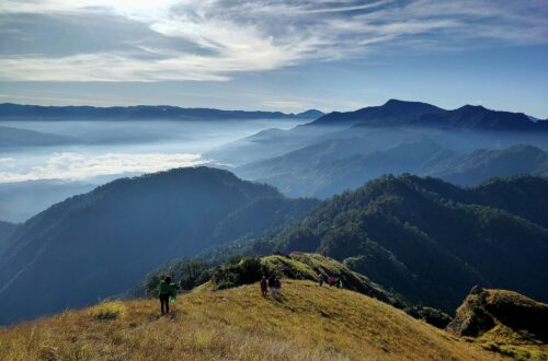
We witness the sunrise by 5:45 am in Mt. Ugo ridgeline. We pause to capture the beauty of the sun rising over the enveloping sea of clouds and the mountain ranges. These wonderful sights that greet us are one of the reasons why we endure long climbs.
After the rolling hills, I can already see the steeper section of the assault going to the campsite. At this point, the trail got trickier because it is filled with loose rocks. As a result, our group exercises utmost caution. My knee is already trembling as we go on the steeper assault but I manage to move forward because I know the view from the campsite is majestic.
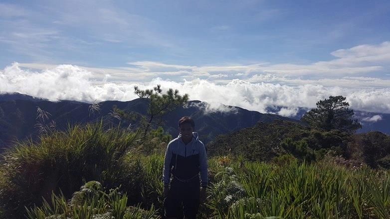
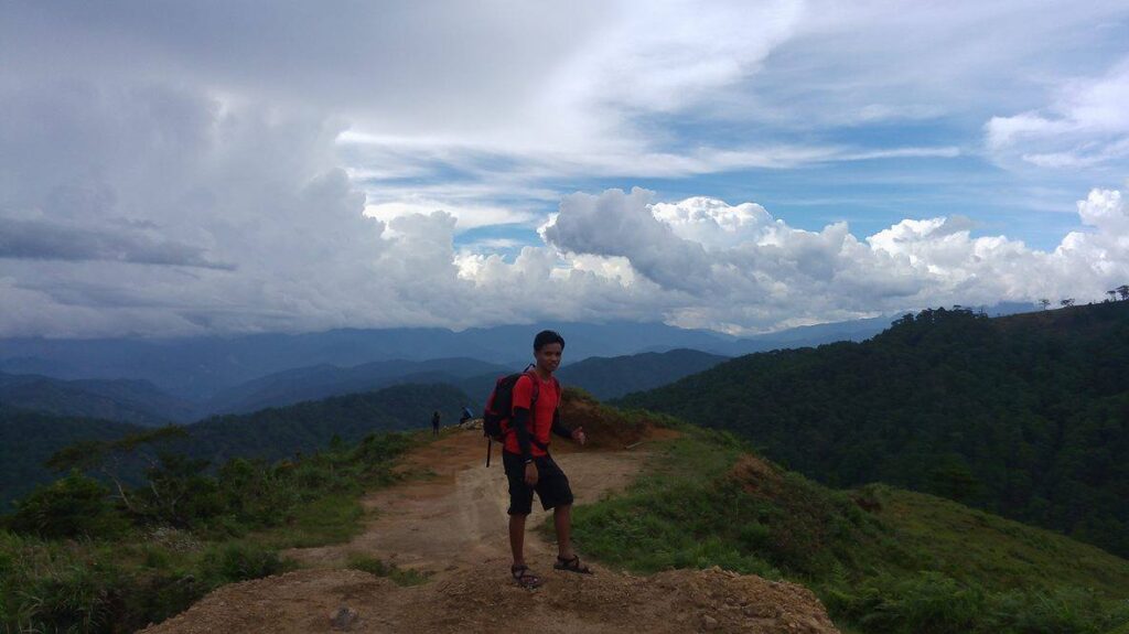
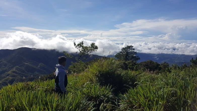
We pass on a grassy slope and reached the campsite of Mt. Ugo around 6:30 am. The campsite offers a 360-degree view of the Cordillera mountain range. It is a clean and wide grassland good for camping. The place is so peaceful and it’s also windy there. I saw the famous dead tree that still standing which gives a perfect backdrop in the background with the sea of clouds, mountains, and sunrise. Some of the members of the group climb the dead tree to better capture the magnificent view.
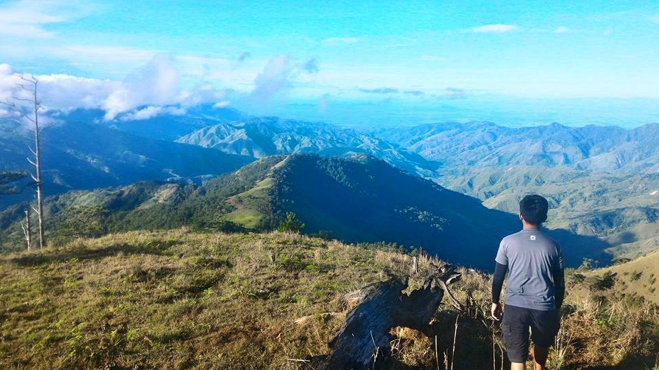
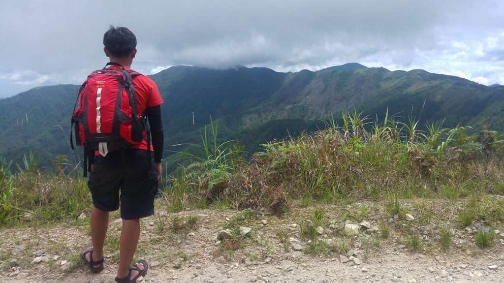
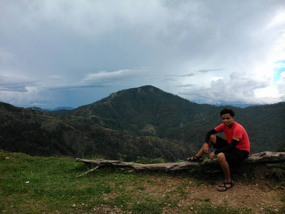
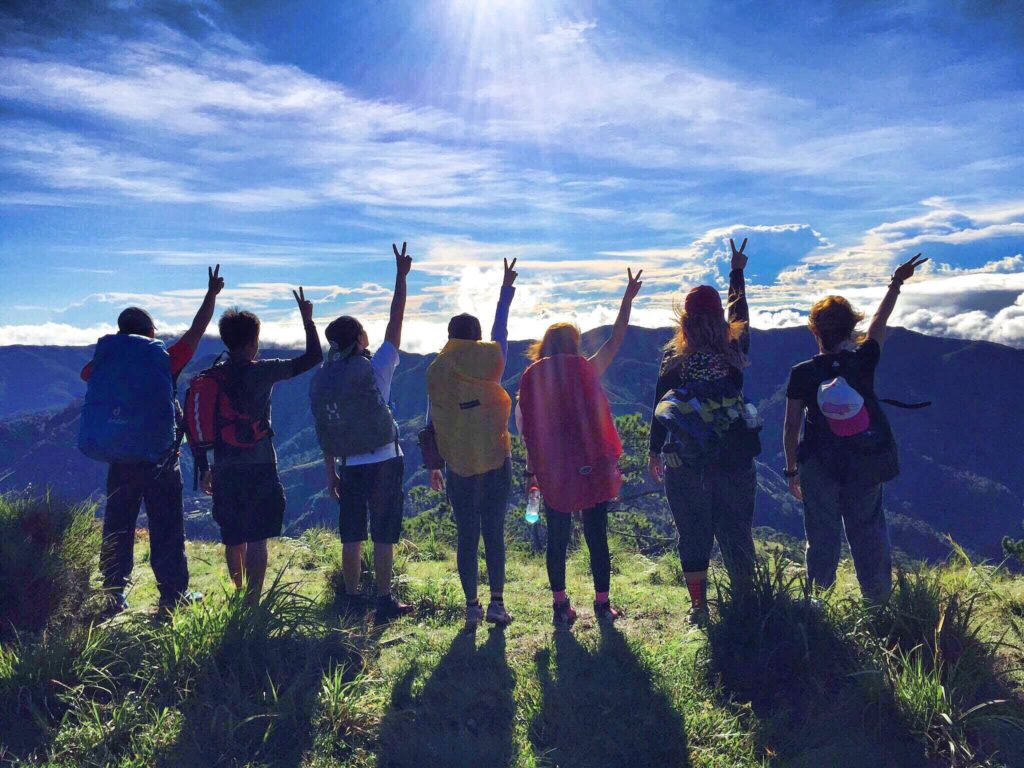
Mt. Ugo’s elevation is not that high compared to its neighbor Mt. Napulauan and Mt. Pulag. Nevertheless, the mountain is very similar to its neighboring mountains in terms of showcasing the great outdoors and breathtaking views of the Cordillera region. We took a lot of group pictures at the campsite.
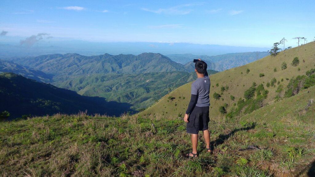
Without a doubt, the weather and nature didn’t disappoint us. It’s a perfect view on top of the mountain. I feel like I’m in a different world. Besides I can see the extravagant mountain view of the Cordillera region, the rolling pine hills of Nueva Vizcaya, and the plains of Pangasinan. Overall, I saw the beauty of the Philippines.
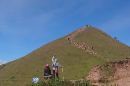
On the other hand, the summit is just twenty minutes ascend from the campsite. This mountain has a very long trail to the summit. We passed through a foot-wide trail on mossy forests, then pine trees, and grassland.
Finally, our group reached the summit of Mt. Ugo at 7:30 am. The weather is perfect. Thank God for the golden sky above me. The fulfillment of reaching the summit is so rewarding. I can see the extravagant mountain view of the Cordillera region, the rolling pine hills of Nueva Vizcaya, and the plains of Pangasinan. Overall, I saw the beauty of the Philippines.
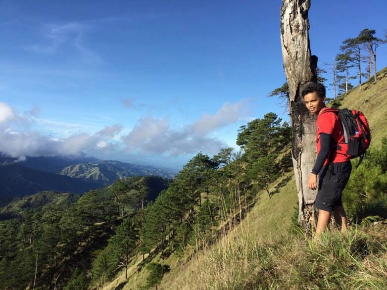
Indeed, blessed are those who could see nature’s beauty. I’m proud of being one. Moreover it was a very clear day at the summit of Mt. Ugo, in the south, I can clearly see Mt. Arayat in the distance. In the north, I can see a panoramic view of Mt. Pulag, Mt. Tabayoc, and Baguio City.
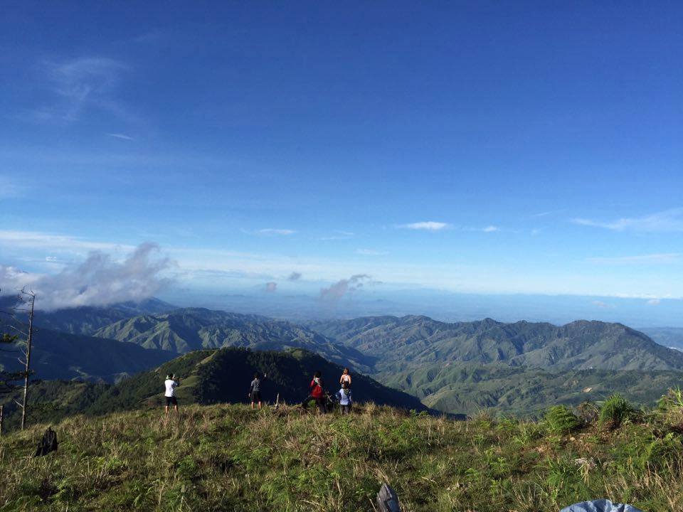
Furthermore, Mt. Ugo summit has a stunning mountain view of the Cordillera region similar to its higher counterparts. Its summit is gladly enclosed by luscious trees. The summit marker however was missing during our climb. For the last time, we take group pictures at the summit.
Descending through beautiful pine trails
We started our descent at 8:30 am. The descending trail is seventeen kilometers down to Itogon, Benguet. For the first few hours, we descend on a very steep, ridge-like pine forest trail followed by rolling hills. We take extra precautions as we go down because it is slippery.
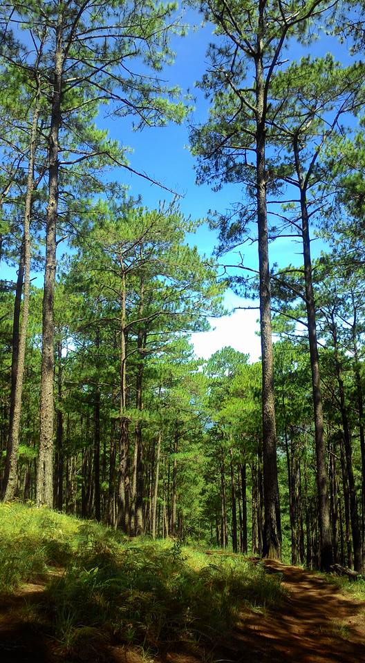
Salad bowls of pine trees are all over the place and the scene was in every way breathtaking. The hike was so relaxing because of it and I felt a sense of inner peace. Pine trees attracted the breeze which also made the hiking like a walk in the park.
It is one of the best pine tree views I’ve ever witnessed. It is a stunning and a delight to witness. This pine-forested trail is very similar to the Mt. Ulap descending part and the Akiki trail of Mt. Pulag. As we rest along the trail, we appreciate the steep slope of the pine-surrounded trails. On the other hand, we have many moments of stopping on the high ridge just to capture the stunning view of nature.
We want to stay and rest longer on this trail to marvel at this kind of scenic pine-covered slopes view but we need to follow the itinerary. As we continue our descent in the pine forest slopes, I always look around and appreciate the super beautiful scenery and enchanting sight. It is one of the reasons why I climb mountains to commune with nature.
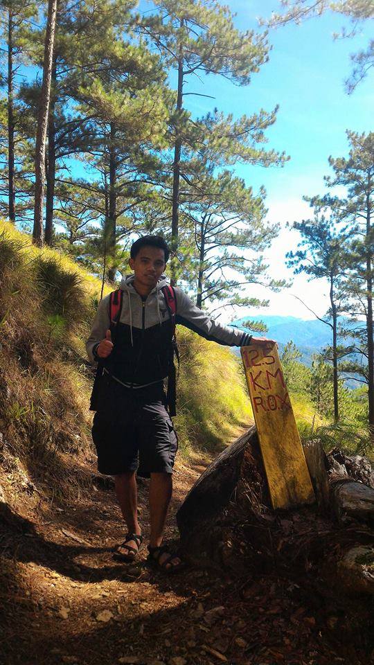
Later the trail becomes more pleasant with a few descending slopes. Then we saw some cows on the trail that freely graze on the grasses. I also saw a kilometer marker on the trail indicating the relative distance from the foot of Mt. Ugo. The kilometer markers were set up by R.O.X (Recreational Outdoor Exchange), a popular one-stop shop for outdoor and adventure needs.
Although it’s a long way down I don’t feel like I’m tired because the views are so wonderful that I can’t close my eyes because I can only see this view once in a lifetime. We enjoy the moments, we laugh and have funny moments on the trail.
For the most part, we trail run on the long trail as fast as we can and it was good, the trail is great for trail runners. Furthermore, one member of the group said that the trail shares some striking similarities with the pine forests trail of Mt. Purgatory Traverse.
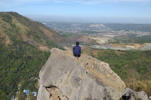
On the way down, I can see Baguio City and Binga Dam from a distance. The traverse connecting Nueva Vizcaya and Benguet province is a challenging trail that serves as the southeast entrance to the Cordillera mountain chain. Then we reached a rice field indicating we are near the village. However, we had to wait several minutes for our guide and the other members because the trails split in two directions.
We reached Lusod village after coming out of the pine-forested trail and passing by rice paddies around 11:45 am. We take our lunch at the Lusod village store, drink a hot local coffee, refill our water and interact with the locals.
After an hour of resting and lunch, we resume the trek at 12:50 pm. We went through several kilometers of pine-forested trail with the tall pine trees providing cover against the scorching sun. Once we got past the pine forest, the trail became open and steeper.
After the long trail, the last part of our descent was walking on the Pilapil of Benguet rice paddies. It is a seven kilometer trail from Lusod village to kilometer-zero in Barangay Tinongdan in Itogon, Benguet. The trail is narrow and filled with loose rocks so we have to exercise caution as we go down. However, in everywhere I look, Mt. Ugo never disappoints me with the spectacular view along the trail. The air is fresh, the ambiance is cool, and surrounded by luscious green plants.
We’ve already crossed and passed by several mountain ranges and remote villages of Itogon. Upon reaching kilometer-5 we can already see the highway below and upon reaching kilometer-4, we already spotted Agno River in the background and the houses of Barangay Tinongdan below. Also, I refill my water bottle at the kilometer-4 water source and take a quick rest.
It seemed we are near yet but still so far. So we trail run again. As we continue to go down the mountain, I noticed we were the only group that climb Mt. Ugo that day. It was Saturday. Friday to Saturday is the climb proper. On the whole, we are alone on this giant mountain.
When we reached the kilometer-3 marker sign, It gives us relief that we are getting closer to the foot of Mt. Ugo. The trail is getting narrower but we already saw signs of human activities below.
The final three kilometers of the hike take us to Itogon, Benguet, and then to the barangay hall. We saw the community at kilometer-1 wherein we have our snack at the small store while waiting for others to regroup. On the other hand, I thought this was the jump-off point but I learned from our guides that we still need to walk one kilometer before reaching the jump-off point.
Our group was able to cover three kilometers after an hour on a steep descent and flat surface in between rice paddies. It is a scenic view resembling a valley. We pass by local houses near Kawayan village and then we arrived at Itogon village around 4:45 pm.
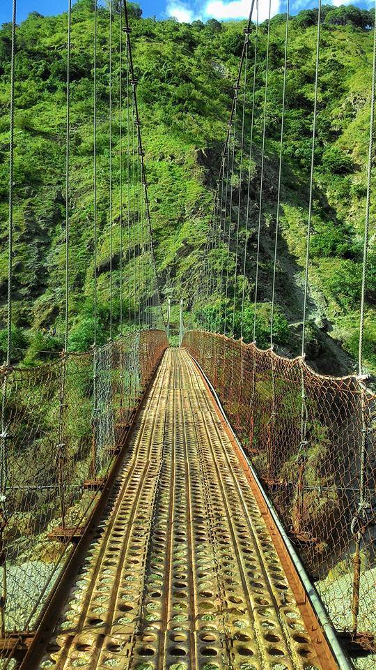
Finally, we reached the famous Itogon Hanging Bridge. Undoubtedly, this was the longest and highest-hanging bridge I’ve ever crossed. This is also the mark that the hiking is about to end. We stop for a moment and take pictures there.
After that, we walk another five hundred meters on the concrete road to reach the barangay hall. The long trail going down to Benguet had me in so much awe. Mt. Ugo traverse is indeed a very long hike.
At last, we arrived at the barangay hall of Itogon, Benguet around 5 pm. We successfully completed the Mt. Ugo Traverse. Later, a lovely sunset welcomes us. It takes us almost nine hours to complete the descent, however, the climb was all worth it. Overall, I enjoy the hike. Mt Ugo, I will never forget you for the countless breathtaking experiences. It was so great I will always cherish it forever in my memories.
Mt. Ugo without a doubt is one of the must-visit attractions and destinations in Benguet. Thanks be to God for giving us strength and making this climb an unforgettable and awesome experience.
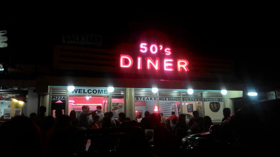
At 7 pm, we arrived in Baguio City and we have our dinner at 50’s Diner restaurant, we order burgers and sandwiches before going back to Manila by bus. We board the Victory Liner bus going back to Manila around 9 pm. Later we come back home safely. I wanna thank Rommel our group leader for organizing this kind of event. Everything was worth it. It was a great experience.
In this Mt. Ugo traverse hike, I meet new people with the same interests in climbing mountains in Northern Luzon and seeing the beauty of what nature has to offer. Overall, Mt. Ugo is one of my most memorable climbs.
Mt. Ugo is my first major climb and it’s quite a challenging climb simply because of its very long trail. It was a long and tiring traverse. We literally cross two provinces during the entire climb. It takes patience and persistence to endure the long trail up and down the mountain range. However, the pain we endured is nothing compared to the treats our eyes had while standing on the edge of the mountain and looking down on one of God’s great creations. Mt. Ugo is definitely a great hiking destination based on my experience. Moreover, it is one of the most beautiful trails I’ve ever seen and become one of my favorite mountains in the Philippines.
Sample 2 Day itinerary to Mt. Ugo Traverse (Overnight)
Day 0
10PM – Assembly
11PM – ETD going to Aritao, Nueva Vizcaya
Day 1
4AM – ETA Aritao or Bambang, Nueva Vizcaya,
4:30AM – ETD for Kayapa, Nueva Vizcaya via rented jeepney
6AM – ETA Kayapa, register, secure guides, breakfast
6:30AM – Start hiking
11AM – ETA Indupit Village, Lunch
12:30PM – Resume hiking going to Domolpos Village
4PM – ETA Domolpos Village, stay in the elementary school, dinner, and socials
8PM – Lights out
Day 2
3AM – Wake-up call, breakfast
4AM – Commence the final leg to the summit
5:30AM – Sunrise viewing, campsite
6:30AM – Mt. Ugo summit, picture taking and rest
8:30AM – Start descent on a very steep, ridge-like pine forest trail
11:30AM – Lusod Village, lunch
12:30PM – Resume hiking
3:30PM – Itogon Village; take pictures at Itogon hanging bridge
4:30PM – End of hiking, tidy-up, and the jeepney or van will be waiting past the river
5PM – Arrival at the Tinongdan barangay hall
6PM – ETD for Baguio via chartered jeepney or a van
7PM – ETA Baguio, dinner at Good Taste Café & Restaurant
9PM – Proceed to the bus terminal going to Metro Manila
Sample 1 Day itinerary to Mt. Ugo Traverse (Dayhike)
Day 0
10PM – Assembly/meet-up
10:30PM – ETD going to Kayapa, Nueva Vizcaya
Day 1
6AM – ETA Kayapa, register and secure guides, breakfast
6:45AM – Start hiking
10AM – ETA at Indupit village, rest, lunch
11AM – Resume hiking
12PM – Arrival at waiting shed with views of Mt. Ugo, regroup
2PM – Junction to last water source
2:30PM – Assault going to campsite and summit
3PM – Campsite, rest, photo-ops
3:45PM – ETA summit of Mt. Ugo
4PM – Start the descent
7PM – ETA Lusod village, dinner
10PM – End of hiking, barangay hall of Tinongdan
11PM – Departure going back to Manila
Note: this sample itinerary is just a basis and not absolute or will not be 100% perfect due to many factors such as the weather condition, pacing, traffic, emergencies, extended time of photo ops, etc.
Things to bring on your visit to Mt. Ugo:
Garbage Bag (Leave No Trace Principle)
Sleeping Bag, Tent, and cook set if you’re doing overnight at Mt. Ugo campsite
Jacket
Comfortable hiking shoes or sandals
2 to 3 liters of water
Trail food/snacks
Extra clothes, slippers, and money
Cap or scarf
Personal medicine
Camera, power bank, and extra battery
Sunblock (optional)
Umbrella
Reusable water container
Personal toiletries
Arm sleeves
First aid kit and personal hygiene kit
Emergency Stuff (Whistle, Flashlight & Raincoat)
Neck pillow for the long ride (optional)
Mess kit if you’re doing an overnight climb
Reminders and Tips:
- If you’re planning to overnight at Mt. Ugo, do not forget your winter jacket, sleeping bag, and a good set of tents.
- Please bring garbage bags. This is very important. It’s good to keep Mt. Ugo clean for future generations to see.
- You can choose where to camp either in the school or at the campsite after the ridge part.
- Pack light. This is very important. Bring only the things you will need for the climb.
- Mt. Ugo is a major climb, so be prepared physically and mentally.
- Hydrate yourself along the trail and pack lunch.
- Always follow the Leave No Trace principle (LNT). Take nothing but pictures, leave nothing but footprints, and keep nothing but memories.
- Respect the place, wildlife, locals and fellow hikers.
- Fully charge your phones and cameras before the trip. Bring along a power bank if necessary.
- Waterproof everything (bags, gadgets, clothes, etc.)
- Refrain from littering and kindly put your trash inside your bag or at the designated trash can.
- When cooking, set up the stove away from areas prone to forest fires. In addition, minimize the use of fire. Firewood selection is critical to minimizing its impact on the environment.
- Before starting to climb Mt. Ugo there are fees to be collected. The entrance fee is 150 pesos and it should be paid at Kayapa. The environmental fee for DENR (Department of Environment and Natural Resources) is 90 pesos and it should be paid at Tinogdan where the DENR personnel will collect the environmental fee. In addition, the exit fee is 300 pesos and it should be paid also at Tinongdan Barangay Hall.
- The guide fee for a dayhike is 1200 pesos and it’s suitable for five hikers.
- No walk-in is allowed. All mountaineers should book, register or reserve in advance prior to the climb date.
- Mt. Ugo is open for biking activities and mountaineers who want to do a day hike and see the beauty of the mountain trail.
- Last but not least if you smoke, make sure that you put out the embers. Don’t throw out your cigarette butts to avoid the risk of accidentally starting a forest fire.
How to Go to Mt. Ugo:
- Ride a Victory Liner bus from Kamuning bus terminal going to Aritao, Nueva Vizcaya.
- From Aritao, hire and ride a jeep or van going to Kayapa, Nueva Vizcaya.
I highly recommend getting a packaged tour when you plan to visit Mt. Ugo for ease and convenience. Included in the packaged tour is a roundtrip transfer via bus or van (Manila to Aritao; Baguio to Manila), roundtrip transfers via van or chartered jeep (Aritao to Kayapa; Itogon to Baguio), Local guide fee, Coordinators fee, drivers fee, and meal (depends on your package tour).
I hope this hiking guide to Mt. Ugo has been helpful to you. You’ll never want to miss Mt. Ugo Traverse if you’re a hiker and adventurer. Don’t forget to share this with your friends or groups if ever you plan on doing the Mt. Ugo Traverse. God bless you in all your hiking adventures.
Jervis Ergino
Hi! I’m Jervis Ergino, the digital content creator behind Hike to Mountains, a travel and hiking blog in the Philippines. This blog is dedicated to helping people know more about the best hiking and tourist destinations in the Philippines.