Mt. Tagapo Talim Island Binangonan Rizal Climb Guide (Itinerary + Tips)
Introduction
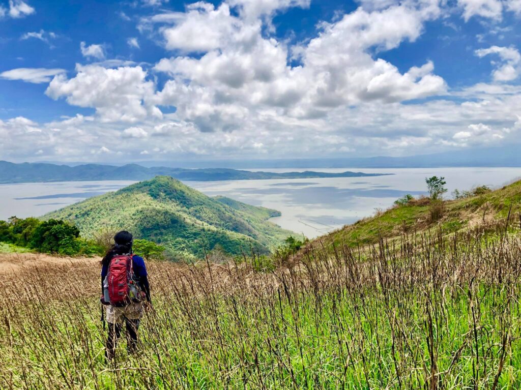
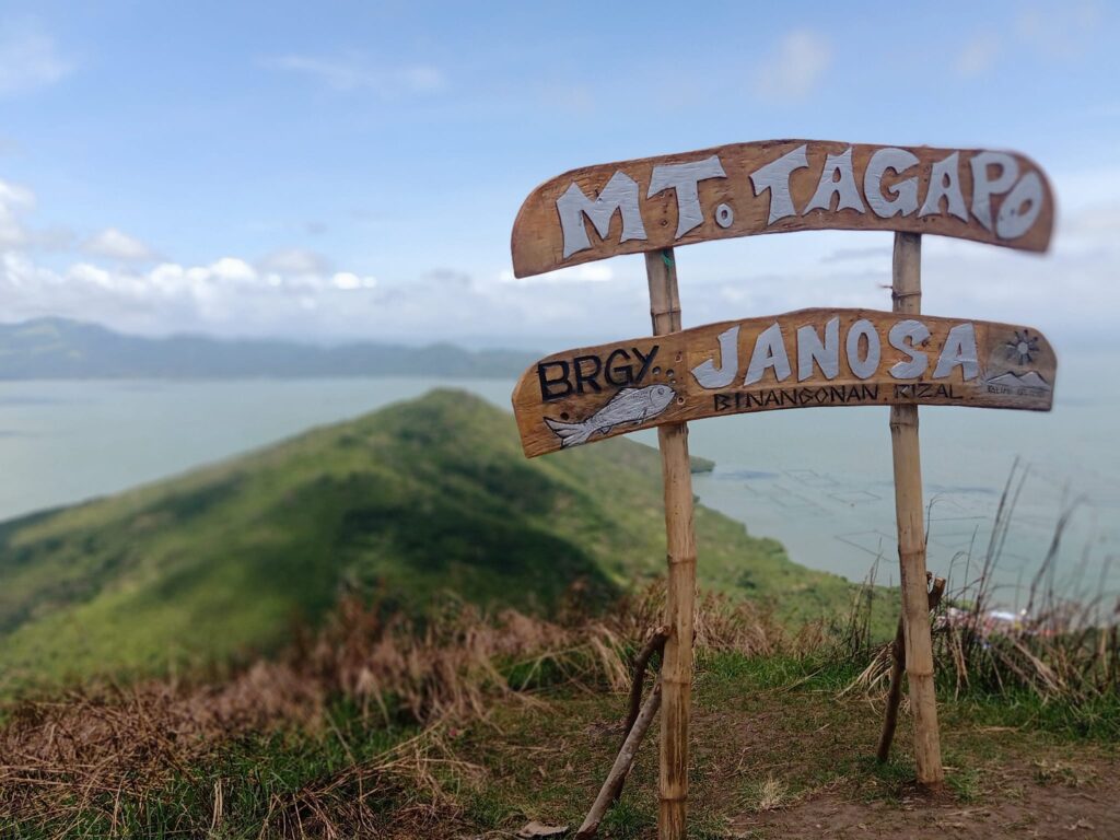
Mt. Tagapo is a cone-shaped mountain located in Barangay Janosa, Talim Island, Binangonan, Rizal. It offers stunning views of Laguna de Bay and Rizal province. Mt. Tagapo has a height of 438 meters above sea level or 1,437 feet. It is considered to be the highest point of Talim Island. Without a doubt, Talim Island is the name of the island because of its shape like a blade, ripping across Laguna de Bay from the south and to the north. Moreover, its distinctiveness as an island community within a vast lake is incomparable and exceptional.
In the past, Talim Island was considered a stratovolcano and the whole island is like a corpse. However, as time passes by it is now part of Laguna Caldera. Mt. Tagapo is commonly known as Mt. Susong Dalaga in the native language. It was said that the mountain was named as such due to the form of a young woman’s breast at the peak of the mountain. On the other hand, Mt. Tagapo came from the Tagalog word “Taga” which means “to chop” with regard to the exercise of chopping bamboo that is dispersed around the mountain.
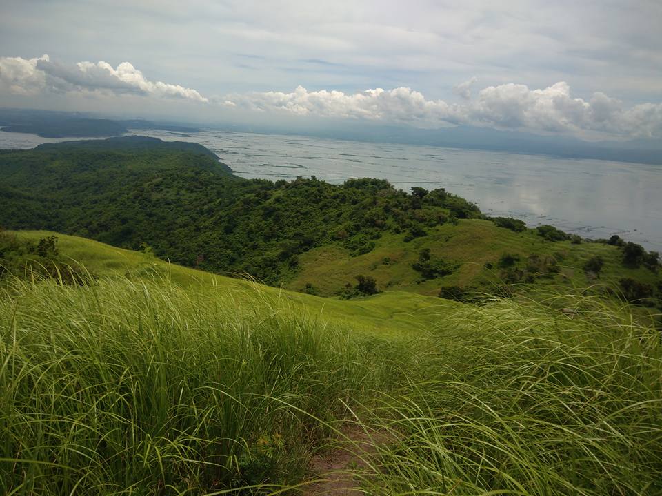
Mt. Tagapo is situated at the heart of Laguna Lake which is considered the largest lake in the Philippines. Its remarkable topography and beautiful terrain make it an excellent hiking destination both for beginner and seasoned hikers. Mt. Tagapo has a total trail length of 6.5 kilometers back and forth. Although Mt. Tagapo is not as high as other mountains in the Rizal province it rewards mountaineers with an astonishing and unforgettable view.
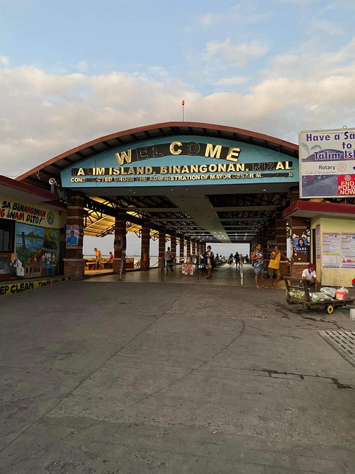
In order for someone to hike this mountain, one must board a passenger boat going to Talim Island. In general, the island is politically under the municipality of Binangonan, Rizal. At the summit of Mt. Tagapo hikers and mountaineers have the chance to see the beautiful Laguna Lake and nearby mountains. Without a doubt, its neighbor mountain Mt. Sembrano is already a popular hiking destination among beginners in the hiking scene. On the other hand, Mt. Tagapo serves as an alternative mountain for beginners to try.
Name: Mt. Tagapo
Difficulty: 2/9
Elevation: 438 MASL
Jump-Off: Barangay Janosa (Talim Island), Binangonan, Rizal, Philippines
Hours to summit: 1.5 hours
Features: Grassland, bamboo forest, and a fantastic view of Laguna de Bay and Rizal province.
My trip to Mt. Tagapo
I said to myself in the past days that it’s never too late for my summer adventures and outdoor cravings. So one day, I decided to join an organized tour going to Mt. Tagapo in the month of June. Our group consists of ten sure joiners coming from different parts of Metro Manila, Cavite, and Bulacan. It was Sunday morning when I joined the other members of the group in our assembly place near the gas station in Makati City. After several minutes of waiting and preparing our things, our private van started heading toward our main destination.
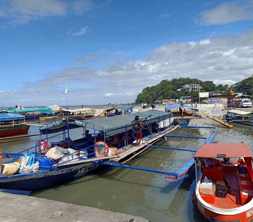
Our private van reaches Binangonan Port at 6 am after two hours of land travel. From the Binangonan Port, we ride a motorized boat going to the jump-off point of Mt. Tagapo. It was around 7:15 am when we reached the Barangay Janosa and our group registered and get a local guide. Before we start the hike we have a one-minute prayer to God to thank him and to guide us throughout our entire hike and trip that day. A few moments later we started the hike going to the summit of Mt. Tagapo.
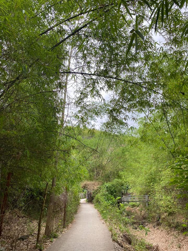
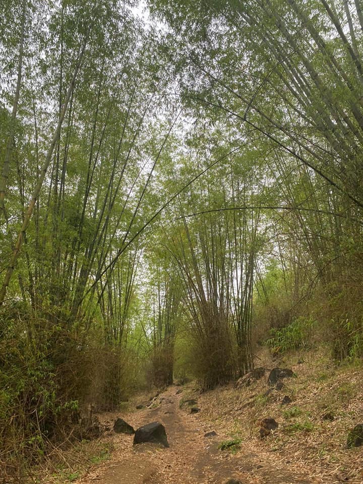
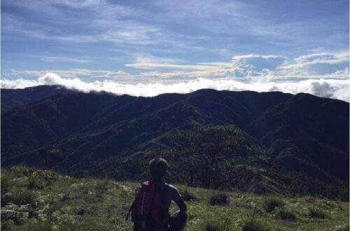
After one hour of hiking, we reach the bamboo forest section of Mt. Tagapo where we take a nine-minute rest. We eat our trail food and we drink water to conquer our thirst. Afterward, we continue the assault going to the summit passing through cogon grasses that has a height of five feet. While hiking, I said to myself this is the kind of ambiance I need because of the fresh air, beautiful wildflowers, and superb greeny views.
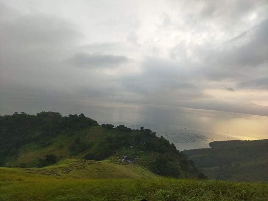
It was around 10:20 am when we reached the summit of Mt. Tagapo. We take another rest and we have our early lunch. After done having lunch, we take pictures of the beautiful surrounding of Mt. Tagapo and we watch birds flying in the sky.

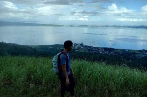
From the summit, we can see a 360-degree view of the Laguna de Bay, some municipalities and coastal towns of Rizal, and the nearby mountain Mt. Sembrano. To the south, we can clearly see Mt. Kalisungan, Mt. Atimla, Mt. Cristobal, and Mt. Banahaw. To the southwest, we can see prominent mountains such as Mt. Makiling and Mt. Maculot. For this reason, our group appreciate the view of nature on an exposed trail and we stayed at the summit for one hour and thirty minutes.
We take so many wonderful photos at the mountain peak and we have our group pictures. Without a doubt, the view at the summit of Mt. Tagapo fulfilled my summer adventure and outdoor memories. We start our descent at noon and our mountain guide told us that the locals used bamboo to produce secondary products such as charcoal and furniture.
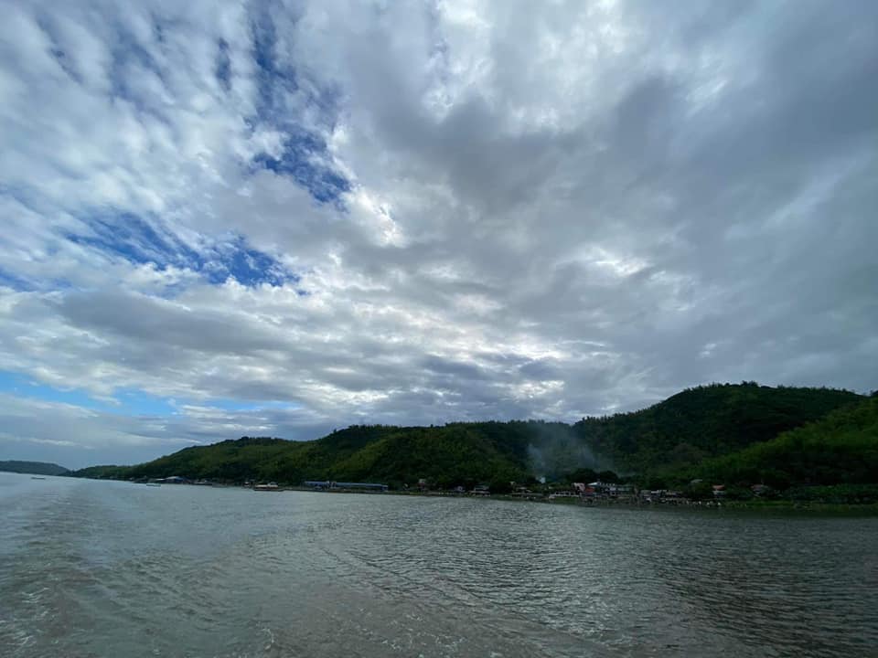
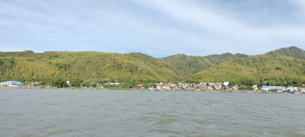
We reach back the jump-off point after two hours of moderate descending on an easy trail composed of giant grasses and cogon grasses. After that, we ride a passenger boat going back to the port. I noticed that the wind and waves are so strong during the afternoon but our motorized boat manage to get over through rough waters. Moreover, our group witnessed how vast the Laguna de Bay or Laguna Lake is. In my opinion, it’s like a sea in the heart of Laguna province.
It was around 2:20 pm when we arrived at the Binangonan Port and we thank our boat guide for our safe trip. Then we go inside our private van and the van headed back towards Makati City. While we were on the road trip, one member of the group invited me to join the Basic Mountaineering Course (BMC) to be held in Sitio Boso Boso, Antipolo City in the coming month of August. The Basic Mountaineering Course will teach us a ton of different things such as choosing the right mountaineering equipment, doing first aid, and organizing a climb.
He further explained to me that there will be a rented jeep at the meeting place near Gateway Mall and also there will be a BMC certification to be given after the mountaineering course. However, at that time, I’m still undecided. At 5 pm we reached Makati City and we bid goodbye to each other members of the group. I arrived home at 6 pm. For this reason, I thank God for a safe summer adventure in Binangonan, Rizal, and for guiding us all throughout the entire adventure.
In my perspective, Mt. Tagapo has a well-established trail going through its steep slope which is very similar to Mt. Gulugod Baboy in Batangas province. Undoubtedly this is definitely a very good mountain for first-time hikers. On the whole, my trip to Mt. Tagapo sums up this amazing quote “If you truly love nature, you will find beauty everywhere.”
Sample 1 Day itinerary to Mt. Tagapo
4AM – Meet up at the designated location
4:30AM – Ride a jeep going to Binangonan, Rizal
6:30AM – Arrival at Binangonan highway, ride a tricycle going to Binangonan Port
7:10AM – Binangonan Port, take a passenger boat going to Barangay Janosa
9AM – Arrival at Barangay Janosa, register, arrange the guide, and last-minute pack up
9:20AM – Start hiking
10AM – Bamboo forest
11:20AM – Summit of Mt. Tagapo, rest, take lunch, and snap photos
12:20PM – Start descent
1:30PM – Back at jump-off point, ride a passenger boat going back to Binangonan Port
3PM – Binangonan Port, depart for Manila
6PM – ETA Manila
Things to bring on your visit to Mt. Tagapo:
1 to 2 liters of bottled water
Trail food like chocolate, jelly ace, egg, and banana
Umbrella
Personal medication
Extra cash and clothes
Toiletries like towels and bath soap
Handkerchief
Alcohol
Plastic bag for your trash
Sunscreen and Sunblock
Trekking pole (optional)
Hat, shades, cap, and scarf (optional)
Arm sleeves (optional)
Insect Repellent for overnight camping
Flashlight or headlamp for overnight camping
Tent and sleeping bag if you’re doing overnight
Camping gear and essential if you’re doing overnight
Reminders and Tips:
- Just pack light. Mt. Tagapo is a minor climb and it’s an ideal mountain for beginners.
- Registration and getting a local guide are required before climbing Mt. Tagapo for safety purposes. You will secure a local guide at the barangay hall of Barangay Janosa, Talim Island.
- It is important to bear in mind that the last passenger boat ride at the port is around 4 to 6 PM. On the other hand, passenger boat rides are available at the port as early as 6 am.
- Camping at the summit of Mt. Tagapo is not allowed for safety purposes. You may camp only at designated camping sites that are located fifteen minutes away from the summit.
- The trail classification in Mt. Tagapo is well established, easy to navigate, and has the perfect combination of moderate ascent and some flats in between. The hike to the summit takes about two hours only while the total hours to and from the summit of Mt. Tagapo could take only four hours or less. Therefore, it’s an easy hike suitable for kids and adults.
- If you’re going for a day hike, it is advisable to start the hike as early as 8 am to avoid the intense heat of the sun. Moreover, if you’re hiking in the summer season, it’s highly recommended to bring an umbrella because Mt. Tagapo summit has no shade and is very exposed to the sun.
- There are no small stores in the mountain so it’s better to bring enough water before riding a boat going to Talim Island. Also, bring your own trail food to minimize your expense.
- As always please follow the Leave No Trace principle. For instance, don’t litter and vandalize. No picking of plants and bring your garbage with you to keep the mountain clean.
- Restrooms and wash area are present at the main jump-off point.
- The local guide fee for a day hike is 500 pesos and it’s good for 4 people. The overnight fee is 1000 pesos and the environmental fee is 40 pesos.
- There’s an open hole at the summit so be cautious when taking pictures or walking around the summit.
- Bringing of a flying drone is allowed.
- There are no blood leeches or “Limatik” in Mt. Tagapo.
- According to the local tour guide, during the wet season, the trail becomes difficult and very muddy. On the other hand, the coast guard may cancel the boat ride if the weather is too bad.
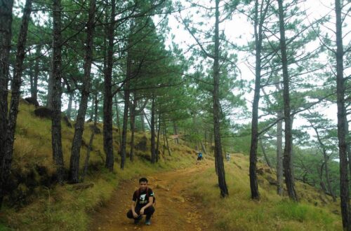
- There are two contrasting trails from Barangay Janosa to the summit of Mt. Tagapo. The first trail is covered with a bamboo forest. The second is an easy and open trail in grassland and farmland with more flat grounds than moderate ascents.
- Bring jackets and fleece blankets when you’re staying overnight at the mountain as the temperature during the night can get very cold. In addition, there is insect and bugs around the mountain so better bring insect repellant.
- The approximate budget for a solo day hike is 1300 pesos because you will simply shoulder the local guide fee and transportation expense. On the other hand, the estimated budget for overnight is 1800 pesos.
- Cellphone signals are mostly present at the jumpoff point and in the upper reaches of the mountain.
- Please take note that the UV Express fare from Edsa Shaw going to Binangonan highway is 100 pesos and the tricycle ride going to Binangonan Port cost 20 pesos per person. Meanwhile, the boat ride from Binangonan Port (Pritel) to Barangay Janosa is 65 pesos and it’s a two-way trip.
- Last but not least, If you’re coming from northern Luzon province, I highly recommend getting a packaged tour when you plan to visit Mt. Tagapo so you don’t have to worry about the transportation going in and out. Inclusion in the Mt. Tagapo package tour is a roundtrip van transfer from Manila to Rizal and vice versa, a roundtrip boat transfer from Binangonan to Talim Island, and vice versa, a local guide fee, registration fee, environmental fee, tour coordinator fee, and driver’s meal. Meanwhile, the excluded in the package tour are personal meals and food.
How to Go to Mt. Tagapo
By commute
Option 1:
- From EDSA Crossing, Mandaluyong, ride a van or a jeep going to Binangonan, Rizal.
- Then from Binangonan town proper, walk or ride a tricycle going to the port.
- From the port, ride a public passenger boat going to Talim Island. Alight at Barangay Janosa. The approximate travel time for the boat ride is one hour.
Option 2:
- From Cubao, ride a UV Express van going to Cogeo, Antipolo, and tell the driver to drop you in front of Sta. Lucia Mall.
- Then walk your way towards Robinsons and ride a jeep going to Binangonan Port.
- From Binangonan Port, ride a boat bound to Talim Island and drop off at Barangay Janosa.
Option 3:
- From Cubao, ride a jeepney beside the Farmers Market or Ali Mall going to Binangonan, Rizal, and tell the driver to drop you at Pritil Port.
- Then from Pritil Port, ride a boat going to Talim Island and drop off at Barangay Janosa.
- Then walk going to the barangay hall to register and secure the local guide.
Note: Please find out the last return trip from Barangay Janosa to Binangonan with the boatmen or the locals so you can adjust your schedule or itinerary properly.
For the most part, let’s practice discipline, responsibility, and be on time. On the whole, I hope this Mt. Tagapo day hike guide has been helpful to you. Don’t forget to share this with your friends and colleagues. God bless you on all your hiking trips. Thanks for reading.
Jervis Ergino
Hi! I’m Jervis Ergino, the digital content creator behind Hike to Mountains, a travel and hiking blog in the Philippines. This blog is dedicated to helping people know more about the best hiking and tourist destinations in the Philippines.