Mt. Makiling Traverse Dayhike Guide
Introduction
Mt. Makiling is a beautiful mountain stratovolcano located between the Laguna and Batangas province. It is situated just sixty-five kilometers from Manila and it’s just a two-hour drive from the National Capital Region. Consequent to its vicinity to Metro Manila, many tourists visit this mountain on weekends and during the holiday season. The last eruption in Mt. Makiling is believed to be in the Holocene period. Mt. Makiling has a height of 1090 meters above sea level or equivalent to 3576 feet. From the summit, it offers mountaineers a comprehensive view of the Southern Tagalog mountains such as Mt. Banahaw, Mt. Kalisungan, Mt. Cristobal, Mt. Obabis, and Mt. Prinza. Mt. Makiling Traverse (Maktrav) has a total distance of 17.8 kilometers and it has an 884 meters elevation gain.
According to Dr. Jose Rizal’s writings in the year 1890 about the story and myth of Maria Makiling: Once upon a time in a place called Makiling, there lived a god and goddess couple. They have a daughter named Maria. Maria is a very beautiful maiden or fairy. Her beauty is captivating and any young man will be charmed by her porcelain complexion and shining eyes. Their family is known to be kind and helpful to others, especially those in need, which is why the people around them love them so much. In those days, the gods were given the power to mingle with the people.
One day Maria was seen by a handsome young farmer and because of her beauty, the young man fell in love with her. He has always looked forward to it since then. The young farmer is the envy of his fellow farmers because his crops have not been affected by plague or pests due to the care and protection of Maria Makiling. Because of this, the young man always climbs the mountain to see and be with his fairy lover. They soon became lovers which reached the knowledge of the girl’s parents. Maria was immediately separated from that man by her parents because it is not possible for a goddess to fall in love with a mortal.
But there came a day there was a war in their place. The leader of the army of soldiers came and said all the young men in their area will be trained to become soldiers and join the army. In order for the young farmer to avoid joining the army, his mother decided to marry him to the most beautiful girl in their area who was the daughter of the richest family. The young man was so sad that he decided to climb a mountain and confess it to Maria Makiling. Maria Makiling was deeply saddened by what the young man confessed and the fairy even said that she would have married him.
After their sad conversation, Maria Makiling even gave the young man jewelry and clothes that he could use in marriage. The young man went home and after that incident, Maria Makiling was never seen again for a long period of time. The time came when Maria became the master of Makiling. He was kind to people. He helped the poor and the afflicted and sometimes even loaned people expensive equipment, but later, their behavior changed due to generational change. They carried out their abuse and were unable to return the equipment they were borrowing from Maria.
Maria Makiling became forgiving but people still retaliated against her. From then on, Maria couldn’t keep her temper and she gradually got angrier. Soon there was lightning, thunder, and rain of fire. That is what she gave in exchange for those who abused his kindness. She hasn’t appeared to people since then. If you look at Mt. Makiling, you can see that it looks like a reclining woman with long hair. For this reason, Mt. Makiling became so famous because of the story of a legendary fairy who once became the guardian of Mt. Makiling in the province of Laguna.
Presently, Mt. Makiling Forest Reserve is an inactive volcano and it is considered an ASEAN (Association of Southeast Asian Nations) Heritage Park in the year 2013. The ASEAN Heritage Parks is widely known as the agent of endeavor to safeguard regions of particular biodiversity importance and noteworthy distinctiveness throughout ASEAN member states.
Mt. Makiling is home to 2038 species and 19 subspecies of flowering plants and ferns. In addition, it is a dwelling place for 45 species of mammals, 181 species of birds, 65 species of reptiles, 22 species of amphibians, and 7000 species of insects. Also, it serves as a shelter for various animals or endemic species that can only be found in the Philippines such as Philautus surdus frog, the Philippine warty pig, and Philippine deer. The eminent rafflesia also known as malaboo the same size as a salad dish can be found at station 14.
Mt. Makiling Forest Reserve has a length of 4244 hectares from the parts of Los Baños municipality, Calamba City, and Santo Tomas City in the province of Batangas. The forest reserve is supervised by the academic institution of Makiling Center for Mountain Ecosystems. Mt. Makiling traverse starts from Santo Tomas Batangas and ends at Los Baños Laguna. Overall if you are looking for a daunting mountain to climb this year then Mt. Makiling is one of your options because it is very much reachable from Metro Manila.
Name: Mt. Makiling Traverse
Difficulty: 5/9
Elevation: 1090 MASL
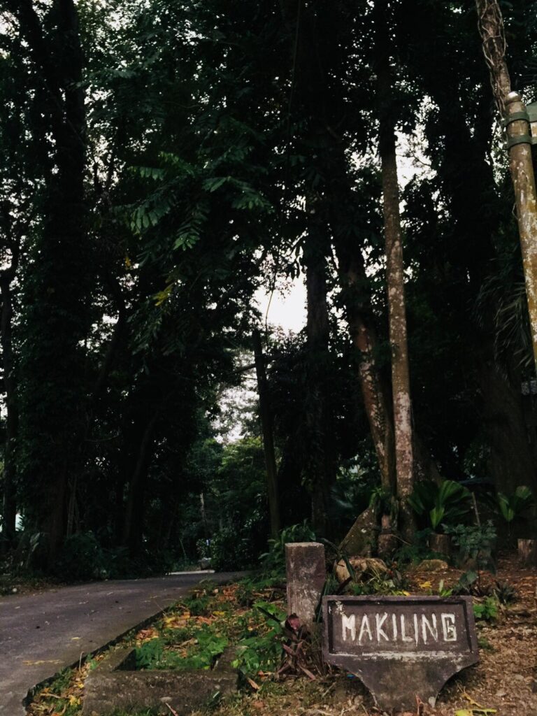
Jump-Off: Sitio Jordan, Brgy. San Miguel, Sto. Tomas, Batangas
Exit point: UP College of Forestry, Los Banos, Laguna
Hours to summit: 5 to 7 hours
Features: magnificent views of Batangas and Laguna province, rope segment, ridges, flora and fauna, rafflesia, rocky face, tropical, and dipterocarp rainforest.
My hiking adventure to Mt. Makiling
One of my hiking buddy named Jason invited me to do a Mt. Makiling traverse day hike. But before I replied to him I research on the internet about hiking Mt. Makiling. Then I recall that Maria Makiling’s legendary story was taught during my elementary school days. Also since I do a major climb in Benguet in the past month and I finally gather information about Mt. Makiling I replied to him that I will be joining the major day hike event on Sunday.
Jason and I went to the meetup place in Shell Gas Station in EDSA Mckinley around 12:30 am. From there, we meet the organizer named Emerson and he immediately collects the payment for the event. As we waited for the others to come to the meet-up place, we ordered some snacks and packed lunch at the FamilyMart. It was around 1:15 am when our private van left EDSA Mckinley and headed to Santo Tomas Batangas. Our group arrived at the jump-off point at 6:20 am at the Barangay San Miguel in Santo Tomas Batangas. We left the things that we don’t need during the climb in our van.
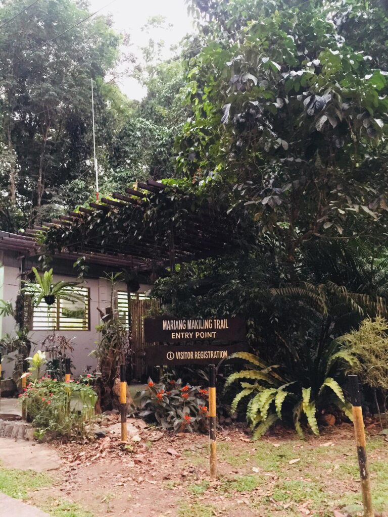
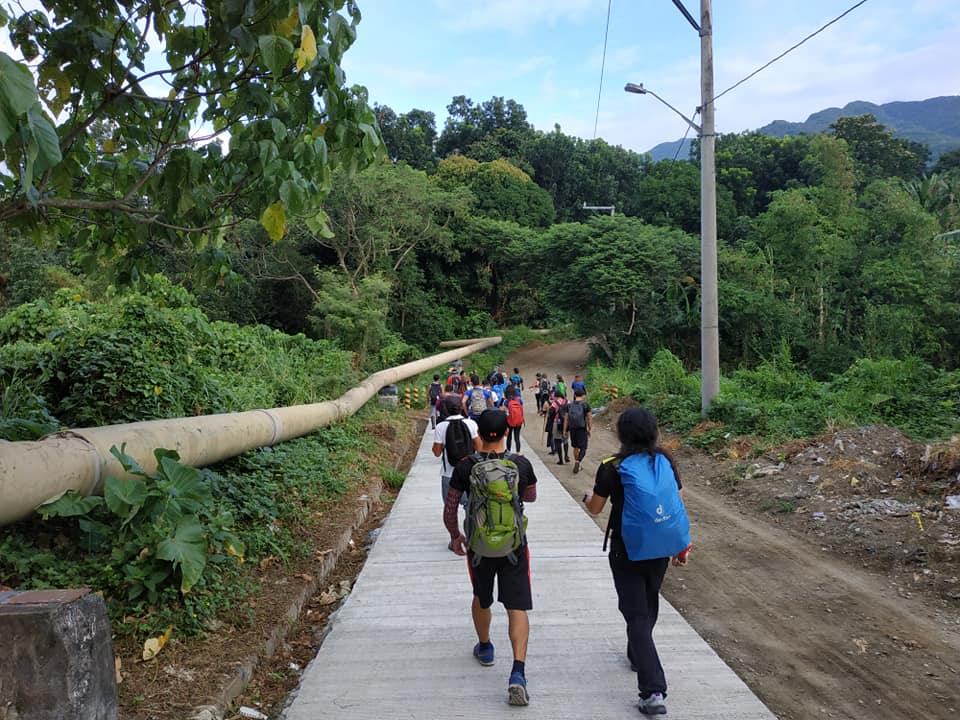
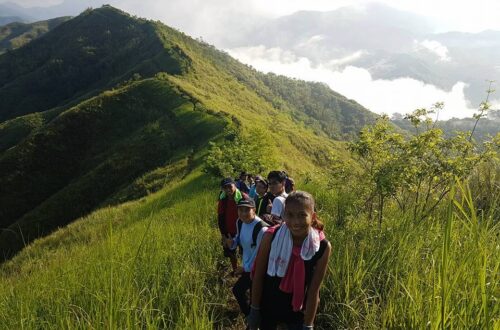
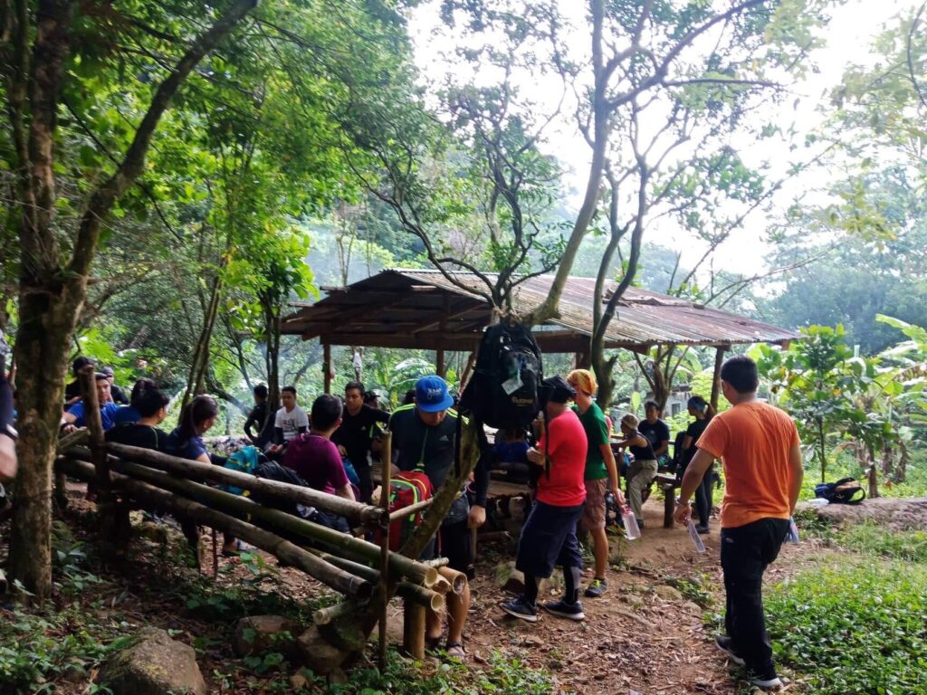
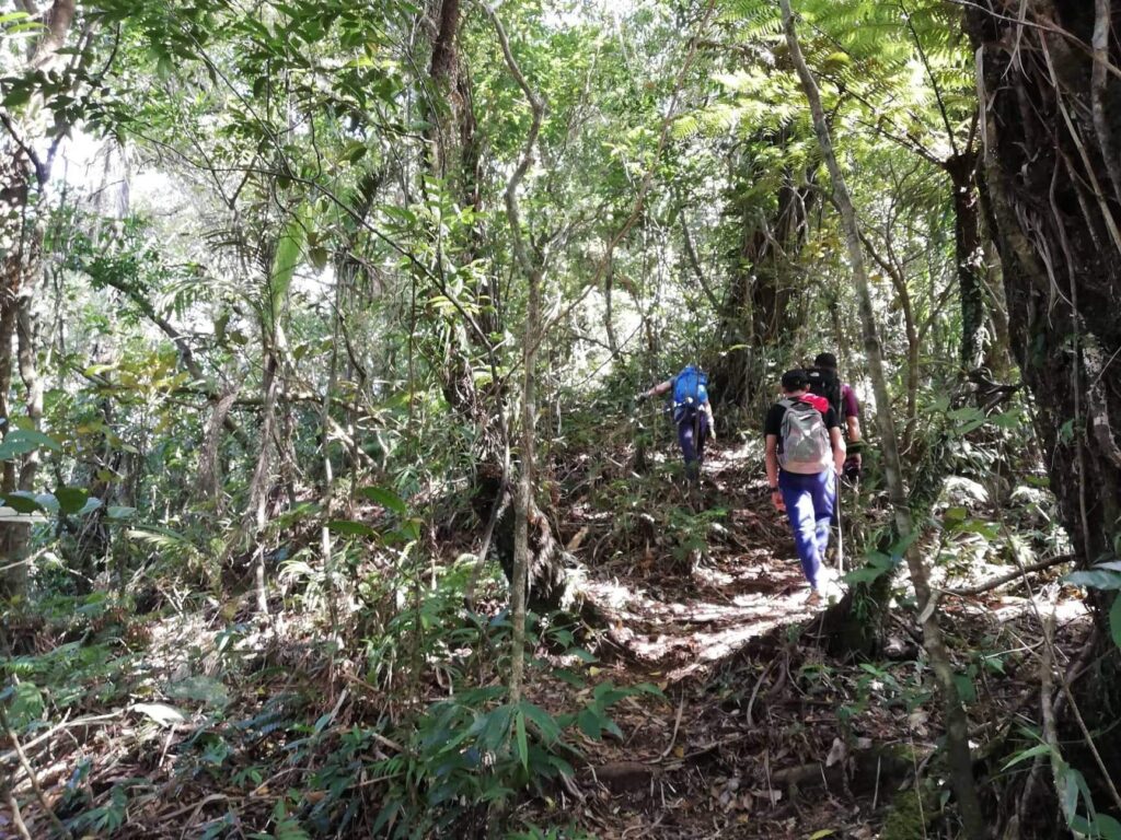
Our organizer registers us and we have a short orientation of the Mt. Makiling traverse trail. Our guide told us there are so many blood-sucking leeches or limatik because it was rained here in the past days. Before we start the climb we have a brief meaningful prayer sent to heaven for guidance and protection. The climb started at exactly 7 am. We pass residential houses and a one-kilometer dirt road trail. The weather is good and we reached station 1 with a nipa hut where we can see a water station. From station 1 up to station 9, the trail becomes a rolling terrain and continuously ascends. The trail is mostly composed of huge trees and rocks, some grassland, and tall cogon grasses dominating the view.
Later one of the members of the group named Lina was the first victim of the blood-sucking leeches. According to her, it goes through her hand because she was not wearing an arm sleeves and our local guide took it off and transferred it to his hands. In my opinion, the limatik are small vampires which terrify the innocent one. Then one by one we put small tissues on our ears to avoid limatik from going inside the ear. Nevertheless, during our moderate ascent, we encountered a lot but we managed to break through and continue climbing.
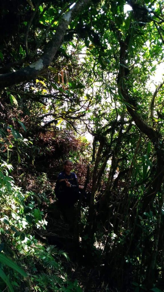
At station seven we take a much-needed long rest. Some of the members take a nap while others eat their favorite trail food. After twenty minutes, we continued our climb on the forested trail of Mt. Makiling. From my point of view, the forested section of Mt. Makiling is very akin to the forests of Mt. Manabu and Mt. Malipunyo. There was a moment when our group need to pass the ravine where the plain fields of Batangas province are distinguishable.
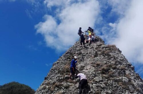
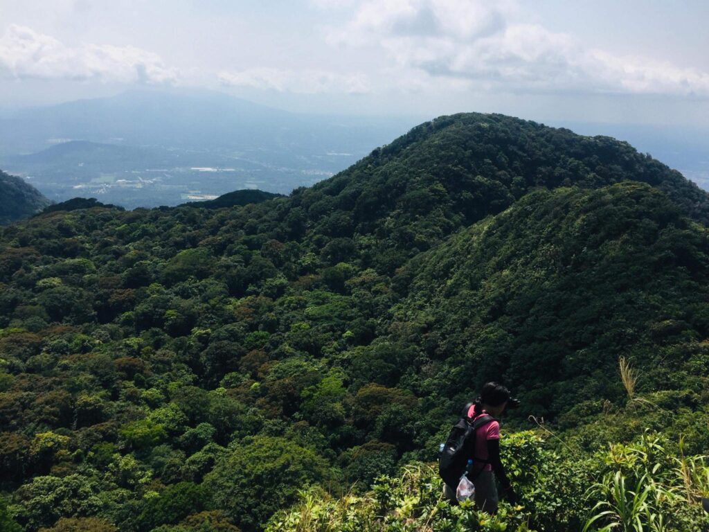
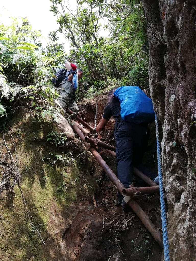
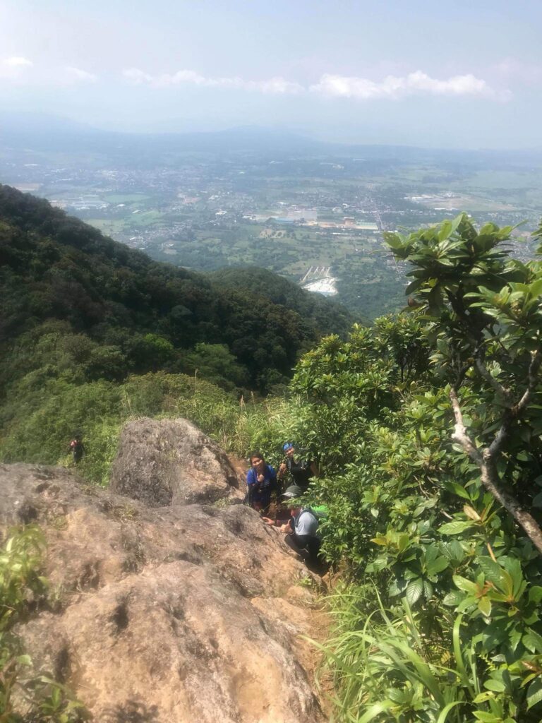
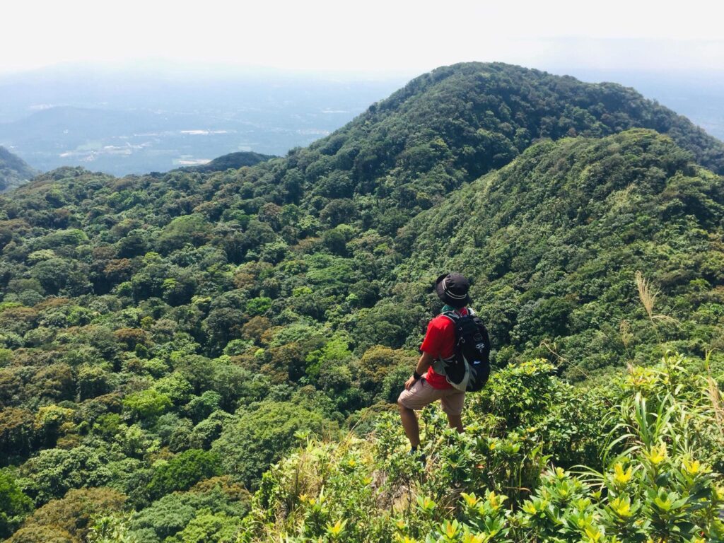
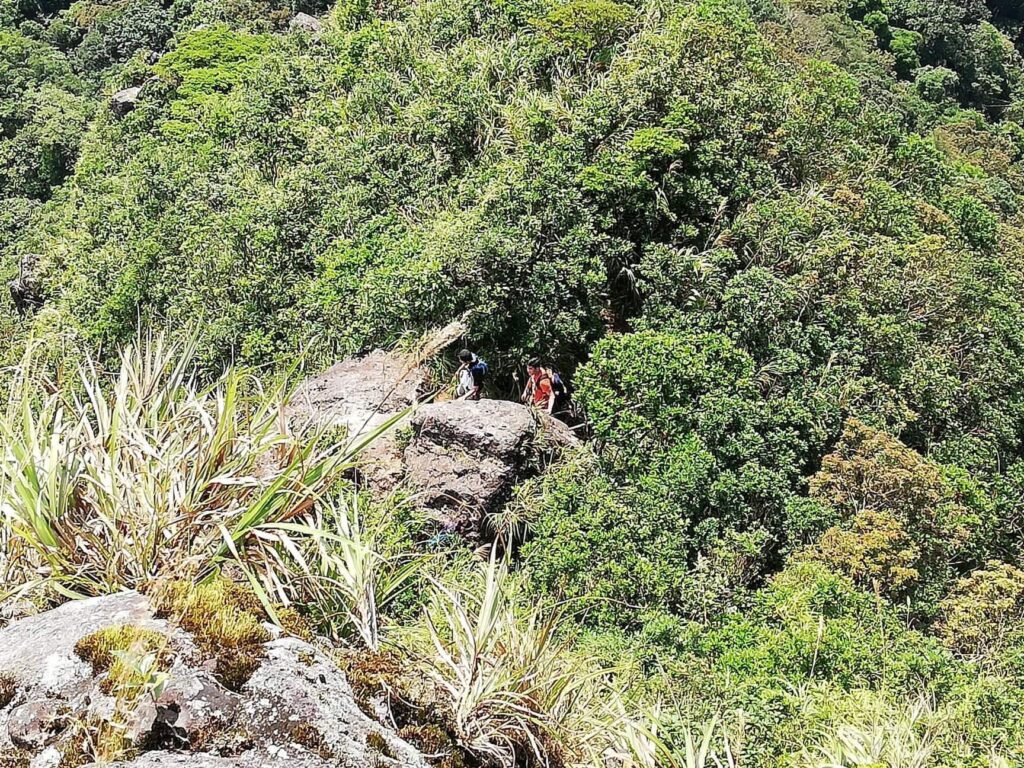
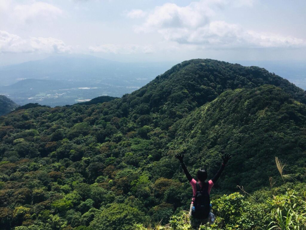
From station 10 up to station 18 is a long walk in the middle of the mountain rainforest. We drink a lot of water to vanquish our thirst. Then we reached station 19 where our group needed to help each other pull ourselves up in the multiple rope segment portion to reach the haring bato. According to our mountain guide, it is called the haring bato because of its rocky surface. At the haring bato, we can see Mt. Malipunyo, peak 1, and peak 2 of Mt. Makiling. To our left side, we can see the immense Mt. Banahaw and Mt. Cristobal looming in the background, and to the south, we can see the Batangas coastal mountain as well as some parts of Mt. Halcon, Mt. Maculot, and the Tagaytay Ridge.
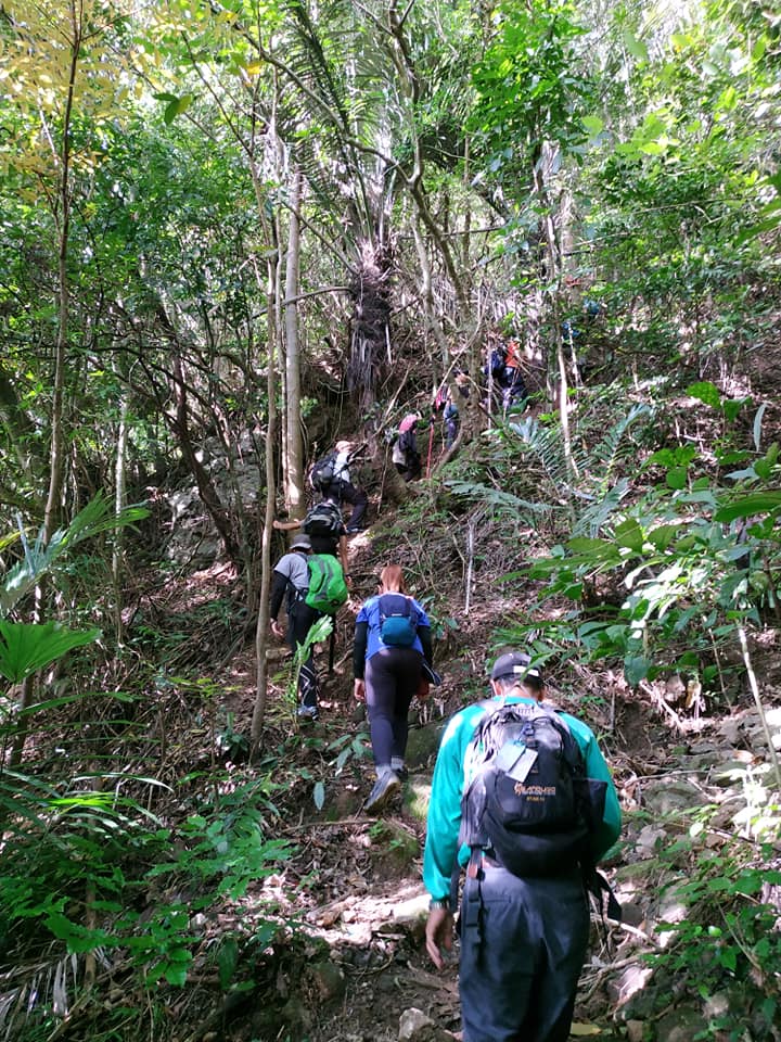
From my perspective, station 19 is one of the most technical parts of our day hike. Even so, the environment turned into a cogon-grass-filled ravine in which the bottom parts of the rainforest mountain slope we go by were viewable. As we were obtaining more elevation from several roped-laddered portions and rock scrambling, an imposing view of the Batangas province can be perceived.
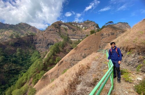
Afterward, we reached the mossy section of Mt. Makiling where the light rain started to pour on us. Because the trail is muddy I lose my balance a few times. Then we have a quick rest and we take amazing pictures of the amazing surrounding at the upper section of the wild boar trail. After done having a pictorial session, we continue our ascent and the weather cooperate with us. We have a clearing along the ridgeline so we snap amazing pictures again of Laguna de Bay.
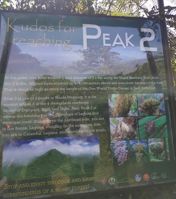
Then after hours of hiking, we reached marker station 30 or the summit of Mt. Makiling. We are now at 1020 meters above sea level. The tall trees obscure the scene of the environment. From here, we take another breather to relax our body and mind. In addition, we checked if we have limatik in our bodies and hiking backpack. Luckily, we didn’t find a single blood-sucking leech. We take our lunch here and I noticed that the summit can fit many groups of hikers.
When our group leader give us a hand signal we started to descend the UPLB trail. This trail consists also of 29 marker stations where each marker station is estimated to be 150 to 500 meters apart. For the most part, the trail is slippery and we need to slow down even though the hiking trail is easy. At station 20 the trail transformed into relatively flat ground. As we go down I can see different kinds of animals, insects, and enormous plants.
From my perspective, Mt. Makiling is one of the most diverse mountains I’ve ever stepped on. The rainforest flora and fauna at the UPLB side are much taintless juxtaposed to the Santo Tomas part of the mountain. I can see a lot of ferns and dipterocarp trees which are very similar to Mt. Manabu. At stations 14 and 15, we spotted rotten rafflesia which is truly amazing to see. Some of the group members who passed by told us that rafflesia easily rot because of the heat.
After nearly two hours, our group reached station 11 or also known as the Agila Base which marks the end of the forested trail. From there we bid farewell to our helpful mountain guide and some of the members gave him a tip. From a short distance, we can see several motorcycles or what they call a habal-habal in which mountaineers can take a ride going to station 1 at the University of the Philippines Los Baños (UPLB). Even so, none of us take a shortcut ride all the way down and we all decided to continue trekking on the downward paved road. Progressively little by little our group passed by the remaining stations.
It was past 6 pm when we reached the gate of UPLB and the traverse day hike is finally completed successfully in eleven hours. From here, we tidy up and later our private van headed back toward Metro Manila. Along the way when we have our late dinner at the cafeteria beside the highway. At 11:30 pm we arrived at EDSA Ayala and we parted ways.
Mt. Makiling traverse (Maktrav) day hike is one of the most challenging day hikes I’ve ever accomplished that year. I found that the Mt. Makiling traverse is much more challenging than the Mt. Arayat traverse. Nevertheless, I finally conquered the limatik-infested mountain and I’m still not sure if I will ever do it again in the future. In general, my hiking adventure to Mt. Makiling sums up this notable quote “rise above to reach the peak.”
Sample 1 Day itinerary to Mt. Makiling
12:30AM – Assembly at the designated meet-up place
1AM – Departure going to Santo Tomas, Batangas
5AM – Arrive at Santo Tomas, Batangas, breakfast and final preparation
6AM – Start hiking
7:25AM – Arrive at the nipa hut
9:20AM – Melkas Ridge
10:20AM – Haring Bato
11AM – Lunch
12PM – Start traversing
4:30PM – Agila Base
5PM – UPLB College of Forestry, rest and tidy up
6:15PM – Departure going back to Manila, dinner along the way
10:30PM – Arrive in Manila
Things to bring on your visit to Mt. Makiling:
Two liters of bottled water or other rehydration fluids
Chocolate bar or candy bar
Trail food like skyflakes, fruits, and bread
Small flashlight
Rainproof hiking backpack and jacket
Camera to be able to capture unforgettable moments and sceneries
A good pair of hiking sandals and a slipper
Toiletries
2 to 3 sets of change clothes
Valid Identification Card
Alcohol
Pocket money for personal expenses
2 plastic bag
Packed lunch
Personal medicine kit
Raincoat or rain gear during the wet season
Gloves (optional)
Trekking pole (optional)
Reminders and Tips:
- Mt. Makiling is a major climb with a difficulty of 5/9 with roped segments and it’s not an ideal mountain for beginners in the hiking scene. The hike to the summit will last 5 to 6 hours at a moderate pace and with enough rest. The total hours to and from the summit could take up to 11 to 13 hours. So if you’re doing the Mt. Makiling traverse day hike, it is prudent to start as early as possible in the morning preferably around 5:30 am.
- Getting a mountain guide is required before climbing Mt. Makiling.
- Please take note that blood-sucking leeches or limatik are mostly present throughout the whole forested trail, especially during the rainy season. On the other hand, rattan, a tropical plant with thin and tough stems is mostly present on the Santo Tomas side of the mountain. In addition, the Lipa plant and Ligas plant are present on the mountain trail.
- As of today, Mt. Makiling traverse is close to all hikers. Even so, the Agila Base is the only trail that is open to tourists.
- The cellphone signal at Mt. Makiling is so weak, especially in the middle and summit portion.
- The fixed roped section can be seen at the rocky segment of the mountain which is very helpful during the steep ascent.
- Restroom and toilet are present at the main jump-off point.
- Littering or the inappropriate disposal of waste products is strictly prohibited.
- If this is your first time hiking Mt. Makiling then don’t hesitate to ask the local personnel there for the right directions.
How to Go to Mt. Makiling
By commute:
- From Metro Manila, ride an HM Transport bus going to Santa Cruz municipality in Laguna. Tell the bus driver to drop you at Olivarez Plaza Mall in Los Baños.
- Then from Olivarez Plaza Mall ride a jeep bound to UPLB College of Forestry and Natural Resources. Upon arriving at UPLB (University of the Philippines Los Baños) walk for a few minutes going to the Mt. Makiling entrance gate. From there you will have to register, pay the entrance fee and get a local guide before climbing the mountain.
Note: the estimated travel time from Quezon City going to Los Baños is three to four hours but it will depend on the traffic situation. Also, you have the option to ride a bus going to Santo Tomas City Batangas in the Buendia bus terminal. Tell the bus driver to alight you at Barangay San Miguel in Batangas.
By private car:
- From Metro Manila, take the South Luzon Expressway (SLEX) and Maharlika Highway.
- Then turn left to Mak-Ban Road and afterward make a left turn to Barangay San Vicente in the city of San Pedro in Laguna then follow through all the way to the registration site of Mt. Makiling.
There you have it mountain lover. You just live your life first. Just live your life because every road trip and adventure comes with an unforgettable experience. I deeply hope you found this Mt. Makiling traverse day hike guide valuable to you and to your circle of friends. Thank you for the time to read.
Jervis Ergino
Hi! I’m Jervis Ergino, the digital content creator behind Hike to Mountains, a travel and hiking blog in the Philippines. This blog is dedicated to helping people know more about the best hiking and tourist destinations in the Philippines.