Mt. Maculot Hiking Guide (Itinerary + Tips)
Introduction
Mt. Maculot is one of the most popular hiking destinations in the Philippines. It offers panoramic views of the world-famous Taal Lake and the surrounding towns of Batangas. Mt. Maculot summit has a height of 930 meters above sea level or 3051 feet. On the other hand, Mt. Maculot Rockies has a height of 706 meters above sea level or 2316 feet. Despite the fact that Mt. Maculot is less than 1000 meters above sea level, it can be seen from Puerto Galera and some parts of Northern Mindoro province.
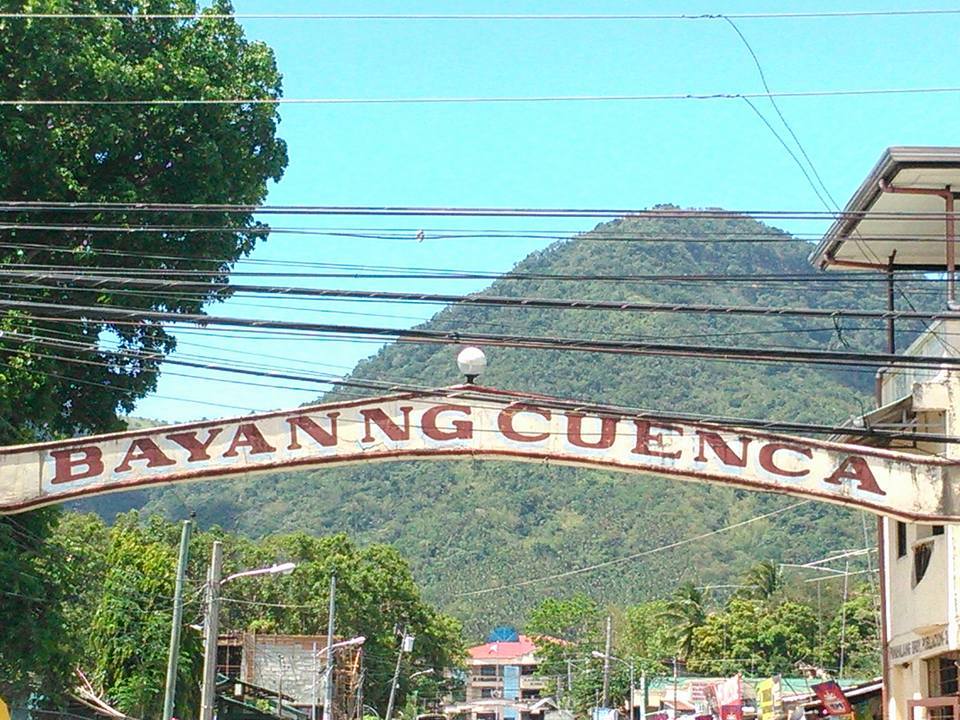
Mt. Maculot is located at the heart of Batangas which is in the municipality of Cuenca, Batangas. It is one of the nearest mountains outside Meto Manila. Due to its proximity to Metro Manila, many hikers and mountaineers visit this mountain on weekends and during the summer season. Today, Mt. Maculot is a dormant stratovolcano and a major tourist destination that is perfect for a day hike adventure for hikers at all levels.
Mt. Maculot has three well-known destinations. First is the Rockies, second is the summit and the third is the Grotto which has an elevation of 510 meters above sea level. Among the three the Rockies is the most popular. All these destinations can be reached within a day by doing a traverse dayhike. However, most hikers opt to go to the Rockies only because of the impressive view already.
Kulot is a Tagalog word that means “curly”. It was said that the mountain was named Mt. Maculot due to the curly-haired Aetas who once lived in this mountain. According to Mt. Maculot’s past history, there are several hiking-related accidents that occurred within the mountain. Two hikers fall from the Rockies and it resulted in death. Nevertheless, the mountain remained a preferred hiking destination among beginners in the hiking scene and is still crowded during holidays and weekends.
Name: Mt. Maculot
Difficulty: 4/9 (traverse), 3/9 (Rockies)
Elevation: 930 MASL (summit)
Jump-Off: Mountaineer’s Store, Barangay 7, Cuenca, Batangas
Exit point: Barangay 5, Cuenca, Batangas
Hours to summit: 4 hours
Features: magnificient views of Taal Lake and plains of Batangas, rock formations, and forests
My hiking adventure to Mt. Maculot
During the past months, I have always climbed a mountain in Rizal province. So one day I decided to join an organized trip going to Mt. Maculot to have a different view of the surrounding. I believe Sundays are for unwinding and reconnecting with the natural world. It was Sunday at 1 am when I arrived at our assembly place in Mcdo Greenfield. We are twenty-six in the group chat consisting of two private vans.
When everyone has already arrived at our assembly place, the two vans left Manila and headed towards Batangas. After three hours and thirty minutes of land travel, we finally arrived at the main jump-off point of Mt. Maculot. The tour coordinator registers and secures our guide. After that, we pay the registration fee and we have a short prayer to God thanking him we got to the destination safely. Then our group chooses the traverse trail to get the full beauty of the mountain.
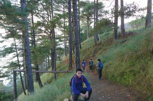
Our local guide and tour coordinator told us that we would first go up to the Rockies, then to the summit and the last is Grotto. After that our group walk and start to hike. The first part of the hike is on a cemented road. It was very easy for twenty minutes. It’s like walking in the park. After that, the trail becomes an uphill climb. It is a seventy-degree assault. We are now sweating heavily and tired as we go up the slope of the mountain. I think I lose all the food that I ate for early breakfast in the steep ascent. For this reason, our group takes a quick rest.
We eat our trail food inside our bag and drink a lot of water to quench our thirst. Without a doubt, the ascent from the base of the mountain going up to the slope of Mt. Maculot truly tests our patience but the view is rewarding. We see the stunning sunrise and we can already see the municipalities and plains of Batangas. After done resting, we continue the hike at a moderate pace. We pass by some weeds, vines, ferns, mango trees, and avocado trees.
Along the trail, we shared stories of our current job and the mountains we climbed before. One hiker even joked that as we go up the mountain the prices of the goods go up too. We were laughing as we go up the mountain. After nearly one hour of the continuous hike on a dusty and steep trail, we reached the flat ground where we find a mini store that sells fresh coconut juice and some bread. As a result, we buy coconut juice to refresh our drained bodies. Truly, the assault going up is no joke.
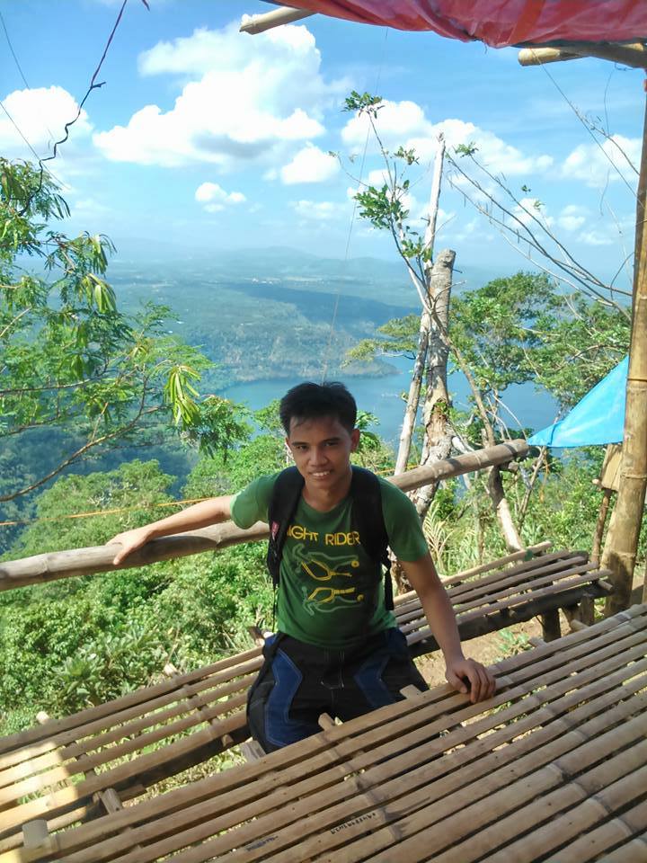
After that, we continue the hike and after some twenty minutes we reach the campsite of Mt. Maculot. We saw several groups of hikers that do overnight at the campsite. We greeted them good morning and they smiled at us. Also, I noticed that there were so many hikers and campers on Sunday. At the campsite, there’s a small nipa hut where our group takes a quick rest before going to the Rockies.
Then our local guide told us that we need to wait for at least twenty minutes before heading to the Rockies. After waiting for twenty minutes, our group starts to descend on a very steep and slippery trail. We use the strategically installed rope along the trail to hold on properly as we go to the Rockies. Also, the guide assists us during the descent. Our group scrambled up the big and sharp rocks.
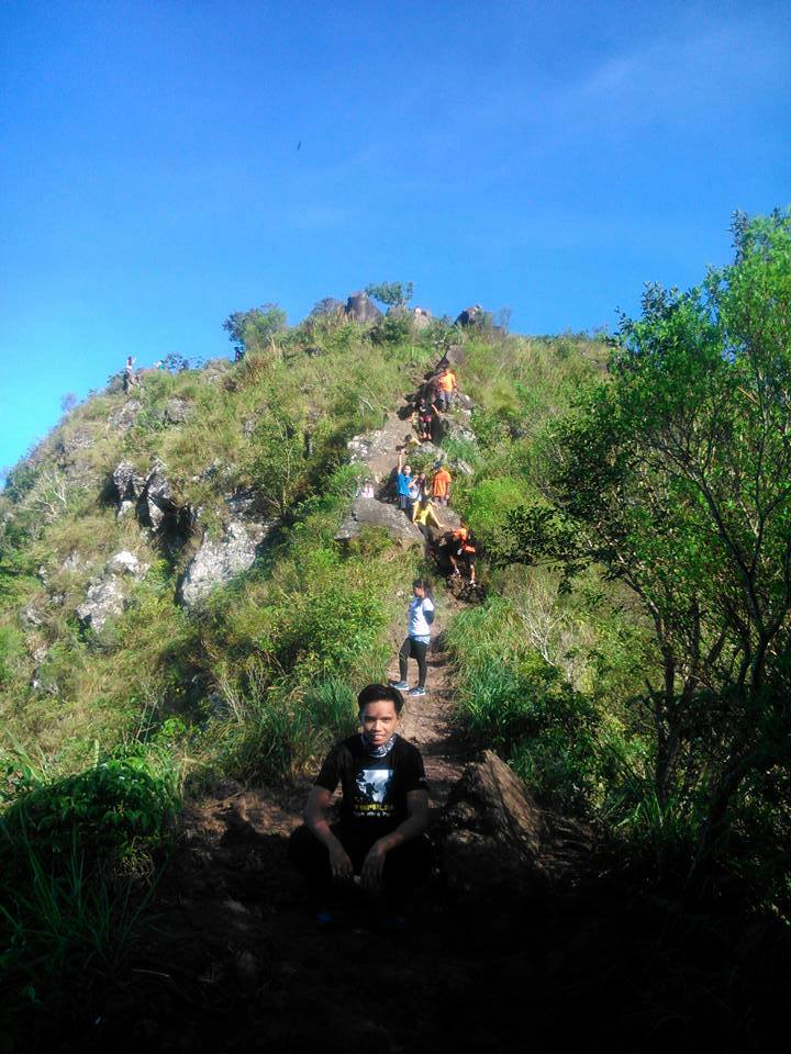
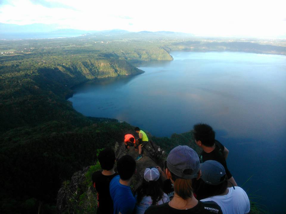
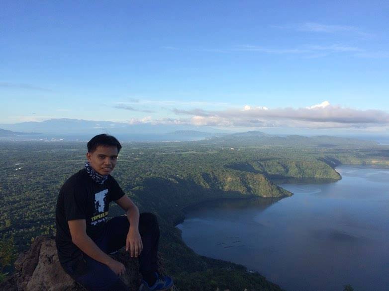
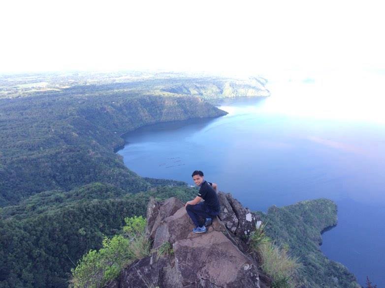
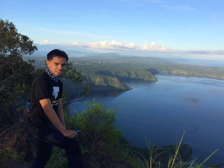
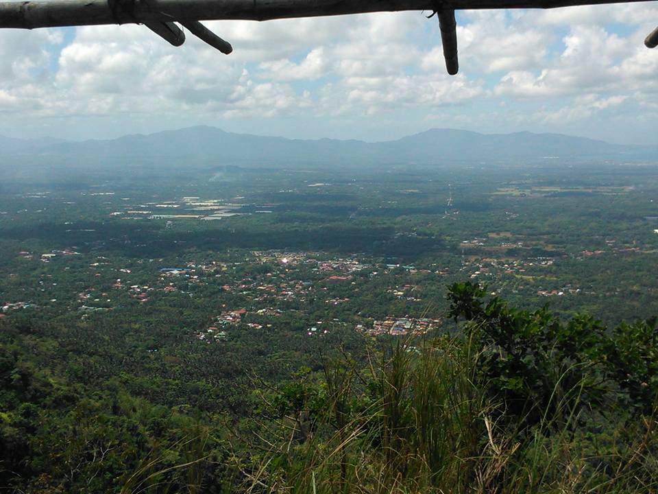
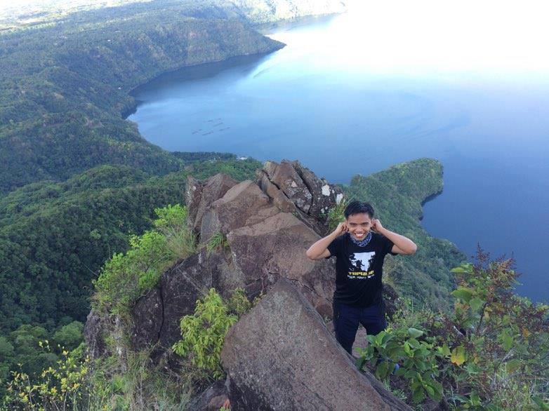
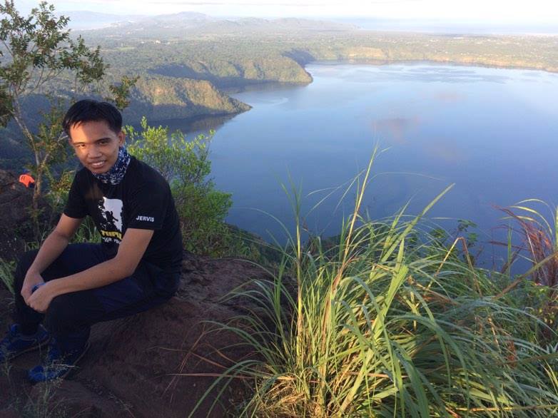
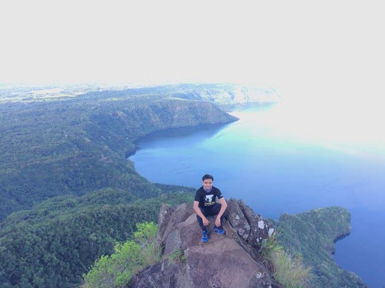
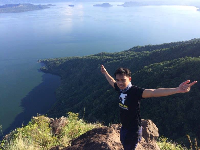
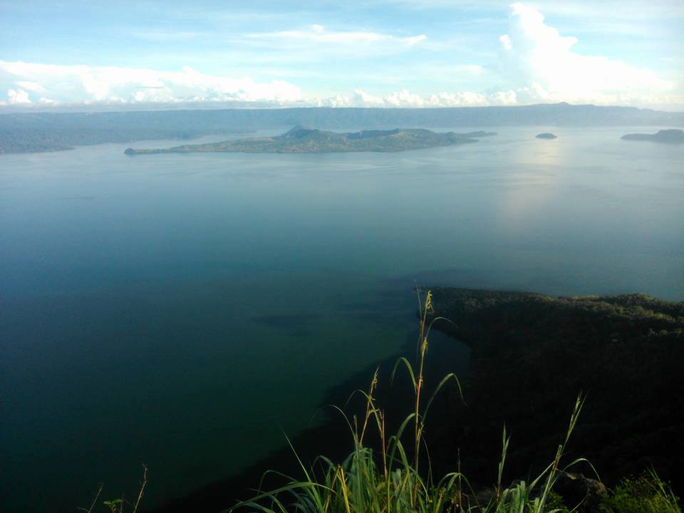
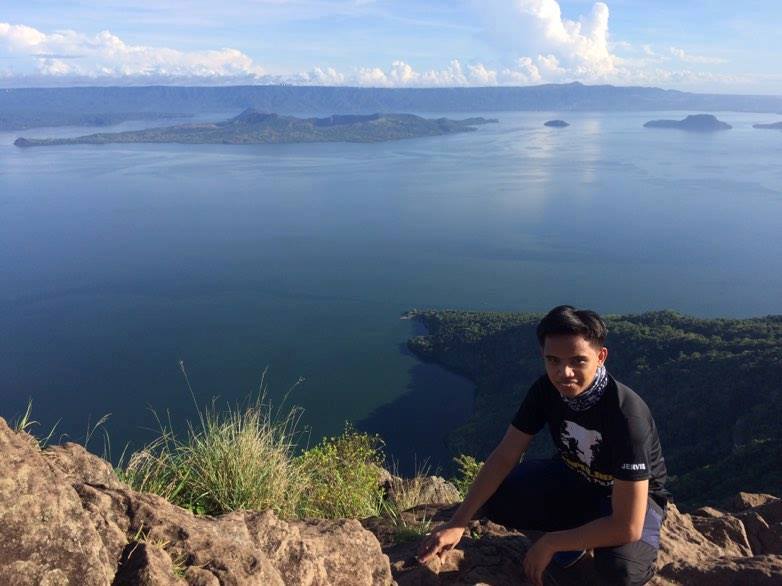
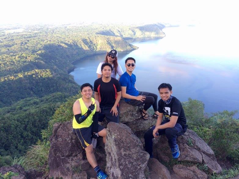
Then ten minutes later we finally reached the Rockies of Mt. Maculot. The scenery is mesmerizing. It’s incredible to be out there seeing the famous Taal Lake. It is a jaw-dropping view at the top of the Rockies. Undoubtedly, the hike and the trip are all worth it. I feel the cool wind blowing which is so relaxing. Indeed, nature is so wonderful, and so are the people.
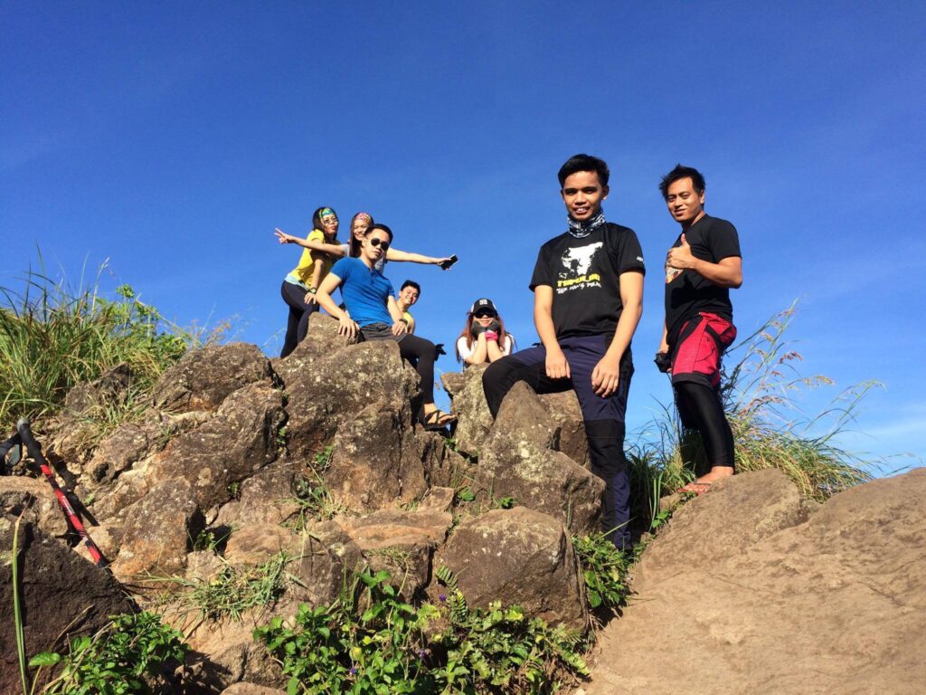
We start taking pictures and videos of the stunning scenery of Taal Lake, Taal Volcano, and towns in the background. Then one member of the group flies his drone camera to capture the view from above. In my point of view, Mt. Maculot is a gorgeous mountain created by God. It is a masterpiece of the Batangas province.
I have never been to Mt. Maculot. Seeing something in a photo and seeing it in real life is completely different. Then I said to myself that photographs will never be able to capture the full beauty of nature. Photographs take a moment in time and freeze that moment forever.
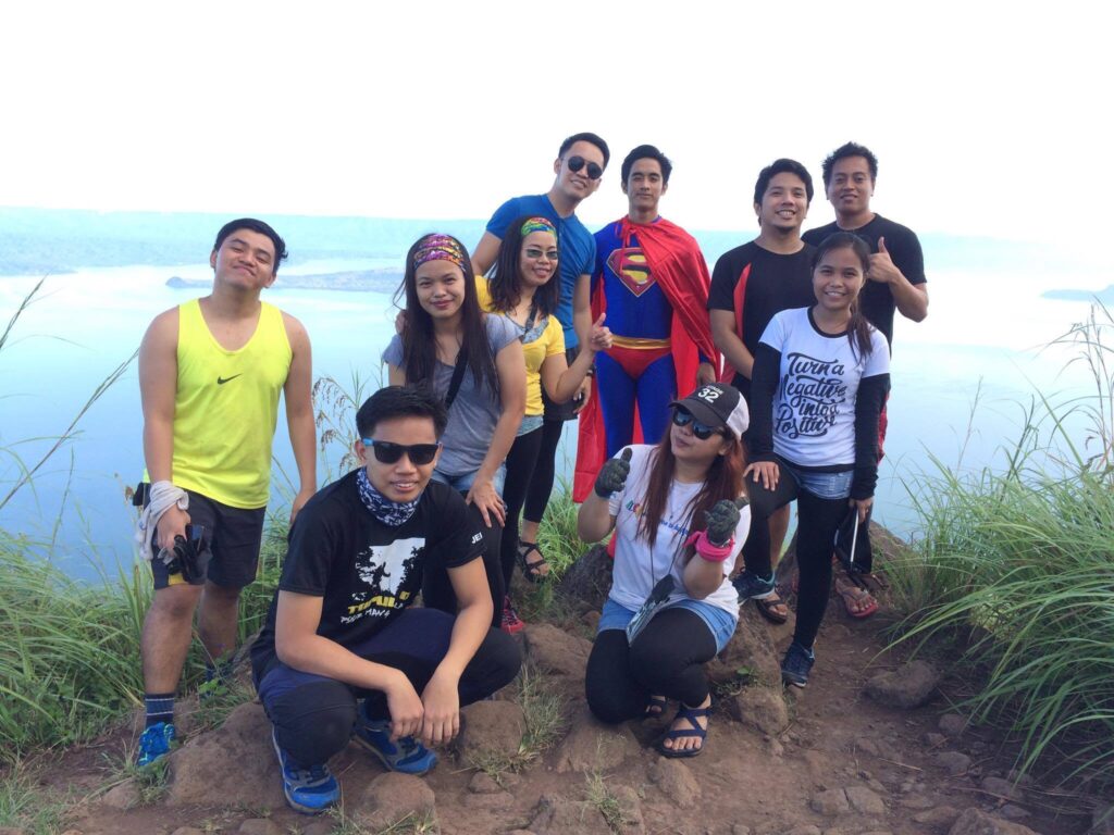
On the other hand, our group needs to be very careful at the rocky portion where we stand and take pictures. Then one hiker changes his outfit to superman. We shared waves of laughter because of his costume. To be honest, I’ve never seen that before during the entire period I hike. As a result, we have our awesome group pictures taken at the Rockies. We stay in the Rockies for almost one hour. We enjoy the mesmerizing view of the surrounding.
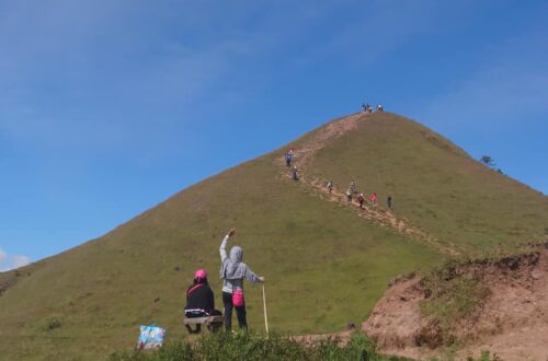
Then our tour coordinator and local guide give us a sign to us that we need to leave the Rockies and start hiking again back to the campsite. For the last moment, we take several pictures of the pristine place and then we continue to hike. After fifteen minutes of rock bouldering, we reached the campsite and we take a quick rest before proceeding to the summit of Mt. Maculot.
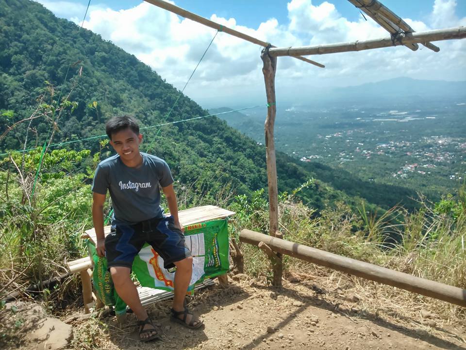
From this viewpoint, we can already see the summit. We eat our trail food and after that, we continue the ascend. The trail is covered with a lot of trees and overgrown grass, so I don’t have to worry about the heat of the sun. For one hour and ten minutes, we hike on this forested trail at a faster pace. Then at 10:45 am our group reached the summit of Mt. Maculot. It takes us four hours to reach the summit.

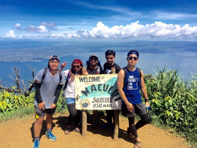
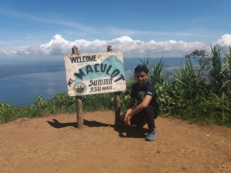
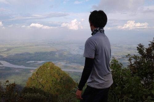
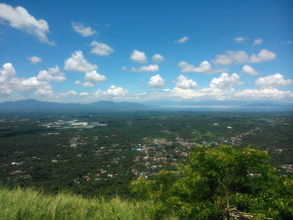
Without a doubt, the view from the summit is much better compared to the Rockies. It is a 360-degree view of the beautiful province of Batangas. We are rewarded with one of the best viewpoints of Taal Lake. We are so lucky because we have a wonderful clearing. The bright sunny day allowed us to see the whole Taal Lake unobstructed, which is truly mesmerizing. The place is very picturesque and the view is revitalizing.
I can see several prominent mountains from the south such as Mt. Makiling and Mt. Halcon. Then I noticed that the summit area is not really wide and there are only a few trees to offer us shade. Also, we saw several hikers coming in from the Grotto side. We think they do the opposite traverse hike. Then we have our group pictures taken at the summit.
We share thoughts about hiking this mountain and I found out that some of the members in our group are first-timers and some are veterans in hiking already. We start the descent to the grotto at 11:30 am. The first part is easy. The trail going down the mountain is also a forested part with overgrown grasses. We explore the forested side of the mountain. Then we reached the two rope segment or the rappel portion to go down the slippery and steep path. In my opinion, this is the most technical part of the entire traverse.
We wait for each other turn. Then we need to be very careful with our steps as we hold on to the rope. My knee and legs are trembling as I go down slowly. The local guide assists us to pass the steep path. I enjoy this new experience. According to our local guide, only 30 percent of the mountaineers go after the traverse dayhike because of its difficulty.
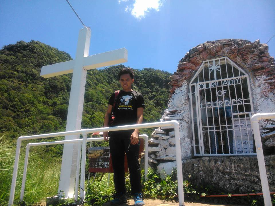
A few minutes later, we finally break through the difficult section of the trail. As we continue to go down the mountain, some of the members have scratches on their legs because of the thorns. In my opinion, going up is challenging but going down the mountain is even more challenging. Nevertheless, we reached the Grotto at 1:30 pm.
I loved the hiking trail and I love hiking. We saw mini-stores in front of the Grotto. Then our local guide told us that those stores we see are not normally there. Since we hike before Holy Week the stores are available at the moment. Our group takes a much-needed rest and some of the members snap pictures of the grotto. On the other hand, I didn’t take photos because I’m afraid that there is a ghost that will show up in my pictures. Just kidding.
After done taking a rest, we continue the descent on the slope of the mountain. No more rope segment on the way down. However, we walk through several paved stairs and a concrete ladder. As the sun is already high at that time, we descent at a faster pace to avoid the direct heat of the sun. Some of the members do trail runs and some members open their umbrellas. A little walk we pass the Stations of the Cross before the exit point.
At 2:20 pm, our group finally reached the exit point where we saw several tricycles that are lined up. It is a sign that our group successfully completed the Mt. Maculot traverse day hike. It took us two hours to descent and seven hours to complete the day hike. Mt. Maculot traverse has a total of 4-kilometer trail length from Barangay 7 to Barangay 5, Cuenca, Batangas. The entire hike ended with a smile on our faces. Then we take a shower in the barangay.
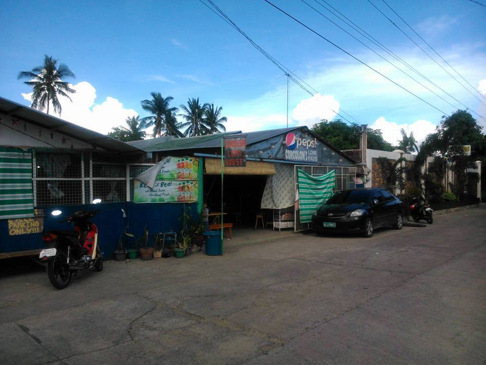
Our group log out and then our van left Cuenca, Batangas at 3:30 pm. We have a stopover and afternoon snack at Corcolon Lomi Haus in San Jose, Batangas. Their Lomi noodles are quite big with lots of toppings. In my personal preference, this is the best Lomi I have ever tasted. For this reason, it was a satisfying and fulfilling afternoon snack. Then after our quick snack, we go inside the van again.
We reached Manila at 7 pm after four hours of a road trip. I thank God for guiding us and keeping us safe throughout the entire hike and trip. My hiking adventure in Mt. Maculot is so enjoyable. Without a doubt, I will hike this mountain again. God willing.
Sample 1 Day itinerary to Mt. Maculot (Rockies-Summit-Grotto)
3AM – Meetup in Buendia bus station
4AM – Ride a bus bound to Lemery, Batangas
6:30AM – Arrive at Cuenca Proper jump-off point, register, and secure a guide
7AM – Start hiking
8:30AM – Campsite, rest
9AM – Rockies, snap photos
9:30AM – Ascend from the Rockies going to the summit of Mt. Maculot
11AM – Summit, photo-ops, rest, and take lunch
12PM – Start to descend
1:30PM – Arrive at Grotto, quick rest, take pictures, resume descent
2:30PM – End of hiking, arrive at the exit point, log-out, and wash-up
3:30PM – Ride a jeep going to City Lipa Grand Transport Terminal
4PM – Arrive at Lipa Grand Transport Terminal, ride a bus bound to Metro Manila
7PM – Arrive at Metro Manila
Note: this sample itinerary is just a basis and not absolute or will not be 100% perfect due to many factors such as group pacing, weather condition, delays, etc.
Things to bring on your visit to Mt. Maculot:
2-3 liters of bottled water
Trail food like banana, nuts, chocolate, biscuit, jelly ace, fruits, etc.
Packed lunch
Flashlight
Personal medicine
Extra clothes
Extra money for personal expense
Towel
Toiletries
Camera, Power bank
Plastic bag or garbage bag
Alcohol
Valid ID
Arm sleeves
Umbrella (optional)
Cap or scarfs (optional)
Gloves (optional)
Sunblock (optional)
Whistle (optional)
Raincoat during the rainy season
How to Go to Mt. Maculot
By commute
- From Manila, go to Buendia bus station and ride a bus going to Batangas. Tell the bus driver to drop you at Tambo Exit.
- Then ride a jeep bound to Lemery and drop off at Cuenca near the INC church.
- From Cuenca, ride a tricycle or walk towards the main jump-off point. Then register at the barangay outpost.
By private car
- From Manila, pass through the South Luzon Expressway (SLEX) and Star Tollway going to Batangas and exiting at Tambo exit, Lipa City.
- From the Tambo exit, turn left and then take the Jose P. Laurel Highway. After that turn right before the Phoenix Gas Station and proceed to the National Highway going to Cuenca.
- From Cuenca, ask the locals there where is the registration site of Mt. Maculot or the Mountaineer’s store. Then they will tell you the exact location.
Note: To reach the exact destination point you can download and open your Waze app. Then pin the destination to Mountaineer’s Store, Cuenca, Batangas. Also, it is important to note that there are two jump-off points, one is for the Rockies and the other is for the Grotto side.
Reminders and Tips:
- Mt. Maculot is a minor climb and it’s a beginner-friendly mountain. It has a well-established trail with a steep slope that requires bouldering.
- Don’t hike alone and always have a local tour guide with you. Hiking is not a game. You need to plan for your own safety.
- The best time to hike Mt. Maculot is during the weekdays to avoid the large crowd.
- I’m not in favor of doing selfies or posting on a risky spot, especially in the Rockies. Extra caution is advised. Remember, a true hiker always observes safety first at all times.
- Parking spaces, restrooms, bathrooms, and sari-sari stores are available at the jump-off point.
- Wear appropriate hiking shoes, sandals, and dry-fit clothes.
- Just pack light if it’s only a day hike and just bring the important things needed in the hike.
- Please waterproof your important things during the wet season.
- Bring jackets when you’re staying overnight at the campsite as the weather during the night is cold.
- Please follow the Leave No Trace principle at all times. Do not litter and put all your trash in the proper way. Do good deeds to our mother nature. Sustainability is a must.
- Avoid loud music and shouting while hiking. Respect fellow hikers and the mountain.
- If your group plan to do overnight, please take note that there is a wide campsite near the Rockies where you can pitch your tent and camping essentials. Also, there are locals who offer a tent at affordable prices.
- Securing a local guide is required before you start to hike for your own safety.
- I highly recommend getting an organized tour when you plan to hike Mt. Maculot for ease and convenience and to lessen your expense. Inclusion in the Mt. Maculot package day tour is roundtrip transfers via private vehicle (Manila-Batangas-Manila), local guide fee, and registration fee. Excluded in the package day tour are personal food and shower fees.
- Bring enough water to keep yourself hydrated and bring food because the prices of the goods and drinks at the mini-store near the campsite are a little bit cozy. If you want to lessen your expense during the hike, I suggest bringing a lot of heavy foods and packed lunch. Also, take note that there is no water source in the mountain.
- As much as possible, start the hike early in the morning. It is very hot during the daytime.
- The registration fee at the barangay outpost is 20 pesos per person.
- The guide fee range from 500 to 1000 pesos for a dayhike (maximum of 5 people). Note: the guide fee varies depending on your preferred destination. (Rockies only or traverse)
- There is no reservation required to hike Mt. Maculot. Local guides will be assigned to you after you register but it is more favorable if you have contacted them in advance.
- Hikers should only walk through designated trails to prevent accidents.
- The estimated budget for a DIY (Do it yourself) is 1000 pesos.
- It is important to get a decent sleep before the hike. Also, be prepared physically and mentally before going on a hike.
- Cellphone signal is very limited throughout the trail.
- If you have more time and budget, you can hike Mt. Manabu as a side trip and twin day hike.
- After the hike satisfies your appetite with the affordable and delicious Batangas Lomi.
- There are monkeys living on the Grotto side of Mt. Maculot If you happen to see them, I suggest don’t do anything. Do not irritate the monkeys or provide food.
- For the regular route of the traverse day hike, the Rockies is the first destination to be reached.
- Mt. Maculot is usually hiked on a one-day itinerary but to better appreciate the beauty of nature, I recommend doing an overnight climb.
- The hike to the summit of Mt. Maculot South Peak can be reached in 4 hours of hiking at a moderate pace and with sufficient rest. Some hikers can finish it in three hours or less. The total hours to and from the summit could take up to seven hours.
- If you’re going for a day hike, it is advisable to start the hike early at 5 AM.
- Hikers have two choices for hiking Mt Maculot. First is you need to hike up to the Rockies only which many hikers do. The second option is the traverse hike from the Rockies to the summit and to the Grotto.
- The hike up to the campsite consists of several resting stations. Each station features a wooden bamboo bench for resting purposes. There are locals selling snacks and cold drinks during the weekends.
- From the campsite, the summit of Mt. Maculot looks near. However, it is another one-hour hike to reach the summit depending on your pace. The trail is abrupt and there are no rest stations as you go up.
- There are tricycles on the exit point of the traverse hike that will take you back to the Cuenca town proper where you can ride a jeep going to SM City Lipa.
- As of now, Mt. Maculot is still closed to all hikers and tourist.
- Last but not least, the tricycle fare going to the registration site is 25 pesos and the parking fee at the jump-off point is 50 pesos.
There you have it. Eat, unwind, travel and repeat. Get out there and enjoy the great outdoors. On the whole, I hope this Mt. Maculot traverse day hike guide has been beneficial to you and motivated you to try visiting the mountain. Also, don’t forget to share this with your groups, friends, loved ones, and colleagues if ever you plan on doing the Mt. Maculot day hike too. Remember sharing is caring. God bless you in all your hiking trips. Have a good day to you. Stay safe and thank you for taking the time to read my blog. Until next time.
Jervis Ergino
Hi! I’m Jervis Ergino, the digital content creator behind Hike to Mountains, a travel and hiking blog in the Philippines. This blog is dedicated to helping people know more about the best hiking and tourist destinations in the Philippines.