Mt. Daguldol Dayhike Guide (Itinerary + Tips)
Introduction
Mt. Daguldol is a coastal mountain located in the province of Batangas. It offers a scenic view of nearby Batangas mountains and beaches. Additionally, Mt. Daguldol has an elevation of 672 MASL or 2204 feet. Mt. Daguldol is exactly situated in Sitio Biga, Barangay, Hugom San Juan, Batangas. It is bound between the municipality of San Juan and Lobo. The Lobo municipality is also a highlands, with Mt. Naguiling being the tallest mountain.
The Tagalog word “Daguldol” means a feeling of apprehension and grandiosity. According to locals, the mountain was named as such because it describes the magnificence of the mountain range and the blunt rolling of its slopes. Mt. Daguldol has a total trail length of nine kilometers.
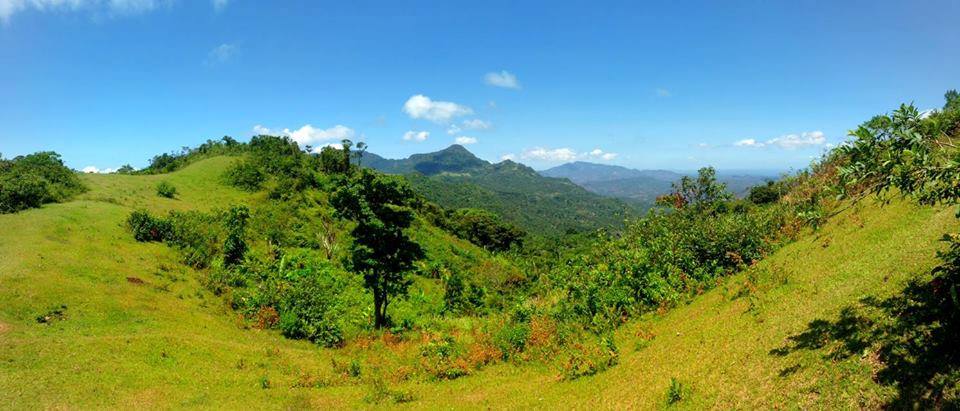
Although Mt. Daguldol is not as popular as the other mountain in Batangas such as Mt. Maculot and Mt. Batulao. However, it’s one of a kind mountain where hikers can be able to experience a diversity of landscapes. Mt. Daguldol has three different trails. First is the trail where one can see the beach or seaside. The second is the trail that passes by woodlands and forests. The third is the grassland trail at the top of the mountain where one can see the mountain ranges and coastal view of Batangas.
Name: Mt. Daguldol
Difficulty: 3/9
Jump-Off: Barangay Hugom, San Juan, Batangas
Hours to summit: 3 to 4 hours
Features: forests, coconut field, grassland, and astounding views of nearby Batangas mountains and beaches
My trip to Mt. Daguldol
While scrolling, I saw someone posted on a Facebook group about the Mt. Daguldol day tour. I was amazed by the pictures because I never thought that the Philippines have this kind of mountain. It looks like it is located in another country. The organizer gave me the itinerary and I was happy to see that there’s a side trip going to the beach. I’ve never joined any day tour before that after hiking you will refresh on the beach. It is something that I look forward to and I want to experience it so I joined an organized tour.
It was Sunday when I meet the group at Cubao. When all the members of the tour are completed. The van left Cubao at 2 am and heads towards our destination Mt. Daguldol. After four hours of land travel, we reached the jump-off point at Barangay Hugom, San Juan, Batangas. I was shocked because the jump-off point is located near the beach and I can see already the captivating blue waves of Laiya beach resort.
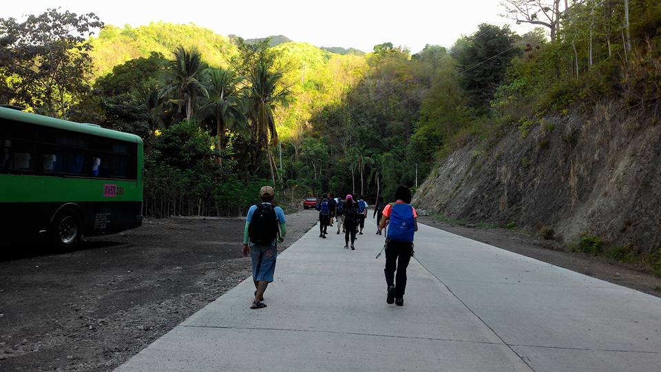
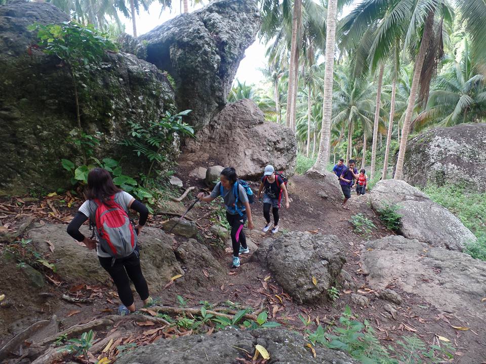
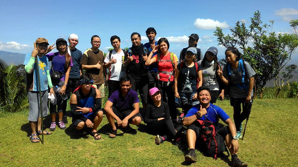
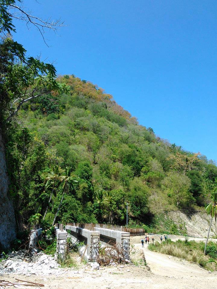
Our group registered, secure a guide and take a quick breakfast. Then after several minutes, we leave in the van some of the things that we don’t need in the hike like swimming attire and extra clothes. The group circled to have a prayer and after that, we started to hike at 7 am. The initial portion of the trail is wide, easy, well-established, and very pleasant with a view of the beach. It is good for us because we are a bunch of beginners and we have only two veteran hikers named Rommel and Glaiza.
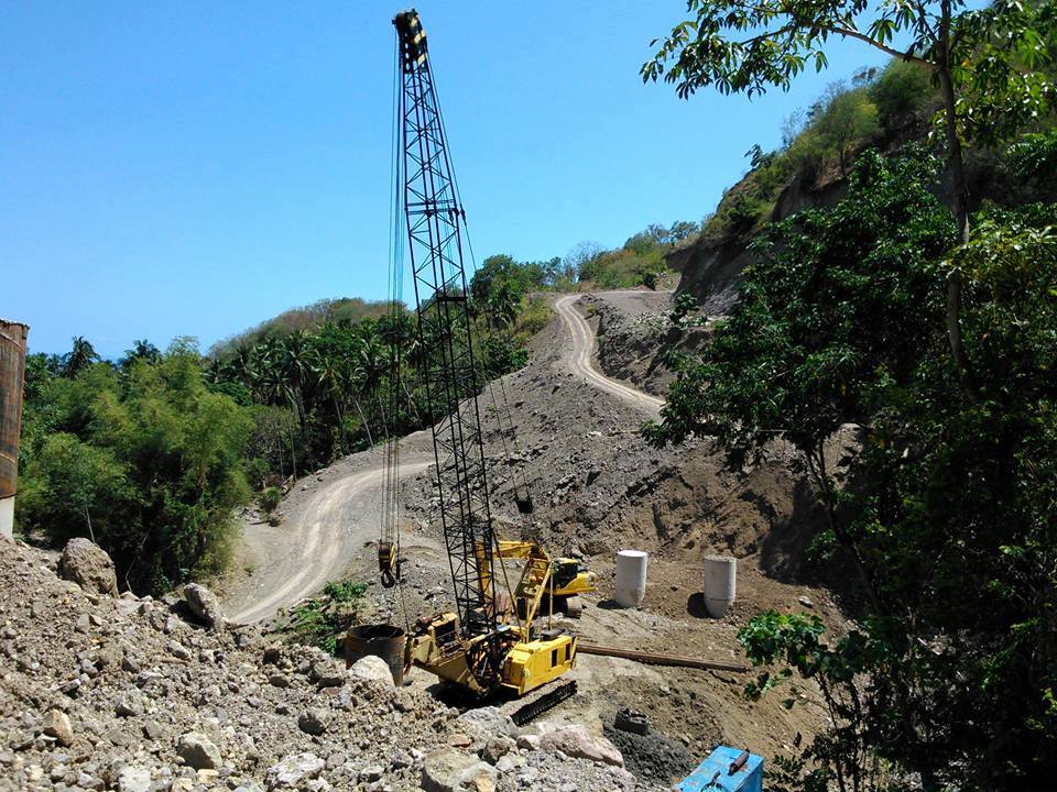
We can see a road being developed near the jump-off point. We walk in a flat concrete road for several minutes then the trail becomes gradually ascending for about twenty minutes. There’s no wind blowing and it’s too hot already as we hike in the summer season. When our group reached the small resting shed we take a much-needed rest.
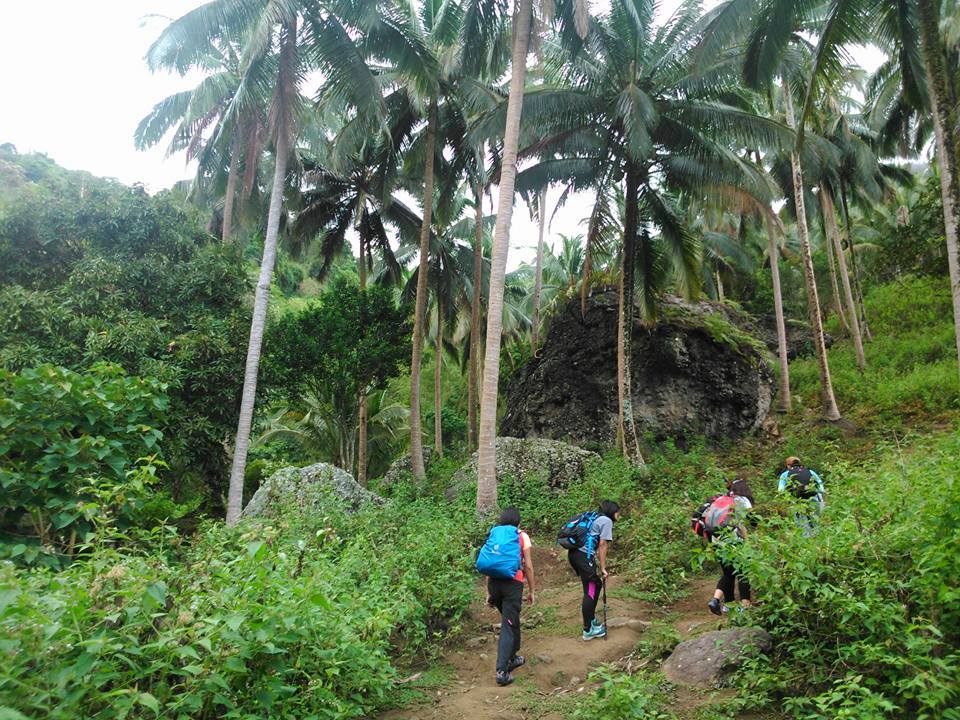
Then we continue hiking at a moderate pace, we passed the stream and the light forested trail full of coconut trees. At this point, we see carabaos, cows, and horses. Our guide told us that these animals we’ve seen have been used for transporting crops to the lowlands of Batangas province. For this reason, a lot of poops and cow dung are scattered in the place so we need to be very careful with our footsteps.
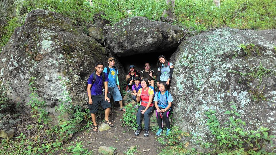
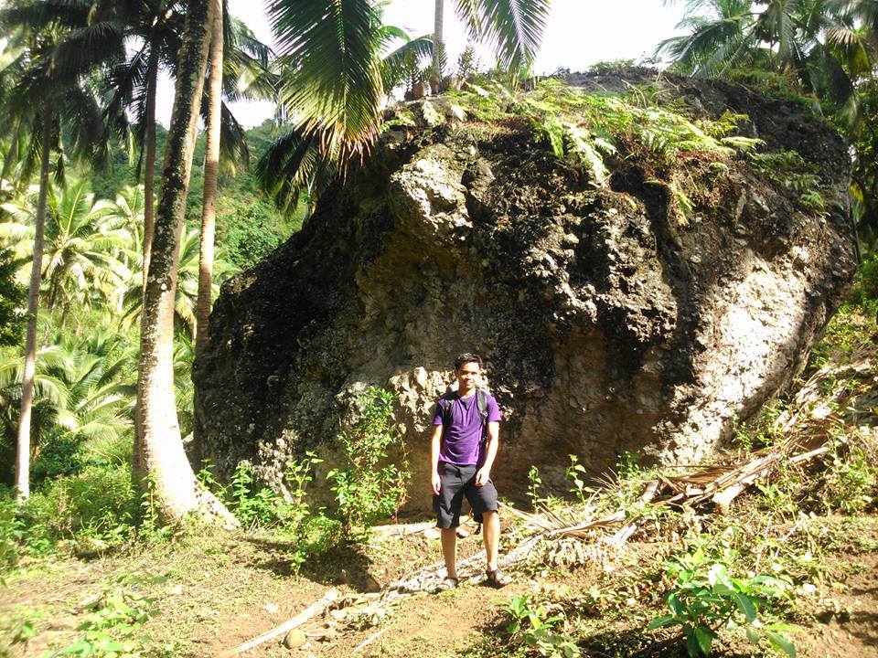
Also, our group spotted some great rock formations scattered all over the place. It is really unimaginable to see it with my own two eyes. We take some photos of it. Also along the trail, we see different fruit-bearing trees such as guava, jackfruit, and mangoes. As we go up the slopes of the mountain composed of rocks and soft earth, our group experienced several mild assaults on and off the boulders.
Later our group walks on the moderate slope leading to Mang Lizardo’s place. It is a good thing that we saw a small store that sells fresh coconut juice, soft drinks, and halo-halo. We take a long rest and buy fresh coconut juice served in the coconut shell to refresh ourselves from the heat of the sun and tiredness. The owner of the store tells our group that this is actually their home and the way to earn a living. As we take a rest, we saw another group of hikers who want to summit Mt. Daguldol, I thought we’re the only group on the mountain.
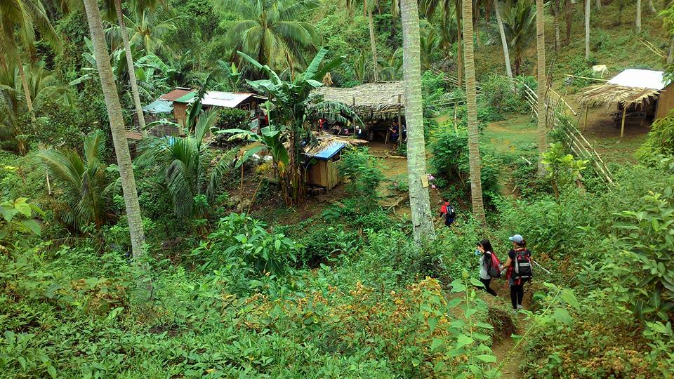
Then we continue the uphill assault covered in trees. The lush green of the mountain is so refreshing. Mt. Daguldol is very rich in flora and fauna. Also in some parts, the vegetation is absolute. For some instance, I can see songbirds and vivid butterflies along the trail. We also saw several small houses where the locals are resting after their work on the farm.

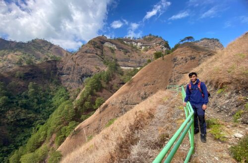
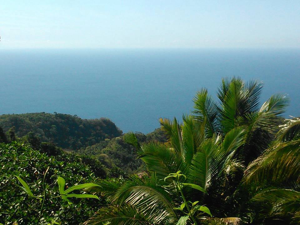
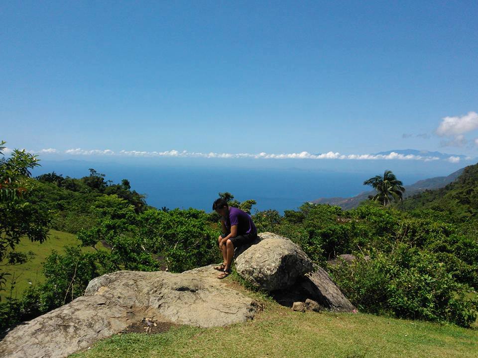
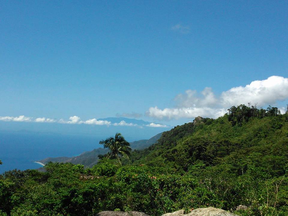
Then we pass through the ascending woodland for about an hour and for some moment we can already see the deep bluish coast of Batangas and we feel the refreshing cool air. In my opinion, the trail here is comparable to the shaded portion of Mt. Gulugod Baboy. Then after several minutes, we reached the grassland slope.
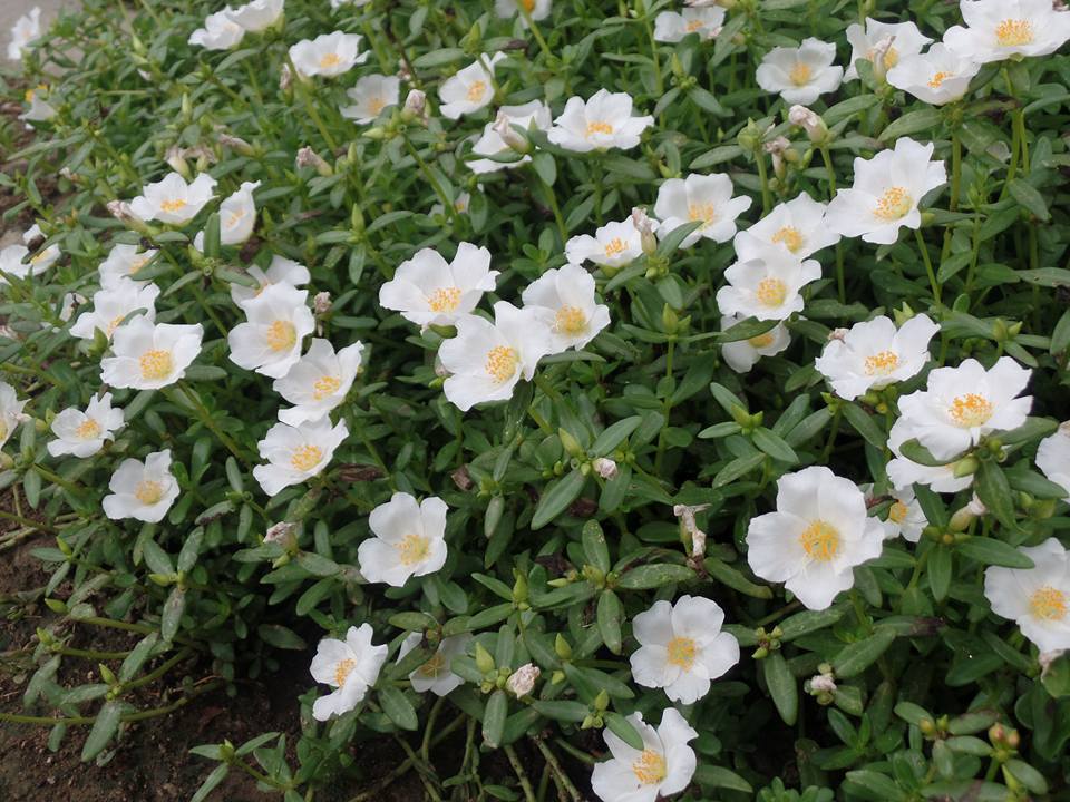
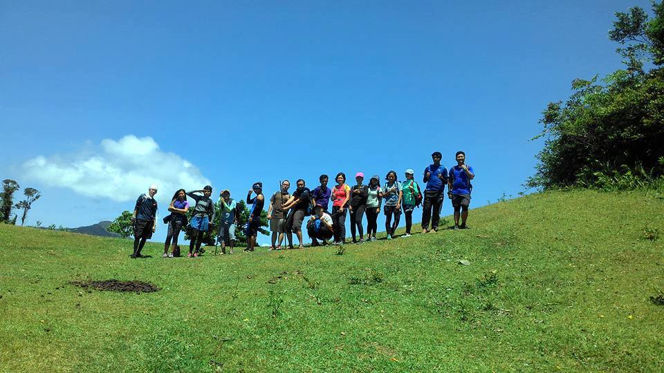
The lush green is all over the place. The place is much like a picnic ground as we explore. The grassland slope looks like a golf course with rock formations scattered around in different places. There are a lot of trees to offer us shade and we can see grazing cows and horses nearby. We found a water source just below the campsite and we refill our bottle. The guide told us that it is safe for drinking. We eat some wild berries as the guide told us that it is a nice dessert after we have a quick snack.
Many hikers thought this place of being the summit but it is actually just a wide campsite, the real summit still twenty-five minutes away. Also, we saw a store near the campsite. Then our group buys some cold drinks, rice meals, and snacks. Overall, this is what I like about hiking Mt. Daguldol, the same for the other members of the group, there are many mini stores along the trail to revitalize our bodies.
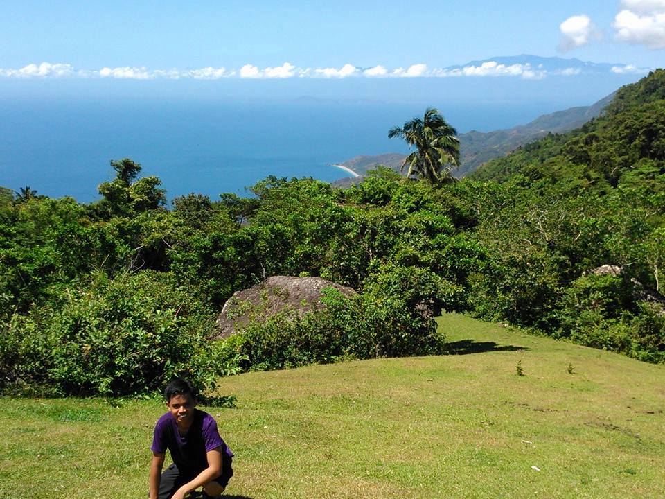
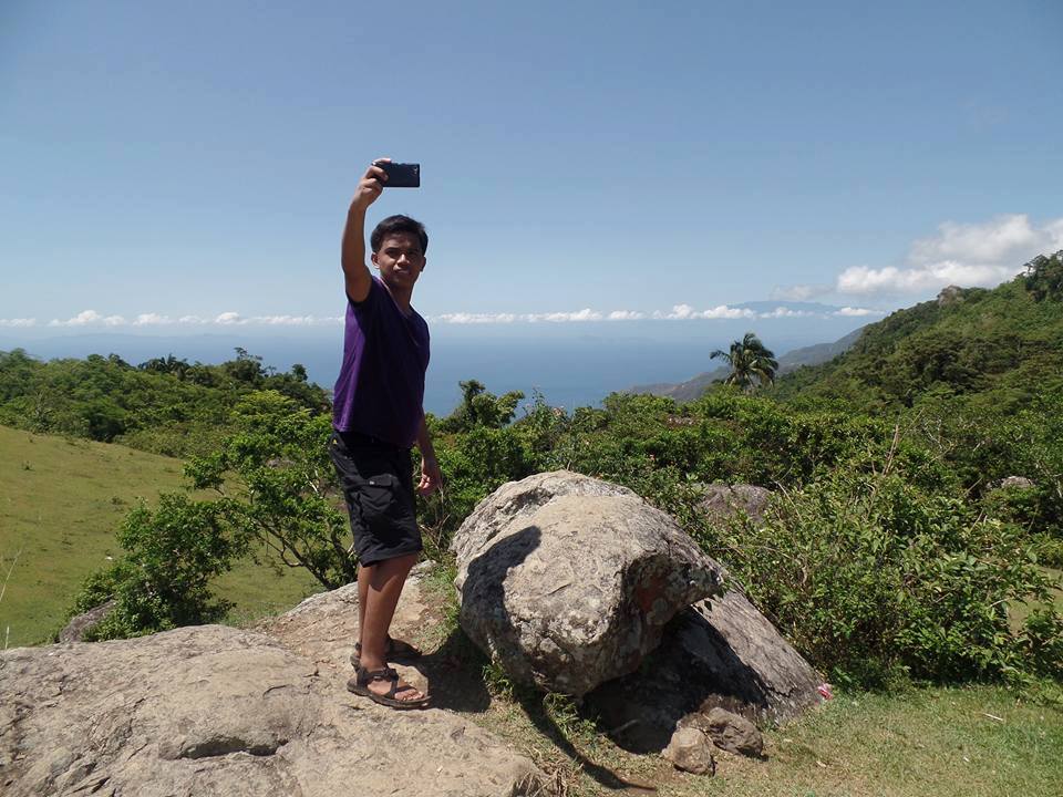
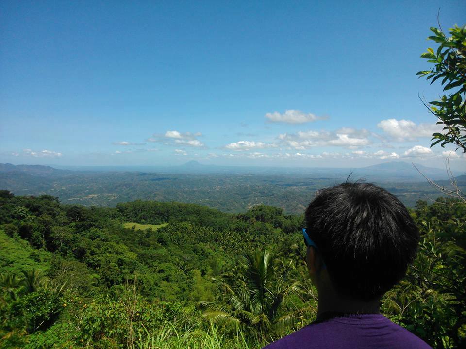
I can see the jaw-dropping coastal area of Batangas, the island of Mindoro, as well as Southern Tagalog mountains such as Mt. Banahaw, Mt. Cristobal, Mt. Banoi, and Mt. Naguiling. Although Mt. Daguldol is one of the not well-known mountains among hikers and tourists. Even so, it offers us one of the most awesome experiences and views in hiking. We enjoy the moment at the top of the mountain.
After all of us are done eating, resting, and spending forty minutes at the campsite, we continue to hike in a fast face because we are so excited to reach the summit of Mt. Daguldol. The assault to the summit was very steep as a result we experienced fatigue. Nevertheless, we reach the summit at 11 am.
The experience of reaching the summit is so fulfilling even though it took us almost four hours to reach the summit of Mt. Daguldol. The weather is excellent, the scenery is beautiful and the view is breathtaking. For the most part, all the hardships are all worth it. Indeed, nature rewards us with one of the most scenic views in our life. This is one of the reasons why I like hiking, to see the beauty and harmony of God’s creation.
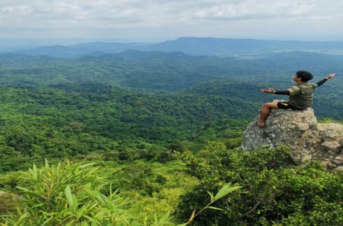
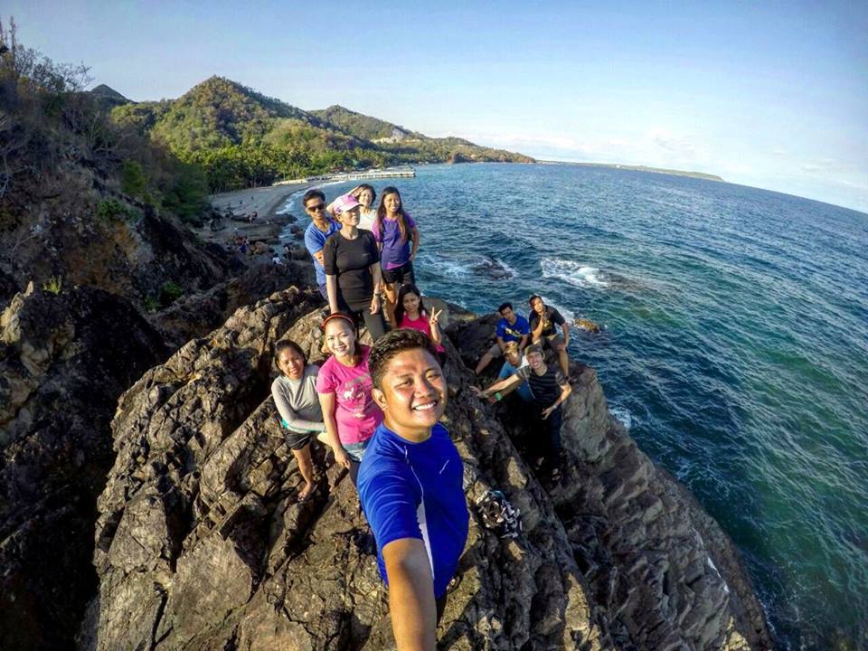
Mt. Daguldol has a very unique summit. It looks like a very wide grassy park. The summit is so wide that it can be occupied by numerous tents and it’s really a perfect place for campers. It is so appealing, it is very similar to the wonderful landscape of New Zealand surrounded by a handful of cattle. Also, the air is fresh and so relaxing.
We explore the place and have our group pictures at the wide-open grassland summit. Then later we take individual pictures of the rock formation sitting, standing, and taking selfies. Moreover, we witness the finest views Mt. Daguldol has to offer. We stayed at the summit for almost forty minutes.
We wanted to stay longer at the summit but since it’s only a day hike and we have a side trip going to the beach. For this reason, we start our descent going back to the jump-off point. We do backtrail. Then we take our lunch near the campsite. After done eating and taking a nap, we continue our descend. Our group pace now is much faster compared to the ascending portion earlier. We greeted some locals and hikers that we pass by.
It was a hot descent midway because there’s no wind at all. For this reason, we have several stops at the small store to buy halo-halo. As we continue our descend, some of the group members trail run going back to the barangay to avoid too much exposure to the blazing heat of the sun. After two hours of continuous descend at a very hot temperature, we finally arrived at the jump-off point. It took us nearly eight hours for our group to complete the hike with various stops and photo-ops.
We log out then our van heads to Laiya beach resort. After some thirty-five minutes, we arrived at Laiya beach resort. It’s time for us to adore the cold waters of Batangas. We already have a cottage and we take a quick rest. Then a few moments later, we change our outfits and we unwind on the beach. We take several pictures at the beach, especially in the rock formation.
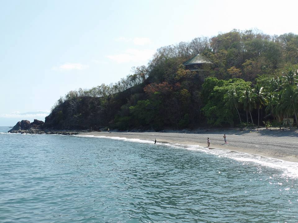

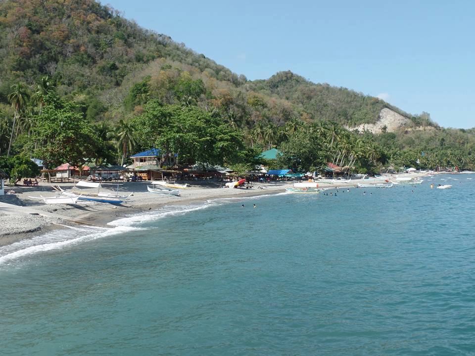
Then later we swim and have a dip on the cool and clean waters of Laiya beach. The beach is rocky and not white fine sand but the view is remarkably astounding. After nearly one hour of swimming and looking at the beautiful sunset, we wash up and later we go inside the van. At this time we bid goodbye to the alluring beach. Then our van left Laiya beach around 6 pm and headed back to Manila. On the way, we have our post-climb dinner at the famous Lomi restaurant at Batangas. We arrived in Manila at 10 pm.
Having myself a summit-to-sea experience, it was truly a great day hike. Without a doubt, my experience was worth every sweat and money. For me, Mt. Daguldol is one of the must-hike mountains in the Philippines. It is definitely a place worth visiting. Going there is like filling two needs with one deed because one can experience the summit to sea adventure. Indeed, Batangas province really offers stunning mountains and beaches for tourists.
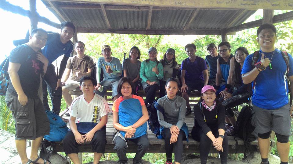
Special thanks to the Trek Hunters group, especially Rommel our group leader for organizing this awesome trip and unforgettable experience. Also, I wanna thank everyone who takes my pictures and shared their trail food with me.
On the whole, my adventure to Mt. Daguldol sums up this quote: “Somewhere between the bottom of the climb and the summit is the answer to the mystery of why we climb.”
Sample itinerary to Mt. Daguldol (Dayhike)
1:30AM – Assembly, meet-up
2AM – ETD going to San Juan, Batangas
6AM – ETA jump-off point of Mt. Daguldol, register, secure guide, and breakfast
6:40AM – Start Hiking
10:15AM – Arrival at the summit, photo-ops
11:15AM – Descent
2PM – Back at the jump-off point
3PM – Sidetrip to Laiya beach
6PM – ETD going back to Manila
10:30PM – ETA Manila
Sample itinerary to Mt. Daguldol (Overnight)
Day 1
6AM – Ride a bus in Buendia or Cubao bus station going Lipa, Batangas
9AM – Ride a jeep going to Barangay Hugom
11AM – Arrival at Barangay Hugom, registration, secure guide, and lunch
1PM – Start Hiking
3PM – Arrival at Mang Lizardo’s place
5PM – Arrival at the campsite, set up camping tent
7PM – Dinner and socials
Day 2
5AM – Wake up call, breakfast
6:15AM – Start hiking going to the summit
7AM – Arrival at the summit
8:30AM – Descent
11AM – Back at Barangay Hugom
1PM – Arrival at Laiya beach, lunch, rest, swim
5PM – ETD going back to Manila
10PM – ETA Manila
Note: this sample itinerary is just a basis and not absolute or will not be 100% perfect due to many factors.
Things to bring on your visit to Mt. Daguldol:
2 to 3 liters of water
Trail food, pack lunch
Plastic bag for your trash
Camera
Personal medicine
Toiletries
Trash bags or Extra plastic for your garbage (Leave No Trace Principle)
Extra cash, clothes, slipper
Towel
Camera
Powerbank
Sun and rain protection (sunblock, umbrella, cap, scarf, arm sleeve, raincoat, etc.)
Swimming attire if you have a side trip on the beach
Waterproof tent, cooking set, flashlight, jacket, and insect repellant if you’re doing overnight
Trekking pole (optional)
Reminders and Tips:
- Mt. Daguldol is a minor climb only and it’s very good for beginners. The trail is simple to moderate.
- As much as possible start the hike early in the morning to avoid the direct heat of the sun especially in the summer season.
- Pack light if you’re doing a day hike. There are a handful of mini-stores found along the trail that sell snacks and drinks. Also, wear comfortable hiking shoes or sandals for ease.
- Mt. Daguldol has a wide campsite and it’s excellent for overnight camping. If your group plan to stay overnight at the campsite, it is better to bring cooked food that doesn’t easily get spoiled because it is time-saving. Also, if you have food remnants, you can feed the dog.
- Undoubtedly, Naambon Falls or Laiya beach is the perfect destination after the sweaty hike. After done doing the Mt. Daguldol day hike you can swim and chill on the beach or you can refresh on the falls. Just take note that the falls are only good during the wet season from June to October because the falls are totally dried up during the summer season. Also, there are convenient resorts in Laiya if you wish to stay overnight.
- Bring extra plastic for your trash. It is very important. Do not leave your trash in the mountain. Bring your own trash when u go down to keep the mountain clean. Be a responsible tourist, hiker, and camper. Always observe the Leave No Trace (LNT) principle. Take nothing but photographs, leave nothing but footprints, keep nothing but memories.
- During harvest season, one can see tons of coconut peelings piled in along the trail. You’ll be fortunate to meet locals in labor who will give you some fresh coconut.
- This mountain has no blood leeches.
- The best time to hike Mt. Daguldol is during the dry season as you will have a great chance to see a clearing at the summit. In addition, the trail becomes hard and slippery, especially during the wet season.
- Hike this mountain now or you’ll age and the charm it has now will vanish. On the other hand, hiking Mt. Daguldol requires you to hire a tour guide. The trail is well-established but some parts of the trail are a bit confusing that’s why a tour guide is mandatory.
How to Go to Mt. Daguldol
By commute
- Ride a bus in Cubao or Buendia bus station going to Lipa, Batangas and drop off at Grand Terminal SM City Lipa.
- From Lipa, ride a jeep going to San Juan, Batangas.
- Then from San Juan, ride a jeep going to Barangay Hugom
- From Barangay Hugom, proceed to the registration site near the jump-off point.
Another option:
- Ride an Alps Bus in Cubao going to San Juan, Batangas.
- From San Juan Alps bus terminal, ride a jeep going to Barangay Hugom
- Then from Barangay Hugom, proceed to the registration site near the jump-off point.
By private car
From Manila, drive going to SLEX (South Luzon Expressway), Star Tollway, exit to Ibaan. Then turn left to San Juan, Batangas, and drive all the way to Laiya then proceed to Barangay Hugom.
Remember to live while you’re busy surviving. Overall, I hope this Mt. Daguldol hiking guide and reference has been helpful to you and inspired you to try outdoor. Moreover, don’t forget to share this with your friends or groups if you ever plan on doing the Mt. Daguldol day hike too. Hope to see you on the trail. Keep on hiking. God bless you in all your future travels and hiking adventures. Thanks for reading.
Jervis Ergino
Hi! I’m Jervis Ergino, the digital content creator behind Hike to Mountains, a travel and hiking blog in the Philippines. This blog is dedicated to helping people know more about the best hiking and tourist destinations in the Philippines.