Mt. Hapunang Banoi Dayhike Guide (Itinerary + Tips)
Introduction
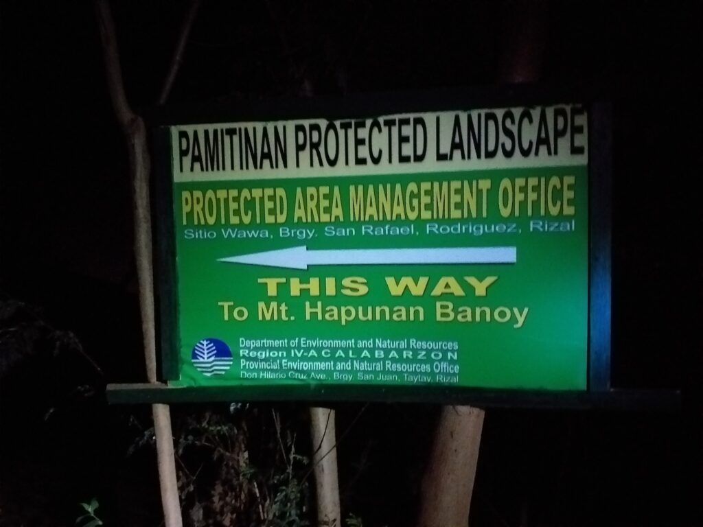
Mt. Hapunang Banoi is a beginner-friendly mountain located in Sitio Wawa, Barangay San Rafael, Montalban, Rizal. It offers panoramic views of the Sierra Madre mountain range and the province of Rizal. Mt. Hapunang Banoi has an elevation of 517 meters above sea level or 1696 feet. Although its elevation is not that high compared to other mountains in Rizal, it become one of the most visited mountains in the province because of its closeness to Metro Manila, the stunning rock formation, and the amazing sea of clouds it offers to the visitors.
Hapunang Banoi means “a place where eagles come to dine.” Banoi is a Bisaya word that means “an eagle” and Hapunan is a Tagalog word that means “to dine”. It was said that the mountain was named as such because it is the kind of mountain where eagles come to eat food and rest. However, the eagles can rarely be found now. In the past, there were many eagles found in the mountain but now several can only be found.
In fact, in the Philippines, there are other mountains named Banoi. One of them is Mt. Banoi which can be found in Lobo, Batangas and the other one is Mt. Tukduang Banoi which is located in Tanay, Rizal. For this reason, it indicates the range of the eagle’s realm in the past. In fact, the eagles are known as the national bird of the Philippines. However as time passes by, the number of eagles has decreased but according to the local guide, they continue to see them at times.
Mt. Hapunang Banoi is a minor climb with a 4/9 difficulty level and a trail class of 1 to 3. It has a well-established trail with moderate steep terrain that features limestone formation and several known mountains in the South. Also, Mt. Hapunang Banoi is the highest mountain in Montalban Trilogy. The main jump-off point is located at Barangay San Rafael, Montalban, Rizal. Today, Mt. Hapunang Banoi is a well-known tourist destination in the Philippines. It’s a good hiking destination for the people who lived near Metro Manila and nearby provinces.
Name: Mt. Hapunang Banoi
Difficulty: 4/9
Elevation: 517 MASL
Hours to summit: 2 hours
Jump-Off: Sitio Wawa, Barangay San Rafael, Montalban, Rizal
Features: scenic views of the Rizal province and limestone formations
My trip to Mt. Hapunang Banoi
I was preparing to do a minor climb before I do a major climb in Benguet in December. For this reason, I choose Mt. Hapunang Banoi dayhike with a side trip in Karugo Falls and Wawa Dam. The event fee is 499 pesos and the climb proper is November 26, 2016. I followed the schedule or itinerary sent by the tour organizer in the chat and I arrived at the assembly place in Jolibee Famers Cubao at 2 am Saturday morning.
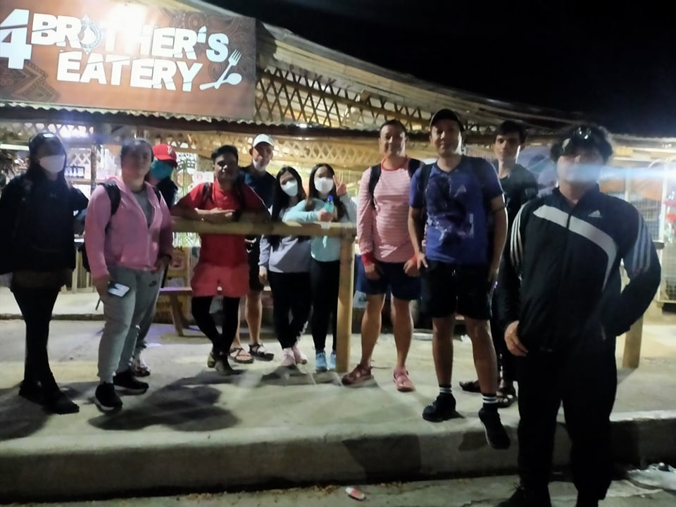
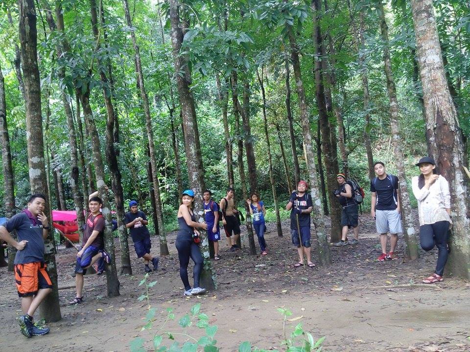
While waiting for the other members of the group to arrive at the meetup place, I ordered spaghetti and a burger for my early breakfast. We are sixteen in the group. When everyone has already arrived and bought some food at the Jolibee, our van left Cubao at 2:45 am. After one hour and twenty minutes of smooth road travel, we arrived at the registration site of Mt. Hapunang Banoi at 4:05 am.
Our tour coordinator pays the necessary fee for our climb. After that our local guide has been introduced to us and we have a short orientation of the mountain. Then our group circled and started praying to God to keep us safe all the time and give us the strength to finish the climb. Also, we introduced ourselves to each other before the climb. For this reason, I found out that most of us are beginners in the hiking scene.
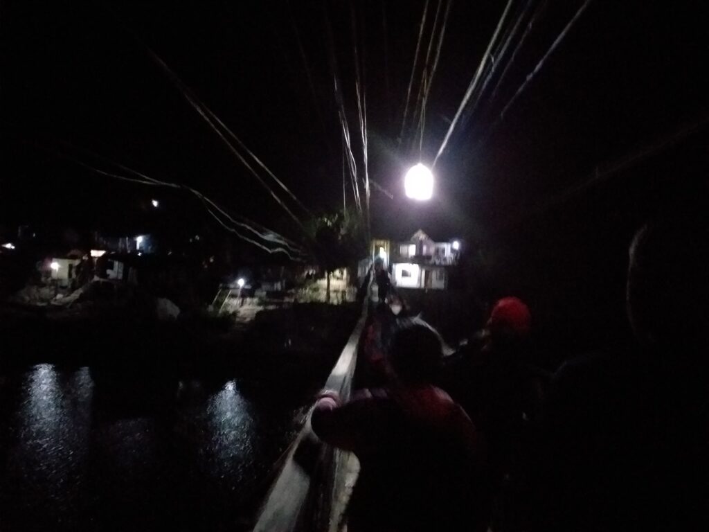
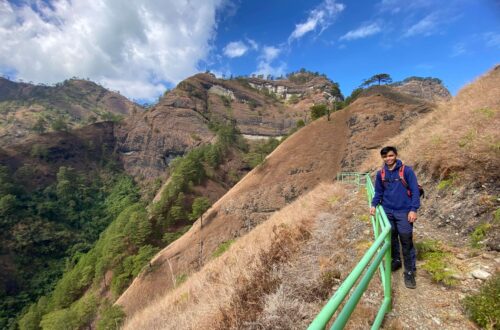
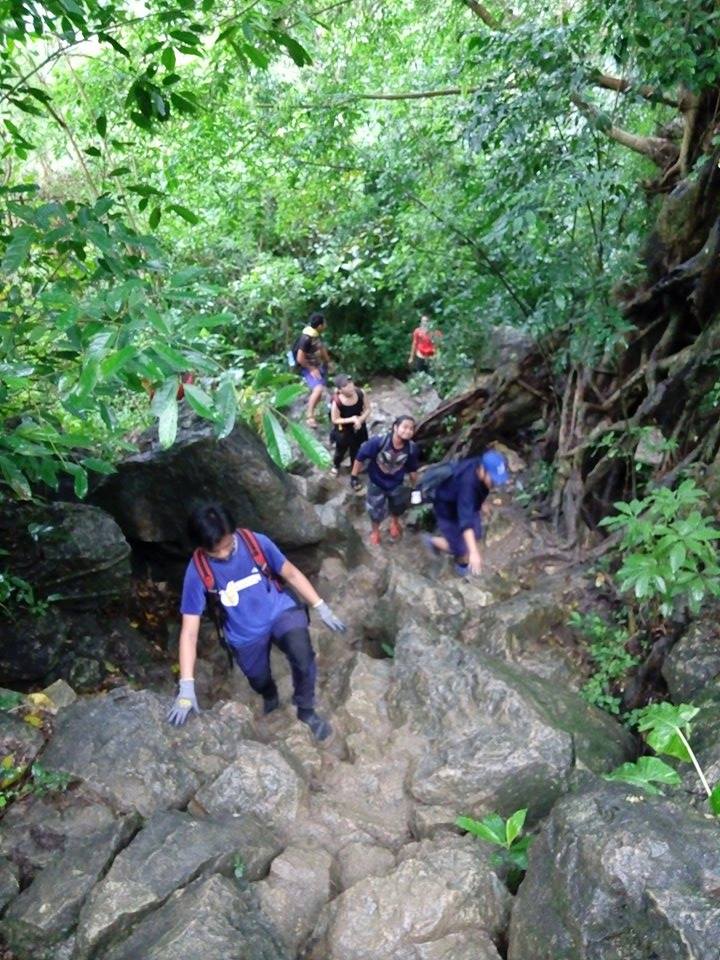
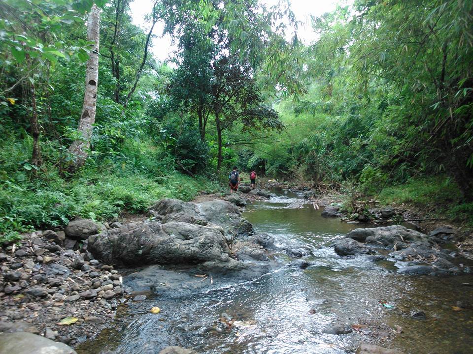
Our group started to walk at 4:45 am. We pass by some local houses and a hanging bridge. Below the hanging bridge is the famous Wawa River. Then we walk on uphill stairs for several minutes. Later we find ourselves at the trailhead of Mt. Hapunang Banoi. Since it has rained yesterday the trail is so muddy. Our group pacing becomes so slow. The trail is a moderate uphill ascent. Nevertheless, we reached the huge rock formation where we found some wooden bench to rest in.
As we continue to hike one member of the group asked our guide if we are halfway to the summit. Then the local guide replied to him and told us that we are not yet halfway. He stated that we are just only starting to hike. At 5:40 am we pass a flat ground in between the mild ascent. For this reason, the guide told us that this is the junction of Mt. Pamitinan and Mt. Hapunang Banoi. Even though the place is still dark we snap photos of the junction.
After that, the trail becomes a continuous uphill climb. Our group do limestone scrambling that required a long steep ascent. Along the trail, our guide told us that we need to watch our heads as we do rock scrambling. As a result, we are sweating heavily as we go up the mountain. We take another rest at 6 am. After done resting and eating some of our trail food in the bag, we continue the climb.
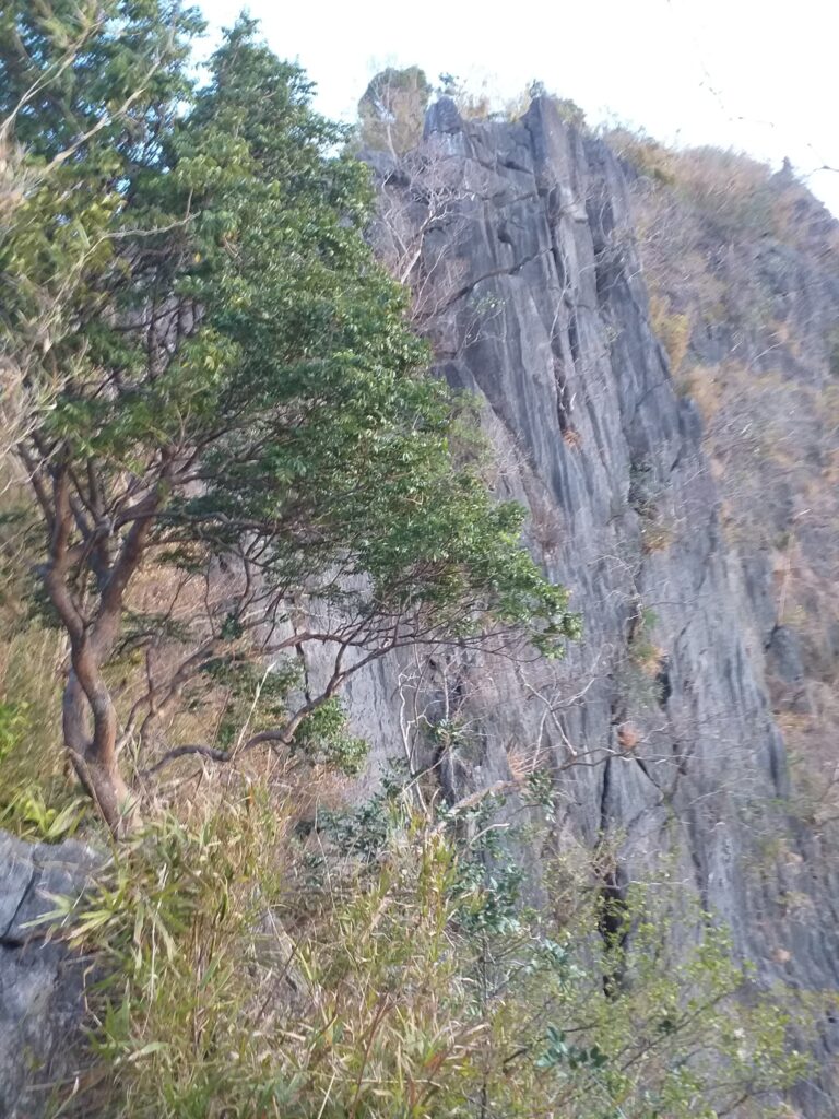
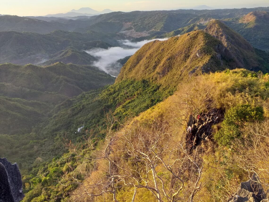
Our group passed by some bamboo native trails for fifteen minutes. Afterward, we reached the cliff portion of Mt. Hapunang Banoi. As a result, some of the members take a risky photo shoot. To be honest, I don’t want to see the other members of the group taking photos at the risky spot because one wrong action can lead to an accident. Even so at this place, we witness the beautiful sunrise that looks like a masterpiece painting. As a result, we have a good source of vitamin D in our bodies. After some photoshoots, we continue the climb towards the summit.
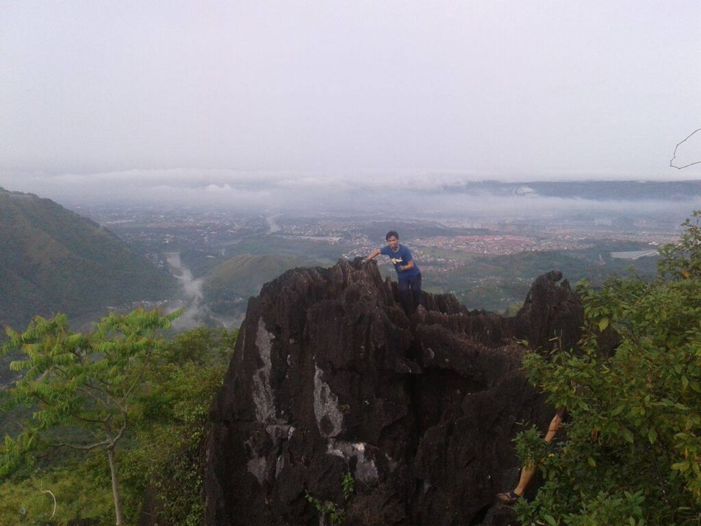
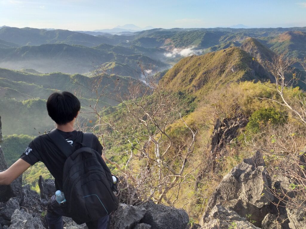
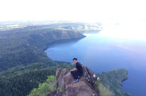
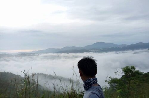
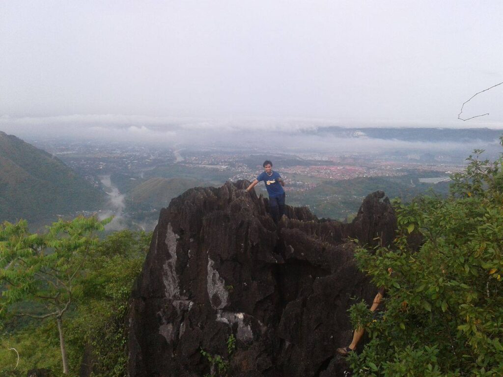
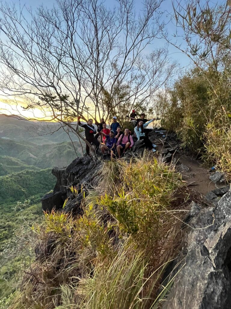
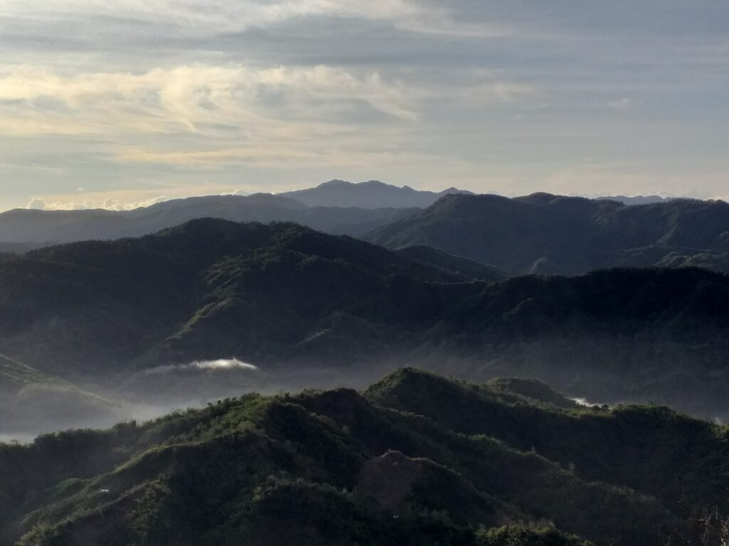
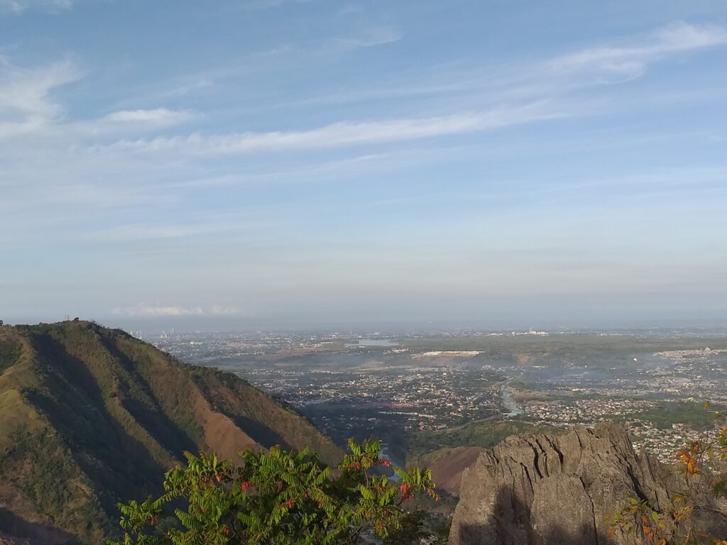
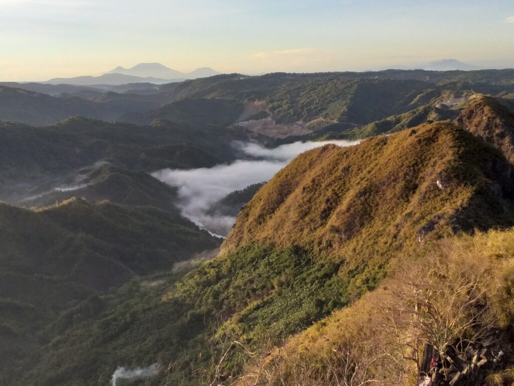
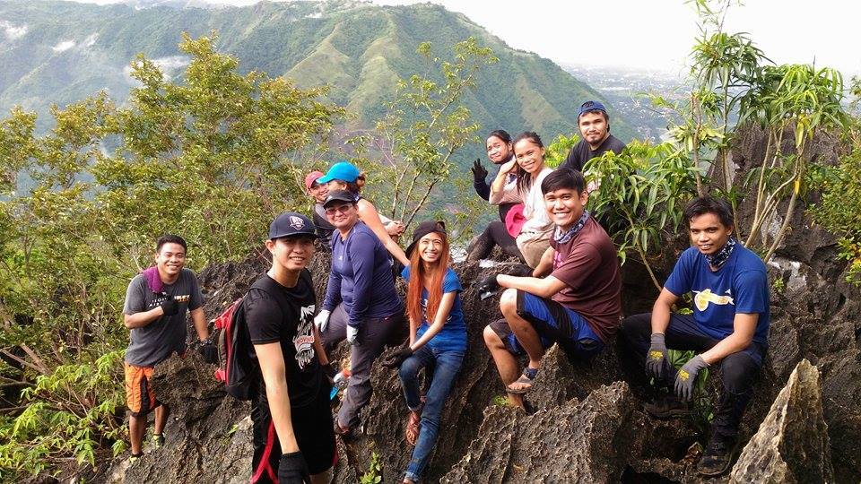
After ten minutes of hiking and rock bouldering, we finally reached the summit of Mt. Hapunang Banoi. The view is breathtaking. We witness a small sea of clouds from distance. At the summit, I can clearly see Mt. Ayaas, Mt. Balagbag and some southern Tagalog mountains such as Mt. Banahaw and Mt. Cristobal. Our guide reminds us that we need to be very careful doing the risky shot photos. For the most part, we have our individual pictures and group pictures taken at the top of the mountain. We savor the view and enjoy the beautiful scenery of the Rizal province.
On the other hand, we noticed that the summit marker of Mt. Hapunang Banoi is vague due to the intense heat of the sun in the past months. Also, our guide told us that the DENR (Department of Environment and Natural Resources) is the one responsible for the summit marker, not the local guide. After done taking pictures, we start to descend going to our side trip which is the Karugo Falls.
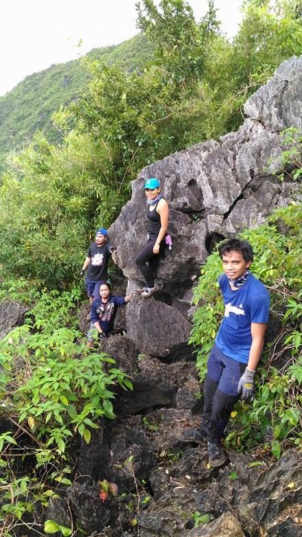
As we go down the mountain sometimes we need to sit down and crawl. In addition to this, we need to balance ourselves as we do rock scrambling. Also, we need to be very cautious with every single step we make to avoid any bruises or injuries. In my opinion, the trail of Mt. Hapunang Banoi is much harder compared to its neighbor Mt. Pamitinan.
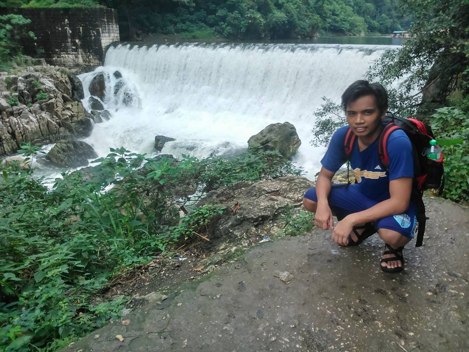
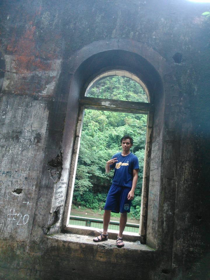
After one hour of descending and passing some hanging bridge, we reached the Wawa Dam. The view is astonishing. For the most part, we can see the stunning rock formation of the mountain. According to our guide, Wawa Dam was constructed during the American colonial era as a water source for Manila. We snap photos of the Wawa Dam and after that, we continue to walk alongside the river going to Karugo Falls. A few moments later we reached the river bed of the Wawa River.
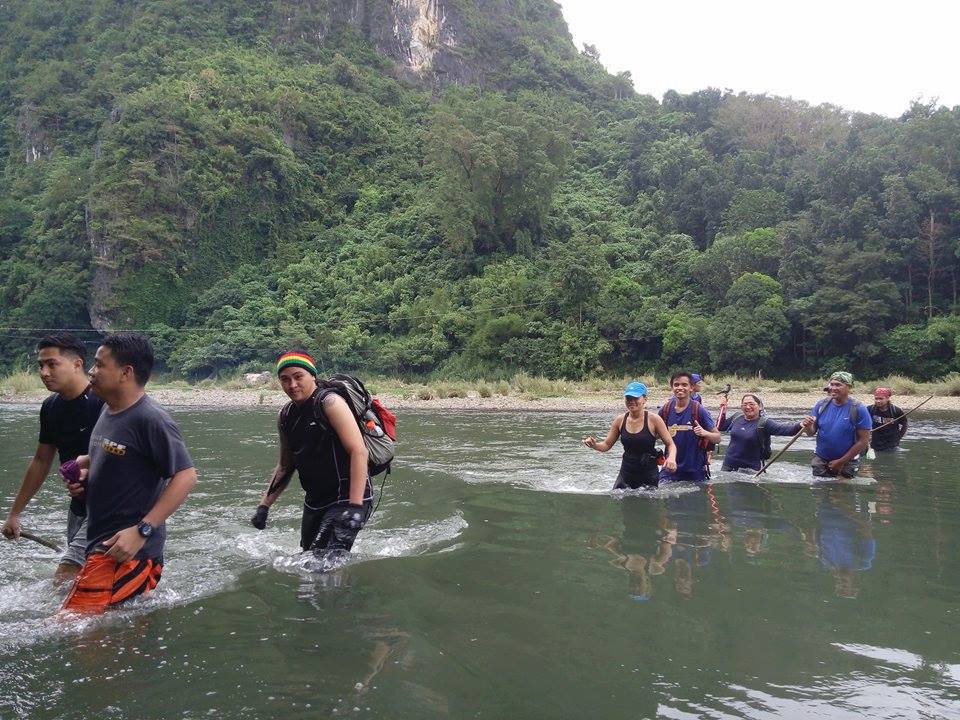
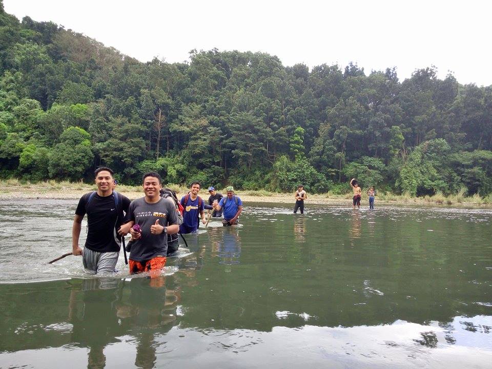
We do river crossing at Wawa River. I noticed that the water in the river is waist-deep only so it’s good for us. Also, I’m glad that I wear hiking sandals during the hike. For this reason, we take several pictures as we do the river crossing. Then moments later we reached the Karugo Falls. In my opinion, the falls are not gorgeous and not big, it’s simple falls only. Nevertheless, some of the members swim and take a dip in the cold water of the falls while others just rest. Indeed, it was a refreshing place.
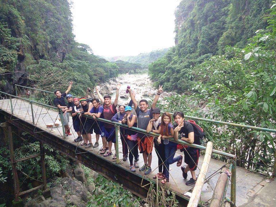
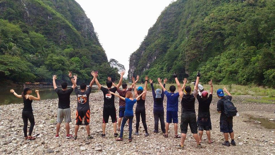
After done swimming and resting, we continue walking going back to the jump-off point. Along the trail, our group saw a bridge leading to Pamitinan Cave. Then after a few minutes, we reached the base of the mountain. Later we have our group pictures taken with the background of Mt. Binicayan and Mt. Pamitinan. We reached the jump-off point of Mt. Hapunang Banoi at 11 am. Without a doubt, the hiking trip is all worth it. Praise God for guiding us and making this dayhike successful. We tidy up and we have our lunch at the small store beside the parking lot.
At 1 pm, we go inside the van and our van left Wawa heading back towards Metro Manila. We arrived in Manila around 3 pm. Undoubtedly, it was such an enjoyable dayhike experience. Special thanks to Enciong for organizing this dayhike event. In general, my hiking trip to Mt. Hapunang Banoi sums up this superb quote “Go where you feel most alive.”
Things to bring on your visit to Mt. Hapunang Banoi:
1 liter of drinking water
Gloves
Trail food like chocolate bars, energy bars, and nuts
Packed lunch (optional)
First Aid Kit and personal medication
Flashlight or headlamp
Garbage bag
Camera
Power bank and extra batteries
Toiletries like wet wipes, tissue paper, shampoo, and bath soap
Toothpaste and toothbrush
Quick-dry small towels
Cap or scarf
Handkerchief
Sunblock
Alcohol
Valid ID for emergency contact
Extra clothes for post-climb
Extra money for personal expense
Post-hike footwear
Jacket (optional)
Rain cover for your backpack during the rainy season
Raincoat or poncho during the rainy season
Sample itinerary to Mt. Hapunang Banoi
2AM – Assembly at Cubao or Greenfield Mayflower Parking
2:30AM – Departure going to Rodriguez, Rizal
4AM – Arrival at Sitio Wawa, Montalban, Rizal, registration and secure guide
4:30AM – Start trek
5:30AM – ETA junction of Mt. Hapunang Banoi and Mt. Pamitinan, breakfast
5:40AM – Resume hiking
6:30AM – Summit of Mt. Hapunang Banoi, photo-ops and sunrise viewing
8AM – Departure going to Karugo Falls
9AM – Arrival at Karugo Falls, swimming, take pictures
10AM – Departure going to Wawa Dam
10:40AM – Arrival at Wawa Dam, photo-ops
11:30AM – Back at the jump-off point, wash up and take lunch
1PM – Departure going to another side trip in Rizal province (optional)
4PM – ETD going back to Metro Manila
5:30PM – ETA Metro Manila
Note: the sample above itinerary is not absolute or will not be 100% perfect due to many factors such as the group pacing, queuing lines, weather condition, delay, traffic, etc.
How to Get to Mt. Hapunang Banoi
By commute
- Ride a train, a jeep, or a bus going to Jollibee Farmers Cubao, Quezon City.
- From Jollibee Farmers Cubao, ride a van going to Montalban, Rizal. Then tell the driver to drop you off at Eastwood, Rodriguez, Rizal (Montalban). The approximate travel time is 1 hour and above.
- From Montalban, ride a tricycle going to Sitio Wawa and drop off at the registration site or DENR office.
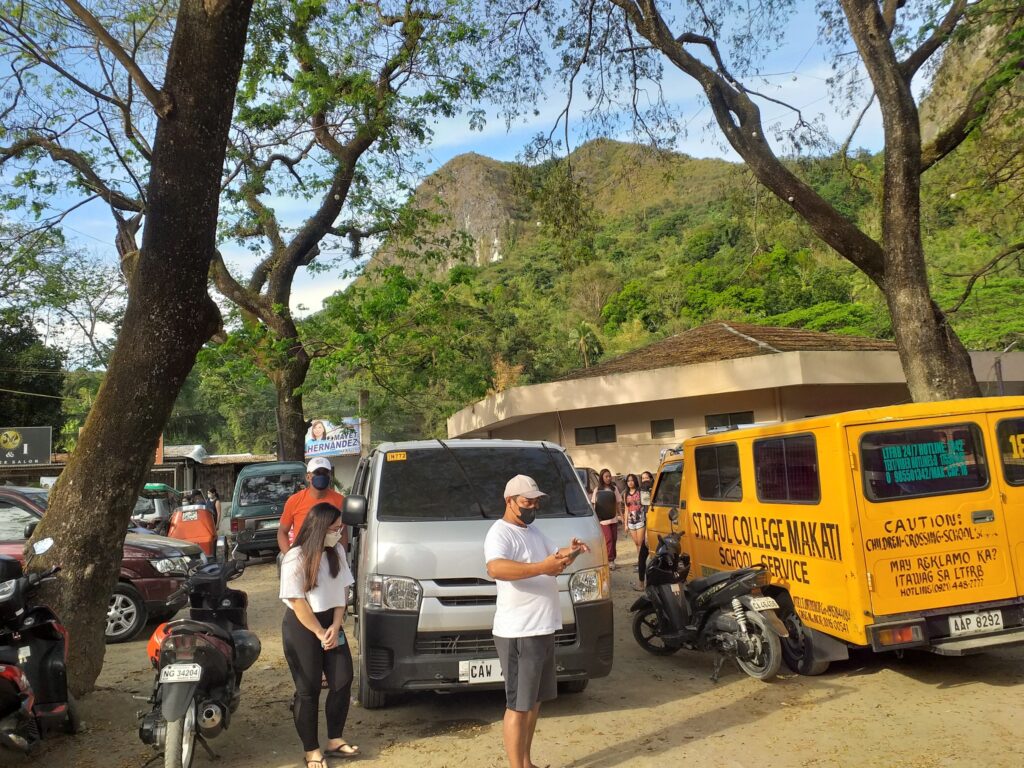
By private vehicle
- Download the Waze app. Then open it and pin the Sitio Wawa. The approximate travel time is 1 hour and 30 minutes. Parking areas are available in front of the tourism office.
Note: the registration office at Wawa opens at 4:30 am.
Reminders and Tips:
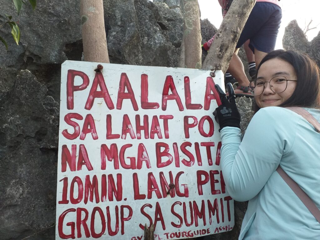
- Registration and getting a local guide are required before the climb. The local guide fee is 500 pesos good for five people. The wash-up fee is 25 pesos.
- Mt. Hapunang Banoi is a minor climb and it is highly advisable for beginners.
- Safety first is a very safe principle. I highly suggest that you don’t take any risky posts for your own safety. Please be very cautious when taking pictures, especially at the edge of the rock formation. Take photos at your own risk. Moreover, a true mountaineer always observes safety first at all times.
- Please always observe the laws of the ecosystem and always follow the Leave No Trace (LNT) principle at all times. Take nothing but pictures, leave nothing but footprints, kill nothing but time and keep nothing but memories.
- Always be a responsible hiker and mountaineer. Also do not litter. Bring your own garbage when you go down or put it in the proper place. Do not leave your trash anywhere to keep the mountain clean.
- I highly recommend wearing hiking sandals rather than hiking shoes because of the sharp rocks along the trail.
- The best time to hike Mt. Hapunang Banoi is during the summer season.
- Bring your own gloves or any hand protection gear before starting to hike. It is required.
- Pack light because it’s only a day hike. The hike to the summit of Mt. Hapunang Banoi will last 2 to 3 hours at a moderate pace and with several breathers. Some can finish it in two hours. The total hours to and from the summit could take up to 5 hours. Furthermore, if you’re going for a day hike, it is advisable to start the climb as early as 4:45 am.
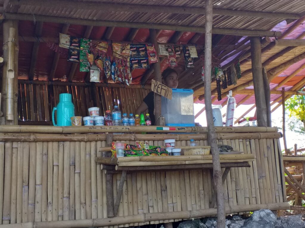
- Parking spaces, sari-sari stores, and restrooms are available at the jump-off point of Mt. Hapunang Banoi.
- There are no blood leeches and cellphone signals at Mt. Hapunang Banoi.
- After the climb, you can have a side trip to Wawa Dam and Karugo Falls.
- Do your own research about the mountains and the weather forecast in the region before embarking on any hiking trip. Hike at your own risk.
- Last but not least, pray before climbing and traveling to other places.
Sometimes we get through a lot of pressure only to come out better than before. Overall, I hope this Mt. Hapunang Banoi hiking guide and reference has been helpful to you and inspired you to try hiking. Moreover, don’t forget to share this with your friends, groups, and companions if you ever plan on doing the Mt. Hapunang Banoi dayhike too. Hope to see you on the trail. God bless us all. Thanks for reading.
Jervis Ergino
Hi! I’m Jervis Ergino, the digital content creator behind Hike to Mountains, a travel and hiking blog in the Philippines. This blog is dedicated to helping people know more about the best hiking and tourist destinations in the Philippines.