Mt. Pamitinan Hiking Guide (Itinerary + Tips)
Introduction
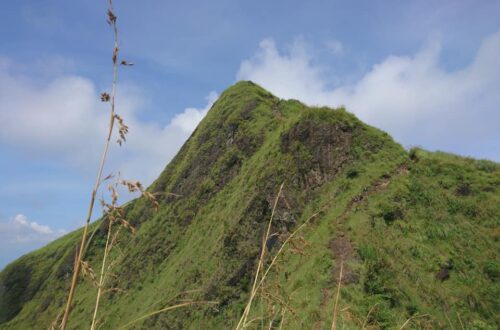
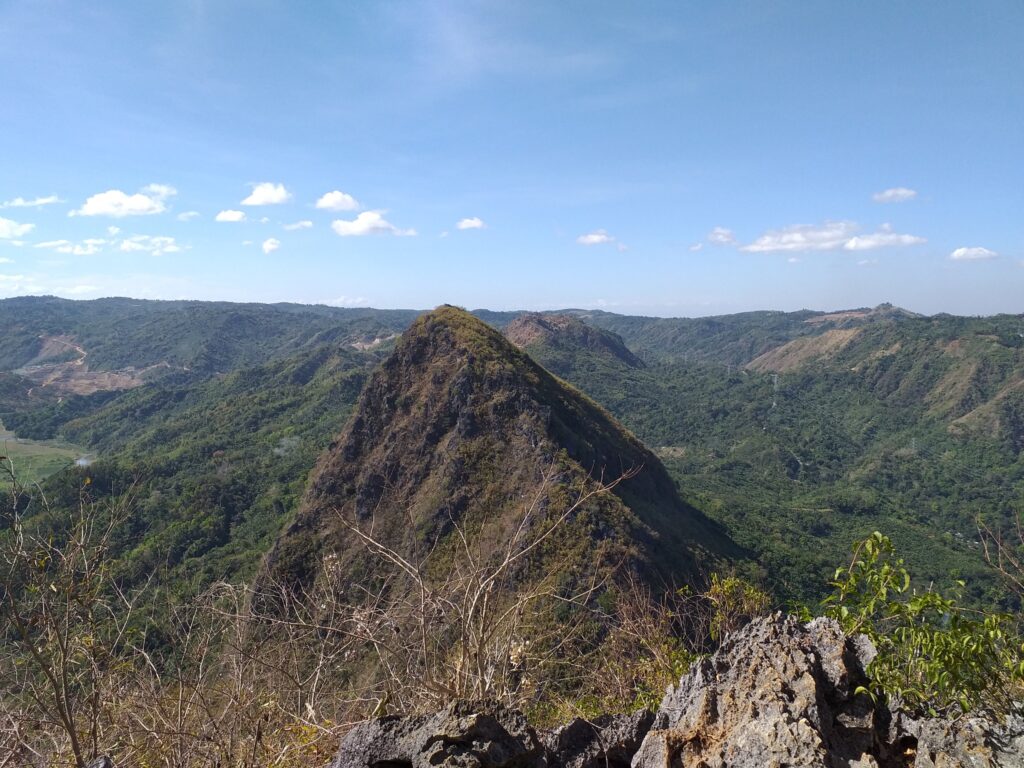
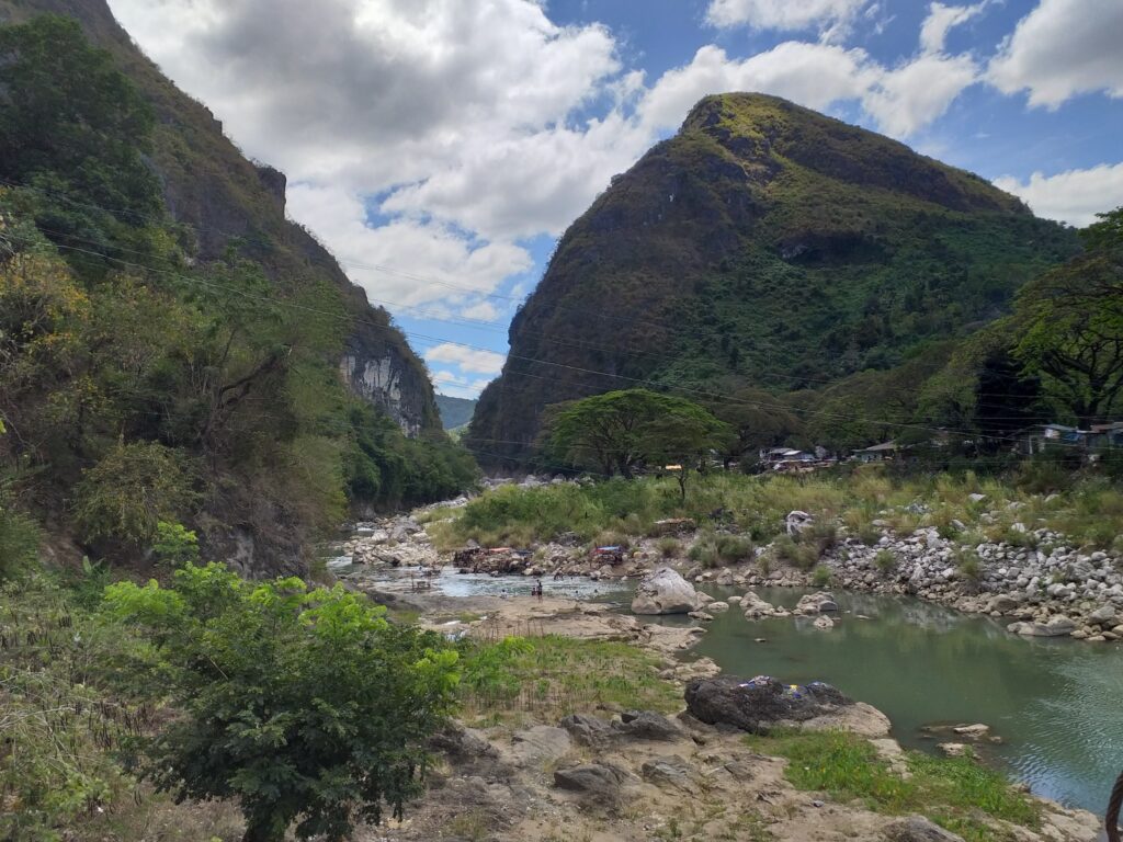
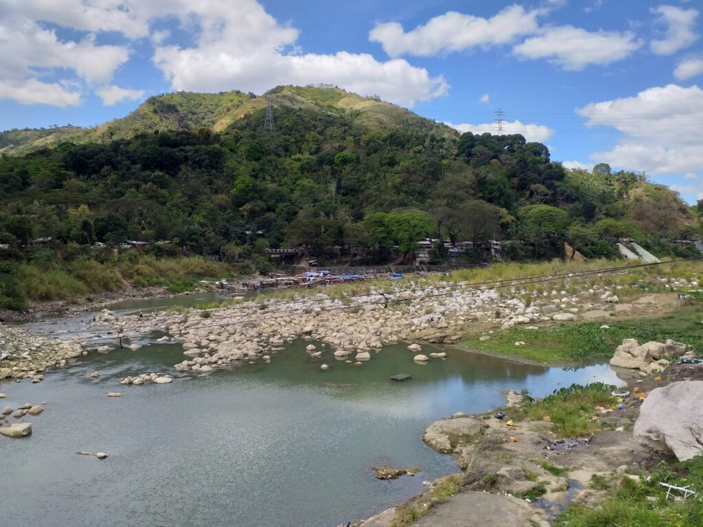
Mt. Pamitinan is a beginner-friendly mountain located in Sitio Wawa, Barangay San Rafael, Rodriguez, Rizal. It offers picturesque views of the Sierra Madre mountain range, the meandering Wawa River, and the municipality of Montalban. Mt. Pamitinan has a height of 426 meters above sea level or 1397 feet. It is the second-highest mountain in Montalban Trilogy.
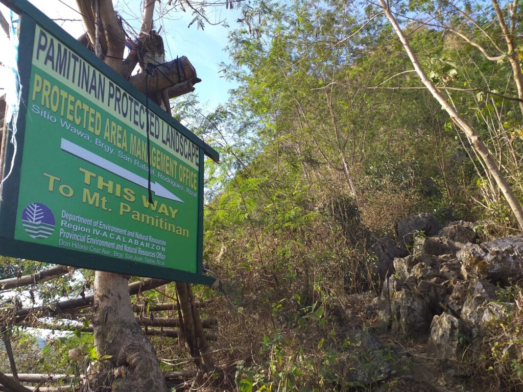
Mt. Pamitinan is a minor climb with a trail class of 1 to 4 and with a 3/9 difficulty level. It has a well-established trail with a moderately straightforward assault that showcases beautiful sharp and jagged rock formations. The main jump-off point is located at Sitio Wawa, Barangay San Rafael, Rodriguez, Rizal. Sito Wawa in Rodriguez is formerly known as Montalban. In addition, Mt. Pamitinan belongs to the Pamitinan Protected Landscape (PPL) which is a protected area of the Rizal province that has 608 hectares in the Sierra Madre mountain range. It is situated just thirty-five kilometers northeast of Metro Manila.
According to its past history, Mt. Pamitinan becomes a hiding place for the Katipuneros in the year 1895 during the Spanish colonial era. The mountains play a role in the history of the Philippines. Andres Bonifacio who is the father of the revolution desired refuge in Pamitinan Cave to commence a new member of the Katipunan group. Moreover, it is where Andres Bonifacio proclaimed one of the first declarations of Philippines independence. Presently his words are still engraved in the Pamitinan Cave: “Viva la Independencia Filipina”.
Today, Mt. Pamitinan is a well-known hiking destination among beginners and outdoor enthusiasts in the province of Rizal. It can be conquered in a half-day and can be combined with another mountain nearby as a twin hike because it is just an hour of drive from the busy Metro Manila. Moreover, It’s a good place to unwind, relieve stress, and have peace of mind with mother nature for the people who lived near the province.
After finishing the climb, one can have a relaxing side-trip at the Wawa Dam and nearby falls. Above all, Mt. Pamitinan is one of the known mountains in Montalban which is famous for its limestone formation and extraordinary mountain peak.
Name: Mt. Pamitinan
Difficulty: 3/9
Elevation: 426 MASL
Jump-Off: Sitio Wawa, Barangay San Rafael, Rodriguez, Rizal
Hours to summit: 2 to 3 hours
Features: limestone formations, and cliffs, picturesque views of the Sierra Madre mountain range, Wawa River, and Rizal province
My trip to Mt. Pamitinan
While scrolling my social media account, I was suddenly impressed by a stunning photo with awesome views captured in the mountain rock formation. I thought that the photo I saw was found in another country, but when I search it I found out that it is located only in Rizal province in the Philippines. For this reason, I immediately search online for some hiking events that I can join. One day I finally found the group that I will join and the tour coordinator gave me the itinerary, the things to bring, and the expense for the Mt. Pamitinan day hike.
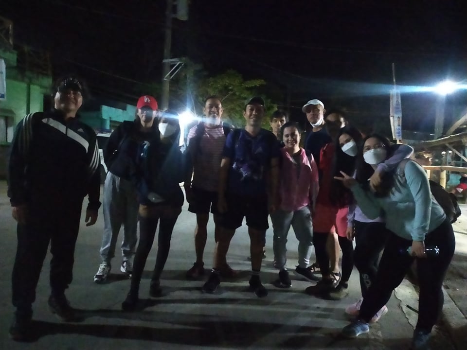
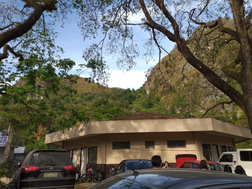
It was Sunday morning when I arrived at our assembly place in Cubao, Quezon City. We are fifteen in the group. When everyone in the group has reached the assembly place and is ready to go, our van with a plate number of CAW 7503 departs Cubao going to Rodriguez, Rizal. After one hour and twenty-five minutes of land travel, we reached the registration area of Mt. Pamitinan.
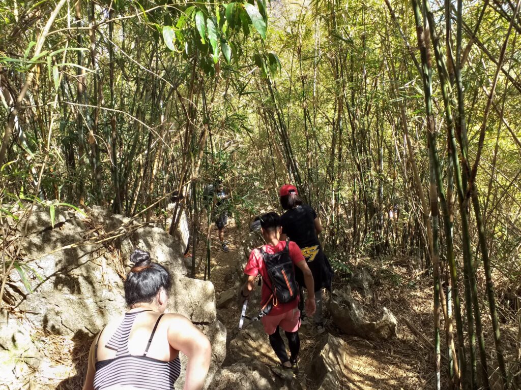
Then our group ascent in the moderate slope of the mountain composed of soft earth and rocks. The rocks are surrounded by bamboo trunks, some of them have an alternating segment of invulnerable green and spiky brown trunk portions. As we continue to climb the forested part of the mountain, one member of the group asked the guide if we are halfway, then the others just laugh because we are nowhere near half of the mountain. The guide replied that we were just only starting to hike.
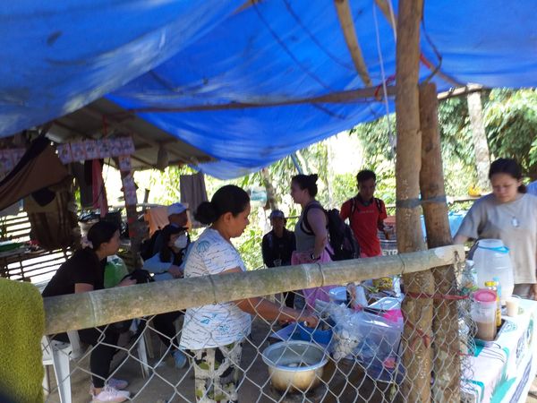
At 5 am we pass a flat ground in between the mild ascent. After that, the trail becomes a continuous uphill climb. Fifty minutes later we finally reached the junction of Mt. Pamitinan where we saw a small store that sells breakfast food and juice. For this reason, we have our short break in this place after a continuous hike.
After done eating food and buying some stuff in the small store, we continue the hike. Some of the members left their belongings like bags, wallets, and other essentials in the owner of the small store. They only bring a cellphone, a camera, bottled water, and gloves. The owner of the store is good and honest so we have faith in him to keep our important things safe. We saw the Mt. Pamitinan marker and we turn right.
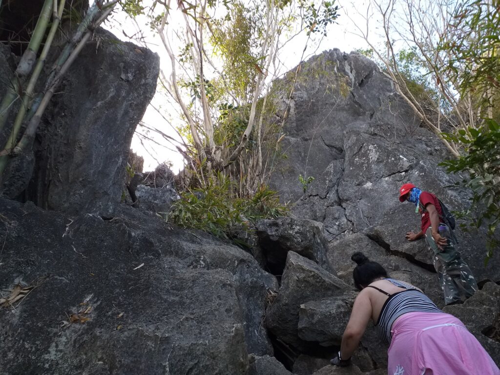
The uphill assault is easy in the first part but when we reached the section of sharp rock formation, the assault becomes difficult. We need to use both of our hands and feet to pass the rock formation. We do rock bouldering and scrambling in the limestone formation of the mountain. At this part, I was already sweating heavily as I continue to climb. A few minutes later, we reached the flat section of the trail and we took a quick breather. In my opinion, Mt. Pamitinan is a good training ground for those who want to try rock scrambling and bouldering.
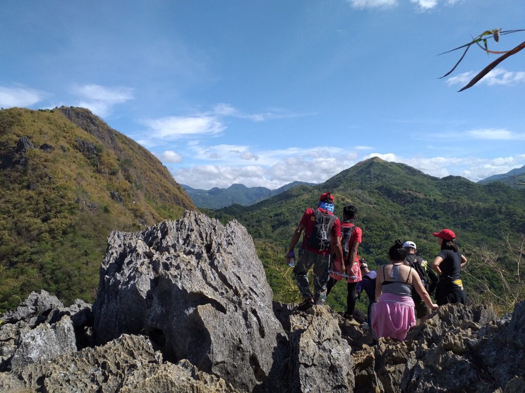
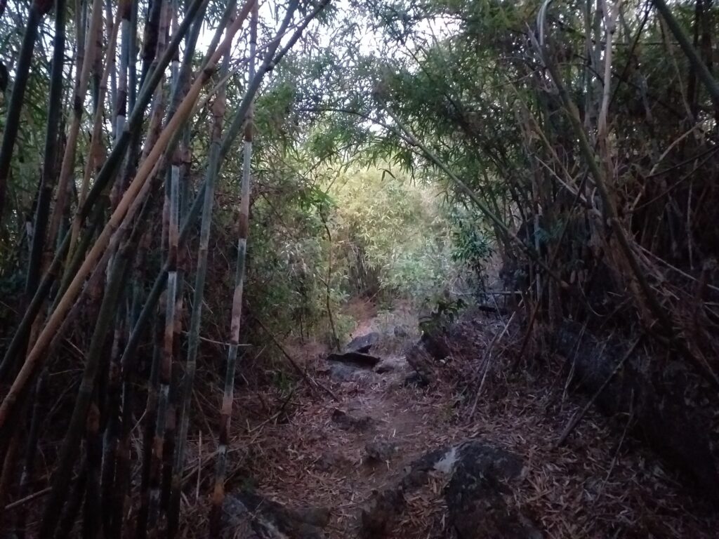
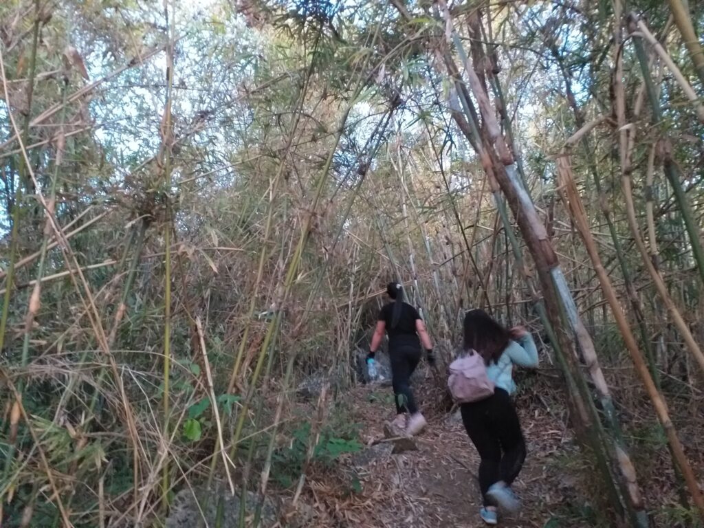
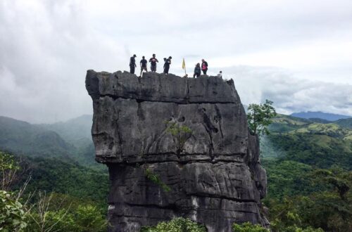
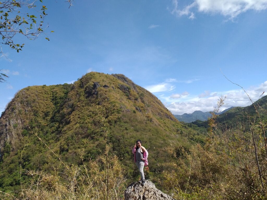
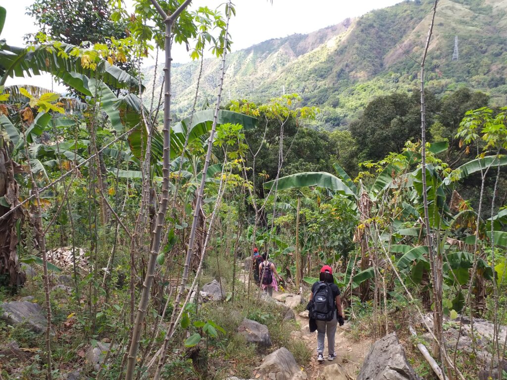
We wait for the other members of the group to come in. As we have our quick rest, we can see the towering Mt. Hapunang Banoi from a distance. Also, we have a 270-degree view of the municipality of Montalban. After savoring the view and breathing some fresh air, we continue the climb at a moderate pace. We passed by some bamboo native trails and twenty minutes later we reached the viewing deck of Mt. Pamitinan.
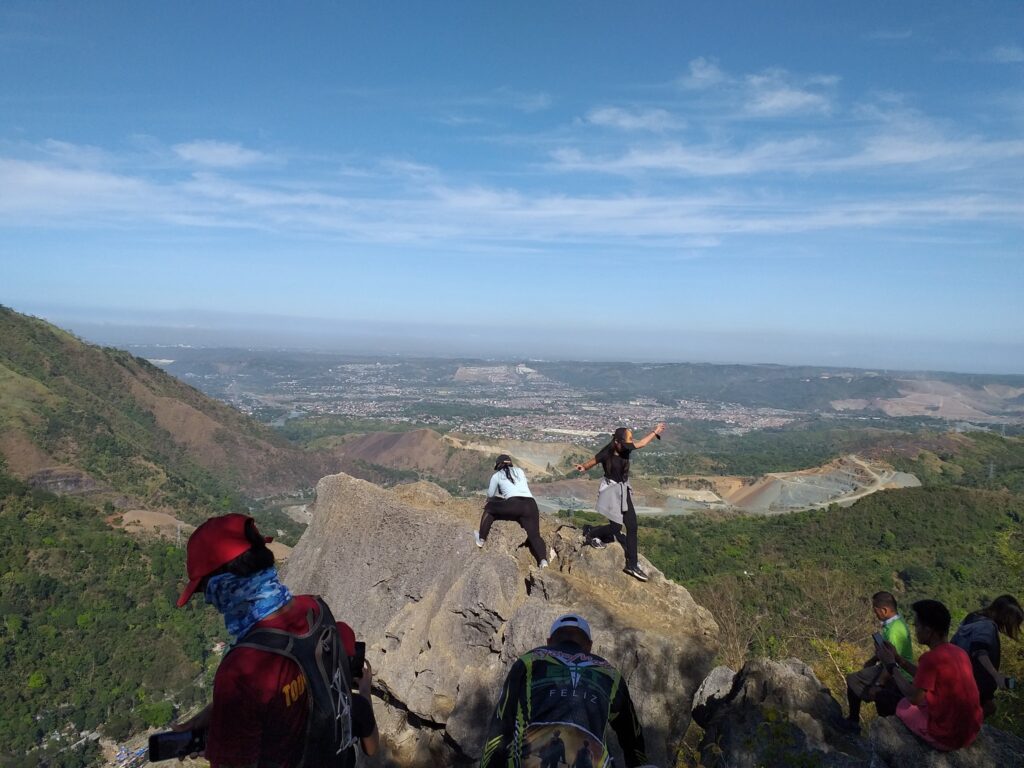
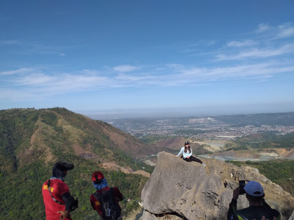
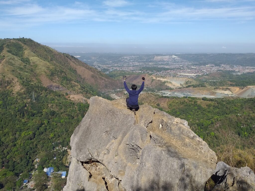
At the viewing deck, we can see a large number of hikers and mountaineers who want to take pictures in the rock formation overlooking the municipality of Montalban. As a result, we wait for twenty-five minutes to have our pictures taken at that famous spot. As we rest, we have a short talk about the mountains we climbed before. I found out that one member of the group already climbed Mt. Pamitinan six years ago, but for the sake of snapping a photo of himself and conquering his fear of heights in the viewing deck, he climbed again.
Also, I found out that one of the members of the group has successful heart surgery in December 2021 but he manage to do a major climb such as Mt. Damas dayhike and Mt. Arayat traverse dayhike. For this reason, we are shocked so some members asked him about his health condition and the feeling of having heart surgery. He replied that he is okay and he told us that his doctor permitted him to do such minor and major climbs. To be honest, it’s the first time that I encounter hikers that have had heart surgery in the past. He looks so strong and determined to finish the climb.
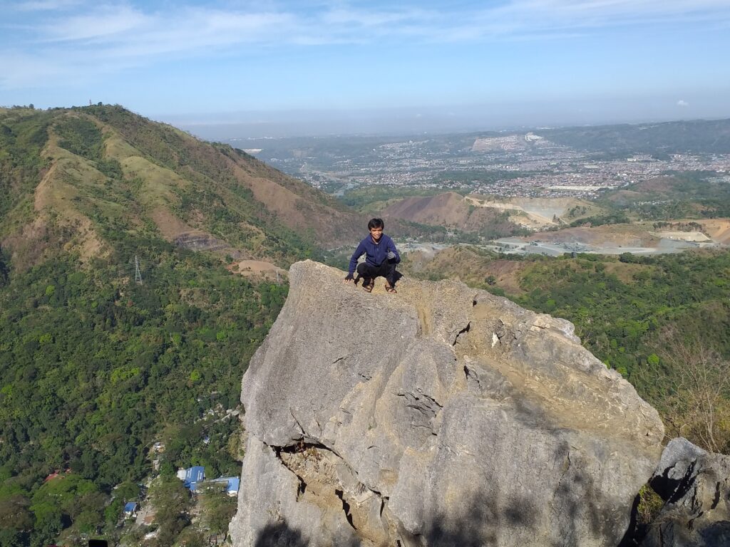
After having a short talk, we finally have a chance to have our photo session at the viewing deck of Mt. Pamitinan. We take solo pictures with a beautiful background. Our local guide told us to be very careful in posting near the cliff, taking the risky posts, and doing death-defying poses. Also, I noticed that our local guide is good at picture taking and has lots of patience. He knows the right angle when taking a picture. He was able to capture golden memories at the great viewing deck of Mt. Pamitinan. Kudos and shout out to our two guides who did a great job in our long photo session experience.
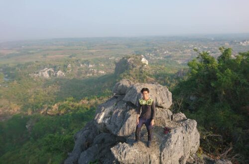
Then we take our time to enjoy the view and the surroundings at the top of the mountain. We’re having a moment of serenity at the viewing deck of Mt. Pamitinan. At the viewing deck, we can even see the Ortigas Center and some parts of Manila. Also, we can see Mt. Parawagan, the meandering Wawa River, and the newly constructed dam below. On the other hand, I kept singing in my head oh heaven is a place on earth. I have the last song syndrome of this beautiful song because I find it so relaxing while enjoying the mesmerizing view.
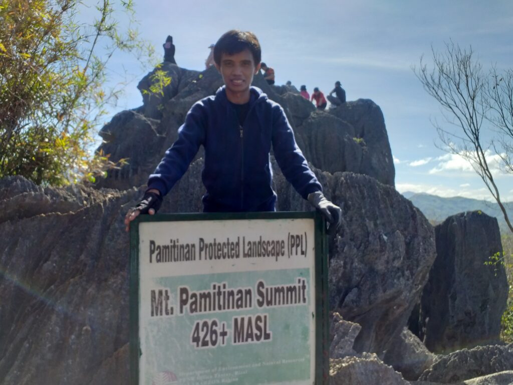
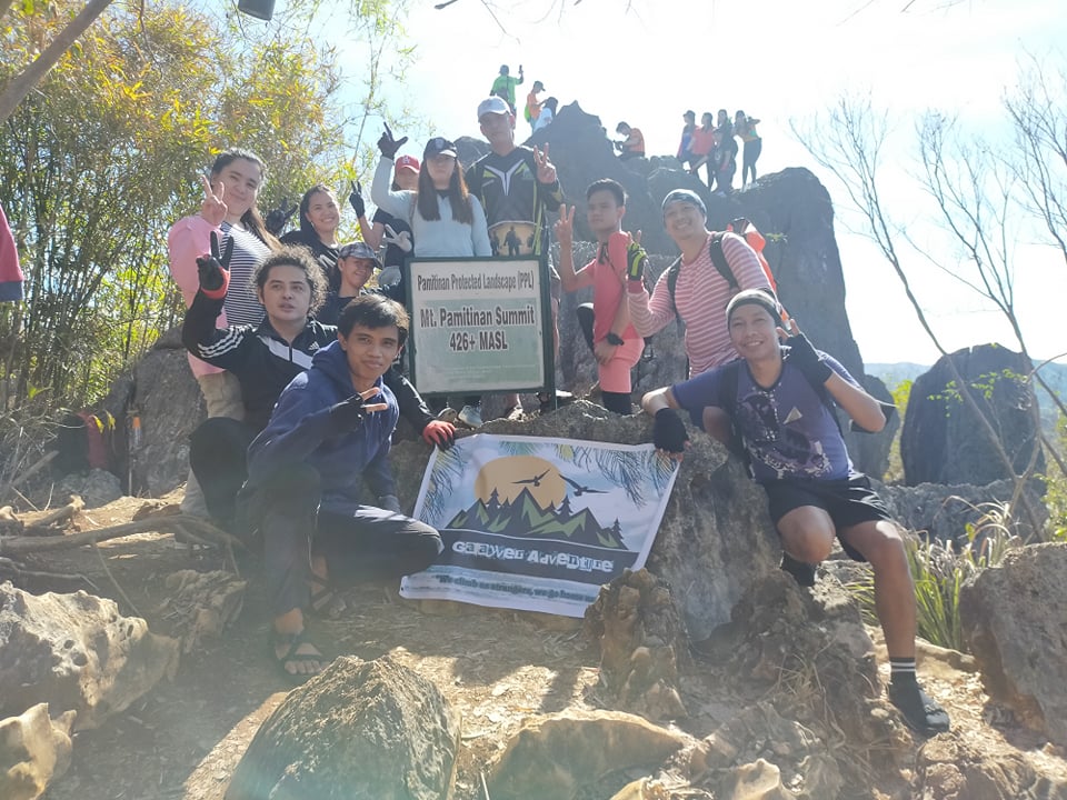
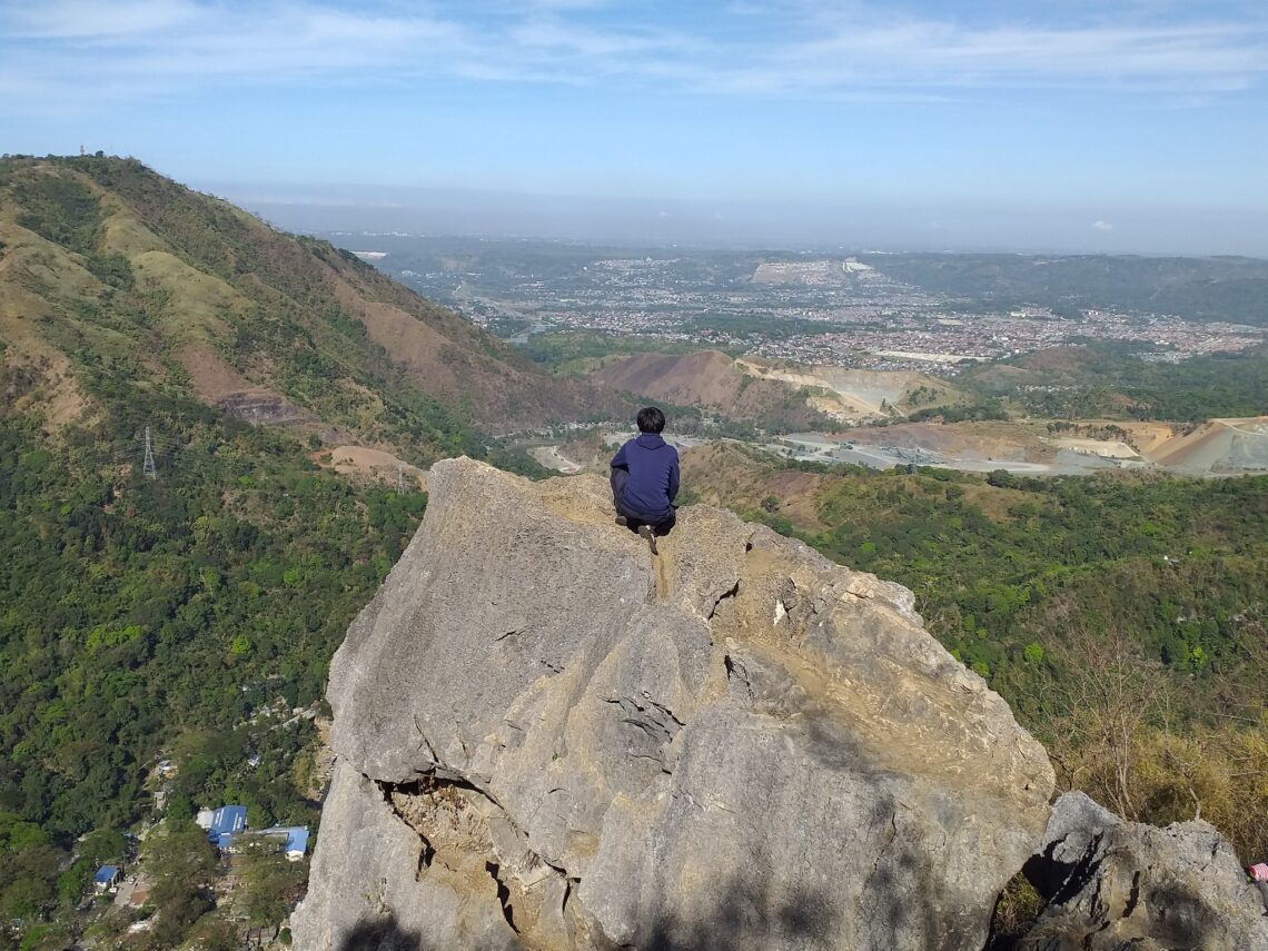
We have our group pictures taken and after that, we continue the climb going to the summit of Mt. Pamitinan. Ten minutes later we reached the summit of Mt. Pamitinan. The view is 360 degrees. It is breathtaking. The sunrise is awesome and we have a good source of vitamin D in our bodies. Also, we spotted some flying eagles roaming around. Indeed, there is forever in mountaineering, forever that I will never forget the beauty of Mt. Pamitinan.
From here we can see Mt. Binicayan, Mt. Arayat, and other mountains in the Sierra Madre mountain range. We have our group picture at the summit marker of Mt. Pamitinan. We always make time to appreciate the beauty of nature. I really love the altitude of the mountain. Everything we saw was worth it so we don’t hesitate to snap photos everywhere. Indeed it was so lovely to be on top of the mountain.
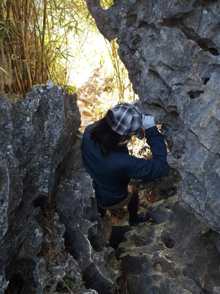
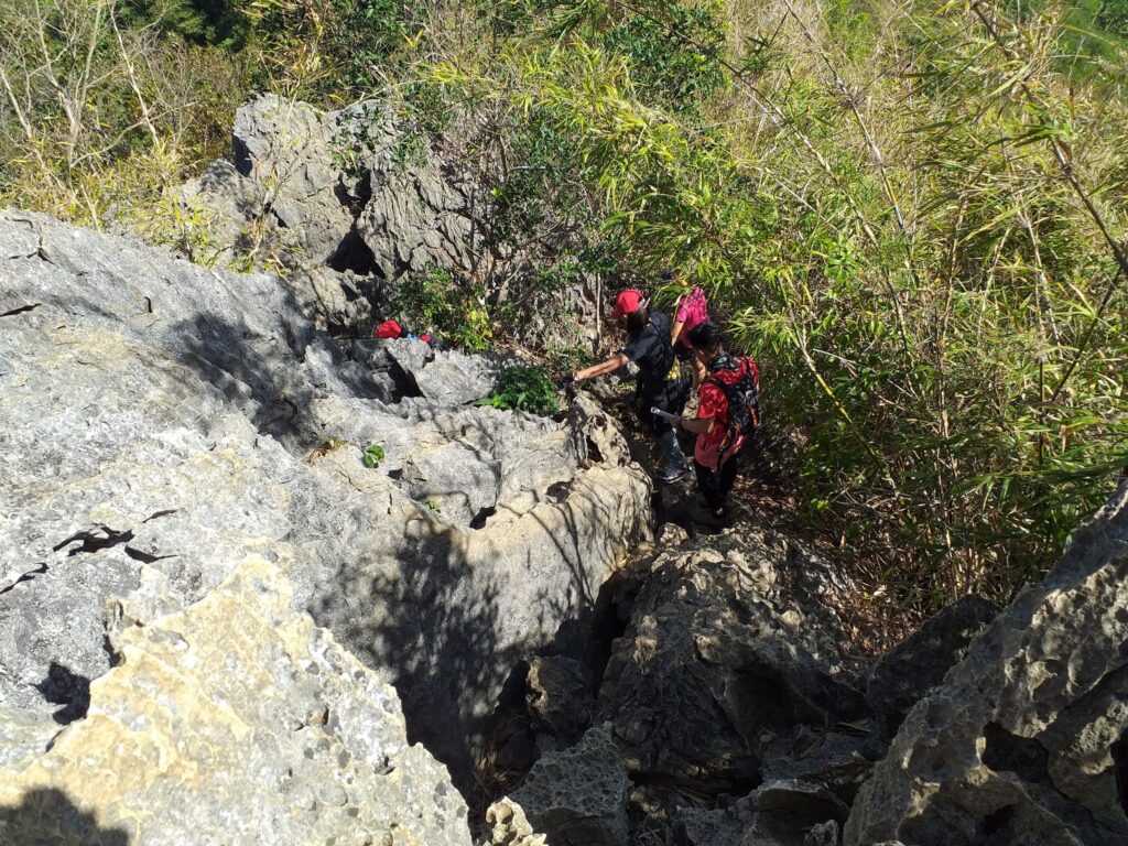
A few moments later, we start to descent. We do backtrail and we do lots of rock scrambling going back to the junction. Our tour coordinator and the local guide told us that we need to do UPS and GPS. As a result, some of the members asked what is the meaning of the abbreviations UPS and GPS. Then the guide replied that UPS means “Upo para safe” and GPS means “Gapang para safe”. After that, they just laughed at us because we need to do that in order to move down the mountain and to be safe. However, I got light scratches as we go down. In my own perspective, going down the mountains is more challenging than hiking up.
We reached the junction after forty minutes of continuous descending in the limestone formation with pointed edges. Then we have a long rest at the junction. We buy lots of food such as noodles, bread and lumpia and also cold drinks to quench our thirst. Also, we have a short discussion of the next destination we are going to travel to. Then the tour coordinator gave a hand sign to continue our descent after the girls have already peed.
Midway to our descent, we spotted some people doing outdoor rock climbing, rappelling, and abseiling. We also see lots of certified and experienced climbing instructors that help the climbers reach the top and return to the ground safely and sound. It was a great place to witness and to behold. For this reason, we stay in one spot for several minutes to witness them doing amazing outdoor rock climbing and rappelling.
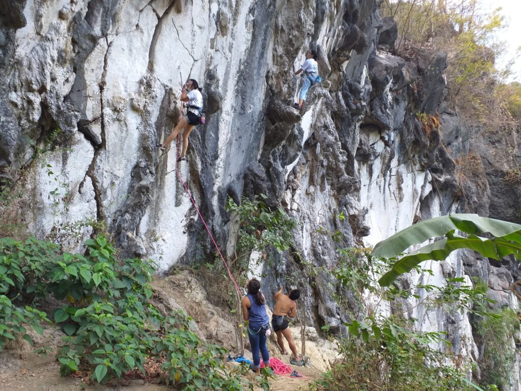
Our tour guide told us that in order to do rock climbing and rappelling we need to prepare and have a lot of practice. Also, he said to us that we also need proper training and the right equipment to be able to perform outdoor rappelling. After we have a glance at the people who do rock wall climbing and abseiling, we continue going down the mountain trail.
Some members of the group trail run because they ran out of water while some members descend at an average pace. Then we reached a sari-sari store that sells delicious food and drinks. We buy some melon juice and cooked foods to refresh our tired and exhausted bodies. Then our local guide has a short story for us. He said that the legendary Bernardo Carpio who is said to be the cause of earthquakes used his mighty power to separate the two mountains Mt. Pamitinan and Mt. Binicayan. For this reason, there’s a wide space between them where the current Wawa Dam is located.
After that, we continue going down the mountain and I find out that the two hikers I joined with came from the province of Tarlac. They told us that they travel all the way from Tarlac. After the hike, they need to travel again back to Tarlac because they don’t have a house in Metro Manila. Also, they told us that most of the pickup points of an organized tour are usually located in Manila.
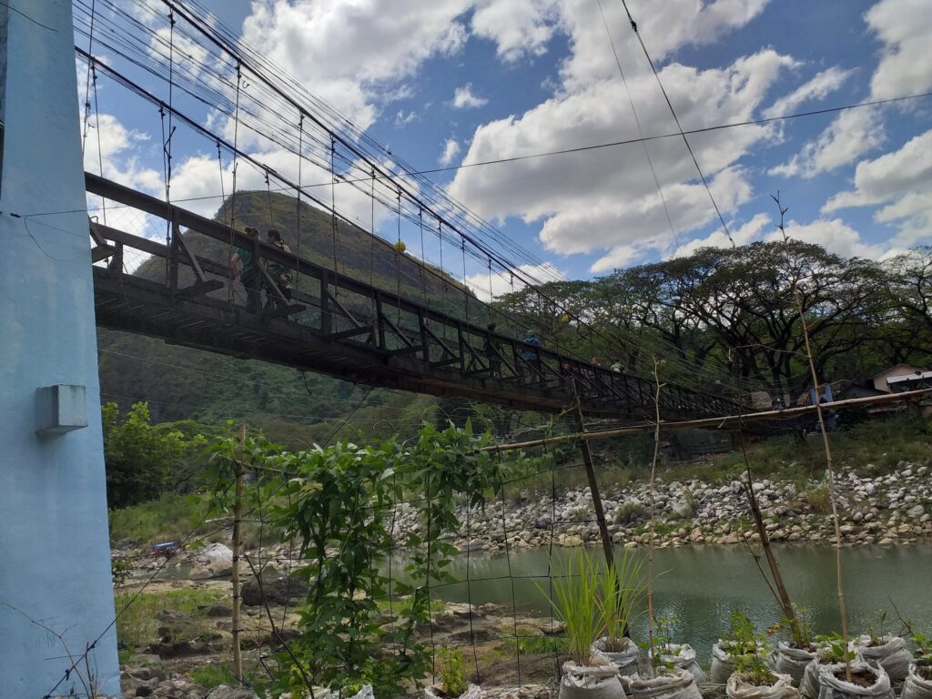
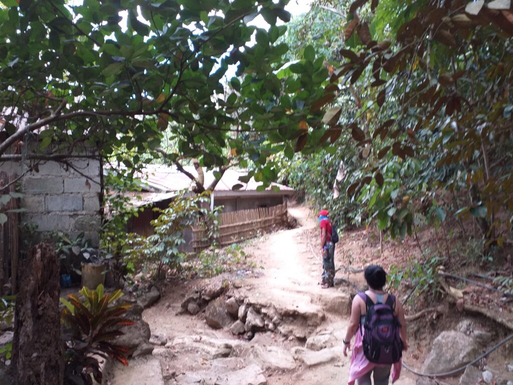
Even so, we continued our hike going back to the jump-off point of Mt. Pamitinan. We pass again the hanging bridge that served as a gateway to the Wawa River. We reached the jump-off point or the barangay hall at 9:30 am. Then we tidy up and have lunch at the small store beside the parking slot. After that, we thank and bid goodbye to our local guide for assisting us. Our guide is so friendly trustworthy and kind. Also, they are equipped with the first aid kit and necessary understanding of the mountain trail.
Then we arrived at Metro Manila at 2 pm. Thank God for another successful dayhike in the province of Rizal. It was tiring but at the same time, it was an enjoyable hike. We have peace of mind and time to connect with the stunning beauty of nature. Without a doubt, Mt. Pamitinan is one of the most hiked mountains in the Philippines.
Also in this climb, I met different people coming from different walks of life such as a call center agent, a certified teacher, a repacker, a freelancer, a nurse, a therapist, and a professional doctor. As a result, the dayhike experience was totally awesome and unforgettable. Overall my hiking trip to Mt. Pamitinan sums up this lovely quote: “Leg pains are temporary, hiking stories and experiences are forever.”
Things to bring on your visit to Mt. Pamitinan:
1 or 1.5 liters of drinking water
Headlamp or flashlight
A pair of gloves
Extra clothes
Extra money and hiking sandals
Trail food like chips, chocolates, candy, nuts, fruits, bread, and biscuits
Packed lunch (optional)
Toiletries like wet wipes, bath soap, and shampoo
Towel
Cellphone
Valid ID
Alcohol or any hand sanitizer
Personal medications and First Aid Kit
Garbage bag or any plastic bag
Arm sleeves (optional)
Sunblock and sunscreen (optional)
Trekking pole (optional)
Umbrella
Raincoat or poncho that is disposable during the wet season
Sample 1 Day itinerary to Mt. Pamitinan (By commute)
3AM – Ride a UV Express van from Jolibee Farmers Cubao going to Rodriguez, Rizal
4:40AM – Arrival at Rodriguez, Rizal, take a tricycle going to Wawa
5AM- Sitio Wawa, register at barangay hall or tourism office
5:20AM – Start hiking
6:20AM – Arrival at the junction
7:40AM – Summit of Mt. Pamitinan, rest and take pictures
8:40AM – Start descent
10:20AM – Back at the jump-off point, washup and take lunch
12:30PM – Explore the place, possible side trip to Wawa Dam
3PM – Departure going to Manila
6PM – Back in Manila
Sample 1 Day itinerary to Mt. Pamitinan (By private car)
2AM – Meet up at Jollibee Farmers Plaza Cubao
2:30AM – ETD going to Sitio Wawa, Rodriguez, Rizal
3:50AM – ETA Wawa, breakfast
4:20AM – Register, secure guide
4:40AM – Start the hike
5:40AM – At the junction, rest
5:55AM – Resume hiking
7AM – Arrive at Mt. Pamitinan summit
8AM – Start descent
10AM – Jump-off point, tidy up, and lunch
12AM – Sidetrip to other places nearby
4AM – ETD going back to Metro Manila
6PM – ETA Metro Manila
Sample itinerary to Mt. Hapunang Banoi and Mt. Pamitinan Twinhike (By commute)
4AM – Ride a van from Farmers Plaza Cubao going to Rodriguez, Rizal
5:40AM – Arrive at Rodriguez, Rizal, ride a tricycle going to Wawa
6:AM – Register at the barangay hall
6:30 AM – Start hiking
8:30AM – Summit of Mt. Hapunang Banoi
9AM – Start descent
9:40AM – At the junction of Mt. Pamitinan
10AM – Resume climb, assault going to the summit of Mt. Pamitinan
11AM – Summit of Mt. Pamitinan, photo-ops
11:45AM – Start descent
1:15PM – Back at Sitio Wawa, wash up, take lunch, explore the place, and a side trip
4:30PM – Going back to Manila
7PM – Back in Manila
Note: this sample itinerary is just a basis and not absolute or will not be 100% perfect due to many factors such as group pacing, waiting time, delay, and weather conditions.
How to Get to Mt. Pamitinan
- Ride a UV express van near the Jollibee Farmers Cubao and tell the driver to drop you off at the Total gasoline station in Rodriguez, Rizal. The approximate travel time is one hour and forty-five minutes.
- Then ride a tricycle going to Sitio Wawa and drop off at the registration site (DENR office) of Mt. Pamitinan.
Reminders and Tips:
- Mt. Pamitinan is a minor climb and it’s a beginner-friendly mountain.
- If you want to not worry about the transportation going in and out of Wawa, I highly suggest getting an organized trip online when you plan to hike Mt. Pamitinan. Included in the Mt. Pamitinan organized day tour are roundtrip van transfer (Manila-Rizal-Manila), guide fee, and registration fee. Excluded in the day tour are personal food (breakfast and lunch) and restroom fees.
- Having gloves is required before climbing Mt. Pamitinan because you’ll be doing rock bouldering and scrambling. In case you forget to bring gloves with you, there are stores in Wawa and the registration area where you can buy a pair of gloves at an affordable price.
- Getting a guide is required. Guides are assigned as you register. The guide fee is 500 pesos for a maximum of 5 people. If you do a twin hike the guide fee is 1000 pesos because each mountain costs 500 pesos.
- The DENR (Department of Environment and Natural Resources) office opens at 4:30 AM and mountaineers are not allowed to start the climb unless they have made prior arrangements with the local officials and tour guide. On the other hand, reservations are required for those going to climb three to five mountains in a day.
- The registration will be done in the barangay hall of Wawa and the DENR office. You need to fill out a waiver and you need to pay the necessary fees for the climb.
- There are stores at the junction of Mt. Pamitinan where you can buy trail food and cold drinks.
- At the jump-off point, there is a parking area, sari-sari stores, food stalls, and restroom areas. The parking fee near the tourism office is 50 pesos.
- I strongly recommend wearing a good pair of hiking sandals.
- If this is your first time climbing mountains make sure to prepare and condition yourself. Do long walks, stretching, and cardio exercises.
- The DENR (Department of Environment and Natural Resources) office opens at 4:30 am, so plan your day tour trip accordingly.
- The tricycle fare going to Sitio Wawa is 20 to 25 pesos.
- Plan ahead and prepare. Please check the weather forecast before going on any climb.
- Always aim to make the least impact on the mountains you visit to keep them clean and to preserve their charm. No smoking inside the mountain.
- Always remember to follow the Leave no Trace principle at all times to keep the surroundings clean and green. Don’t throw your trash along the trails such as plastic wrappers, empty bottled water, and tissue. Keep a garbage bag in your backpack and store your garbage there temporarily. Afterward, you can put your trash in the right place and in a proper manner.
- It is important to remember to pack light only because it’s only a day hike. Also, please take note that the junction mentioned in my hiking trip is the resting place where the trail is split into two directions. The left side is for Mt. Hapunang Banoi and the right side is for Mt. Pamitinan summit.
- Please keep away from blasting loud music while climbing because it will disturb the wildlife and other fellow hikers. Just use your earphones instead if you want to listen to your favorite music.
- In case you see any mountaineer encountering some kind of difficulty along the trail please assist them as much as you can. If a fellow hiker ran out of water and food then offer them if you have more. Just be helpful and be compassionate to other visitors.
- Also, take note to observe the right of way along the trails. If you are descending, give way to fellow hikers who are going uphill. Moreover, if your pace is slow, give way for fast-moving hikers. Similarly, if you are swift, kindly ask slow-moving hikers for permission to advance.
- If your group has good pacing you can do a twin hike. Also, you can have a side trip to Wawa Dam which is a fifteen-minute walk from the registration site.
- The climb to the summit of Mt. Pamitinan will last two hours at a moderate pace and with ample rest. Some can finish it in one hour and thirty minutes. The total hours to and from the summit could take up to 5 hours.
- The estimated budget for a DIY (Do it yourself) is 1000 pesos.
- Below is our tour guide’s contact number and name
Allan Zonio – 09993652005 (PPL) Pamitinan Protected landscape
Roberto Salvador – (PPL) Pamitinan Protected landscape
- Above all, take photos at your own risk. I’m not in favor of taking any risky posts just for the sake of posting them on social media accounts. If you have fear of heights better stay away from the edge of a steep cliff. Remember this a true hiker constantly observes safety first at all times.
There you have it. Get out of your comfort zone and be more independent. In general, I dearly hope this Mt. Pamitinan hiking guide and reference has been beneficial to you and encourages you to try to visit this mountain. Also, don’t forget to share this with your friends, groups, and colleagues if you ever plan to hike Mt. Pamitinan. God bless you in all your hiking adventures. Feel free to message me if you have any questions. I would love to help you out. Thanks for reading.
Jervis Ergino
Hi! I’m Jervis Ergino, the digital content creator behind Hike to Mountains, a travel and hiking blog in the Philippines. This blog is dedicated to helping people know more about the best hiking and tourist destinations in the Philippines.