Mt. Balagbag Rodriguez Rizal Climb Guide (Itinerary + Tips)
Background
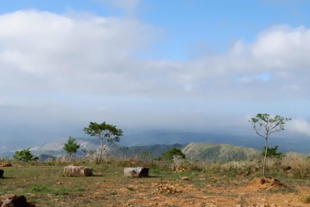
Mt. Balagbag is a beginner-friendly mountain located in Sitio Balagbag, Rodriguez, Rizal. It offers hikers, mountaineers, and mountain bikers a wonderful view of the central business district of Ortigas Center and Makati City skyscrapers. Mt. Balagbag has a height of 777 meters above sea level or 2549 feet. Due to the fact that it is very close to the National Capital Region, Mt. Balagbag became a favorite weekend hiking destination among Manilenos and Rizalenos. In addition, it is just one hour and thirty minutes away from the busy metropolitan city.
Mt. Balagbag is a portion of the Sierra Madre mountain range which is the longest mountain range in the Philippines. According to its history, Mt. Balagbag has been a shooting location in the year 2018 for the Filipino historical epic film movie named Goyo: Ang Batang Heneral. In the past years it had a forested section but today Mt. Balagbag is now barren land. Also, there are security concerns regarding hiking this mountain because of theft incident reports in the year 2014 and 2017. Nevertheless, this mountain continues to attract thousands of visitors every year coming from the different provinces nearby.
Name: Mt. Balagbag
Difficulty: 3/9
Elevation: 777 MASL
Jump-Off: Sitio Balagbag, Barangay San Isidro, Rodriguez, Rizal
Hours to summit: 1.5 to 2 hours
Features: panoramic views of Metro Manila and other nearby provinces
My trip to Mt. Balagbag
It was Wednesday morning when I decided to go to Mt. Balagbag to have a different view of the surrounding. I left my house around 3 am and I boarded a taxi going to Cubao. After reaching the suburbs of Cubao, I immediately look for the bus terminal and after that, I boarded a bus going to Tungko. The bus ride is so lightning fast that after forty-three minutes I arrived at my destination.
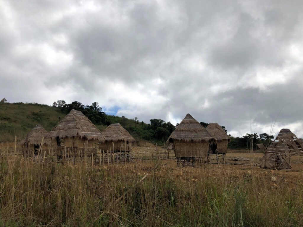
From Tungko, I walk towards the jeepney terminal and later boarded a jeep going to Licao-Licao. After arriving at Licao-Licao, I immediately hire a tricycle to go to the starting point of Mt. Balagbag. My hike started after paying the necessary registration fee and getting a local guide. From there I noticed that the registration area is situated just above the hills and it could be reached after a twenty-five-minute climb from the drop-off point.
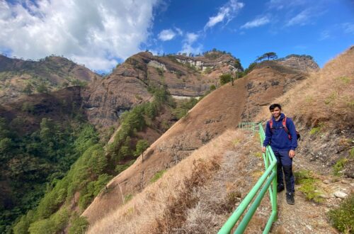
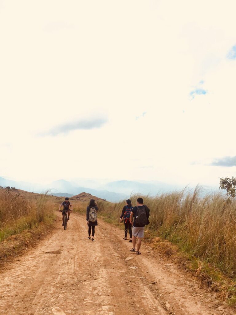
Then as I opened my flashlight and as I climbed my way up I observe that the trail is so rocky in a moderate assault. Nevertheless, the view of the moon and stars makes my body continue moving forward. Later on, we passed by some local houses and the dogs barked at me. Afterward, I greeted good morning to all the locals I’ve passed by and they replied with a good smile on their faces. We continued the climb at a moderate pace and I noticed that we covered almost sixty-five meters already. For the most part, the trail of Mt. Balagbag is a combination of asphalt and sand.
Then we make a left turn and from there the trail becomes a continuous uphill ascending that stretched as far as the main intersection of the mountain. In the middle of the climb, I told my guide that I will be taking a short rest. So I eat my trail food and drink my Gatorade inside my hiking backpack. After fifteen minutes we continue the climb on a fifty-degree slope going to the summit. The sun started to rise slowly and I take it as an opportunity to take pictures of the magnificent sunrise. Then I noticed that the trail now is mostly composed of soft earth and huge rocks which are very similar to Mt. Tapulao.
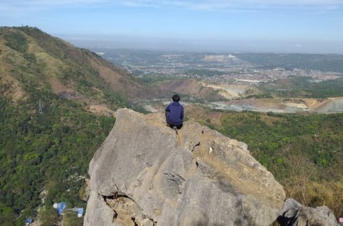
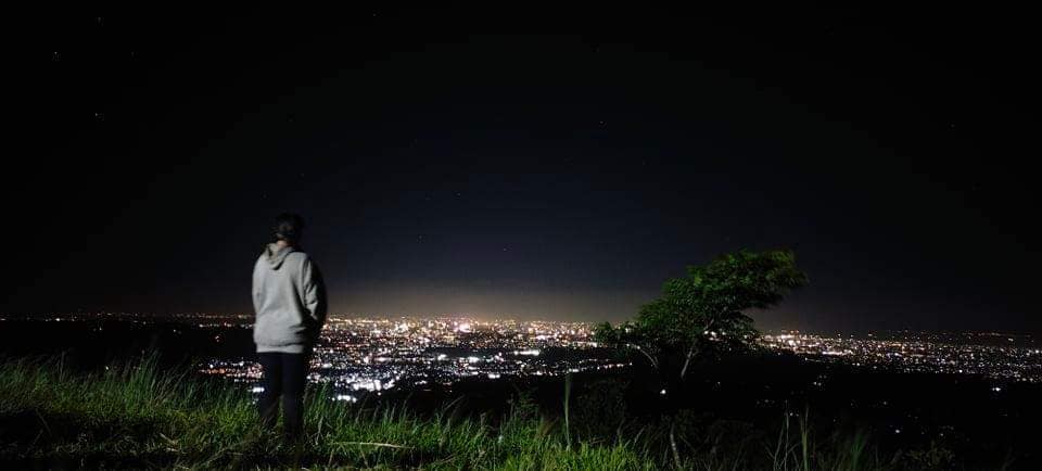
As we continue to ascend, I can already see the buildings of Ortigas Center as well as some parts of Metro Manila. Besides the glowing lights of the sun passing through the business district center were such a staggering sight to behold for several minutes. For this reason, I snap photos again to capture the beauty of the remarkable city and to have a souvenir in return. Also during that time, my guide is so patient with me that he wants to take pictures of me for as long as he could.
Then I have a short talk with my local guide, he said that the towering skyscrapers we saw in the distance reminded him of his first view of Metro Manila as a child twenty-three years ago. Also according to my guide, there’s a route from Mt. Balagbag going to Maranat Falls in Norzagaray, Bulacan. For this reason, I was amazed.
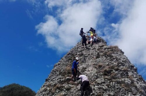
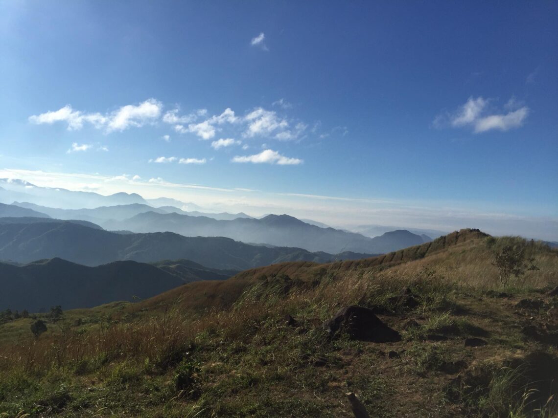
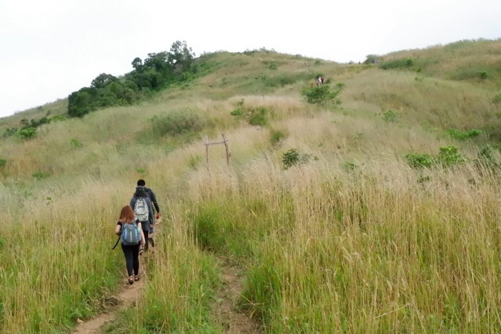
Even so after some sweet talks, we continued the hike and we reached the junction where we can already see the wide campsite of Mt. Balagbag. So we hurry up and do a fun run for a few minutes. After a few moments, we reached the campsite and the resting hut where we ultimately rest for ten minutes. I drink my bottled water and eat again my remaining trail food. After that, we continued the final assault going to the summit. Along the way, I can see the popular Sierra Madre mountain range and the province of Bulacan which is so mesmerizing. Without a doubt, it reminds me of the Mt. Pulag grassland part. We reached the summit of Mt. Balagbag after two hours and twenty-five minutes of hiking.
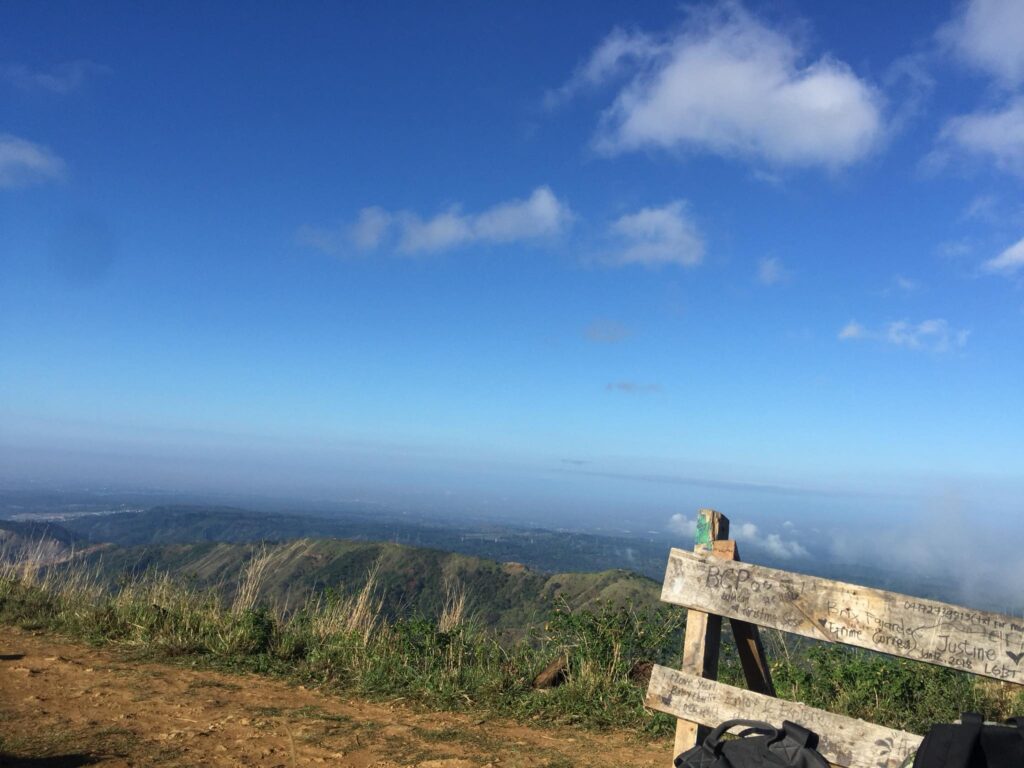
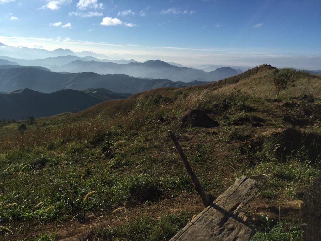
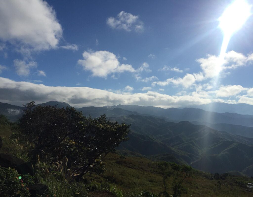
As a reward, I take my time to take pictures of the glorious view of nature. Undoubtedly the rolling verdant hills, the sunrise, the sea of clouds, the dramatic landscape, and the panoramic view of Mt. Arayat and Laguna province I saw from distance is an amazing experience. As a result, my cellphone now is full of pictures and memories that will last a lifetime. Then I said to myself that there’s no need for any filters for the photos because the view is already satisfying. Without a doubt, I truly appreciate the picturesque trail and view.
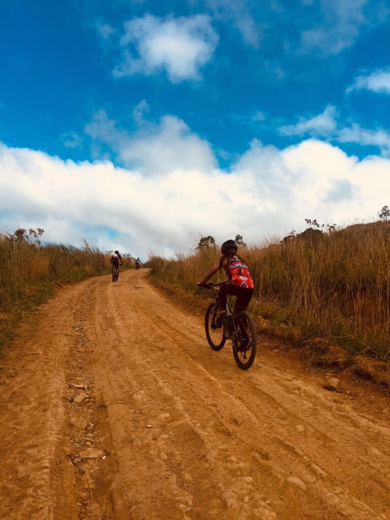
After enjoying the 360-degree breathtaking scenery and surrounding at the top of the mountain, I decided that it is the right time to descend. So we started descending at a faster pace since I already know the pathway I’d been walking on. We pass by some overgrown grasses and native houses along the way. Then after thirty minutes, we encounter some mountain bikers coming from the province of Nueva Ecija and we greeted each other. Moreover, I told them to have a solid bike ride. Even so, as the sun was already high at that time and the trail is super exposed, we run faster as we can to have a minimal rest at the small store that sells refreshment drinks.
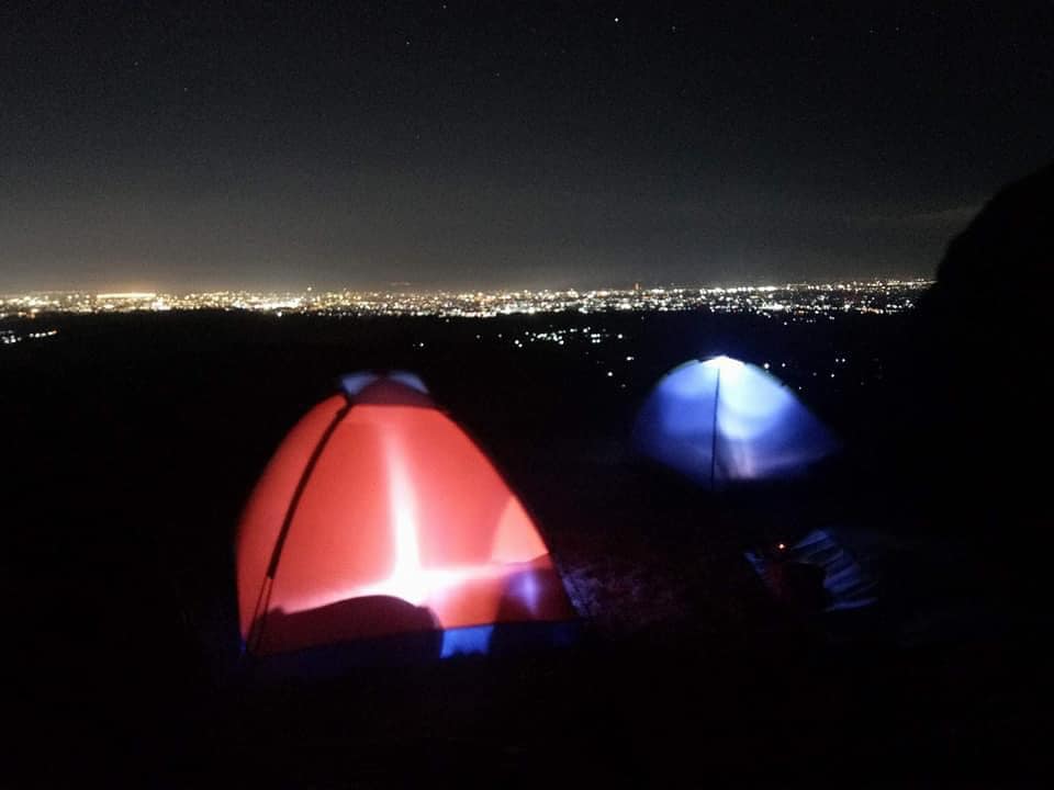
Then at 10:33 am we reached the barangay outpost of Mt. Balagbag. From there I thank my friendly guide and give him a tip for a successful day hike. Moreover, before I leave the place I said to myself that I will surely come back to this mountain via an overnight hike to see the beautiful night sky and city lights of Metro Manila. After a safe road trip, I returned home at 4 pm in the afternoon and I thank God for another wonderful day hike experience in the province of Rizal. As of today, Mt. Balagbag is the cheapest mountain I’ve ever climbed to.
Sample 1 Day itinerary to Mt. Balagbag
3:30AM – Assembly at Quezon City
4AM – Ride a bus going to Tungko
5AM – Arrival at Banco de Oro, Tungko Jollibee
5:30AM – Arrival at Licao-Licao
6AM – Barangay outpost, registration, final preparation, and secure local guide
6:30AM – Start hiking
7:30AM – Arrive at the campsite, rest, and quick breakfast
9:30AM – Summit of Mt. Balagbag, rest and take pictures
10:30AM – Start descent
12PM – Tidy up at the barangay
1PM – Going home
Sample Overnight itinerary to Mt. Balagbag
Day 1
12:45PM – Meetup at the bus station along EDSA
1PM – Departure going to Tungko
2:10PM – Arrival at BDO Tungko, ride a jeep going to Licao-Licao
2:55PM – Arrival at Licao-Licao
3:25PM – Register and get a local guide
4:30PM – Set up camping tent
5PM – Sunset viewing, prepare meals, and rest
7PM – Dinner and socials, stargazing, and picture taking
10:30PM – Sleeping time
Day 2
4:40AM – Wake up call, prepare breakfast
6AM – Sunrise viewing
8:30AM – Break camp
9:15AM – Departure going to the nearest side trip in Rizal or Bulacan
2:20PM – Going back to National Capital Region
4:10PM – Arrive at National Capital Region, end of the tour
Note: this sample itinerary is just a basis and not absolute or will not be 100% accurate due to many factors such as group pacing, waiting time, delay, and weather conditions.
Things to bring on your visit to Mt. Balagbag:
Extra pair of clothes
Face towel
Extra cash
Trekking shoes or sandals
Trail snacks
Two-liter of drinking water
Garbage bag
Toiletries
Towel
Valid ID
Cellphone and Drone camera
Sun protection things like sunscreen and umbrella
Tent for overnight camping
How to Go to Mt. Balagbag
- From Cubao bus station, ride an airconditioned bus bound to Tungko, Bulacan. Tell the bus conductor to alight you at Banco De Oro. The approximate travel time is one hour and fifteen minutes.
- Then from the Tungko jeepney terminal near Banco De Oro, ride a jeep going to Licao-licao. The approximate travel time is thirty minutes.
- Then ride a tricycle or walk your way to Mt. Balagbag registration point for thirty-five minutes.
Note: The last ride of the jeep going to Licao-Licao is 10:30 pm. The jeepney fare from Tungko to Licao-Licao is thirty pesos.
Reminders and Tips:
- Getting a mountain guide before the climb is required even though the path to the summit is straight. It’s for your own safety.
- Mt. Balagbag is a minor climb that has a trail of a class of 2 and a difficulty of 3/9 so pack light only. In addition, Mt. Balagbag has just a total trail length of seven kilometers.
- If you want to witness the stunning sunset over Metro Manila and see the clear night sky, then you can go afternoon and do overnight camping at Mt. Balagbag. However, for your own safety, I highly recommend you to join a large group consisting of four to nine members to avoid any robbery incident. Also, take note that there is no tent for rent at the Mt. Balagbag jump-off point so better bring a tent if you want to do overnight at the mountain.
- The mobile signal at Mt. Balagbag is decent throughout the trail.
- The registration fee for a day hike in Mt. Balagbag is 60 pesos and it will be collected at the barangay outpost and at the camping area.
- The guide fee for a day hike is 500 pesos and it’s good for five people. You can get a guide at the barangay hall outpost.
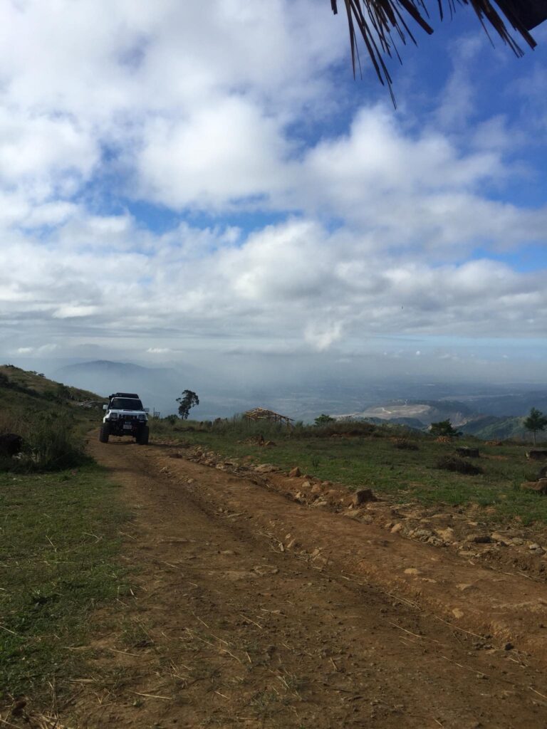
- If you have a 4×4 pickup truck, motorcycle, or mountain bike, then you can drive towards the Mt. Balagbag campsite.
- Wearing hiking shoes or sandals is highly recommended because the trail is mostly scattered with loose rocks and soil.
- Going to the summit of Mt. Balagbag takes about two hours at normal pacing. The total hours to and from the summit could take up to four hours.
- If you’re going for a day hike, it is advisable to start the climb as early as 5 am in the morning to avoid the intense heat of the sun in the later hours.
- It is advisable to bring smaller bills or coins for the transportation expense and hiking essentials.
- Never forget the Leave No Trace principle. Don’t put any of your garbage along the trail, put it inside your bag or in the designated trash can.
- The estimated budget for a day hike is 1,100 pesos which includes transportation expenses, local guide fees, and personal food. On the other hand, the estimated budget for an overnight climb is 1,600 pesos. Please take note that expenses may vary depending on personal feasting of food and other essentials.
- There are available restroom and sari-sari stores at the jump-off point of Mt. Balagbag. The restroom fee ranges from 10 pesos to 20 pesos per head.
- If you don’t want to hike going to the campsite and summit of Mt. Balagbag, then you can hire a tricycle or a two-wheeled single motorcycle at the jump-off point. The tricycle fare is thirty pesos.
- Mt. Balagbag is now open for all mountaineers and visitors who want to enjoy nature.
- Avoid hiking alone or doing a solo day hike especially if you don’t know the mountain trail.
- Bring an umbrella and lots of water during the summer season because there are only a few trees that offer shade.
- Mt. Balagbag is a very good place for mountain bikers and trail runners.
- Above all check the weather forecast in the region before starting to go on a trip. Be prepared and exercise caution at all times and avoid going in the wet season as the trail become so muddy and hard to navigate.
There you have it lovely people. Sometimes it takes a struggle for us to get the best out of life. Overall, I greatly hope this Mt. Balagbag day hike guide has been useful to you. Moreover, don’t forget to share this with your friends and companions if you ever plan to climb Mt. Balagbag. Thank you.
Jervis Ergino
Hi! I’m Jervis Ergino, the digital content creator behind Hike to Mountains, a travel and hiking blog in the Philippines. This blog is dedicated to helping people know more about the best hiking and tourist destinations in the Philippines.