Mt. Batulao Dayhike Guide (Itinerary + Tips)
Introduction
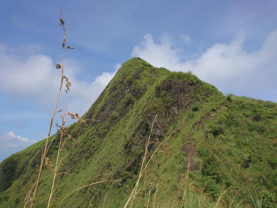
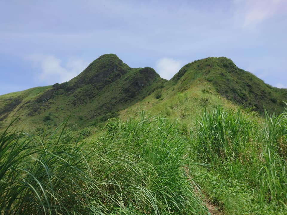
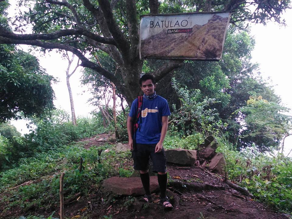
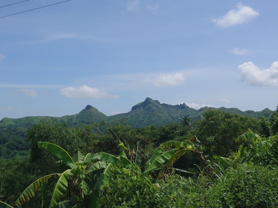
Mt. Batulao is an inactive stratovolcano and a famous hiking destination located at Nasugbu, Batangas. It offers majestic views of the landscape of Batangas and other provinces nearby on a clear day. Mt. Batulao has an elevation of 811 meters above sea level or 2,660 feet. It has well-established trails that are beginner-friendly and has a difficulty of 4/9. Moreover, it has moderately steep terrain and majestic rolling hills which make it one of the coolest mountains to climb in Southern Luzon.
Mt. Batulao’s name came from a fabulous origin. The Tagalog word Batong Dilaw means “yellow stone”. It was said that the mountain was named as such due to the rays of the early morning sun turning the mountainside into yellow on a clear day. Despite the fact that this happens only in the last week of December, Mt. Batulao’s beauty throughout the year is more than enough to make it among the favorite hiking destination in the Southern Luzon region.
Mt. Batulao has a total trail length of 12 kilometers and it will take around 5 to 6 hours to finish the climb depending on your pace. In addition, Mt. Batulao is just a three hours drive from Metro Manila and because of its proximity to the city, it became one of the popular day hike destinations among the Manilenos. It is one of those quick and easy hikes with magnificent views. Its open slopes make the climb chill, relaxing, and worth it.
Name: Mt. Batulao
Difficulty: 4/9
Elevation: 811 MASL
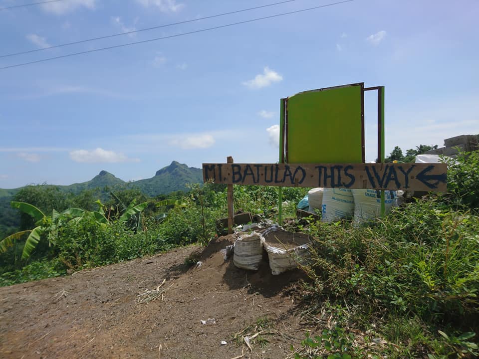
Jump-Off: KC Hillcrest Golf Course (Evercrest), Nasugbu, Batangas
Hours to summit: 3 hours
Features: rolling slopes, open trails, grassland, and picturesque views of Batangas
My trip to Mt. Batulao
In the past week, Biazon the tour organizer invited me to join the Mt. Batulao day hike and told me that the mountain was an easy hike. In my mind, I want to start my weekend in the mountain. For this reason, I immediately join the day hike event in Mt. Batulao. It was early Saturday morning when I arrived at our designated pick-up point in Kia Theatre, Cubao, Quezon City.
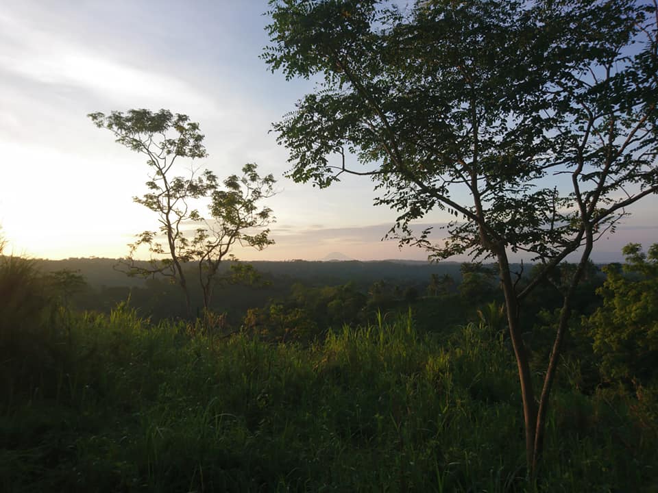
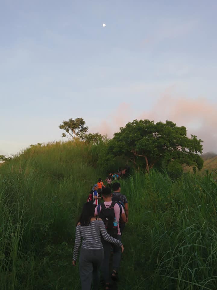
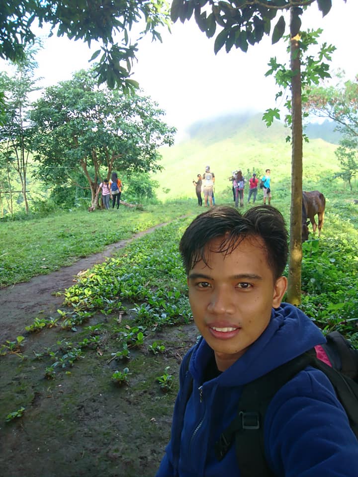
We are fourteen in the group. When everyone already arrived at the pick-up point and was done ordering food in the fast-food restaurant, our van left Cubao. After three hours and ten minutes of road travel, our van reached the registration site of Mt. Batulao. We go out of the van and we feel the cold temperature. Our tour organizer register our group and the local officials of the mountain gave us a local guide for the climb. It was 6 am when we start to walk on a cemented and well-maintained road for several minutes.
It was like walking in the park. I didn’t run out of breath neither I was tired. Past 6:30 am when we reach the first resting station which is a small hut. Some of the members buy bread, noodles, Gatorade drink, and coconut juice as their breakfast. When everyone in the group done eating, we resume the climb. As we walk by we saw some horses eating grass and we saw local kids roaming around. Being in the province for a little time felt good to me.
Then several minutes of walking we reach the second nipa hut. The temperature is still cold and I can barely make a sweat. Our group rested for ten minutes and afterward we reach the third nipa hut which is the main jump-off point of Mt. Batulao. Then we followed the old trail at an average pace. The trail is an up and down pattern. According to our local guide, because of the many ups and downs of the mountain, the altitude gain from the jump-off point going to the summit is less than 300 meters above sea level only.
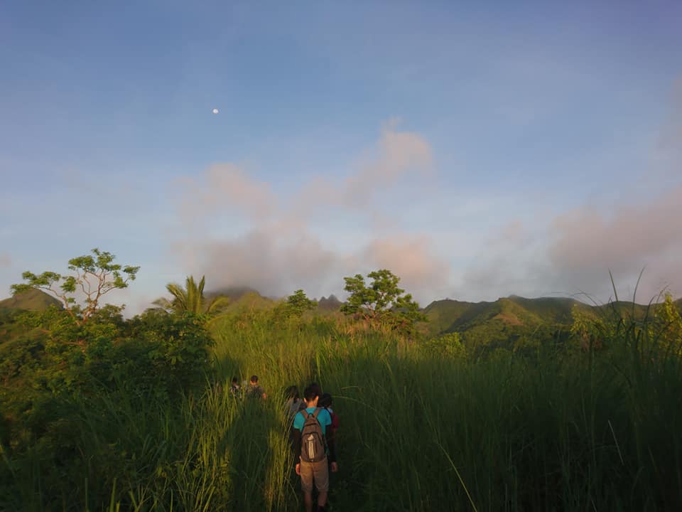
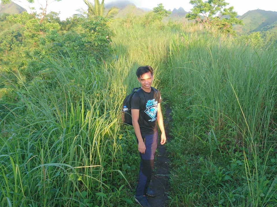
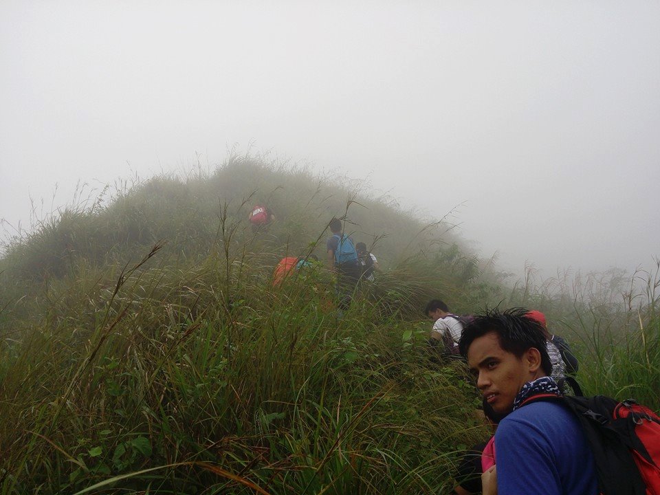
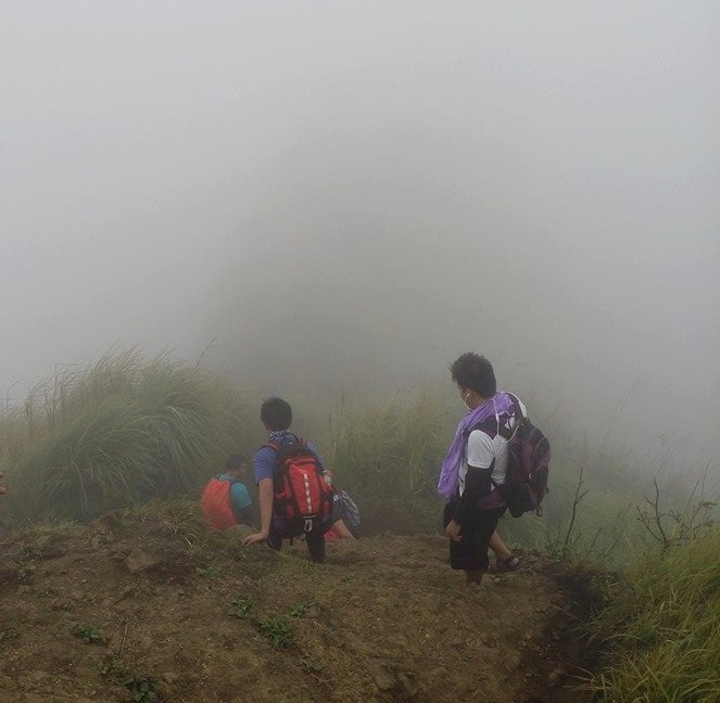
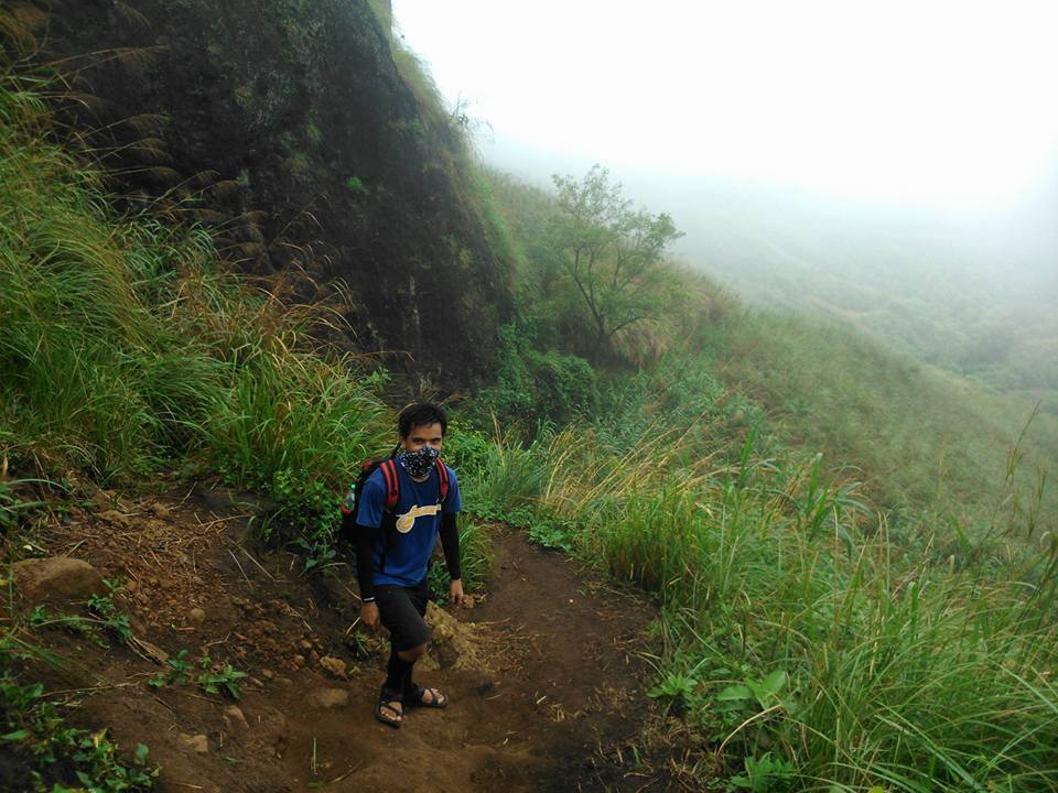
After being done resting for a little time, we continue walking. The climb was challenging due to the slippery muddy trail. According to our guide, it rained here in the past few days so it was a bit exhausting as we go through the muddy trail. Also at this point, I couldn’t remember which camp we are in right now. They said that there are ten camps located in Mt. Batulao. On the other hand, I can only remember the time when we paid another registration fee for a minimal amount.
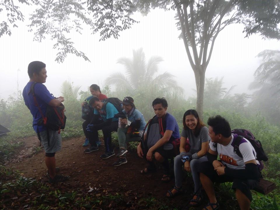
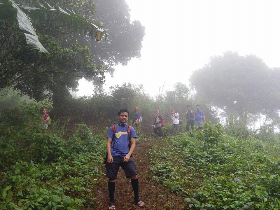
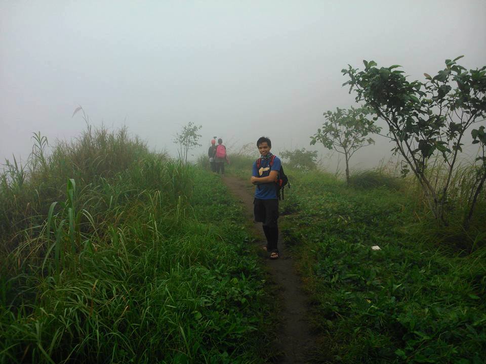
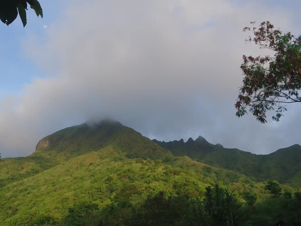
Then forty-five minutes later the trail becomes a moderate assault. For the most part, the trail is an uphill climb. We are now sweating heavily as we go up the mountain slope. Then we have a quick rest under the huge tree and we have a beautiful view. While resting we saw a group of hikers coming down from the summit. We greeted them good morning and they told us that we are near the summit.
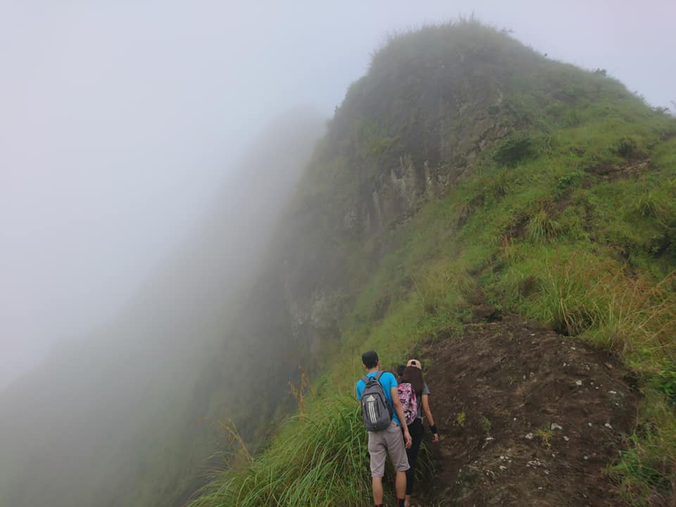
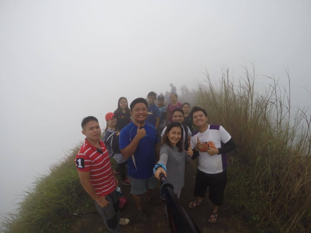
We resumed the climb and our group swiftly passed camp 6 and camp 7. At this point, I noticed that the trail become too narrow that it allows only a single person to pass at one time. After one hour of an uphill climb, we take a long rest. Some of the members felt sad because there are multiple fees from the owner of the land. We eat our trail food and we drank water to give relief to our sweaty bodies. Afterward, we continue the climb at a moderate pace.
Then the tour organizer told our group to be careful on the trail because it’s hard to fall especially if you expect someone to catch you. We were laughing so bad after he said that. Then a few minutes later we have jaw-dropping scenery with a great mountain view. I’m so glad I was finally able to climb one of the most popular hiking spots for beginners and trail runners. Indeed, Mt. Batulao is a sanctuary for hiking enthusiasts and nature lovers. That’s why the mountain is sometimes called Batulove.
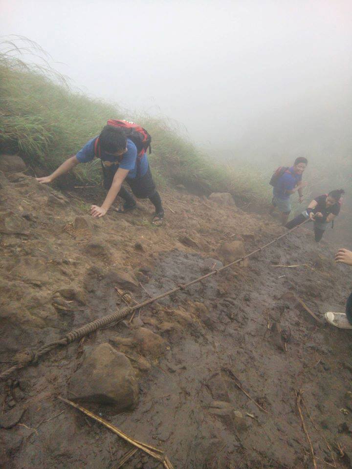
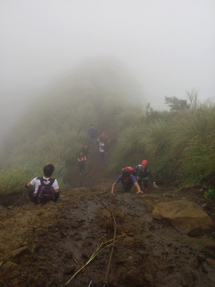
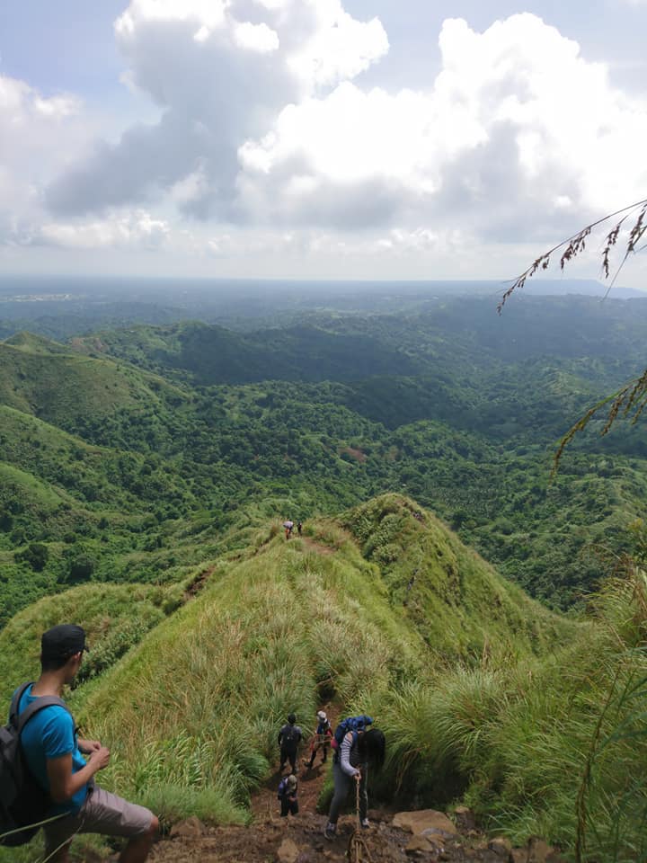
Then we reach the rope segment of the mountain which is a 90-degree assault. It is a super steep part situated between Camp 8 and the summit. I could feel my heart beating faster because I was so nervous at that time. I think this is the most technical part of the climb. We need to use both hands and feet while climbing through the rocks. Also, each member in the group needs to be patient and wait for each other turn.
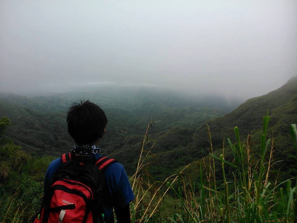
Our local guide assists us and I noticed that only a few members of the group used the fixed rope. In my mind, maybe it was easier climbing through the rocks than doing rappelling. After twenty minutes, we finally survive the challenge. We reach the summit at 8:30 am. We are so happy to see the 360-degree view of the surroundings and rocky landscapes.
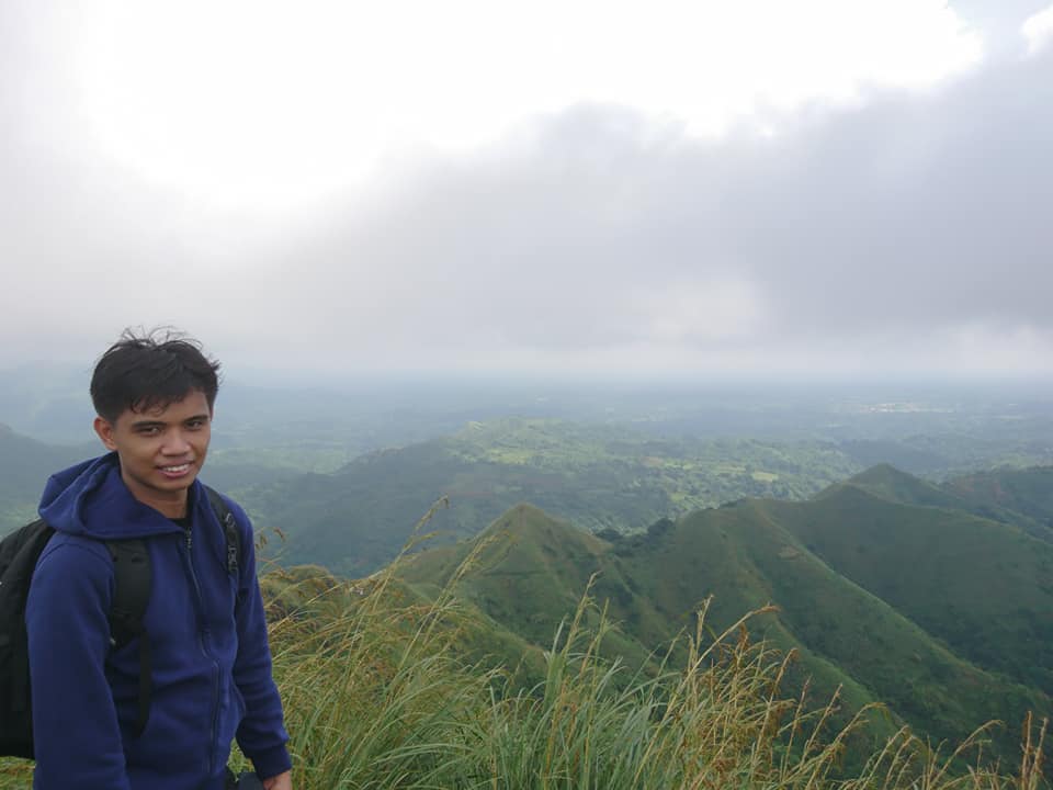
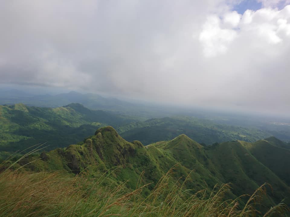
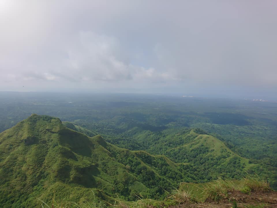
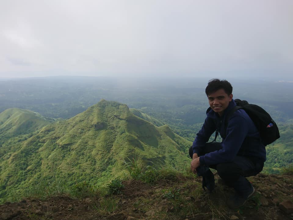
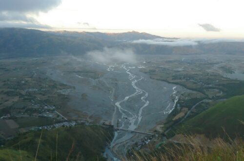
At the summit of Mt. Batulao, I can clearly see the plains of Cavite and Batangas province, the coastline of Nasugbu municipality, the Calatagan Peninsula, Balayan Bay, Tagaytay Highlands, Mt. Talamitam, and some mountains in Cavite province. Moreover, the wind at the summit is so refreshing that I’ve forgotten what we’ve been through in the climb. We enjoy the excellent view and we have a nice group picture. I think we have a perfect clearing. It’s not too hot and not too cold.
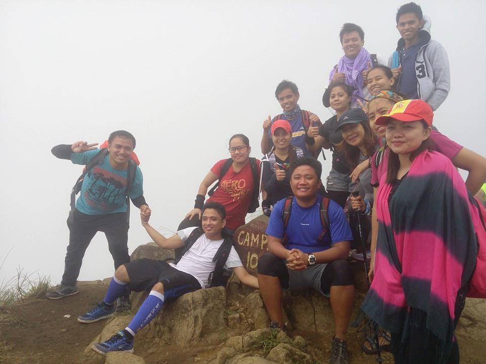
On the other hand, since we hike on weekends, the summit is a little bit crowded. We saw some foreigners too enjoying the cold air. After done taking pictures, we eat our food inside our bag. However, the bugs are bothering us while eating. Nevertheless, we share our trail food with each other and I found out that most of the members I joined with is a repeat hikers. They told me that this is the fourth time they climb this mountain. Then twenty-eight minutes later our tour coordinator told us that we need to start to descend because the black clouds are coming in and it was about to rain.
For this reason, we didn’t stay too long at the summit. We hurry up and our group decided to go to the new trail. We did a traverse climb. I think going down is more challenging because it takes a toll on my knees and my legs every time I step my feet on the ground. Also, the trail is very slippery as the heavy rain started to pour on us midway through our descent. Nevertheless, we take pictures again as a remembrance of our rainy climb.
We pass overgrown grass and later we saw a small nipa hut. We take a long rest and order some noodles and halo-halo as we wait for the rain to stop. Luckily after thirty minutes of waiting, the rain did stop and we resume the descent going back to the jump-off point. On our descent, we saw other mountaineers who do trail running. As a result, we also do trail runs.
As we are near the end of the trail, the view is still gorgeous. After one hour and forty-seven minutes of descending, we finally finished the traverse climb and we reached the place where our van is located. Then we tidy up at the small house near the jump-off point. After that our van left Tagaytay City and we have a nice ride going back to National Capital Region (NCR). It was 4 pm when I came home.
Overall the climb is super enjoyable. Thank God for this beautiful mountain that he created. I love nature and I really like the lush green view, and it’s good for the eyes. In this climb, I realize that to walk in nature is to witness a thousand miracles. The only downside to climbing this mountain is that there are so many registrations that you need to pay a certain amount. It’s like paying a toll fee. Nevertheless, the view is priceless and I will recommend this mountain to my group of friends.
Things to bring on your visit to Mt. Batulao:
Light flashlight
Valid ID
Cellphone
1.5 to 2 liters of water
Lightweight clothing
Extra clothes and slipper
Extra cash
Trail food like a jelly ace, biscuit, nuts, and bread
Toiletries, towel
Alcohol
Sunblock
Scarf or cap
Umbrella
Personal medicine and First Aid Kit
Two to three plastic bag
Raincoat during the wet season
Packed lunch (optional)
Whistle (optional)
Trekking pole (optional)
Sample 1 Day itinerary to Mt. Batulao
2:30AM – Assembly time, meetup
3AM – Departure to Nasugbu, Batangas
6AM – Arrival at Evercrest, start hiking
7AM – Arrival at Camp 1, registration, and rest
8:30AM – Arrival at Camp 10, picture taking
9:30AM – Descent to new trail campsite peak 8
10AM – Arrival at peak 8, registration, rest, and early lunch
11AM – Start descent going to Evercrest
12PM – Arrival at Evercrest, wash up, and take a shower
1:15PM – Leave Evercrest going to the side trip in Tagaytay City
4PM – Early dinner and socials
6PM – Departure going back to Metro Manila
8:30PM – ETA Metro Manila
Sample 2 Day itinerary to Mt. Batulao
Day 1
10AM – Meetup at Buendia Bus Terminal
10:30AM – ETD going to Batangas
2PM – ETA Evercrest, Batangas, registration, and start hiking
4PM – Arrival at the new trail campsite, set up a tent
5PM – Preparation of meals, sunset viewing
6:30PM – Dinner and socials
9PM – Lights out
Day2
5AM – Wake-up call, breakfast
6AM – Break camp, sunrise viewing
6:30AM – Assault to summit
7:30AM – Arrival at the summit of Mt. Batulao
8:15AM – Start to descend
10AM – Jump-off point, tidy-up, lunch
11AM – Going to Tagaytay Mahogany Beef Market or other places in Tagaytay
4PM – ETD going back to Manila
7PM – Arrive at Manila
Note: this sample itinerary is just a basis and not absolute or will not be 100 percent perfect due to many factors.
How to Get to Mt. Batulao
By commute
- From the LRT Buendia bus terminal, ride a DLTB bus bound to Nasugbu, Batangas, and tell the bus driver to drop you off at the junction going to Mt. Batulao. The approximate travel time is three hours.
- Drop off at KC Hillcrest Hotel and Golf Club. Then ride a tricycle going to the registration site.
By private vehicle
- From Manila, follow the way going to Tagaytay via Cavitex (Manila–Cavite Expressway) or SLEX (South Luzon Expressway).
- Then at the intersection in Olivares, drive all the way going to Nasugbu, Batangas.
- After that turn left at KC Hillcrest junction. Then take the first right and drive straight towards the parking slot. The approximate travel time is nearly three hours.
Note: Please download the Waze app for better navigation going to the Mt. Batulao registration area. Open the app and pin the KC Hillcrest Hotel and Golf Club.
Reminders and Tips:
- Mt. Batulao is a minor climb but be sure to pack ample water, snacks, and sunscreen, especially in the summer season. It’s easy to get dehydrated because the vast majority of the trails are uncovered which exposes hikers to a lot of sunshine. Also, there are days when the mountain can feel like a desert because of its super hot and humid temperature. It’s recommended to wear sun protection things like caps, and long sleeves as the trail are super exposed to the heat of the sun.
- As of now, Mt. Batulao is open for all mountaineers who want to climb the mountain.
- The tour guide fee for a traverse dayhike (new to the old trail) is 800 pesos and it’s good for 5 people. Meanwhile, the tour guide fee for a backtrail hike is 500 pesos. On the other hand, the tour guide fee for an overnight climb is 1,200 pesos good for six to seven people.
- The ecological fee is 140 pesos per head and the parking fee is 50 pesos.
- Getting a local guide is required before the climb. Kindly contact Kuya Erwin (09285755394) as your local tour guide and photographer in Mt. Batulao. Also, you can contact Kuya Ramon Casanova your local tour guide thru his numbers 09301206603 (TNT) and 09672963538 (Globe).
- The registration site of Mt. Batulao is located at Evercrest Golf Course, Nasugbu, Batangas. The registration fee is 200 pesos per head for a traverse dayhike.
- There are small stores in the mountain where you can buy snacks and soft drinks like coke and mountain dew.
- Don’t drop any plastic, any empty bottles, and any tissue on the ground. Don’t pick any flowers or plants on the trail. Also do not litter. It is very important to keep all trash with you to keep the mountain clean. I suggest you keep it in your hiking backpack and store it there temporarily until you saw a garbage can. Leave nothing but footprints, take nothing but pictures.
- The best time to climb Mt. Batulao is during the weekdays to avoid the crowd and to have more time for impressive picture taking. Also, don’t visit the mountain during the wet season as the trail can get very muddy and difficult to navigate.
- If you are an experienced hiker, you can do a twin hike or trilogy day hike with Mt. Talamitan.
- If this is your first time climbing a mountain, make sure you condition yourself and do cardio exercises such as jogging, running, walking, or weightlifting.
- Wide parking slots and shower rooms are available at the registration area.
- Avoid turning on loud music during the climb. It is better to hear the peaceful sounds of mother nature.
- Be nice to the local guides and respect them. Also, make the local guide feel like a part of your group. Offer them food and water and invite them during socials.
- Cellphone signal is mostly present in the mountain.
- If you want to lessen your expense, I highly recommend joining an organized tour going to Mt. Batulao. Included in the organized tour is transportation in and out of Batangas, registration fees, and tour guide fees.
- There is no reservation in climbing Mt. Batulao but it’s much better if you contacted the local guide in advance prior to the climb date.
- It is very essential to observe the right of way on the trails. If you are going down the mountain, give way to hikers who are going up. Also, if your pacing is slow, make way for fast-moving mountaineers. Similarly, if you are fast-moving, kindly ask slow-moving hikers for permission to advance on the trail.
- The best time to start the climb is before 5:30 am to witness the sunrise and to avoid the scorching heat of the sun later because Mt. Batulao is an exposed trail. Meanwhile, the best month to climb Mt. Batulao is from November to April.
- Overnight camping is allowed in Mt. Batulao but to a designated campsite only. Camping at the summit is not allowed by the local guide. You can bring your own tent or you can rent a tent. The tent rental fee is 350 pesos per night.
- The hike to the summit will last two to four hours at a moderate pace and with ample rest. Some can finish it in 2 hours. The total hours to and from the summit could take up to seven hours.
- The safe budget for a DIY (Do it yourself) is 1,650 pesos which includes transportation and food.
- The new trail of Mt. Batulao has a toll pay of 140 pesos per person. On the other hand, the traverse section has a toll payment of 60 pesos per head.
- If you’re a seasoned hiker, I recommend trying the traverse dayhike which means you’ll ascend the summit through the old trail and descent via the new trail to see all of its stunning and glorious views. After thirty-five minutes of walking, there is a junction where the two trails met. Take note that the old trail is on the left side and the new trail is on the right side.
- If you’re coming from Cavite City and you’re going to commute going to Mt. Batulao, wait for a PITX bus in Saint Dominic or in SM City Bacoor. The earliest trip of the bus coming from Metro Manila is around 5 am and it will pass through Saint Dominic around 7 am. Tell the bus conductor to drop you off near Mt. Batulao, from there you will ride a tricycle going to the main jump-off point.
- Building a fire inside the mountain is strictly prohibited and is punishable by the law.
- You can have a side trip to the popular Caleruega Church if time permits.
- Above all, just pack light if it’s only a day hike.
There you have it, ladies and gentlemen. Slow down and enjoy life. It’s not only the scenery you miss by going too fast, you also miss the sense of where you are going and why. Overall, I hope this Mt. Batulao hiking guide and reference has been advantageous to you and encourages you to try visiting the mountain. Also, don’t forget to share this with your loved ones and friends if ever you plan on doing the Mt. Batulao day hike too. Remember shares would mean so much more. God bless us all and thanks for the time reading my blog.
Jervis Ergino
Hi! I’m Jervis Ergino, the digital content creator behind Hike to Mountains, a travel and hiking blog in the Philippines. This blog is dedicated to helping people know more about the best hiking and tourist destinations in the Philippines.