Mt. Balingkilat Traverse to Nagsasa Cove Day Hike Guide
Introduction
Mt. Balingkilat is located in Subic, Zambales. It offers a magnificent view of Zambales coastal mountains and spectacular coves. Mt. Balingkilat has an elevation of 1100 MASL or 3608 feet.
Balingkilat is a native Aeta word that means “Mountain of Thunder”. It was said that the mountain was named as such because lightning always struck the peak of the mountain during the rainy season. Mt. Balingkilat also known in the past as “Pointed Peak” used by US Navy servicemen designated in Subic Naval Base.
Mt. Balingkilat is the highest peak in the Cawag Trio Mountains situated at the coastal mountain range of Subic. It’s followed by Mt. Dayungan and Mt. Cinco Picos. Moreover, Mt. Balingkilat is a favorite hiking destination among seasoned and experienced hikers because of its proximity to Manila and its rugged landscape similar to Mt. Guiting-Guiting in Romblon. In addition to this, it is one of the well-known and most hiked mountains in Zambales.
Name: Mt. Balingkilat
Difficulty: 6/9
Jump-Off: Sitio Cawag Settlement, Subic, Zambales
Exit point: Nagsasa Cove, San Antonio, Zambales
Hours to summit: 4 to 6 hours
Features: Scenic view of the Zambales coastal mountains and beautiful coves.
My trip to Mt. Balingkilat
I’m itching to do a major climb because in the past three years I haven’t been able to do a major climb due to the ongoing pandemic and having acid reflux disease, so I thought of doing a major hike again and giving it a try. After browsing day tour hikes in the Facebook hiking group for the past few days, I finally saw my next major climb. Mt. Balingkilat day hike traverse to Nagsasa Cove, I said to myself this is the perfect year-end hike.
It was in late December that I decided to join an organized trip going to Mt. Balingkilat. As always I am a solo joiner. The group organizer gave me the itinerary, the package inclusion, and the things we need to bring in the climb.
The climb proper is December 26. For this reason, I did bring some of the leftover food on Christmas Day. It was December 25 in the evening when I went to our meetup place in Greenfield Mayflower Parking. We are twelve in the group. When our group was complete, the van departed around 11:45 pm and headed to Subic, Zambales. I wanted to sleep in the van but it didn’t happen.
After land travel of three hours, we arrived at Cawag Police station in Subic at 2:30 am to have registration. However, the security guard told our driver and our organizer that the registration will be done near the jump-off point of Mt. Balingkilat because they no longer handle the registration process. So our van headed towards the registration site and it was 3 am when we finally registered and reached the jump-off point of Mt. Balingkilat in Sitio Cawag, Zambales.
We prepare the things that we need for the climb. We pack up and leave in the van the things that we don’t need in the climb like extra clothes, swimming attire, and other stuff. Then the group circled and started praying to God to guide our footsteps, keep us safe, give us strength, and come back home safely.
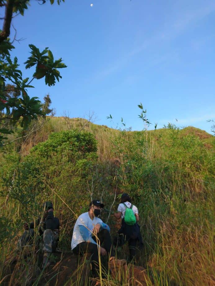
Our tour guide named Joel Soria a native of Aeta was introduced and we had a short briefing of the mountain trail. Then we opened our flashlights and headlamps and we started the hike at 3:20 am.
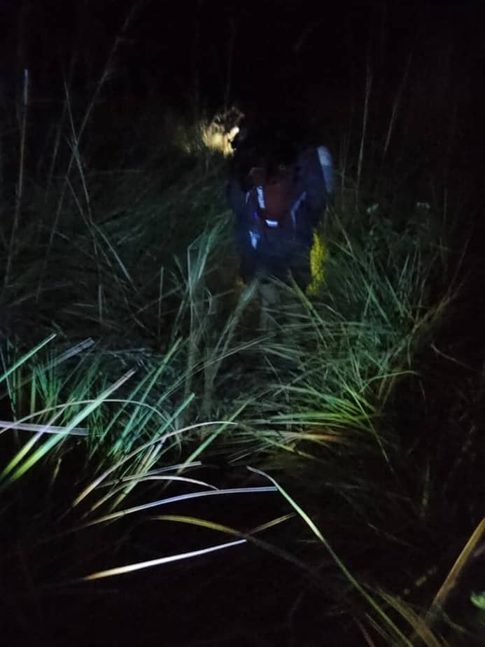
The first few meters of the trail pass by some wooden houses and the dogs welcomely bark at us. Then after that, we walked a few kilometers for almost one hour on a relatively flat trail in an open grassland covered with grass and talahib. I like the idea of hiking in the early morning cause I’m not sweating as much as hiking during day time.
After one hour of hiking, we finally reached the base of Mt. Balingkilat. Our group rested for several minutes under the tree. While we rest we admire the beautiful night sky filled with countless stars. Undoubtedly, it’s an indication we have good weather.
At 4:15 am the trail gradually ascended and was well-established covered with tall grass. Then we stopped at the first water source under the tree in the Kawayanan area. We drank as much water as we could and refilled our water bottle because our guide told us that the next water source is in the descending part of Mt. Balingkilat Traverse.
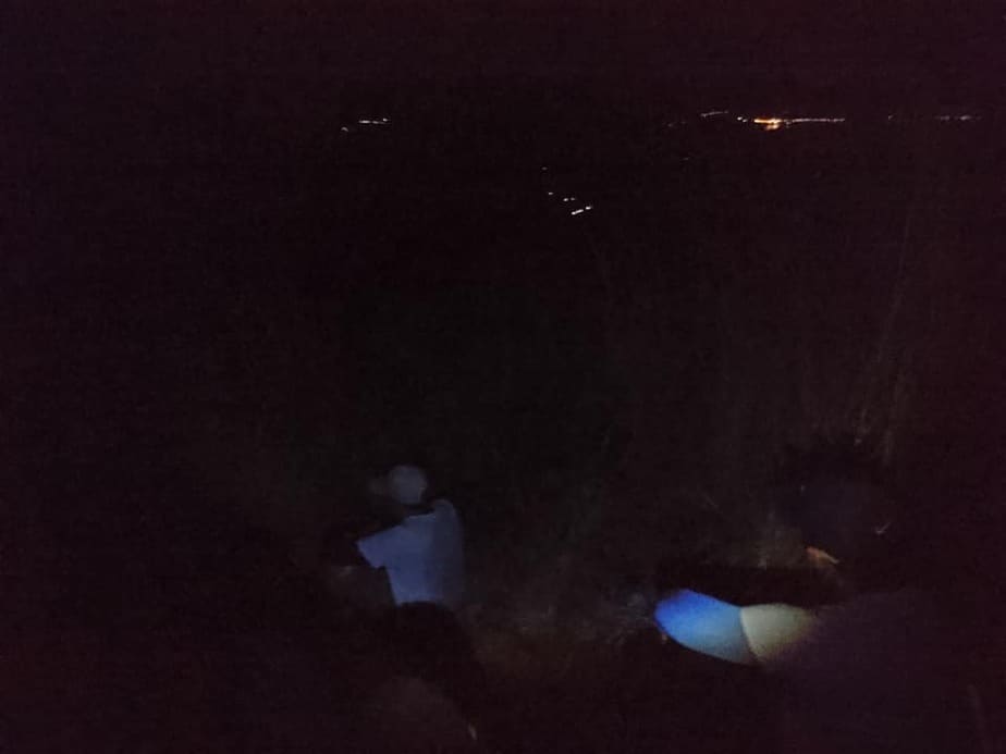
Then after thirty minutes, the terrain became a moderate assault. As we go up the mountain we can see the city light of Subic. It’s a mesmerizing view. At 4:55 am we take another twenty-minute rest under a tree to wait for the other members of the group. I asked our guide if we are halfway to the summit and he replied we’re not yet halfway. So we continue hiking on the moderate straightforward ascent trail.
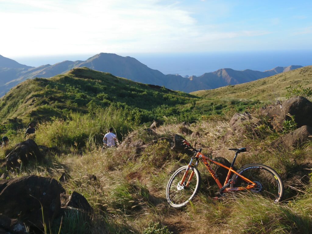
Later we saw the flat ground. We waited for the rest of the group to come in. Our group took a little rest on the flat ground at 5:20 am. As we rested we saw one hiker from a different group carrying a bike while hiking. For this reason, we were shocked. In this case, we thought he was a veteran in hiking already. It’s my first time seeing a hiker that carried a bike while doing the uphill assault.
Also while resting, I asked our guide why Balingkilat is the name of the mountain. Then he replied that Mt. Balingkilat is the name of the mountain because the thunder and lightning are always at the peak of the mountain during the wet season so it is called the “Mountain of Thunder”.
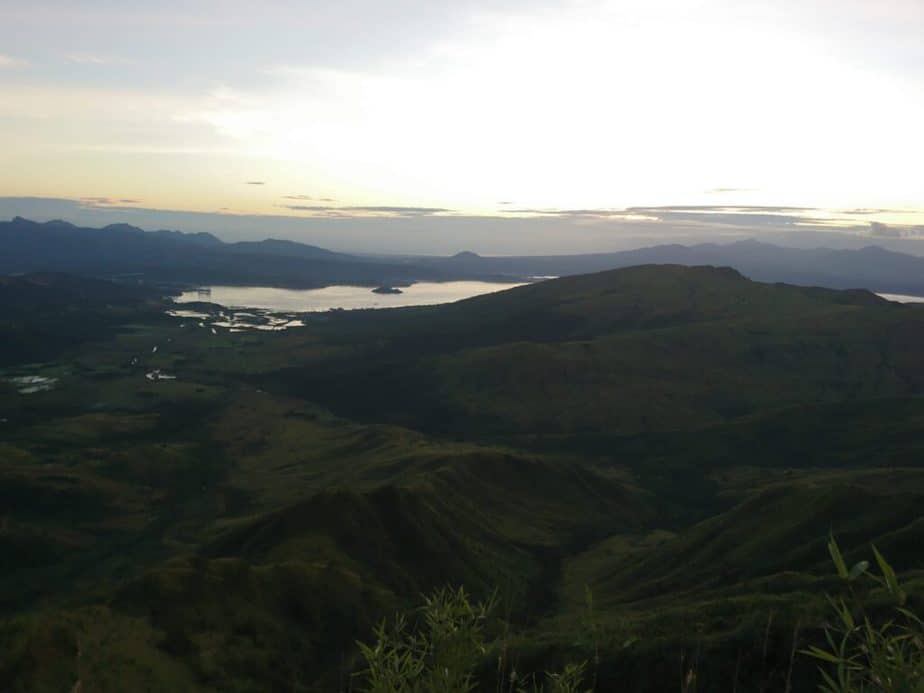
Then after our quick rest, the trail descends a little bit, then later pure assault with several huge boulders dotting the trail. We rested and regrouped again at 6:15 am to witness the magnificent sunrise. We can see the Subic Bay below and the perfect sunrise. Indeed, the view was so exceptional and Instagram-worthy.
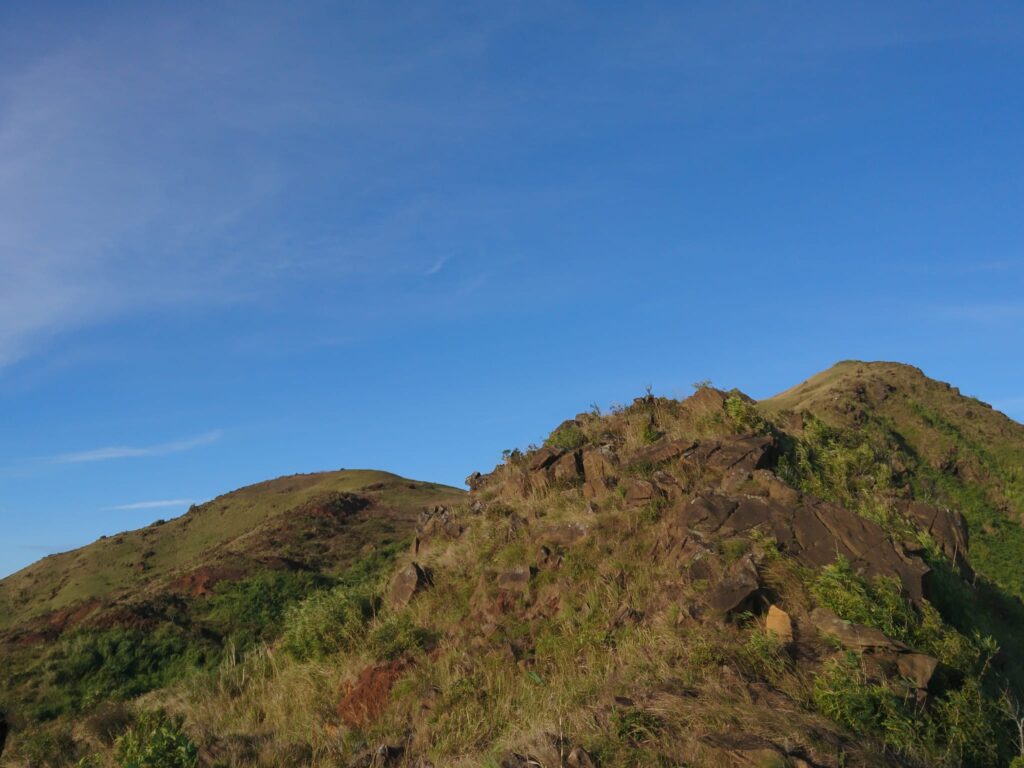
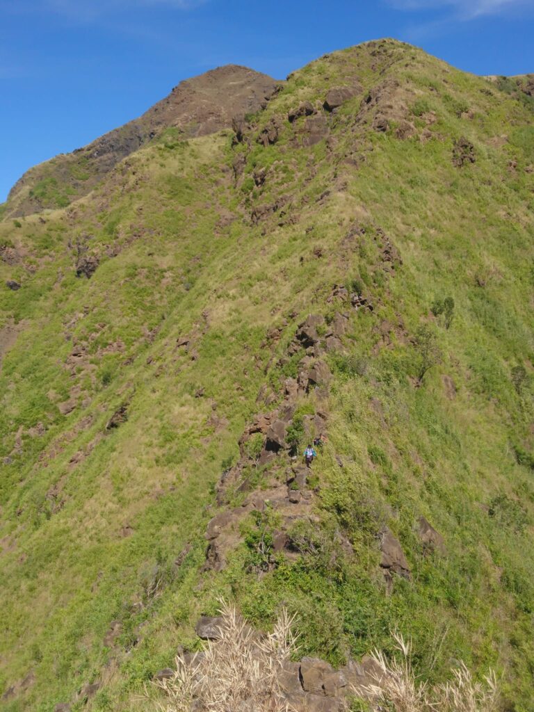
After several minutes, we continued the ascent on a very steep trail. We use both our hands and feet while climbing the huge boulders. The continuous uphill bouldering was difficult for us because it’s almost a 90-degree assault similar to Mt. Daraitan. In my opinion, this is the most technical part of the assault, extra caution is required in scrambling through the rocks and boulders along with high steps. Luckily, specks of trees would appear from time to time offering shade.
We are exhausted and tired as we go up the mountain slope. It’s a steep climb. Therefore, we take several breathers. Without a doubt, the ascent from the water source going up to the campsite of Mt. Balingkilat truly tests our patience but the view is rewarding.
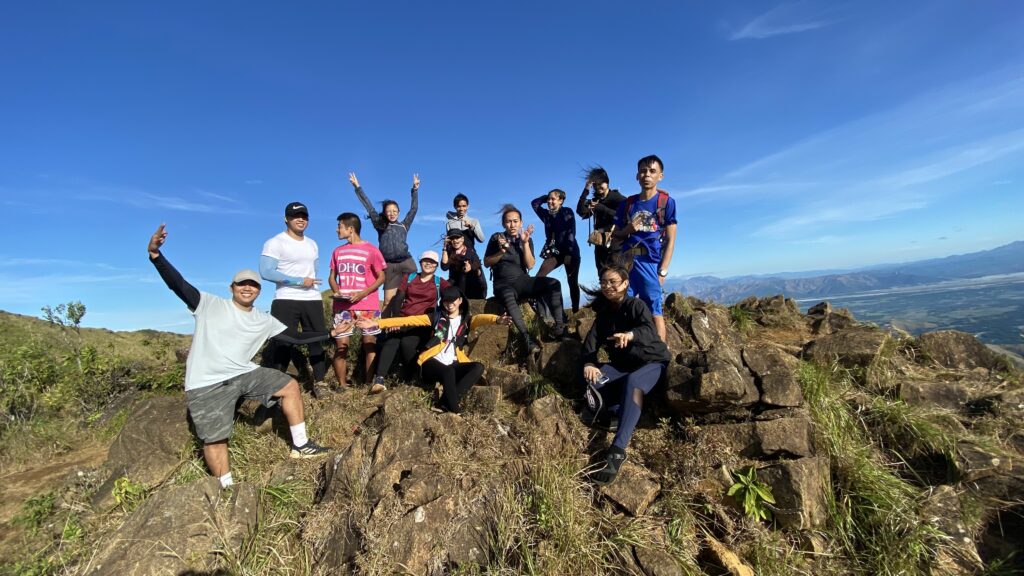
After one hour of continuous ascending on a steep trail, finally, our group reached the campsite of Mt. Balingkilat at 7:20 am. However, it is super exposed to the sun. With no natural barriers at the campsite, the wind is something else. As a result, we experienced the full force of the wind and we felt the cold wind blowing at the campsite. Nevertheless, we had breakfast at the campsite.
We explored the campsite, took videos, and had our group pictures at the campsite and we stayed there for 45 minutes. We lost our tiredness at the campsite because of the strong wind blowing and the incredible view of the province which is refreshing.
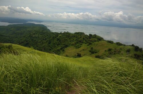
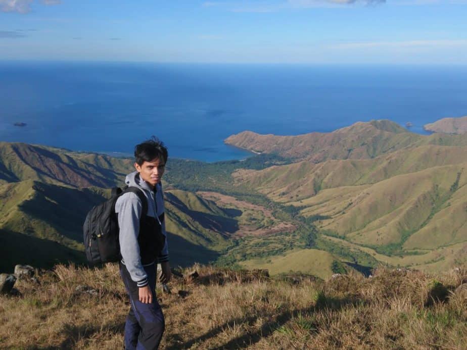
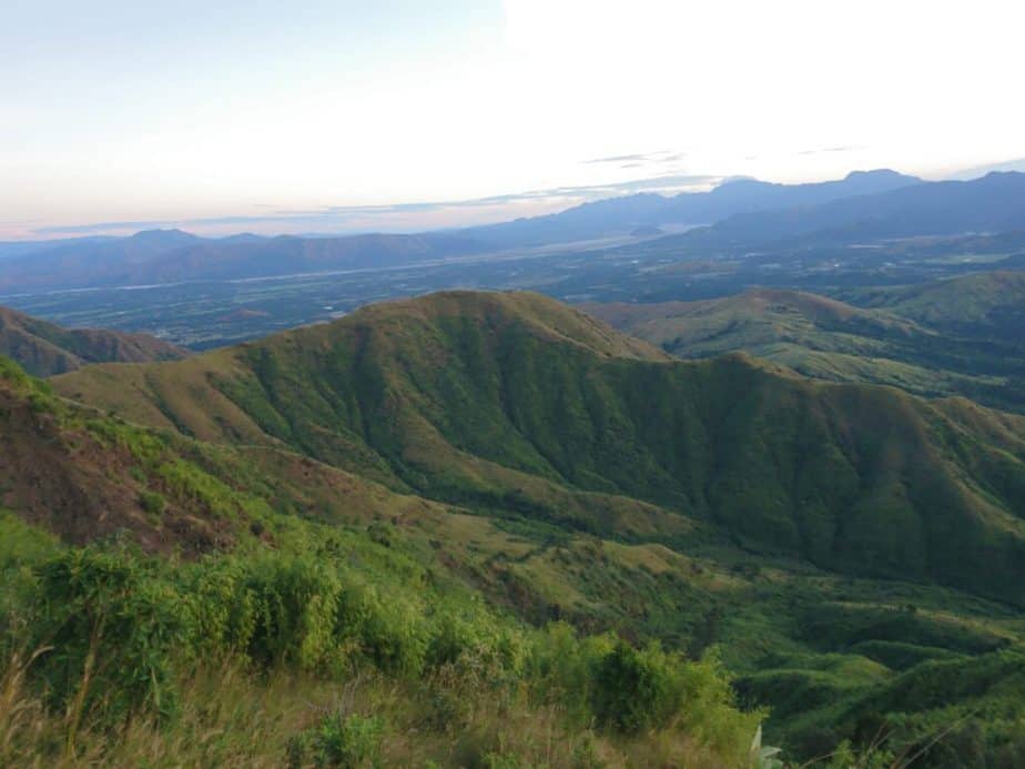
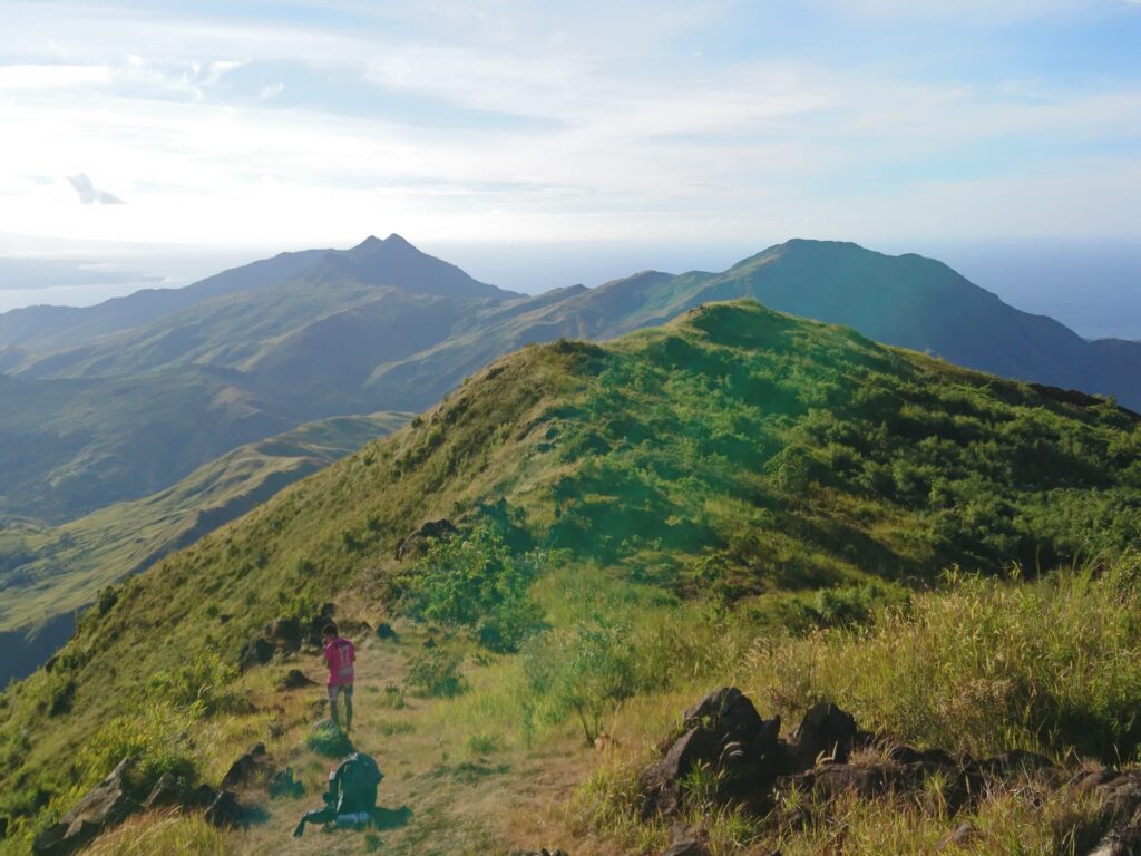
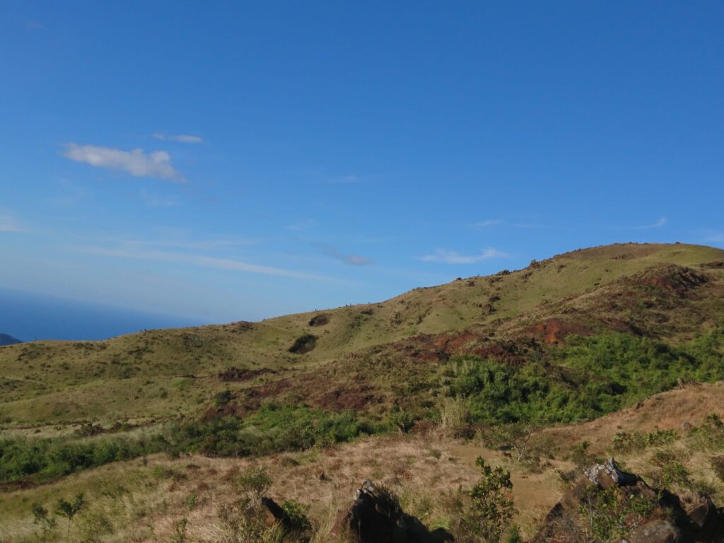
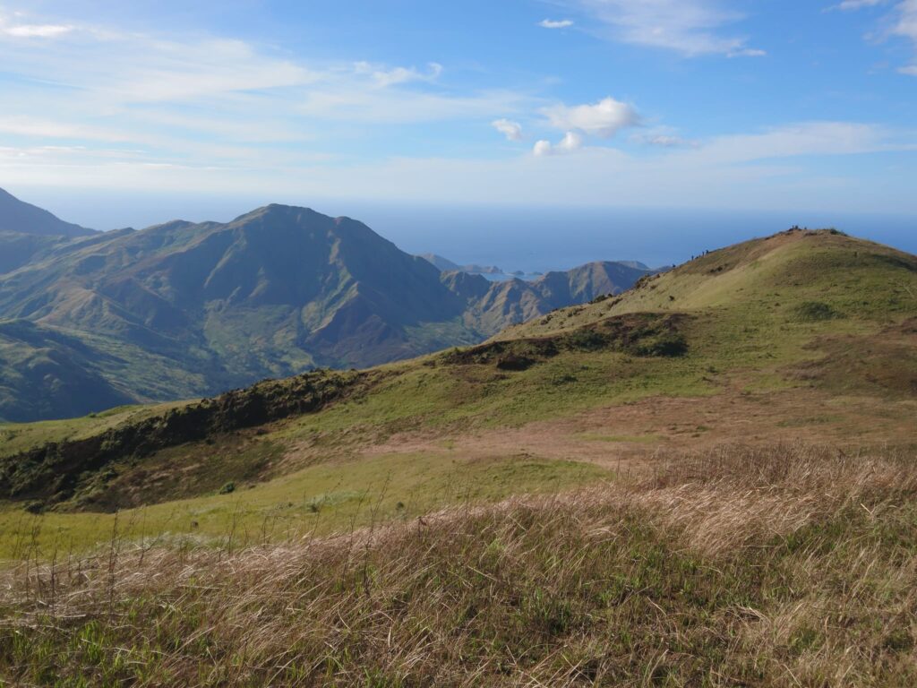
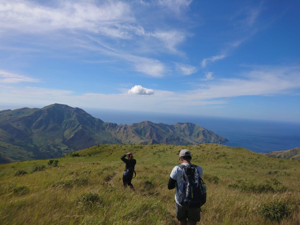
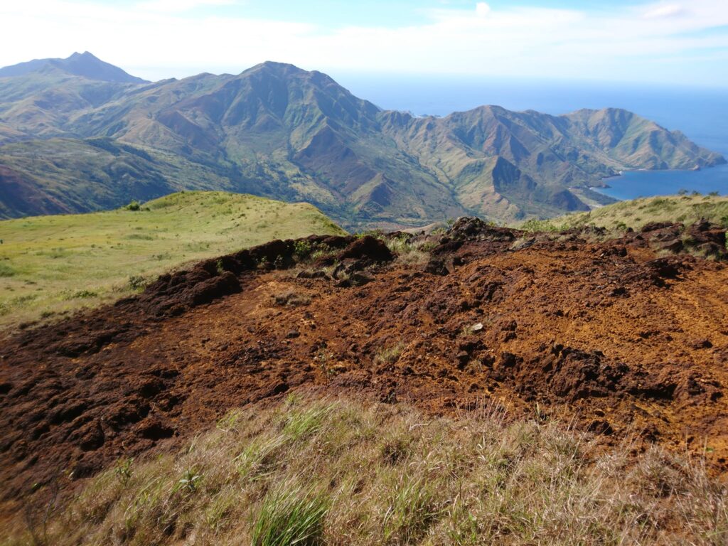
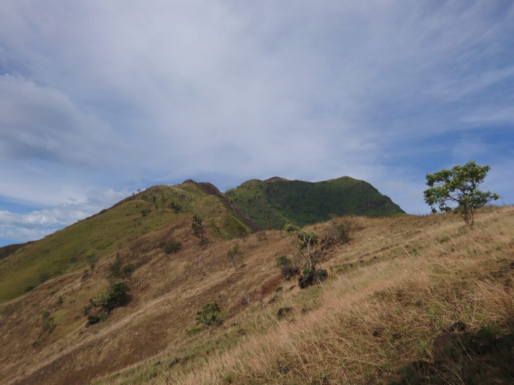
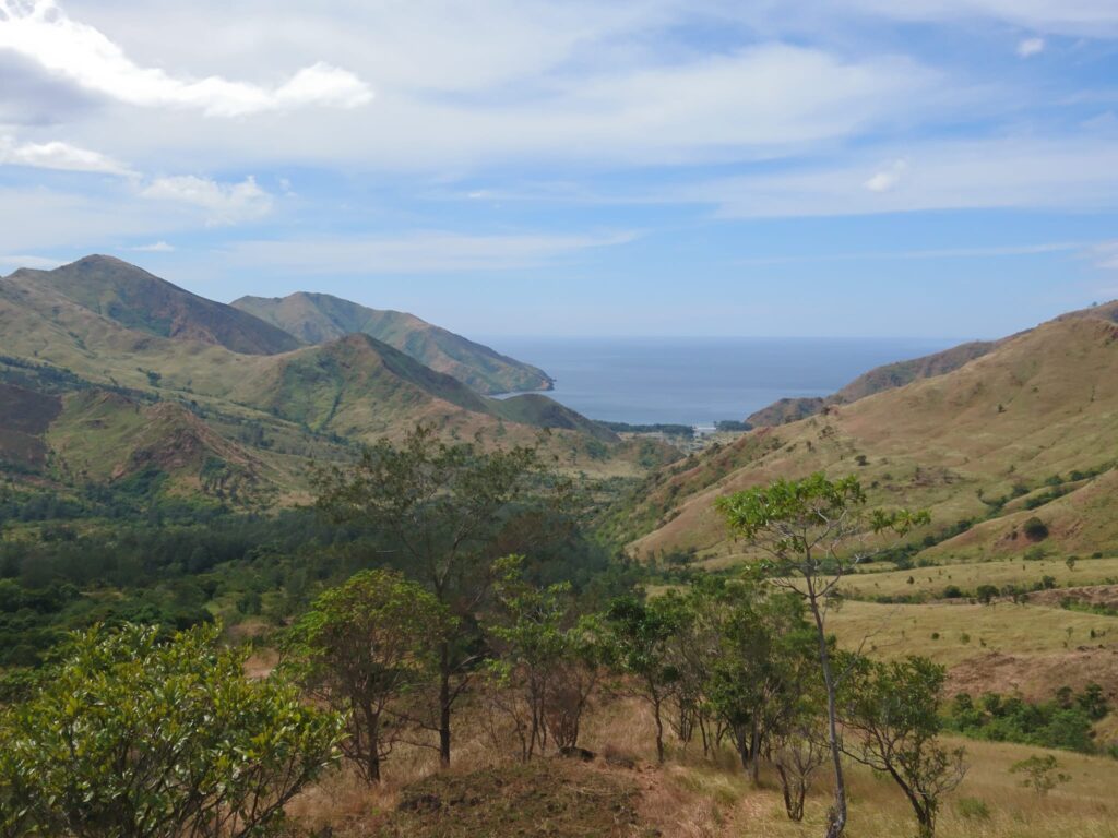
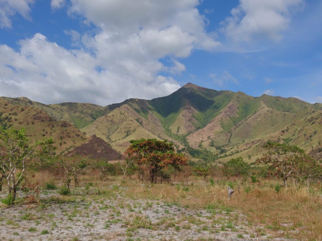
The scenery from the campsite is really amazing. For the most part, I love the views and the surroundings, happy to be here. The campsite is wide, open, grassy, rocky, and characterized by grassland slopes. We can clearly see the Subic Bay coastline, the surrounding municipality, and Mt. Cinco Picos. However, there is no tree at the campsite.
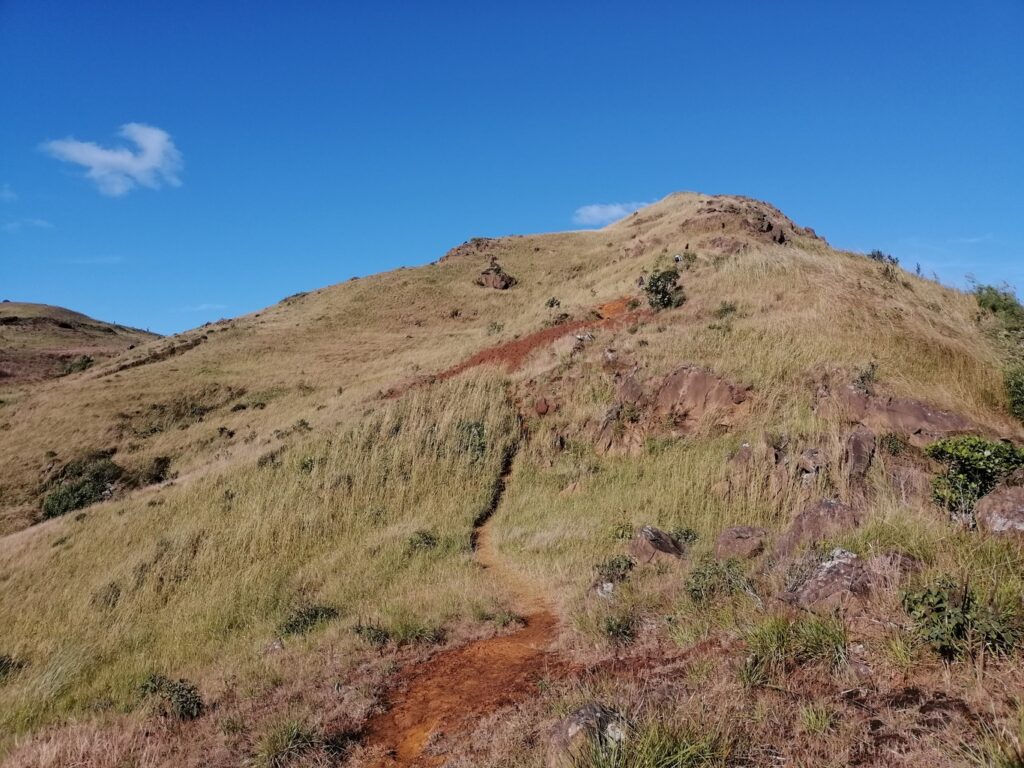
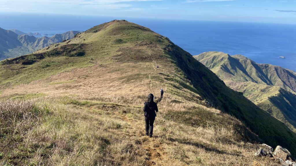
From the campsite we can already see the summit, indicating we are near the peak. We are so excited. Later, we continued our assault going to the summit of Mt. Balingkilat. The trail is very much similar to Tarak Ridge. It’s very windy. There are steep boulder parts in the final leg going to the summit so we have to be very careful.
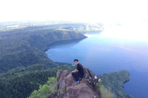
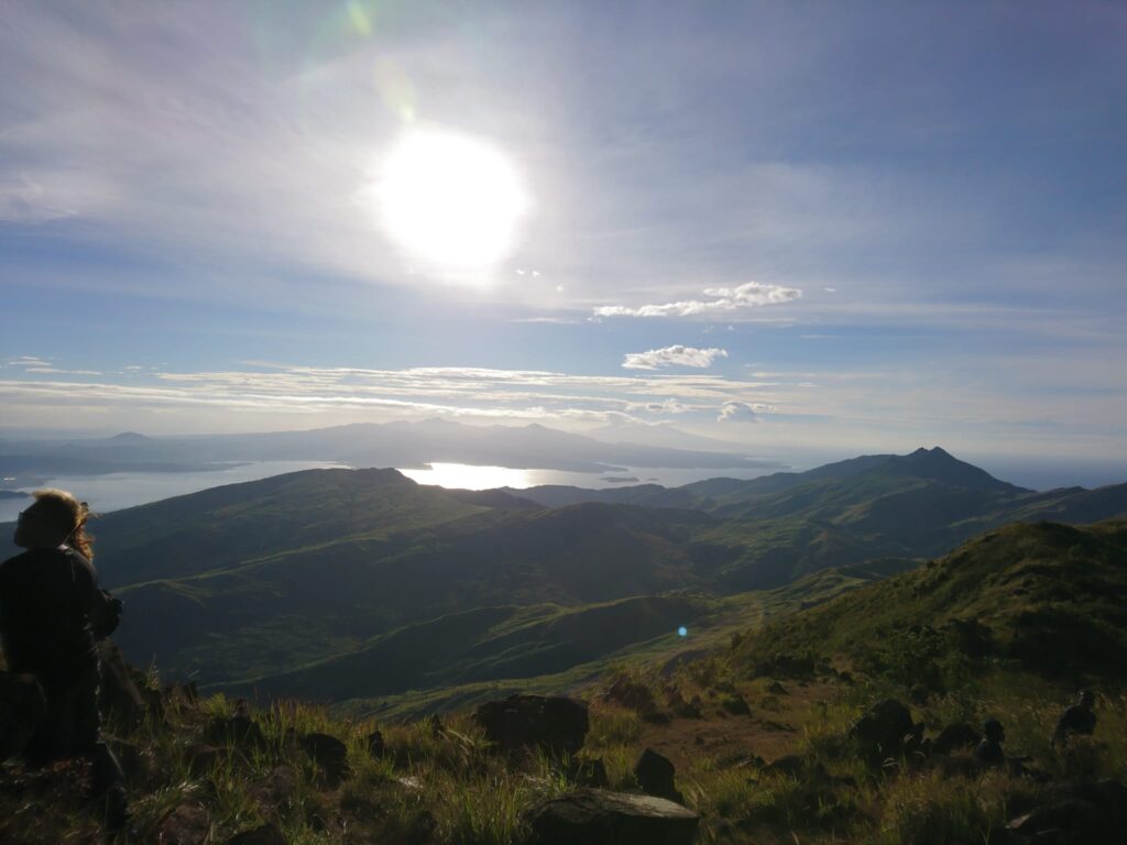
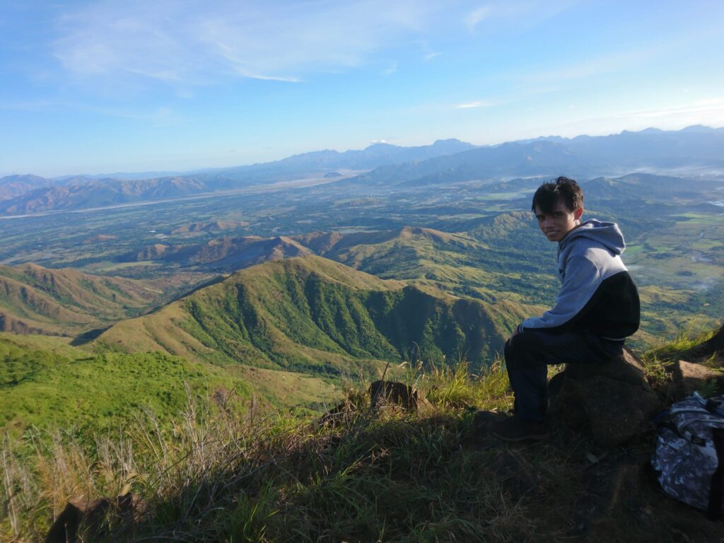
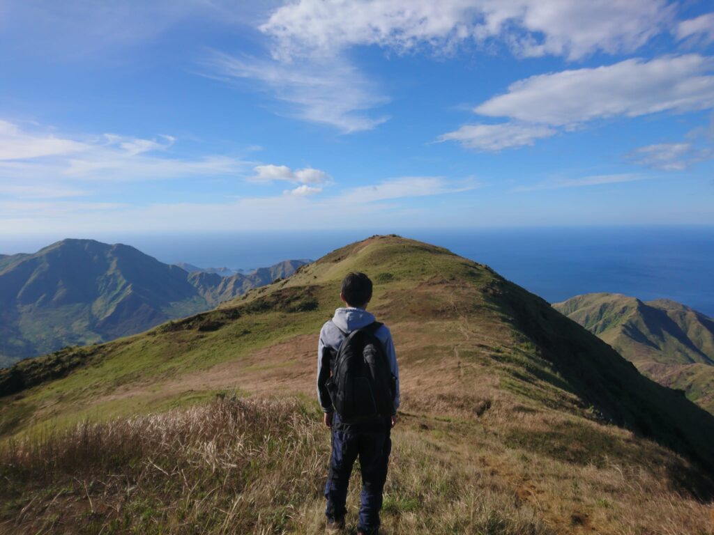
We reached the summit of Mt. Balingkilat at 8:35 am. The mountain rewarded us with glorious views no picture can ever explain. The weather is perfect. The golden sky above us. The view is unique, attractive, and spectacular. The scenery and landscape are stunning. Without a doubt, it is a jaw-dropper, they demand to be seen with your own eyes. From the rich green hills to dreamy grasslands. I never thought there was such a beautiful place in the Philippines just like this.
At the summit, we can see below the beautiful coves of Zambales such as Anawangin Cove and Talisayen Cove, and on the other side are Nagsasa Cove and Silanguin Cove. The magnificent view at the summit is 360 degrees.
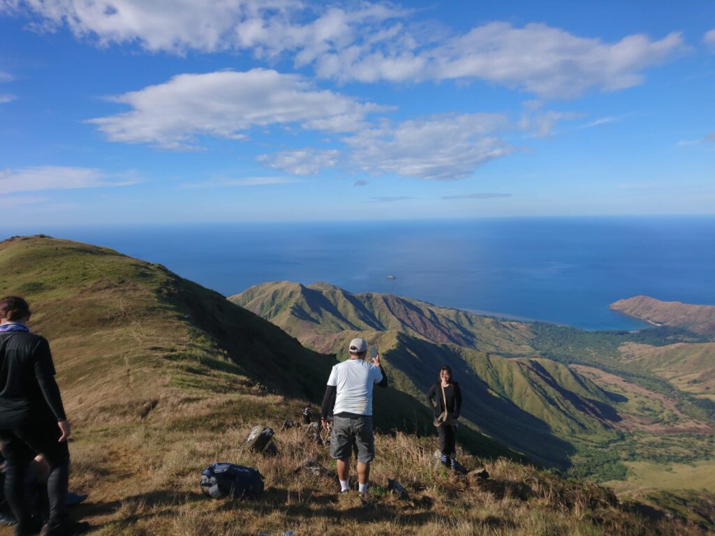
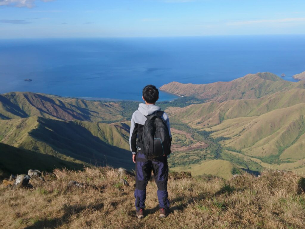
We can also see the panoramic view of Mt. Cinco Picos, Mt. Dayungan, the scenic ridges, the coastline, and the South China Sea. Indeed, God’s creations are really amazing. Everything is just perfect. This is one of the reasons why I love hiking to see the works of God and appreciate nature’s beauty. Our group was fortunate to have a wonderful clearing at the summit. Without a doubt, it’s one of the must-hike mountains here in the Philippines.
I also noticed that the summit area of Mt. Balingkilat is so wide. It’s like I’m walking in the park. What a wonderful landscape. I find myself at peace and in love with the place, the same feeling also for the other members of the group. In general, I can say that this is one of the most breathtaking mountain summits I’ve ever been to. It is majestic. My photos couldn’t justify its beauty in person. Mt. Balingkilat summit is beautiful in any direction I look. In addition to this, it’s one of the best places on earth. The view is all worth it.
We take our time to snap photos, rest, enjoy the beautiful view and savor the moment. One group member even flew his drone above to better capture this once-in-a-lifetime view. Mt. Balingkilat is such a lovely place. Although we wanted to stay longer at the summit we had to go down to follow our given itinerary. Our group stayed at the summit for 40 minutes.
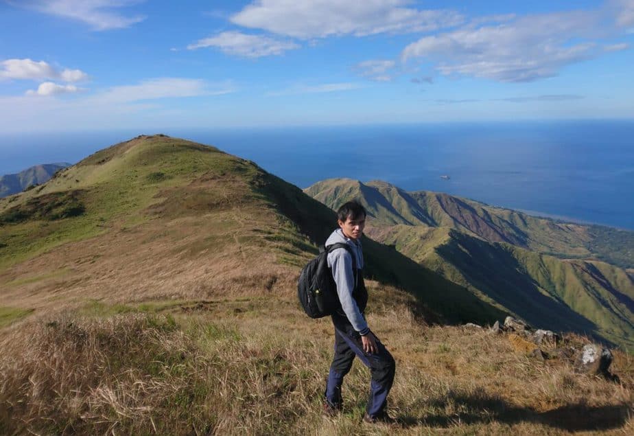
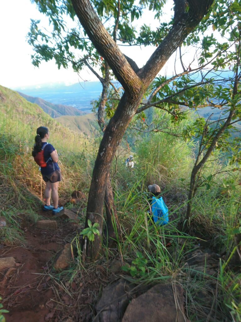
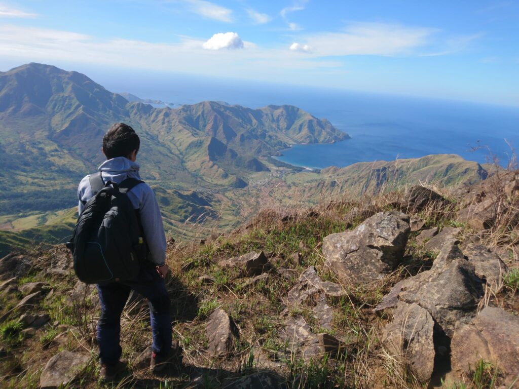
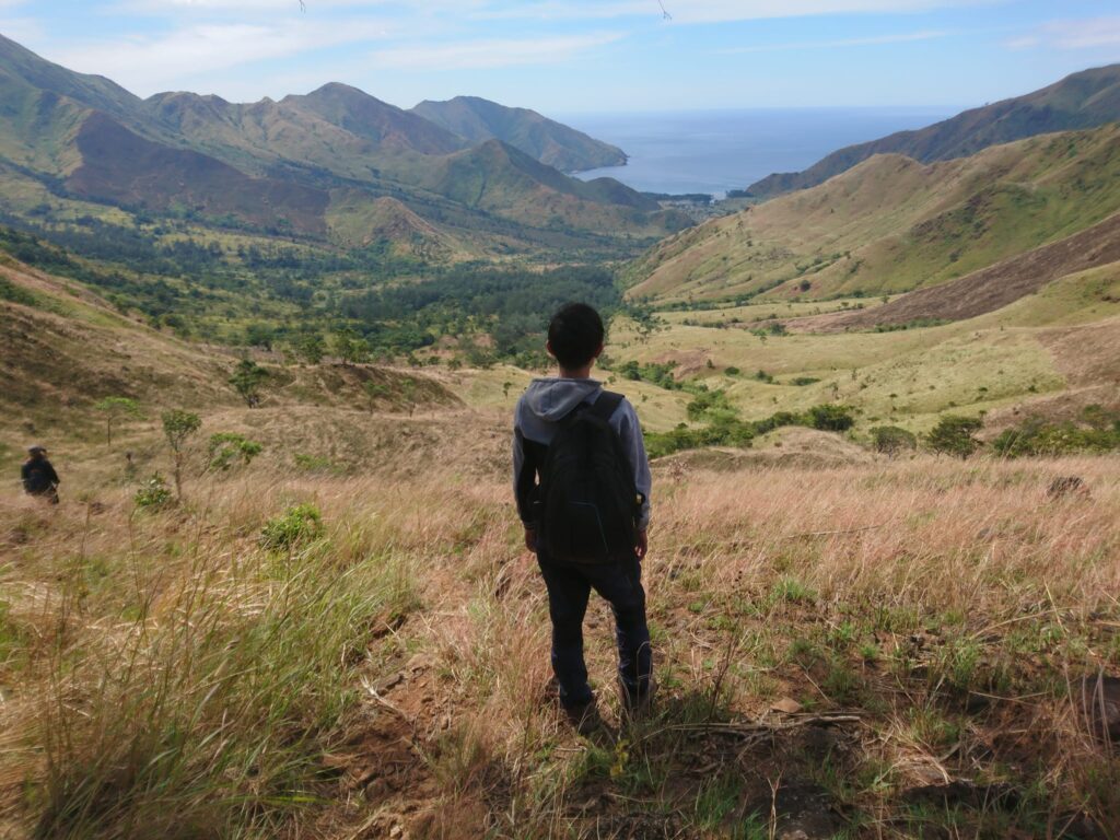
Around 9:30 am, our group started the descent from the summit of Mt. Balingkilat going to Nagsasa Cove. It was great to see the other side of the mountain. I don’t want to close my eyes while descending the plateau because of the superb view. I feel like I’m in heaven already. While descending, I saw a huge area struck by lightning. For this reason, I said to myself truly Mt. Balingkilat is the mountain of thunder.
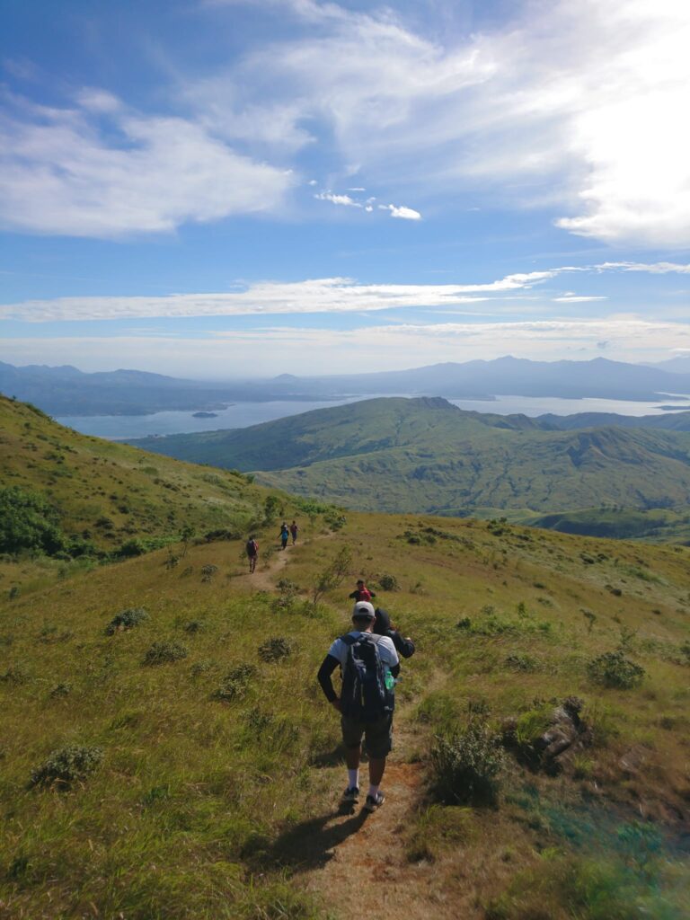
The initial part of the descent is easy in a wide-open grassland. The view is stunning. It’s pretty much a large campsite that could contain a hundred tents. However, as we pass through the steep rocky ridge of Mt. Balingkilat, the trail becomes so hard. In this case, we had to go over numerous rocks with sharp edges, some were even loosely placed. To our left side and to our right side is a cliff. Also, we have to be very careful with our steps so that we do not slip, get bruises, or fall.
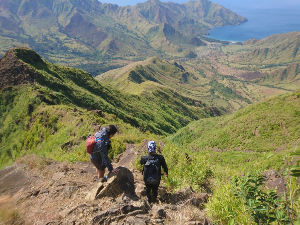
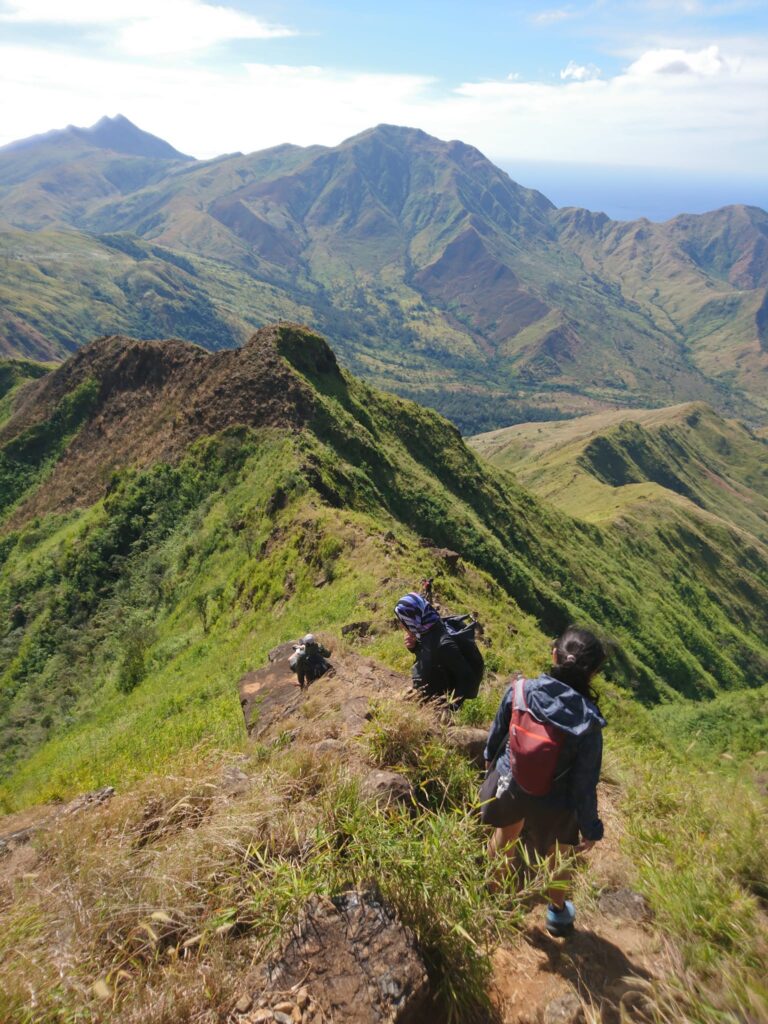
Our group scrambles on the rocky cliffs for about one hour and a half as we go down the ridgeline with no shade. For our own safety, sometimes we need to sit on the trail, crawl and use both hands and feet while descending the steep ridge. Going down the mountain through a rugged ridge is a bit tricky and dangerous. In my opinion, it is the most challenging part of the entire traverse.
After passing through the ridge, rocky slopes, and sharp boulders, we finally reached flat ground and we took some needed rest under a tree. We ate our trail food and after that, we resumed hiking.
Later along the trail, I pulled out my umbrella inside my bag because it’s too hot already and I don’t want to have sunburn on my skin. My umbrella was battered by the strong wind but managed to survive. There are only a few shaded parts midway down the descending portion. As a result, it’s blazing hot. The sun drains all of our fluids in the body. Nevertheless, we enjoy hiking.
We were drained, tired, and exhausted as we went down the open trail because of the intense sun exposure, little tree cover, and extreme heat. Also every time my shoes hit the rock, I was in pain. Then we saw other groups that do Cawag Hexa Dayhike but unfortunately, some of them did not continue the day hike and later exited on other mountains.
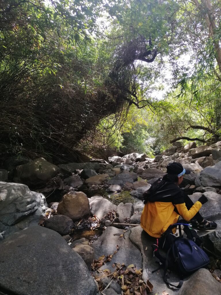
Although it was really hot during our descent, the bright sunny day allowed us to see the mountain unobstructed, which is truly delightful. Our group reached the second water source of Mt. Balingkilat around 11:20 am. We repeal our water bottle at the small stream. The water tastes naturally good and it’s really refreshing. Then we took a little rest and asked our guide how many more hours to be able to reach Nagsasa beach, he replied three hours trekking to reach the said destination. After hydrating ourselves we resumed our hike.
The trail now is gradually descending on a mild slope. It’s a very long downhill trail. The mountain is a bit bald, and as a result, we feel the intense heat. We descended for two hours on this kind of trail. The scorching heat is all worth this amazing view as we go down the mountain and take some rest.
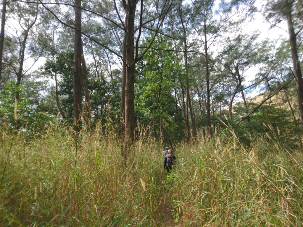
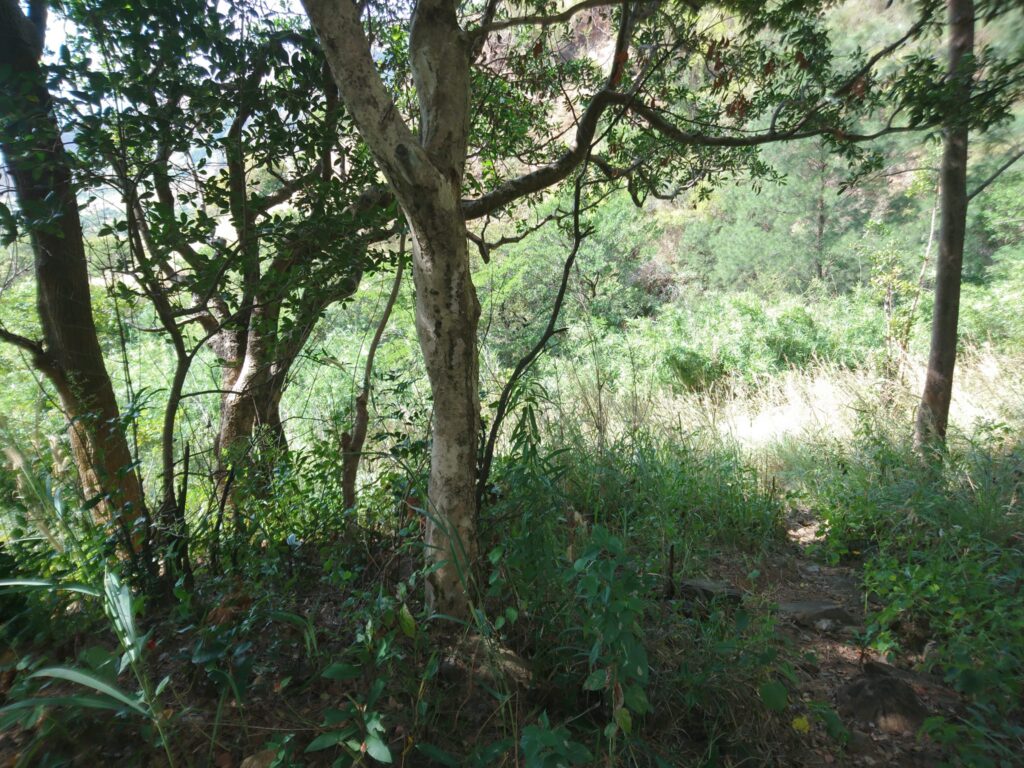
Then our group reached the forest around 1 pm. The trail became almost flat but we haven’t reached the end point yet. Agoho trees are all over the place. It’s good for us that the trails are now covered with a lot of trees so we don’t have to worry about the sun’s heat. We’re just navigating to this forested trail for 45 minutes. Later we reached the base of Mt. Balingkilat.
From this point, we are now walking on the flat open trail exposed to the sun. This part is notorious for its heat. We feel the heat again because there are no trees at all and since it was midday, the sun intensified greatly. I drink a lot of water to quench my thirst when we rest for several minutes. On the other hand, we are almost at the beach.
Then I have the last glance of Mt. Balingkilat peak on my way to Nagsasa Cove. We take photos of the mountain as a return ticket to a moment otherwise gone.
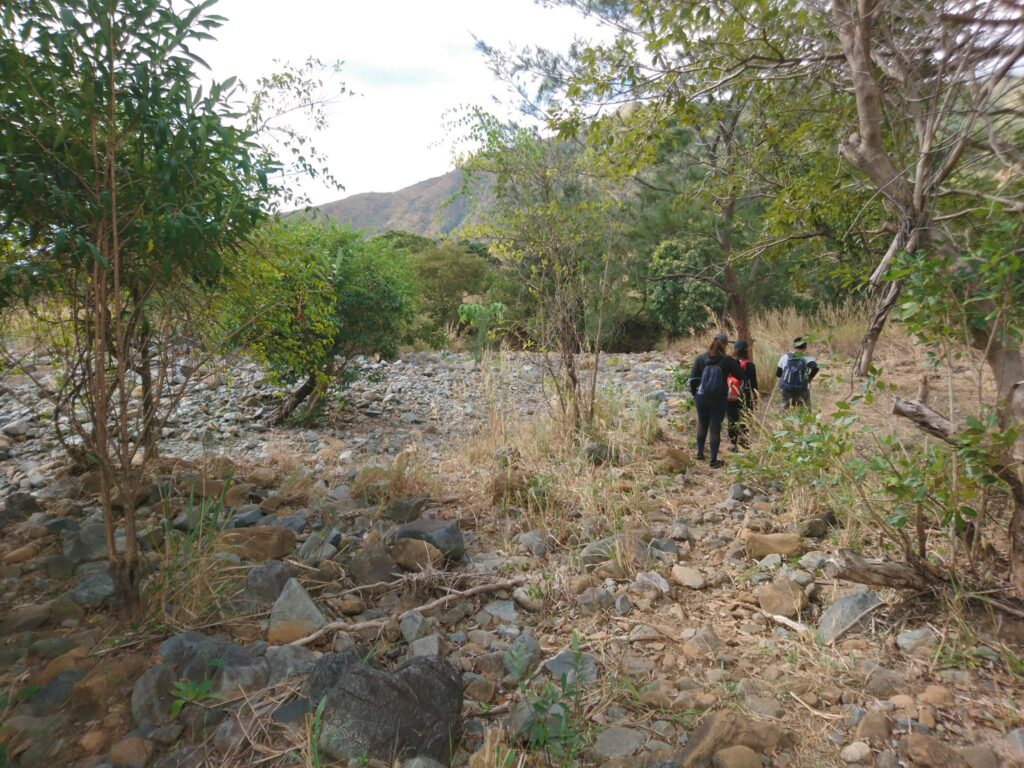
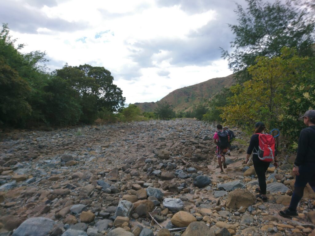
Then we passed by some river systems that have totally dried up. Later we finally saw some houses and the dogs welcomely barked at us. Then we take a much-needed rest near the house thanks to the warm locals who offer us a seat. In my opinion, the descent is much more challenging than the ascent because of too much exposure to the sun. It takes us five hours to descend in the unbearable heat.
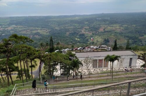
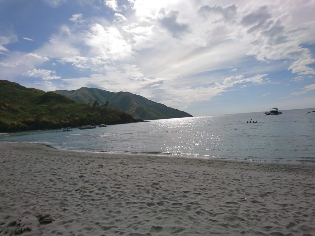
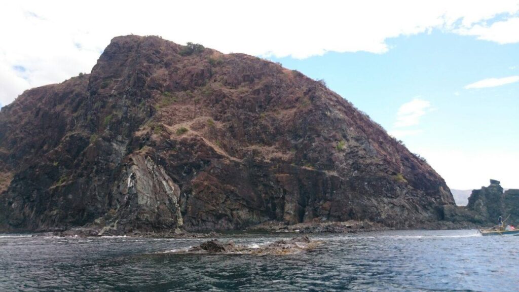
Finally, we reached Nagsasa beach around 2 pm. It is one hell of a hike and a tough climb but it’s an amazing fulfillment. Our group successfully completed the Mt. Balingkilat traverse in 11 hours. We’re glad we made it. It was a solid experience doing a major climb again. Mt. Balingkilat traverse to Nagsasa Cove has a total of 14-kilometer trail length from Sitio Cawag to Nagsasa Cove.
The place is peaceful and not overcrowded. It was so beautiful that we took a moment to appreciate it. We’re having a laid-back afternoon and a good beach vibe. It was a perfect time to relax and take a nap. Also, the view is awesome. We ordered pancit canton and juice at the sari-sari store for our snack. I experienced tranquility as I walked along the shores. The fine grey sand and gentle waves in the cove make it one of the best beaches in the Philippines.
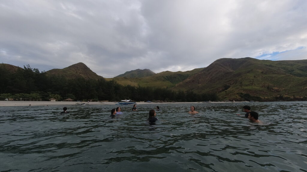
We swim at 4 pm. It is a perfect way to end the day with a refreshing dip. Swimming after a tiring hike is happiness. The relaxing waters were just enough to relax our tired muscles. It was also a time to get to know more of the group members. The weather is not too hot and the water is cold already.
We swam for almost one hour. We’re having fun swimming, we enjoy the beautiful view, we share thoughts about the major climb we did earlier, we share some jokes and the reality of hiking Mt. Balingkilat. Other members of the group said that they would not repeat Mt. Balingkilat’s traverse to Nagsasa Cove again. It’s a once-in-a-lifetime adventure.
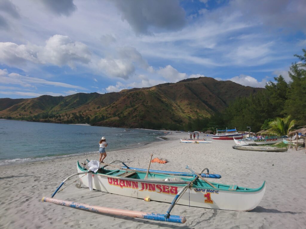
Nagsasa Cove is a relaxing place because of the clear water, white sand beach, and a lot of spacious and clean cottages that are well maintained. Also, the beach is shallow, very much kid-friendly, and less commercialized. I definitely recommend this place.
Our group spent only a few hours in this paradise place as we need to go back to Manila that same day. We rode a motorized boat going to Pundaquit, San Antonio, Zambales at 5 pm. We bid goodbye to the beach.
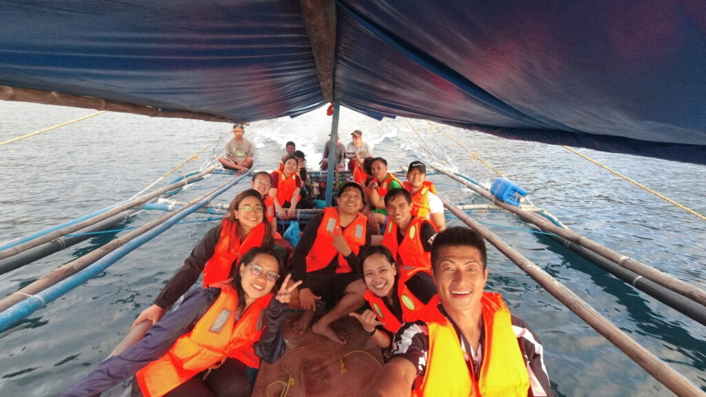
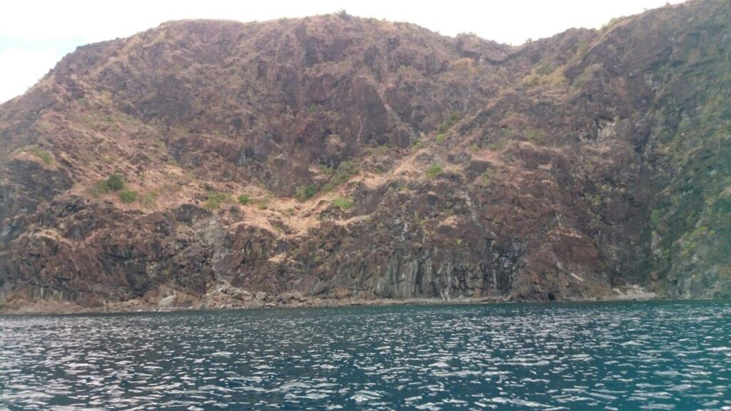
In the middle of the boat ride, we watch the sun fade into the horizon. Also, we saw the famous Anawangin Cove, Capones Island, Camara Island, the Banana boat, and the towering mountains of Zambales. Then later the rough waves arrived but manageable, it added to the thrilling adventure. It is a boat ride that I will never forget. The boat ride lasted for one hour.
We arrived at Pundaquit, San Antonio, Zambales around 6pm. In Pundaquit we wait for our van and after that, we wash up. Later our van departed Pundaquit and headed towards Subic.
Then we have our stopover and dinner at Jollibee near Subic around 8 pm. Around 1 am when we finally arrived in Manila and got home safe and sound. Thanks be to God for guiding us and keeping us safe. Also, I thank everyone for being a part of this fantastic hike. Indeed, it’s more fun in the Philippines. It was a great adventure and an unforgettable experience.
I had a great time in Zambales and I loved it all. Stunning views, big mountains, the wind in the grass, the paradise beach at Nagsasa Cove, and a beautiful view of the sunrise and sunset. I’m so happy that I already explored this lovely place. I live with no excuses and travel with no regrets.
Without a doubt, hike after hike, new and old faces arrive and depart and one day the goodbye you bid a fellow hiker at the jeep, van, or bus terminal will be the last, and all there is between you are memories.
While I was writing this, I felt ecstatic narrating the events of that day, as I truly cherish the beauty of Mt. Balingkilat. Moreover, the appeal of Mt Balingkilat’s beauty is such that it creates this determination inside of an ordinary traveler to dream and explore the extraordinary.
On the whole, my adventure to Mt. Balingkilat sums up with this quote: “The best view comes after the hardest climb.”
Mt. Balingkilat is my eighth major climb. Despite the hardship and a challenging hike that we went through due to intense exposure to the sun, I enjoy hiking this mountain. It is one of the best hiking experiences in my life. Special thanks to the Green Outdoor Tribe group for this awesome trip. For more hiking events, please check their Facebook page group.
Sample 1 Day itinerary to Mt. Balingkilat (Dayhike)
Day 0
9PM – Assembly, meetup
10PM – ETD going to Sitio Cawag, Zambales
Day 1
2AM – ETA Sitio Cawag, final preparation
2:30AM – Start hiking
03:30AM – Assault going to the campsite
6AM – Arrival at the campsite, breakfast
7AM – Summit of Mt. Balingkilat, photo-ops, rest
8AM – Start descend going Nagsasa Cove
10AM – Second water source
12PM – Nagsasa cove, lunch, swim, photo-ops, rest
4PM – Boat ride going to Pundaquit, San Antonio, Zambales
5PM – Pundaquit, wash-up
6PM – ETD going back to Manila, dinner along the way
10PM – ETA Manila
Sample 2 Day itinerary to Mt. Balingkilat (Overnight)
Day 1
7AM – Ride a Victory Liner bus going to Olongapo
10AM – ETA Olongapo City
11AM – Ride a jeep going to Sitio Cawag, Subic
12PM – At the jump-off point
12:30PM – Start hiking
5PM – Arrival at the campsite
7PM – Dinner and socials
Day 2
5AM – Wake up call, breakfast
6:30AM – Assault going to the summit of Mt. Balingkilat
7AM – ETA summit
7:30AM – Start descent and traverse to Nagsasa cove
12PM – ETA Nagsasa cove, lunch, rest, swimming
4:30PM – Boat ride going to Pundaquit
5:30PM – Pundaquit
6PM – Ride a bus going back to Olongapo
7PM – Olongapo, ride a bus going back to Manila
11PM – ETA Manila
Note: this sample itinerary is just a basis and not absolute or will not be 100% perfect due to many factors such as the weather condition, group pacing, traffic, delay, emergency, etc.
Things to bring on your visit to Mt. Balingkilat:
3 to 4 liters of water
Plastic bag
Trail food
Pack lunch
Headlamp or flashlight
Personal medication
Extra cash, clothes, and slipper
Cap, scarf
Jacket, long sleeve
Umbrella
Sunblock
Swimming gear
Toiletries
Whistle (optional)
Raincoat, Poncho (optional)
Neck pillow for the long ride (optional)
Reminders and Tips:
- No guide is no permit to climb Mt. Balingkilat. Registration is required. As per the agreement of the Sitio Cawag officials, a letter of intent must be submitted. It is important that you’ve coordinated with the locals of Stio Cawag because they’ll be getting the name of your guide too.
- The best month to hike Mt. Balingkilat is from October to February when the weather is not that hot. However, if you want to see Mt. Balingkilat in lush green grass rather than the usual brown and dried slope, you may hike during the rainy season. However, the trails are very muddy during the wet season.
- Mt. Balingkilat is a major climb and it’s not for the faint-hearted person. It is not advisable for first-timers and beginners. If this will be your first major climb, you should climb at least two minor mountains or at least be physically active in order to prepare your body for a challenging day hike. Expect this mountain to be a hard climb. If you are an experienced hiker, you will definitely appreciate and enjoy this hike.
- It usually takes four to six hours to reach the summit of Mt. Balingkilat and another four to six hours to reach Nagsasa Cove.
- Seventy-five percent of the trail is open and exposed to the sun so apply sunblock and don’t forget to bring other sun protection. Sometimes hiking to the summit can get cold but when trekking down it gets hot due to less shade.
- Bring at least 3 to 4 liters of water. This is very important as there is only two water source at Mt. Balingkilat. Water discipline is a good skill to have on this mountain. Also, pack light and bring only the things you need for the hike.
- The golden rule of traveling – Leave No Trace (LNT). Take nothing but photographs, leave nothing but footprints, and keep nothing but memories.
- Do not leave your trash and bring your own trash when you go down. Bring your own garbage bag or plastic bag. Always be a responsible hiker. Also, no picking of flowers or plants, and do not litter. Keep Nagsasa Cove clean.
- Respect the place and the locals. Zambales is the home of the native Aetas and we are only there to visit the mountain. The Aeta tribe is believed to be the first inhabitants of the Philippines.
- Cell Phone signals and electricity are not present in Nagsasa Cove. On the other hand, Cell Phone signals are present in Pundaquit.
- Wear appropriate clothing that will cover your skin to avoid the scorching heat of the sun, minor scratches, and itchy skin.
- Pay attention to the weather forecast and announcement before you hike Mt. Balingkilat.
- Dim trekking is highly recommended. Start the hike early morning probably at 2 am or 3 am if you’re doing a day hike. In order not to spend the night on the trail. Also, make sure to bring your own flashlights or headlamps.
- Flying drones is allowed.
- Nagsasa Cove fee:
Entrance Fee – 70 pesos per person
Overnight Fee – 150 pesos per person
Cottage/Hut Rental Fee (Day) – 100 pesos per cottage
Cottage/Hut Rental Fee (Overnight) – 200 pesos per cottage
Tent Rental Fee – 400 to 500 pesos per rent
- Last but not least, I highly recommend getting a packaged tour when you plan to hike Mt. Balingkilat. Included in the package tour is Round Trip private van transfer Manila-Zambales vice versa, boat rental, tour coordinator, driver’s fee, guide fee, registration fee, Nagsasa Cove fee, and cottage fee.
How to Go to Mt. Balingkilat
By commute
1. Go to Cubao Bus station and ride a Victory Liner bus going to Iba, Zambales. Then tell the bus driver to drop you off at the PNP Station of Subic.
2. Then ride a tricycle going to Sitio Cawag, Mt. Balingkilat’s jump-off point.
Another option
1. Ride a Victory Liner bus in Cubao going to Olongapo, Zambales.
2. From Olongapo, ride a jeep going to Subic and then ride a tricycle going to Sitio Cawag registration site.
Note: please check the Victory Liner website for schedules and fares.
Overall, I hope this Mt. Balingkilat Traverse hiking guide and reference have been helpful to you and inspired you to try. Moreover, don’t forget to share this with your friends or groups if you ever plan on doing the Mt. Balingkilat traverse to Nagsasa Cove day hike. Hope to see you on the trail. God bless you in all your future travels and hiking adventures.
Jervis Ergino
Hi! I’m Jervis Ergino, the digital content creator behind Hike to Mountains, a travel and hiking blog in the Philippines. This blog is dedicated to helping people know more about the best hiking and tourist destinations in the Philippines.