Tarak Ridge Dayhike Guide (Itinerary + Tips)
Introduction
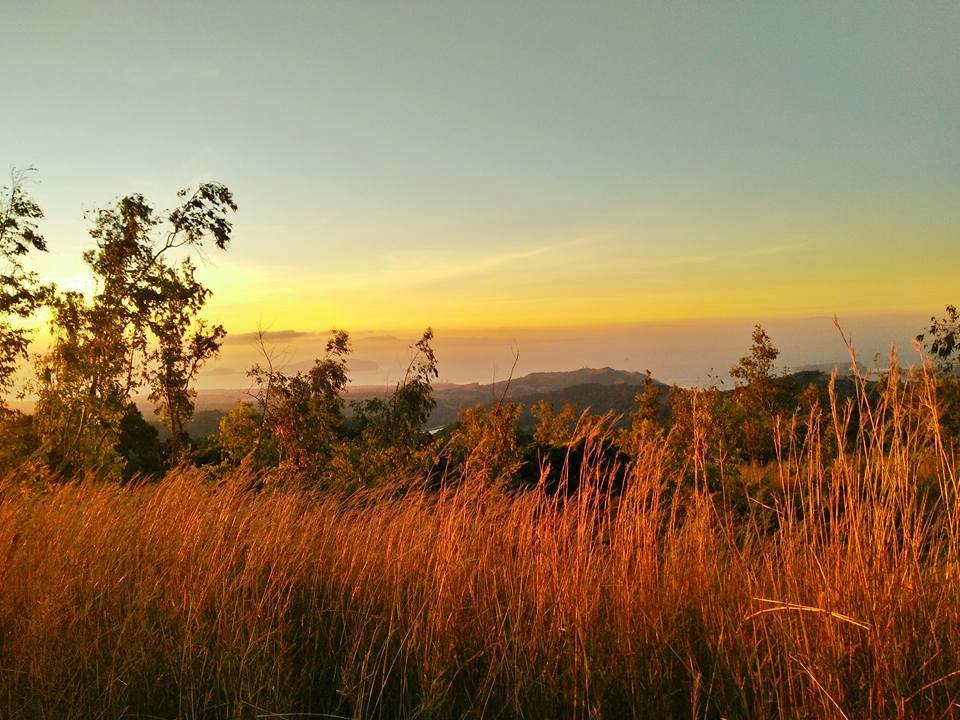
Tarak Ridge is located in Mariveles, Bataan. It offers a picturesque view of Manila Bay, Corregidor Island, and some parts of Manila and Cavite. Tarak Ridge has an elevation of 1,006 meters above sea level while the Tarak Peak height is 1,130 meters above sea level.
According to the locals, Tarak Ridge is a combination of “Tabak” and “Tarik”. Tabak is a Tagalog word that means “hunting knife” while Tarik means “steep”. It was said that the mountain was named as such due to the abrupt length of the ridge and steepness of the trail.
Tarak Ridge also known as Mt. Tarak is a popular hiking destination among seasoned hikers and mountaineers because of its challenging trail composed of craggy surface, rugged terrain, steep ridge, and forested trail. Also, it is only a three to four hours drive from Metro Manila. Tarak Ridge is just a part of the larger crater of Mt. Mariveles where Pantingan Peak is considered as the highest peak. Mt. Mariveles is considered a dormant stratovolcano because it hasn’t had an eruption for years and it has a crater at the summit. Today, Mt. Mariveles is an inactive volcano.
From Mall of Asia or Roxas Boulevard, one can see the silhouette of Mt. Mariveles to the right side during the sunset. Tarak Ridge is usually hiked on a one day itinerary but an overnight hike is more worthwhile because it gives you more time to admire and appreciate its elegance, beauty and panoramic views. The main jump off-point of Tarak Ridge is situated at Barangay Alas-asin, Mariveles, Bataan.
Name: Mt. Tarak
Difficulty: 4/9
Elevation: 1,006 MASL (Tarak Ridge), 1,130 MASL (Tarak Peak)
Jump-Off: Barangay Alas-asin, Mariveles, Bataan
Hours to summit: 5 to 6 hours
Features: forest, Papaya River and impressive view of Manila Bay, Bataan, Corregidor, Manila and Cavite.
My trip to Tarak Ridge
I was happy when my co-buddy invited me to hike Tarak Ridge. I’ve never been to Bataan province and I accepted the invitation immediately. Before the hiking event, I already did some major climbs so this is not new to me and I thought I’m well prepared for doing another major climb. This was my next major climb after my demanding climb in Mt. Tapulao.
I obey the itinerary in the group chat and I arrive at our assembly place in Cubao past 1 am. When everyone in the group had already arrived, our van left Cubao and headed towards Mariveles, Bataan. It was 5 am when we arrived at the main jump-off point of Tarak Ridge after three hours of land travel. The organizer secured our guide and did registration for us while we were preparing for the things we needed on the hike.
After preparing and finishing eating our breakfast, our group along with the guide circled and had a short prayer to the heavens. After that our hike commenced. The initial part of the trail is very easy just walking on a well-established flat trail for 25 minutes. It was still dark when we reached Nanay Cording’s house and we took pictures and gave some donations. Then she told our group to be very careful during the whole climb.
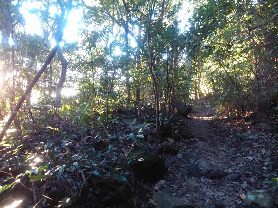
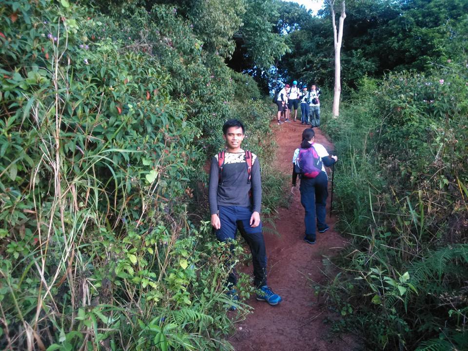
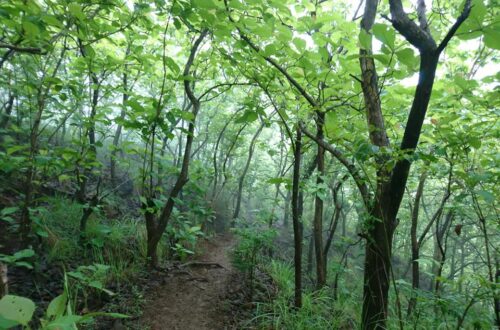
Then after several minutes of walking, the trail becomes a wide forested pathway. It is a combination of short ascent and descent. Later the sun rose and I started seeing the lush green of the mountain and the ridge section. The view was very attractive to the eyes and the fresh air was totally refreshing to the body. Luckily for our group, this mountain is still not overcrowded even during the weekends.
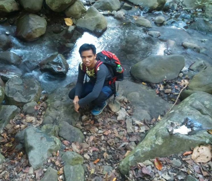
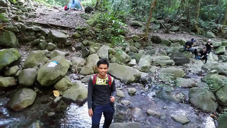
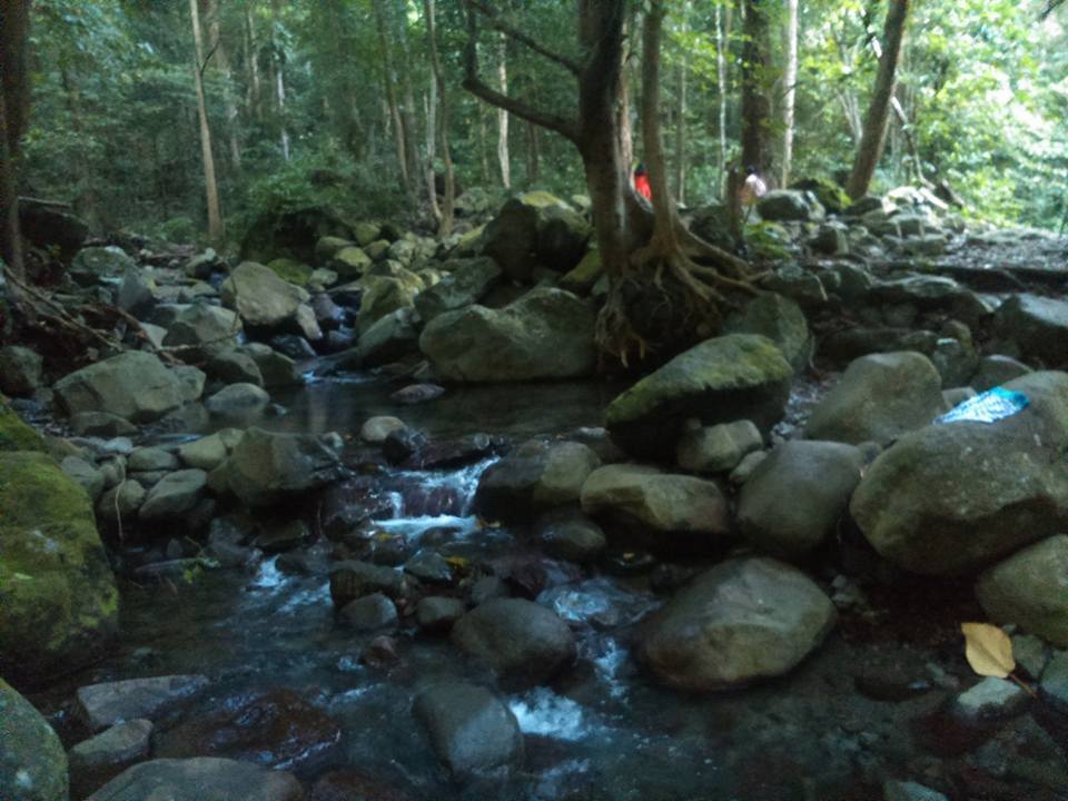
After two hours of hiking, we reached the Papaya River. According to our guide, the water in the river is safe to drink so we refill our bottle at the river and take a much-needed long rest before the assault. As we rested, I noticed that Papaya River is so clean and cool. It is such a nice place for camping. Also, I can hear the beautiful song of the bird and I can see lots of insects, butterflies, and spiders. After eating our trail food, we continued the hike going to Tarak Ridge.
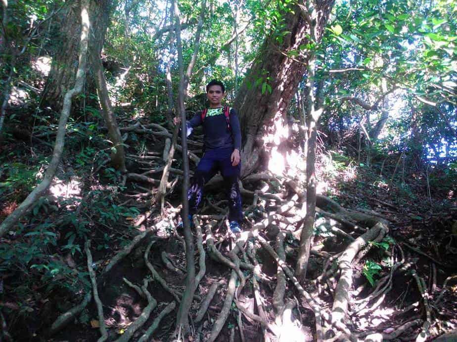
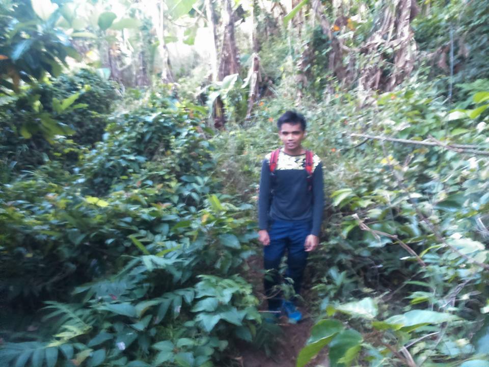
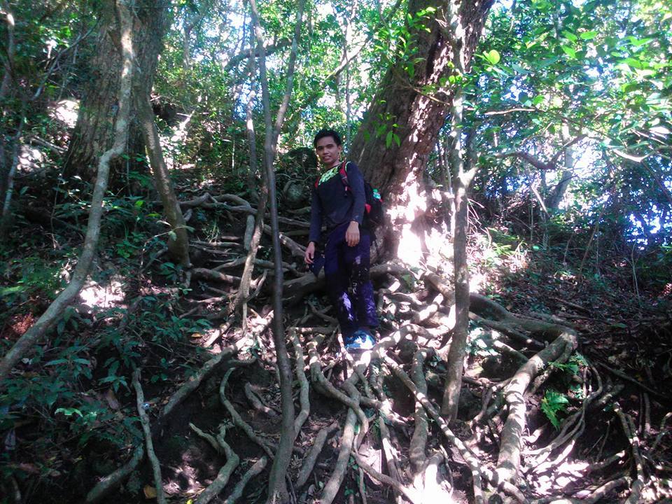
The trail becomes a continuous straightforward assault composed of large tree roots, branches, and twisting vines in dense forest. Our group needs to hold on to whatever large roots and branches are available along the moderately forested trail to avoid any injuries and to move forward. We use both hands and feet while climbing the vertical ascent. As we lift up our heavy bags, we can see a few fallen trees that obstruct the trail. In addition, the greenery and flora were too chunky. As a result, I’m sweating heavily as we go up the mountain.
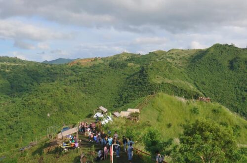
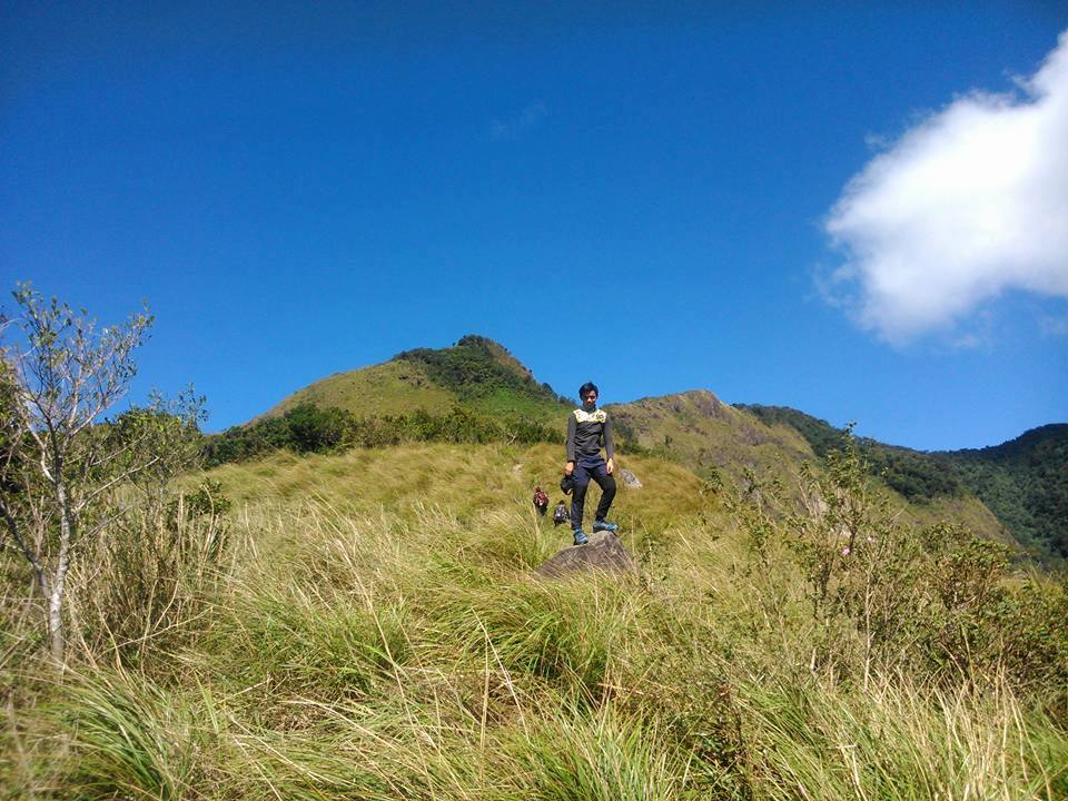
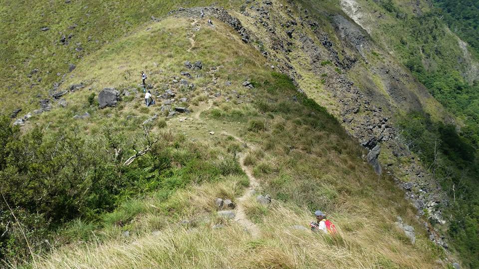
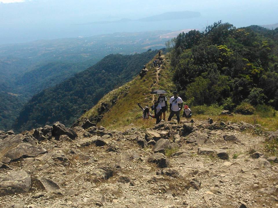
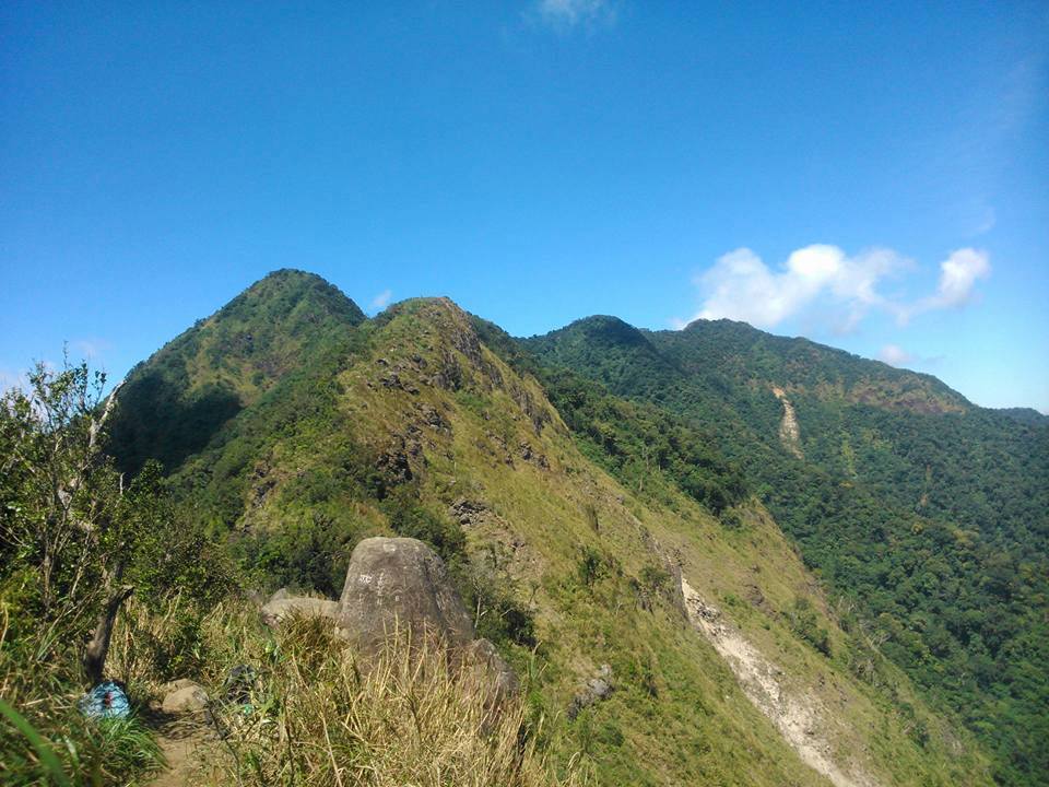
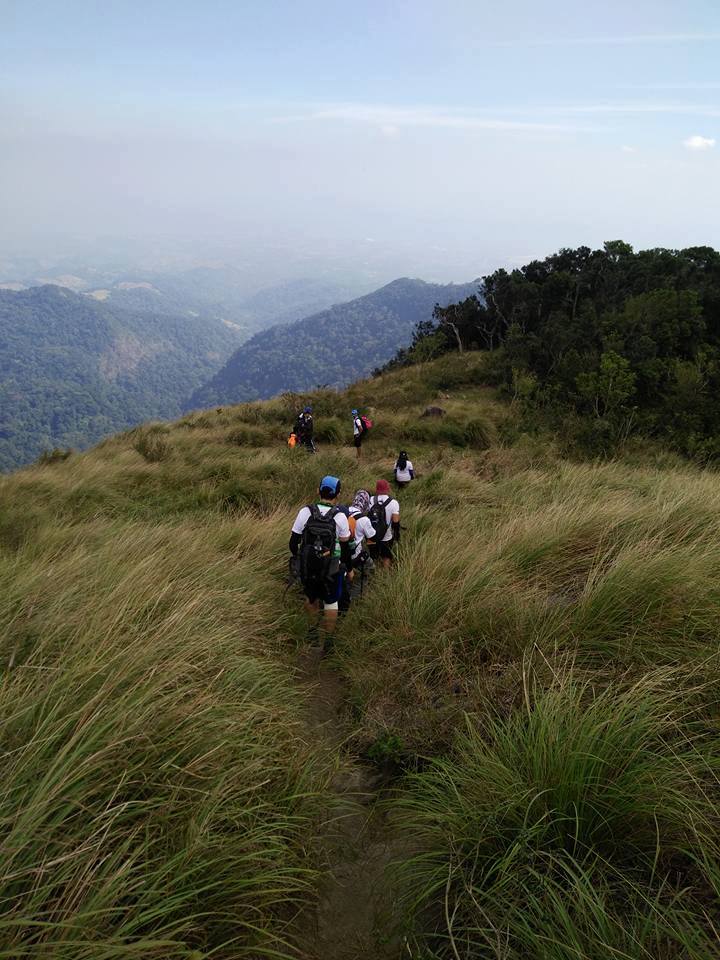
Although the assault from Papaya River to Tarak Ridge is very manageable, we take many breathers along the way. On the other hand, the good thing about the trail going to Tarak Ridge is it is covered with numerous trees that offer shade from the direct heat of the sun. Moments later, we encountered and greeted some hikers going down the mountain. We thought they did an overnight at the campsite. Then as we were nearing the ridge the trees started to disappear and I saw a glimpse of the town, Corregidor Island and Manila Bay.
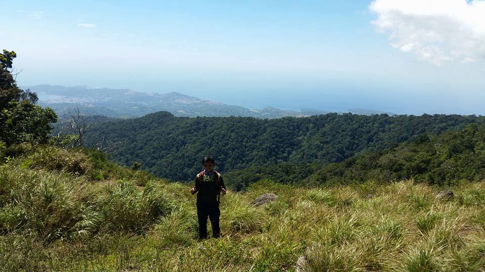
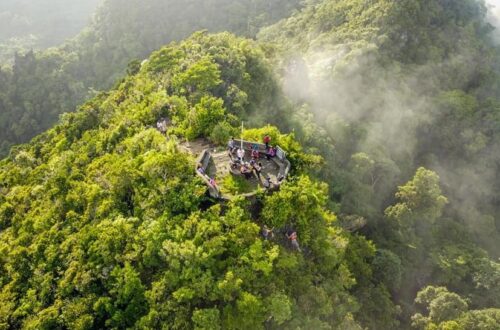
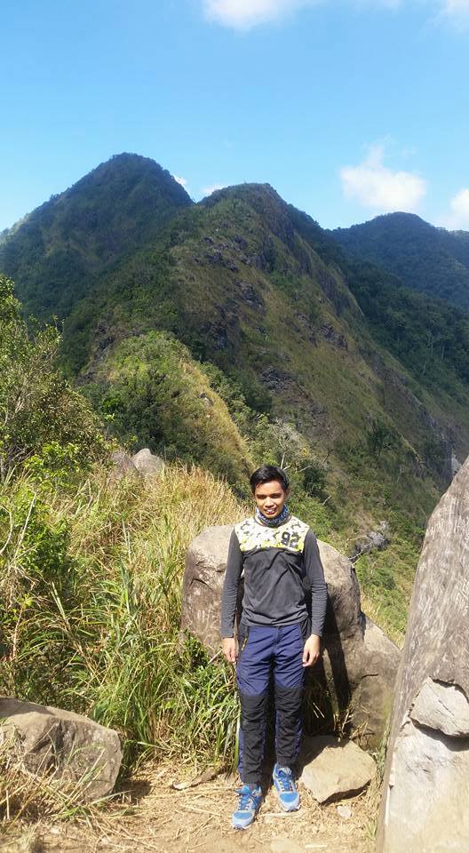
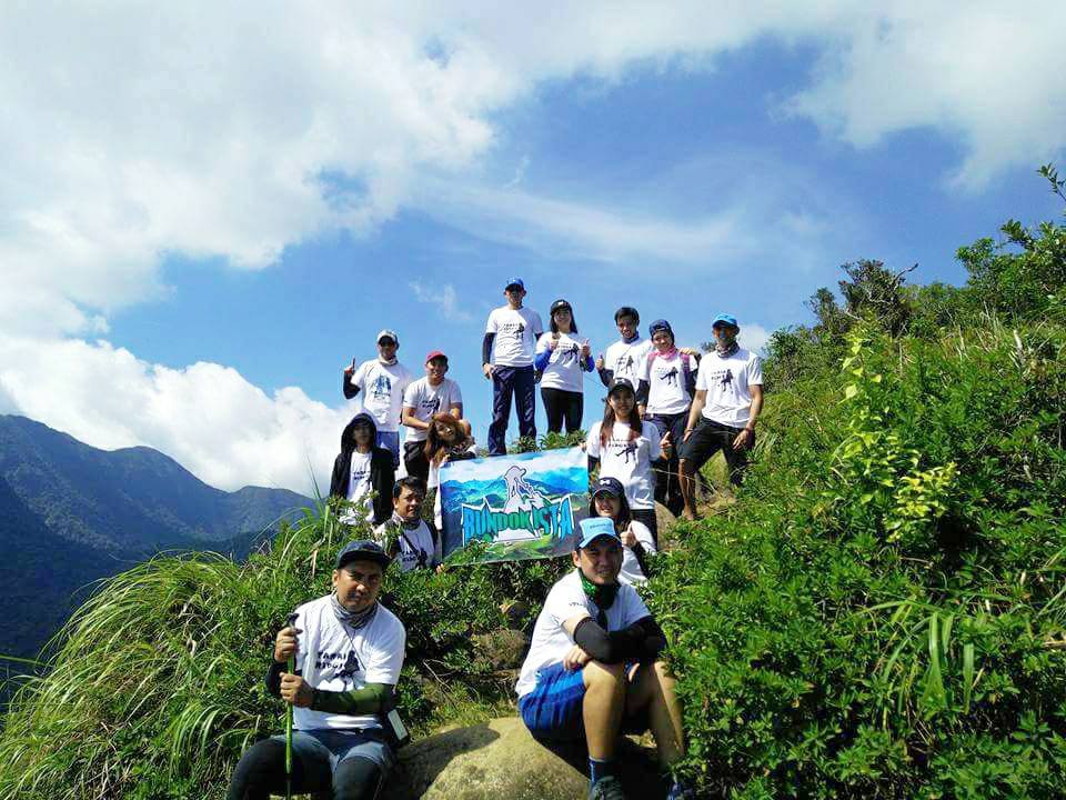
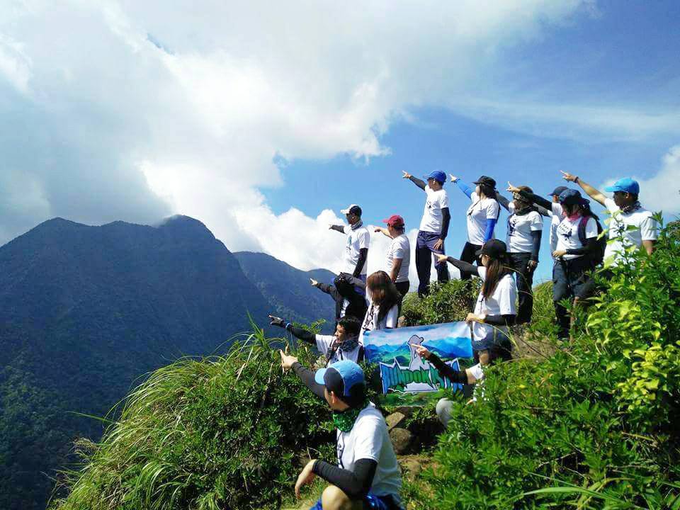
We entered the shrubby grassland section and arrived at the Tarak Ridge around 9 am. It takes us nearly two hours to reach the Tarak Ridge coming from the Papaya River. Our group took pictures at the lovely and windy ridge while we were waiting for some members to arrive at the ridge. The ridge provides us with a perfectly picturesque spot for snapping pictures and videos. The view at the ridge is breathtaking. Tarak Ridge is indeed an exciting spot.
Then we rested under the tree on the left side of Tarak Ridge. We shared some thoughts and perspectives about the ascent going to the ridge and later we took a quick rest.
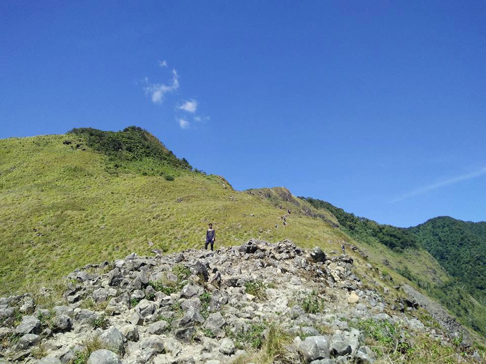
After resting and regrouping, we recommence the hike. Tarak Ridge is wide open and it is fully exposed to the direct heat of the sun. Also, the wind is so strong. We feel the gusts and noisy wind coming from the South China Sea. For this reason, some of the members lose their cap and hat while going up the ridgeline. I wanted to open my umbrella but I thought my umbrella would be destroyed because of the strong force of the wind.
Nevertheless, we proceeded and hurried up to go to Tarak Peak. The trail is so rocky and so steep. We do trail runs to reach Tarak Peak to avoid the direct heat of the sun. Along the ridgeline, I asked myself, why do I love hiking? Why do I keep testing myself over and over again?
To be honest, I don’t have explicit answers to these questions but whenever the mountain calls, I always come and go. It’s the same sentiment I get in Tarak Ridge and it just feels good whenever I’m hiking and I just personally favor peace.
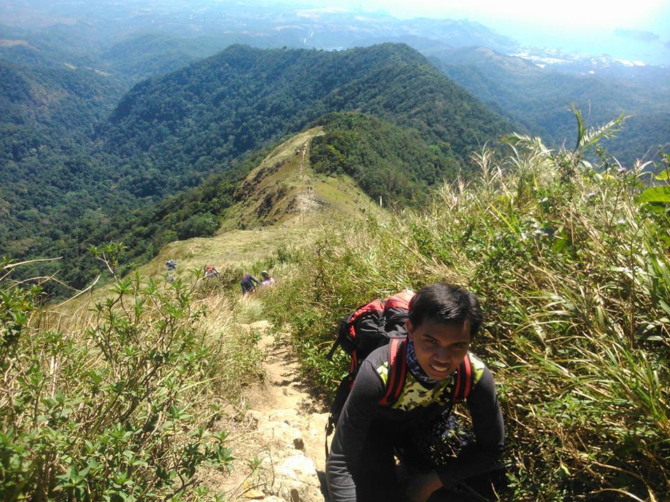
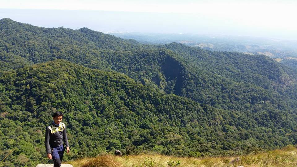
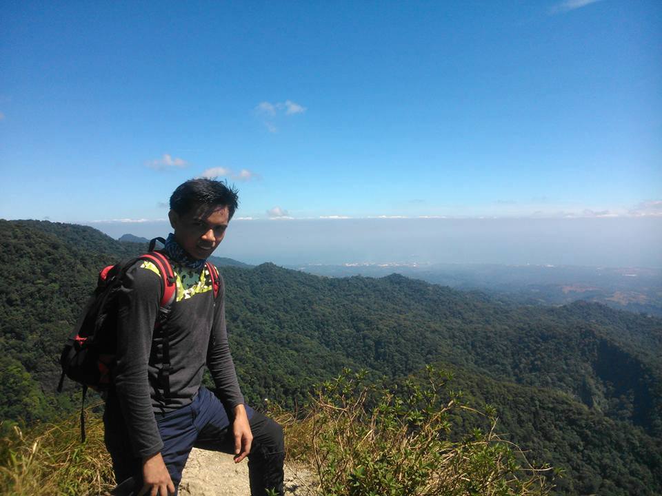
After some 37 minutes of continuous assault, we reached the Tarak Peak at 10:45 am. It took us almost six hours to reach the summit but it was all worth the sweat. Reaching the top of the mountain is an emotional accomplishment to us. Our group has a good clearing and we can clearly see the astounding and gorgeous view of Manila and Bataan including the Five Fingers Cove of Mariveles. It is a 360-degree view.
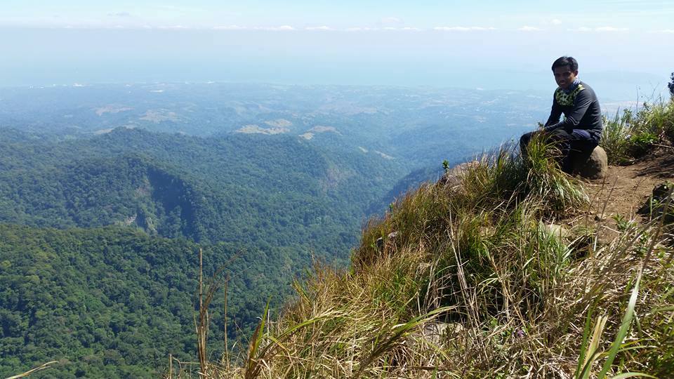
We explored the place and took our group pictures at the summit of Mt. Tarak. It was very relaxing at the top of the mountain. The freshness of the air along with the chirping of birds is really a good thing to watch.
Then later we have our lunch under the shade of the trees. As we took our lunch, our guide told us some mountains we could see at the summit like Pantingan Peak, Mt. Vintana, and El Saco Peak. He also told us that 75 percent of the trail in Tarak Ridge passes through fairly chunky woodland. A few minutes later, we took a nap.
After taking a nap and having a moment of serenity, we started our descent going back to Tarak Ridge around 12:30 am. Some of the members trail run on the way down while others like me are walking slowly but firmly.
I managed to take some pictures of the beautiful scenery of Manila Bay and Bataan even though it’s very hot going down the ridgeline because there are no trees. However, it’s full of life and colors down there. I’m a nature lover and I truly appreciate the beautiful mountain. God is so good to have these delightful and simply amazing creations.
As we go down the forested trail, we share with each other our last piece of trail food. Descending through the same pathway, climbing down rocky and steep slopes, we reached Papaya River in about two hours.
We took a quick dip in the clear river, refilled our water bottles, shared some jokes and took a rest while waiting for the other members of the group to come in. Then after we regrouped and relaxed, we resumed our descent going back to the jump-off point.
One hour later, we reached Nanay Cording house and bought some food and cold drinks to please our tired bodies. Also we deposited our remaining trash in our bag at the mini store and bought some souvenirs like t-shirts. We reached the jump-point of Tarak Ridge around 6 pm and it was already dark when we washed up and took a shower.
After that, we went inside the van and we bid goodbye to our local guide. Then our van heads back to Manila. It was 10 pm when we arrived at Manila intact and alright. Indeed, it was such a great and awesome hiking experience in Bataan.
Tarak Ridge is truly a challenging major day hike. I have so much fun while hiking. This is undoubtedly one of the most outstanding hikes I’ve ever done. The hike is actually moderate in terms of difficulty but the fulfillment of reaching the ridge and the summit is very satisfying. Thanks be to God for giving us the strength and endurance to finish the hike successfully. Moreover, thanks to the Bundokista group for organizing the Tarak Ridge dayhike event.
Overall, my trip to Tarak Ridge sums up with this quote: “The summit is what drives us but the hike itself is what matters.” I love hiking and it is easy to admire nature or look at its beauty but if you try to hike it you will appreciate it more.
Tarak Ridge is my fourth major climb. The trail to Tarak Ridge is very precipitous, one should go on both hands and feet while hiking. 13 hours of hiking is no joke. It is a pretty lengthy and tiring trek. The art of agony. I learned that when you’re exhausted, just rest but don’t give up. Also, this hike taught me that when you’re on the brink of giving up, thou-shalt-not yet because there is a spectacular 270-degree view of Bataan which includes the islands of Corregidor and neighboring islands, as well as Manila Bay all the way to Cavite province.
Sample 1 Day itinerary to Tarak Ridge (Dayhike)
12AM – Assembly, meetup
12:30AM – ETD going to Barangay Alas-asin, Mariveles, Bataan
4AM – ETA jump-off point of Mt. Tarak, registration, secure guide and breakfast
4:30AM – Start hiking
4:50AM – Nanay Cording’s house
7AM – Papaya River, rest
8:30AM – Tarak Ridge, photo-ops, rest
9AM – Assault to Tarak Peak
9:30AM – Tarak Peak, rest, photo-ops, lunch
11AM – Start descending
1PM – Papaya River, wait for rest of group
3PM – Arrival at jump-off point, wash-up and logout
4:30PM – ETD going back to Manila, dinner along the way
9:30PM – Arrival at Manila
Sample 2 Day itinerary to Tarak Ridge (Overnight)
Day 1
4AM – Meetup at Cubao
4:30AM – Ride a bus going to Balanga, Bataan
8AM – ETA Balanga, ride a mini-bus going to Barangay Alas-asin
9:30AM – Arrival at the barangay hall of Alas-asin, register and secure guide
10AM – Start hiking
12PM – Papaya River, lunch, take pictures
12:40PM – Resume hiking
3PM – Tarak Ridge, set up a tent
4PM – Assault to Tarak Peak
5PM – Start descent
5:30PM – Tarak Ridge, sunset viewing and prepare dinner
6:30PM – Dinner and socials
9:30PM – Lights out
Day 2
6AM – Breakfast, sunrise viewing, break camp
8AM – Start descent
9:45AM – ETA Papaya River, swimming and photo-ops
12:45PM – Back at jump-off point, wash up and lunch
2PM – Ride a mini-bus going back to Balanga
3:30PM – Arrival at Balanga, ride a bus going back to Manila
7:30PM – Manila
Note: the above sample itinerary is just a premise and not absolute or will not be 100% ideal due to many factors such as the weather condition, group pacing, traffic, emergency, etc.
Things to bring on your visit to Mt. Tarak:
Jacket
Umbrella
Trail food like jelly ace, eggs, chocolates and bread
2 to 3 liters of water
Extra clothes, slipper and cash
First Aid Kit
Flashlight or headlamp
Hat or cap
Handkerchief or scarf
Personal medicine
Toiletries
Plastic bags
Dri-fit t-shirt
Tent and Windbreaker if you’re doing overnight
Insect Repellant (optional)
Arm Sleeves (optional)
Gloves (optional)
Sunblock (optional)
Raincoat (optional)
Hammock that is lightweight (optional)
Reminders and Tips:
- Tarak Ridge is a major climb and it’s not recommended for beginners or first-timers.
- Before starting to hike, get the contact number at the Barangay Hall of Alas-asin for emergency purposes.
- Tarak Ridge is considered as a class 3 trail that includes sections with rugged terrain where hikers and mountaineers need to use both of their hands and feet for scrambling across large rocks, steep slopes, or a combination of both.
- Respect the locals and the mountain.
- Getting a local guide in the barangay hall is mandatory or required for the safety of all hikers.
- Wear appropriate hiking shoes especially during the rainy season because the trail can be very muddy and slippery.
- There are several mini-store near the barangay hall where you can have your breakfast.
- Cell Phone signals are mostly present throughout the trail.
- Check the weather forecast in Bataan before you visit the mountain.
- Please don’t use bath soap or detergent at the Papaya River since this is the water source of local communities below.
- For a dinner meal, you can go to The Food Project in Orion, Bataan. Just take note their closing hour is 9 pm.
- It is very cold and windy in Tarak Ridge campsite so better bring a couple of jackets or a windbreaker.
- Tarak Ridge has two campsite locations. First is at Papaya River where most campers camp because they have a water source nearby. The second is at the ridge where hikers can get stunning views of sunrise and sunset but there is no water source here. Take note that the Papaya River is the last water source before the ridge.
- Tarak Ridge is 2 to 3 hours away from the Papaya River. From the Tarak Ridge, the summit or Tarak Peak is less than 45 minutes away.
- I highly suggest getting a packaged tour when you plan to visit Mt. Tarak for ease and convenience. Included in the Tarak Ridge package tour is round trip private van transfer from Manila to Bataan and vice versa, coordinator fee, local guide fee, drivers fee, parking fee, registration fee and environmental fee. On the other hand, excluded in the package tour are porter fees, meals and restroom fees.
- There is a parking area and restroom at the jump-off point.
- The registration fee is 40 pesos per person. Restroom fees range from 10 to 20 pesos.
- Most hikers and campers recommend a 2-day itinerary or camping overnight at the mountain to be able to appreciate the magnificence of the mountain.
- There are no blood leeches in Tarak Ridge but be on guard to every large rock and roots you will step on.
- Observe the Leave No Trace principle. Keep all your trash with you and don’t litter the trail. It’s good to keep the mountain clean and well preserved. Always be a responsible hiker and tourist.
- It usually takes about 4 to 6 hours to reach the summit of Mt. Tarak. The total hike to and from the summit of Mt. Tarak takes twelve hours at a moderate pace.
- The guide fee is 1,200 pesos for a day hike and 1,500 pesos for an overnight climb. Note: All prices are subject to change without notice.
- Make sure that you sleep well before the hike.
- A superb side trip after an overnight hike is Corregidor Island which is just twenty minutes away by boat from Mariveles, Bataan. Another option for a great side trip is Mt. Samat. It is a historical shrine with a giant white cross that commemorates the heroism of Filipino and American soldiers who fought and died against the invading Japanese soldiers during World War 2. Mt. Samat is open from 8 am until 5 pm.
- Take note in commuting the last bus going to Metro Manila is 7 pm. Make sure you are on the highway at 5 pm. On the other hand, the last trip from Balanga, Bataan is 9 pm.
- You may also have a side trip to Mt. Tarak Guest House & Resort which is located in Barangay Alas-asin, Mariveles, Bataan. They have swimming pools and cottages if you want to relax and swim.
How to Go to Tarak Ridge
By commute
- Go to Cubao bus station and ride a bus bound for Mariveles, Bataan. Tell the bus driver or conductor to drop you off at Barangay Alas-Asin. The travel time is approximately three to four hours.
- Then from Barangay Alas-Asin, walk towards the registration site at the barangay hall.
- After registration, walk or ride a tricycle going to Tarak Ridge jump-off point.
By private vehicle
Option 1:
- From Manila, drive going to NLEX (North Luzon Expressway). Then exit at San Fernando, Pampanga.
- After that take Jose Abad Santos Avenue all the way to Lubao Pampanga and Dinalupihan Bataan.
- From Layac Junction, Bataan turns left leading to Roman Superhighway and Balanga, Bataan. Then follow the main road going to Mariveles, Bataan and proceed to the registration site in the barangay hall of Alas-Asin.
Option 2:
- From Manila, drive going to NLEX (North Luzon Expressway) and proceed to SCTEX Subic–Clark–Tarlac Expressway.
- Then exit at Dinalupihan, Bataan and turn right at Roman Superhighway.
- After that, follow the main road going to Mariveles, Bataan and proceed to the barangay hall of Alas-Asin.
There you have it. Hike a mountain and you’ll love it. On the whole, I hope this Tarak Ridge dayhike guide and reference has been helpful to you. Also, Don’t forget to share this with your friends, groups and colleagues if you ever plan on doing a Tarak Ridge day hike too. Thanks for reading.
Jervis Ergino
Hi! I’m Jervis Ergino, the digital content creator behind Hike to Mountains, a travel and hiking blog in the Philippines. This blog is dedicated to helping people know more about the best hiking and tourist destinations in the Philippines.