Mt. 387 Hiking Guide (Itinerary + Tips)
Introduction
The Nueva Ecija province is well-known and recognized as the “Rice Granary of the Philippines” because it is the biggest producer of rice in the country. However, only a few Filipinos know that in the northern section of Nueva Ecija lies an astonishing mountain. One of them is Mt 387. It has an elevation of 724 MASL and is considered one of the most picturesque mountains in the Philippines.
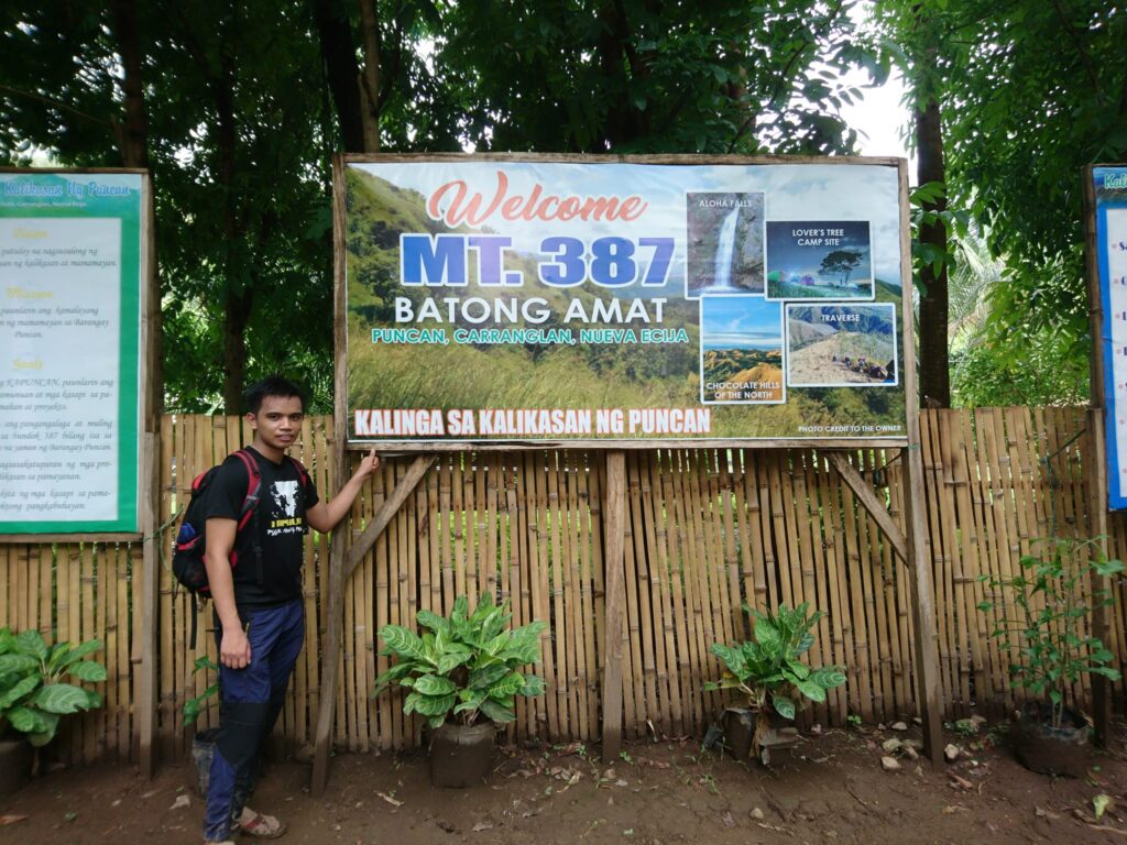
Mt. 387 also known as Batong Amat is located in Barangay Puncan, Carranglan, Nueva Ecija. It offers incredible views and stunning sceneries of the Caraballo mountain range, from the fascinating sunrise to the captivating hills, golden sunset, and its impressive Aloha Falls.
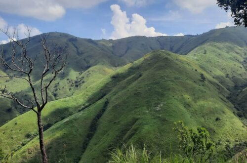
Mt. 387 became one of the most popular hiking destinations in the province of Nueva Ecija among the hikers and campers due to the fact that it was dubbed by many locals and tourists as the Chocolate Hills of the North. At the summit of Mt. 387, one can see the chocolate shapes of the Caraballo mountain range and hills which are identical to the Chocolate Hills of Bohol province.
Surrounded by the hillocks of the Caraballo Mountain Range in Nueva Ecija is the Talavera Watershed Forest Reserve where the hiking trails of Mt. 387 are situated. It was said that the mountain was named as such due to the 387 hectares size of land which belongs to the Talavera Watershed Forest Reserve where Mt. 387 is located.
According to its past history, Mt. 387 was a prominent spot for treasure hunting. It was even reported to be the place where the famous Yamashita gold was buried and hidden. Thus plenty of foxholes and hollows can be found in some parts of the mountain.
According to the locals, the former name of Mt. 387 is Mt. Batong Amat which means “Ghost Rock”. It was named Mt. Batong Amat because it came from the Tagalog word “Batong Maalamat” because many Filipino, Japanese and American soldiers have died and were buried in the mountain during the Second World War and it was rumored that there is a hidden treasure buried in the mountain.
Mt. 387 consolidates just the right component for a significant day hike. It has a demanding fifty to sixty degrees incline assault which is ideal for beginner and experienced hikers. Also, it has pleasant grassy rolling hills for a soothing hike and superb views of the hilly section of the Caraballo mountain range generally referred to as the Chocolate Hills of the North. At the end of the trail is a lovely side trip to the picturesque Aloha Falls.
Name: Mt. 387
Difficulty: Backtrail 2/9, Traverse 4/9
Elevation: 724 MASL
Jump-Off: Barangay Puncan, Carranglan, Nueva Ecija
Hours to summit: 2 to 3 hours
Features: grassland, pine-forested trails, rolling hills, bamboo forest and picturesque views of Caraballo mountain range and Central Luzon region.
My trip to Mt. 387
While I was browsing Facebook I saw a photo that looked like Chocolate Hills. I thought the photo was in Bohol province but when I found out it was actually located in Nueva Ecija province. So I searched the internet and I found out that the Chocolate Hills replica can be seen in Mt. 387. I want to go to Bohol but I don’t have a budget. Since the mountain is located only in Nueva Ecija I will no longer take an airplane to see the famous Chocolate Hills in Bohol.
As the day goes by, the mountains are calling me due to their beauty and proximity to Manila. As a result, I joined an organized trip going to Mt. 387 even though in the past days it has been raining due to the typhoon Domeng. In the news, I heard the typhoon had already passed away but there was still a Southwest Monsoon in the Luzon region that will bring some rain.
The climb date is June 11, 2018. The organizer wanted to cancel the trip but one day before the event she checked again the weather update in Carranglan, Nueva Ecija and she found out it is cloudy but no rain. For this reason, the trip to Mt. 387 has continued. As always I am a solo joiner. I observed the itinerary in the group chat and I arrived at the meetup place in Jollibee Farmers Cubao around 10:30 pm. When all the members in the group chat were completed, the van left Cubao and headed towards the jump point of Mt. 387 which is located in Barangay Puncan, Carranglan, Nueva Ecija.
After almost five hours of land travel, we arrived at the jump-off point. The organizer secured the guide, we registered our name and took our breakfast, and drank coffee to warm our bodies because it was freaking cold outside. Later on, we have a short orientation of Mt. 387 trail to be familiar with different trails of the mountain and their respective difficulties. Our guide even shows us a geographical map of Mt. 387 presenting the safeguarded areas within the terrain.
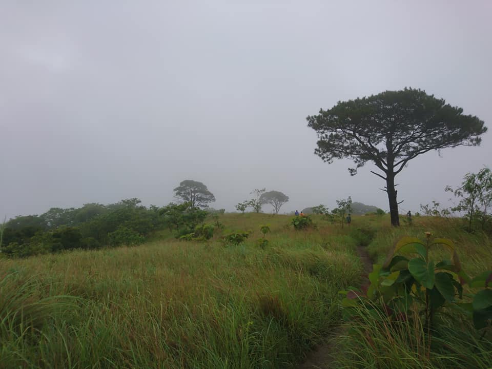
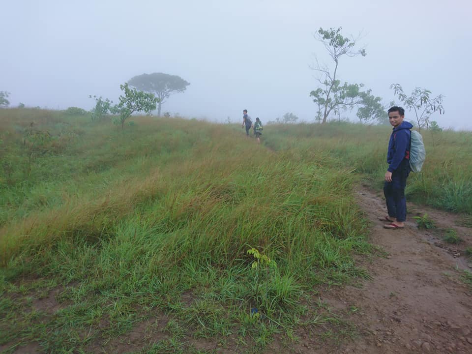
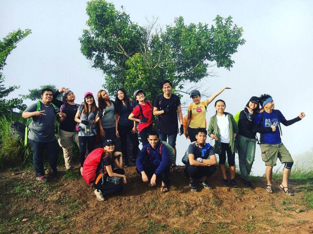
After the orientation of the mountain and paying some fees, our group circled and started praying to God to guide our footsteps, keep us safe and make the hike successful. Around 5:30 am when we started to hike. The initial part of the hike runs on the muddy flat trail that extends to about 200 to 250 meters. Then the trail becomes a continuous mild assault. Some assaults extend to about 250 meters and are very steep. As a result, it catches our breath several times.
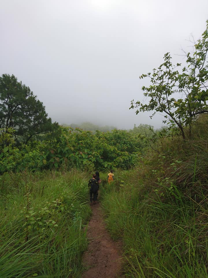
Other assault portions were very short and were easy to cover. It reminds me of my hike in Mt. Mapalad. It is almost the same trail but there’s more assault on Mt. 387 than Mt. Mapalad. There is some flat ground in the assault portion and we have a quick rest while waiting for the other group members to come in. As we rested, the rain started to pour on us. Nevertheless, we don’t have to worry about the rain because all members are well equipped with rain and wind protection.
On the other hand, our group was supposed to have planted seedlings at the top of the mountain but the current weather is not good for tree planting. Torrential rain tends to wash the seedling away. Therefore the tree planting was temporarily stopped.
Before continuing the hike we asked our local guide why the name of the mountain is Mt. 387 and he replied that Mt. 387 was the name of the mountain because it is a part of the Caraballo mountain range which belongs to Talavera Watershed Forest Reserve that has 387 hectares of land.
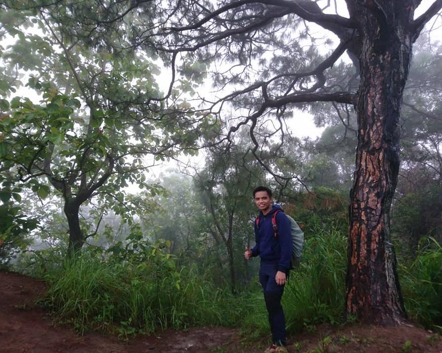
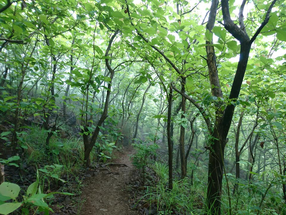
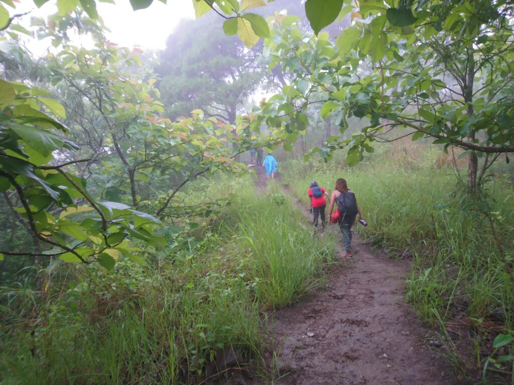
After resting, we continued the hike on a pine-forested trail. This is where many mountaineers take pictures. The final range to the summit was dominated by distinct pine trees. Once the pine tree markers were concealed, a steep assault would follow. After that is a range of grassy flat trails then a short ascent to finally reach the summit. From this point until the campsite at the lovers’ tree is just a walk in the park. We saw another group of hikers along the way and we greeted them.
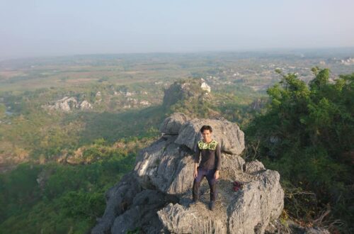
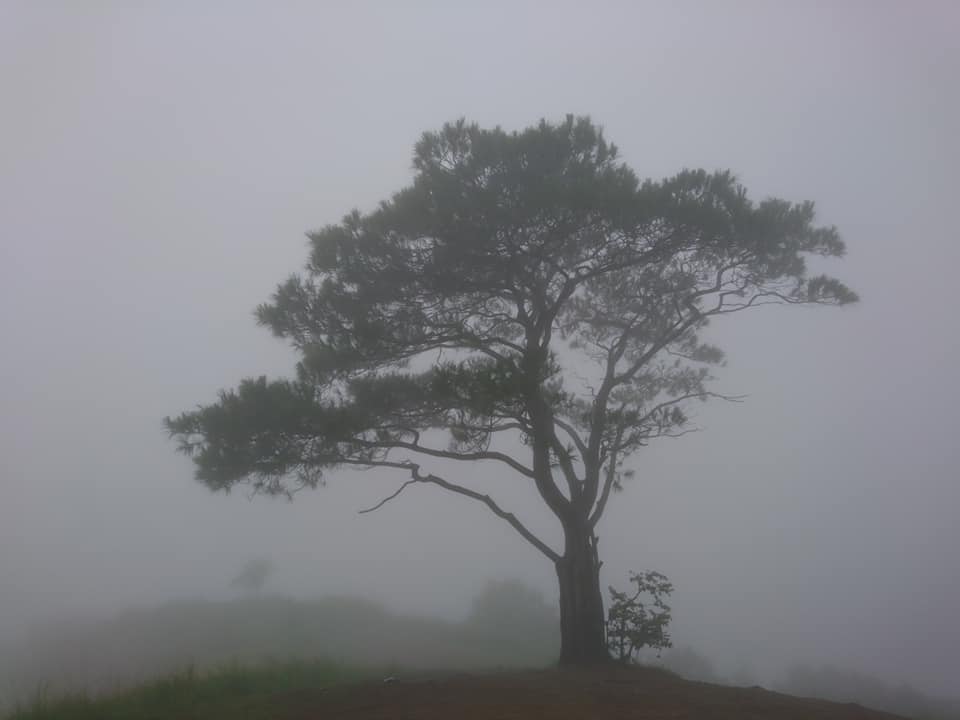
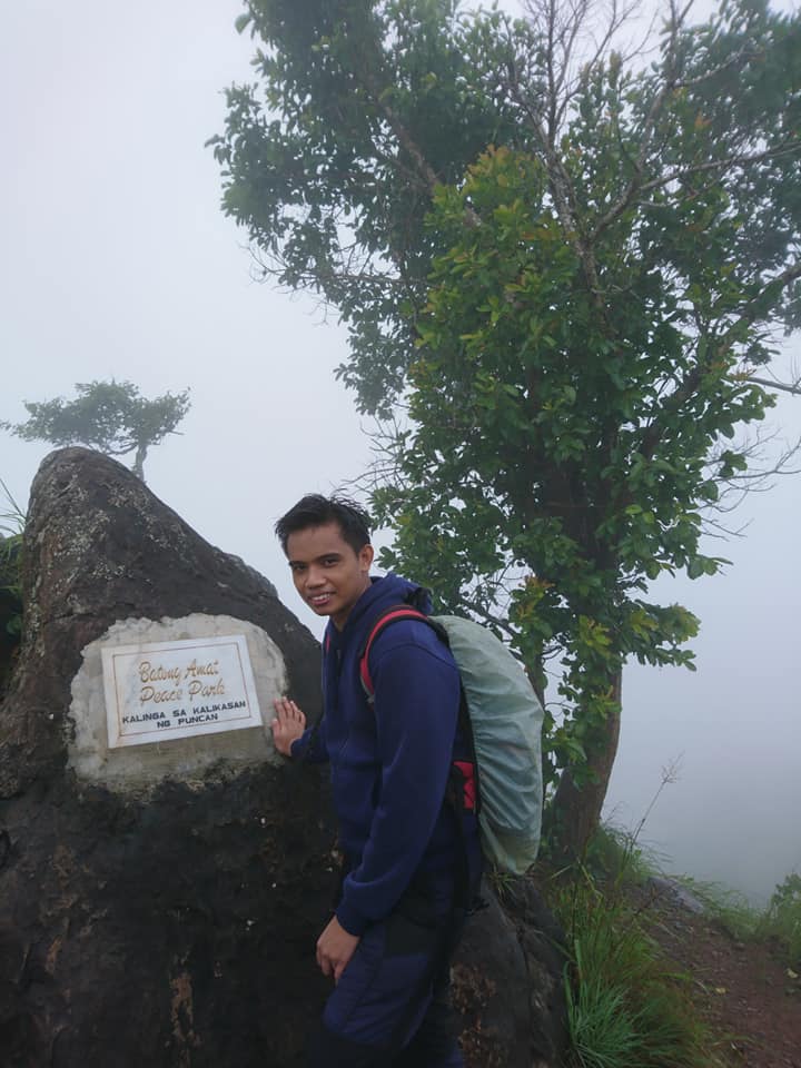
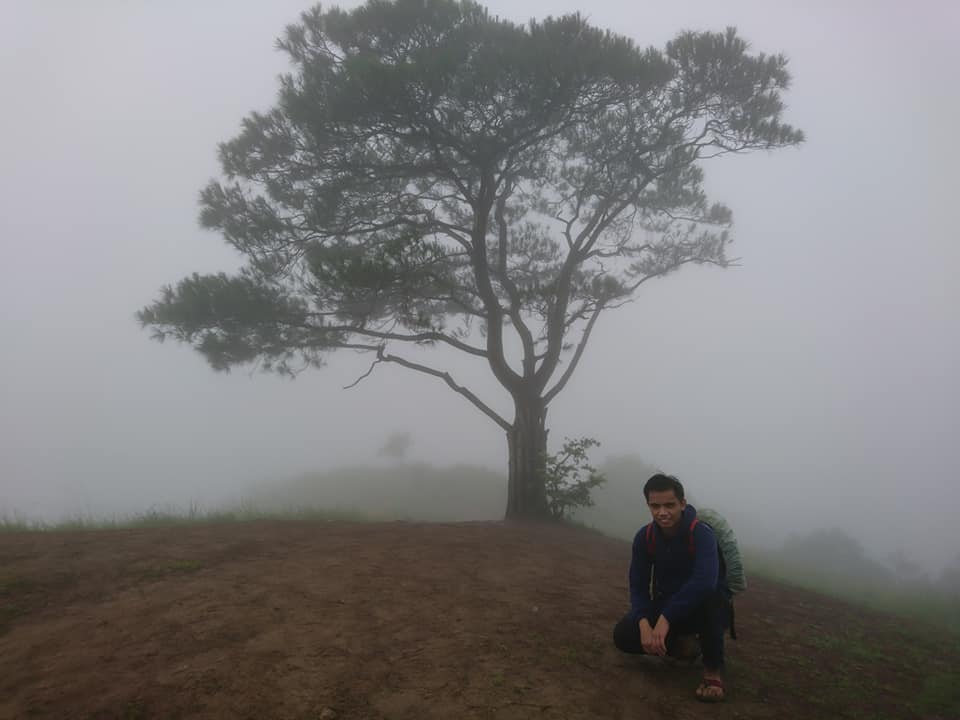
After two hours of hiking, we reached the summit at 7 am. The summit is characterized by huge limestone rock formations also known as Batong Amat Peace Park monument situated on the cliff of the mountain. Mt. 387 summit is a rolling slope that is very similar to the grassland part of Mt. Pulag. Just thirty meters beside the monument is a grassy flat trail where the famous lone lovers’ tree is located.
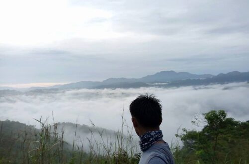
We are hopeful to see a clearing at the summit of Mt. 387 but it didn’t happen. Our group waited for almost one hour at the summit to have a clear view of the surroundings but unfortunately, it was too foggy and the background is white only. We didn’t see any clearing at all, we couldn’t appreciate the scenery and we didn’t see the Chocolate Hills of the North.
According to our guide, if we have a good clearing we can see the scenic Chocolate Hills of the North, the silhouette of Mt. Arayat, TPLEX road, and some mountains in the Sierra Madre mountain range such as Mt. Guiwan and Mt. Bintuod which are regarded as the highest peak in the mountain range.
We are so disappointed because we don’t have a clear view of the surroundings but that’s hiking. It’s not always the view that matters but the journey itself makes it worthwhile. So our group rested at the campsite, had snacks and took photos of the lone pine tree also known to hikers and locals as lovers’ tree.
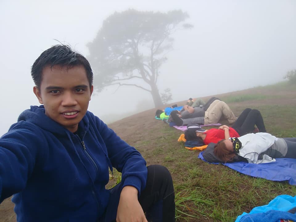
The campsite is so wide and spacious that it can accommodate many campers and I can imagine how impressive the city lights view and the countless stars at night. Our group took many pictures at the summit even though there was no clearing. It is a return souvenir to a moment otherwise gone.
We enjoy the cool breeze, the fresh air, and the swaying trees at the top of the mountain and later take a nap. According to our guide, this summit offers great views of the Caraballo mountain range also known as the Chocolate Hills of the North.
While we exchanged thoughts and laughter at the summit of Mt. 387. Jane, our group leader, said to us that we will backtrail and not traverse because Mt. 387 traverse leading to Aloha Falls is hard, dangerous, slippery and challenging. Also the guide told us that the difficulty of traversing is 4/9 or higher since it was raining so hard and we have some first-time hikers in the group. He said to us that the traverse to the falls is more difficult than the ascent going to the summit. It is very steep, rugged and has almost 75 degree descent. For this reason, we did a backtrail.
So we started to go down and head back to the jump-off point of Mt. 387. Some of the members trail run as they go down the mountain while I just normally walk and appreciate the lush green of the mountain. Also, I had a hard time going down the mountain because it is too slippery. I had to hold on to whatever trunk that was available on the way down. Nevertheless, even though the trail is slippery we cherish the tranquil nature that surrounds us.
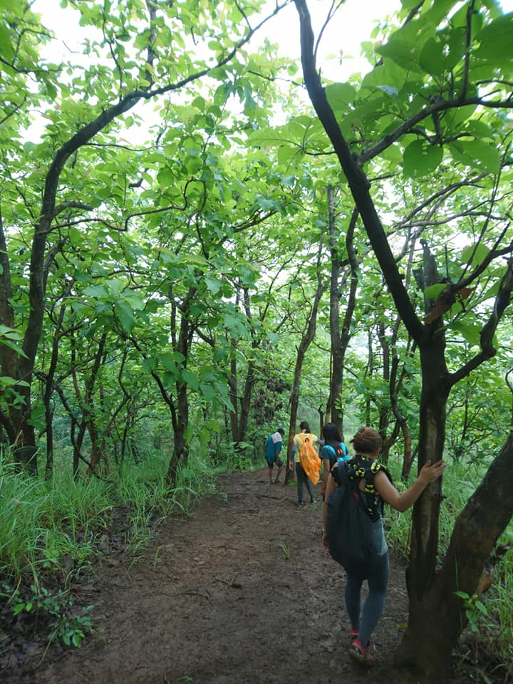
We were having fun while descending, some of the members even slipped on the trail and joked. Then we took a quick rest. As we were waiting for the rest of the group, we took our moment to take pictures at different angles of the lush green. Halfway to our descent, we can see the amazing plains of Nueva Ecija. Our group only takes a minimal rest as we descend.
The descent is smooth and easy towards the end of the trail. We reached the jump-off point after one hour and thirty minutes. At the main jump-off point, we order pancit canton and some snacks to satisfy our exhausted body. The food is great and the locals are very cool. Also, we take pictures at the jump-off point where several banners are spotted. Then we changed our footwear to sandals and slippers because we were going to the falls.
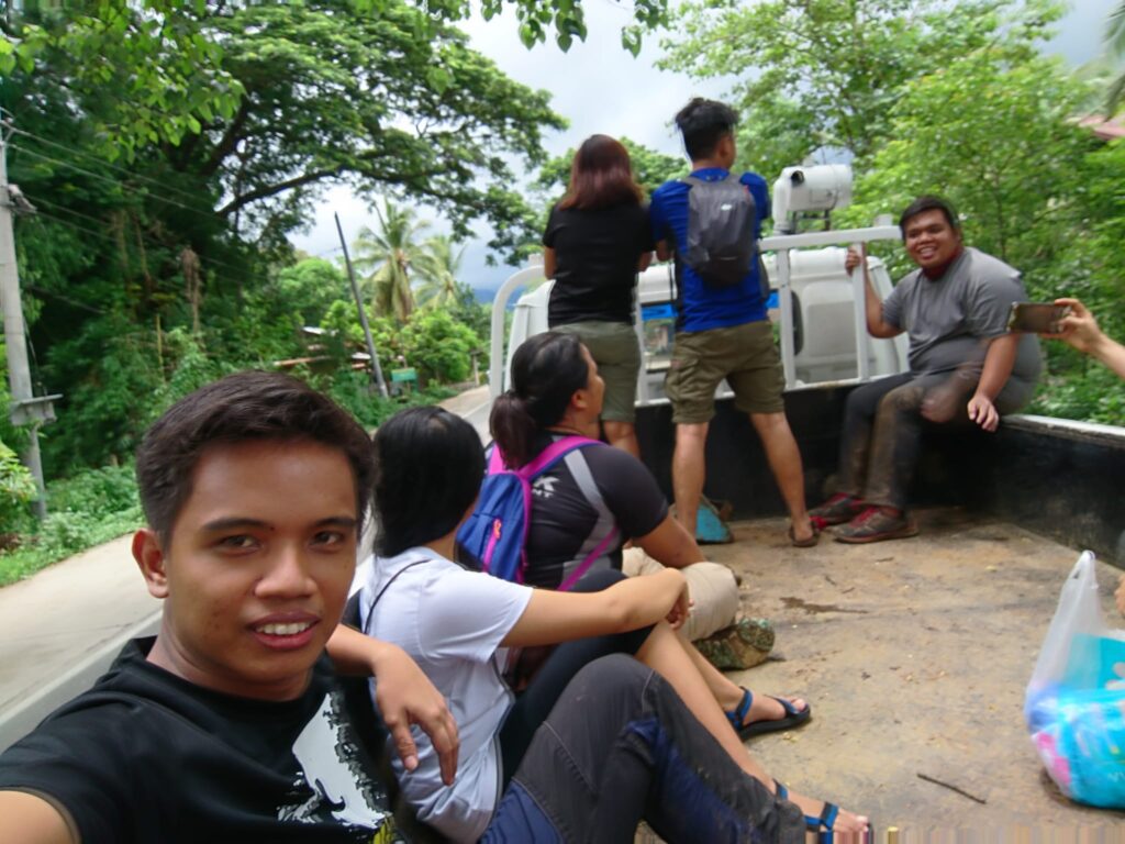
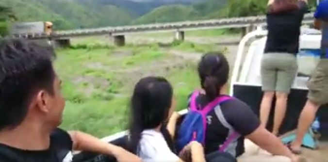
Moments later we rode a 4×4 truck going to Aloha Falls since it is very affordable and pleasant. The ride going to Aloha Falls is bumpy and a thrilling experience. It feels like a festival ride with no safety yoke, and sometimes we are out of balance standing and sitting at the back of the 4×4 truck. We were shouting, joking, and having fun while riding the truck. It is one of my most unforgettable experiences in Nueva Ecija.
After thirty minutes of the bumpy road trip via the 4×4 truck, we dropped off and then walked for a few minutes until we reached the Aloha Falls. As we near the falls, we can already hear the gushing water of the falls. For this reason, we walk fast to see the falls.
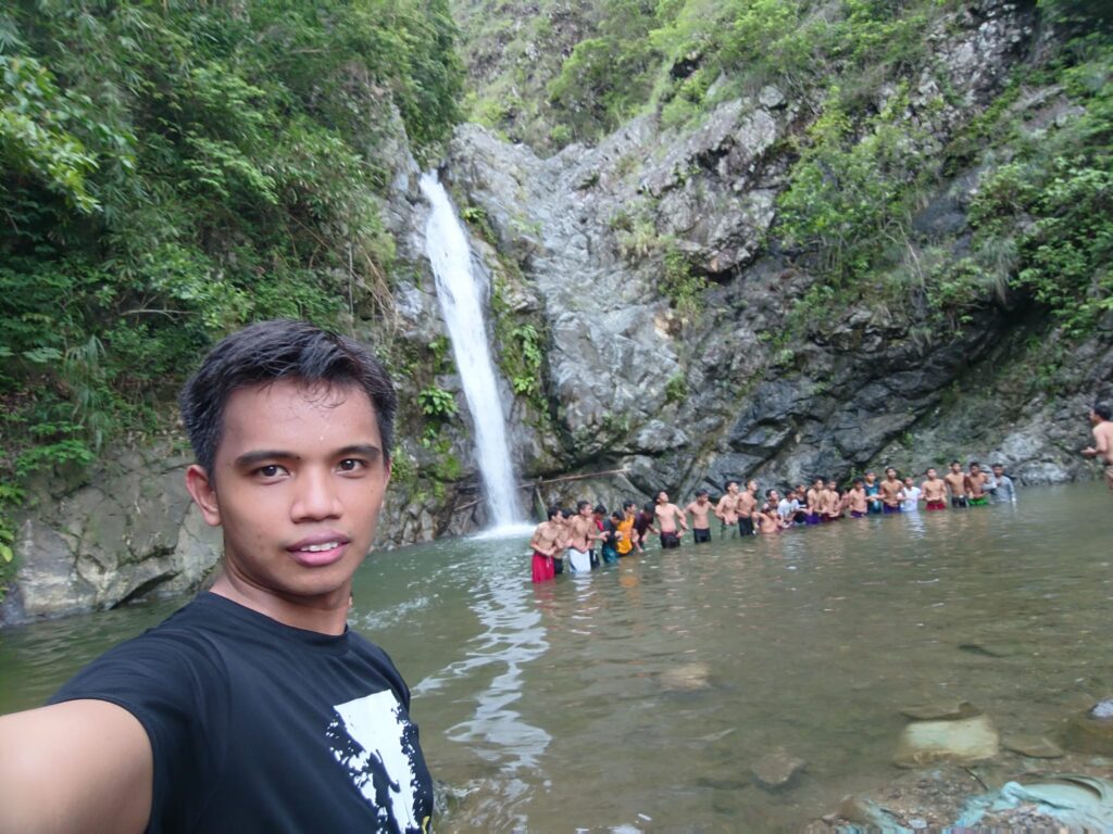
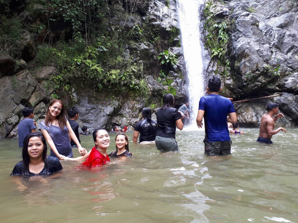
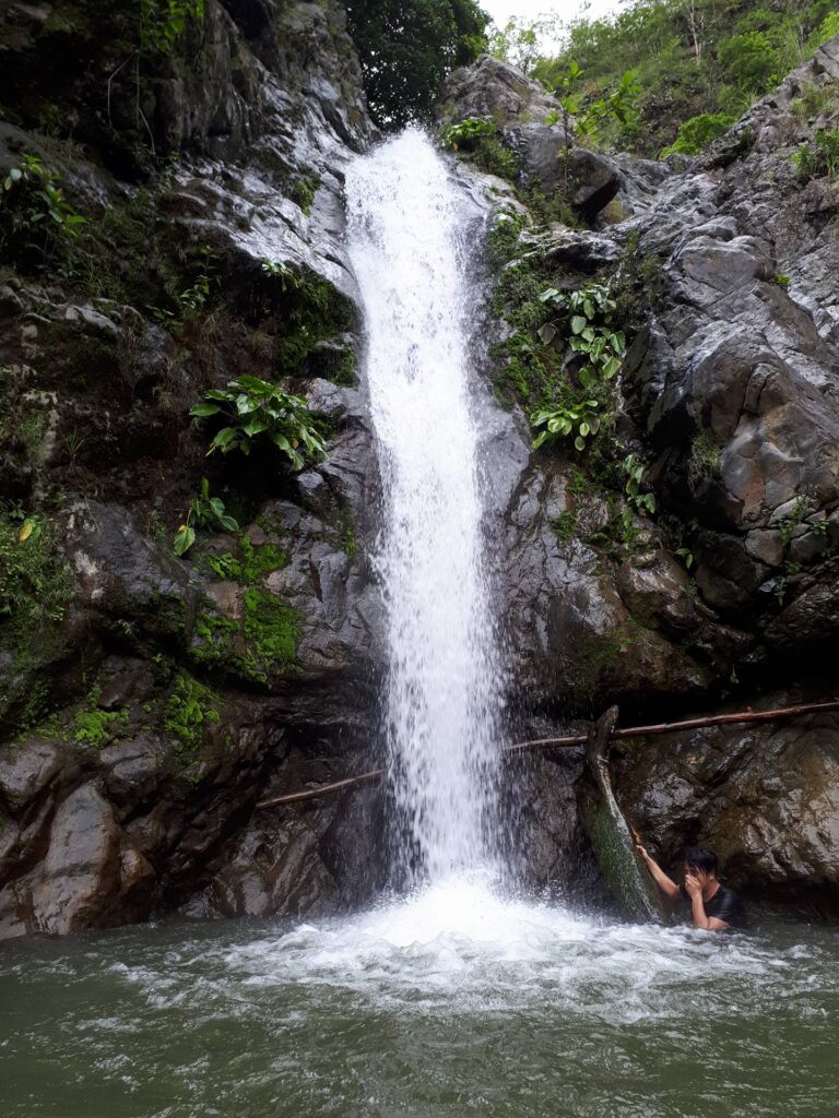
Aloha Falls was a spectacular sight to watch. We are amazed by the beauty of the falls. It reminds me of Ubod Falls in Mt. Damas. The water in the falls is clear. We are rewarded by nature with an exceptional refreshment from Aloha Falls. The cascade down the catch basin was fierce and persistent because it was raining in the past days. The pounding of the cold rushing water to its basin was music to our ears. The water in the falls is mostly shallow except for the part where the cascade is entirely deep.
Some of the members in the group take a dip and swim in the cold and refreshing water of Aloha Falls while some just savor the view and rest. Our guide told us that the height of the Aloha Falls is 20 meters or 65 feet high and the water in the falls is ice cold. As a result, I just go to the shallow part of the falls. The water at the falls is so refreshing, it makes my body relax.
Also our eyes were so delighted by the majestic Aloha Falls. Our brain flooded with numerous memories and our camera filled with countless pictures of the falls. For this reason, I fell in love with Aloha Falls. We stayed in the falls for almost one hour and twenty minutes.
After relaxing, taking a dip in the falls, finishing taking photos, and enjoying God’s beautiful creation, we walk again for several minutes where the 4×4 truck is waiting for us. We boarded the 4×4 truck and we experienced the electrifying ride again going to the jump off point. Although we don’t have clearing at the summit of Mt. 387, we enjoy the falls and the ride. It was a happy adventure with joyful people.
We washed up in the barangay and we ordered food and asked for Paluto in the mini-store at the jump-off point of Mt. 387. I noticed that the locals here are very warm and friendly, from the one in charge of the cook to the kids who offer light snacks along the way and to the one in charge of the restroom.
After we finished eating, our van headed back towards Manila in the late afternoon. Although I’m so sleepy in the van, I managed to see the beautiful plains and towns of Nueva Ecija province. Later we came back home to Manila safely and soundly. Another hike is done, one mountain off of the bucket list. What is the next mountain to hike?
Thanks be to God for keeping us safe and for the great experience in the province of Nueva Ecija. Mt. 387 is truly a great day hike with a fine combination of forested trail, rolling slope, open grassland, moderate assault, and the cool Aloha Falls. Also on this hiking trip, I met intriguing people who also love hiking and traveling. Overall my adventure to Mt. 387 sums up with this quote “The mountains are calling, and I must go.”
Sample itinerary to Mt. 387
12AM – Assembly
12:30AM – ETD going to Carranglan, Nueva Ecija
5AM – ETA jump-off point, register, secure guide, brief orientation, and breakfast
5:30AM – Start Hiking
6:30AM – View deck
7:30AM – Summit of Mt. 387, photo-ops
8AM – Lovers Tree, rest and regroup
9AM – Start traverse to Aloha Falls
11AM – Aloha Falls, swimming, taking pictures and lunch
12:30PM – 4×4 ride going back to jump-off
1:20PM – Wash up, tidy up
2:30PM – Going to the sidetrip
5:30PM – ETD going back to Manila, dinner along the way
10PM – ETA Manila
Note: the above sample itinerary is just a basis and not absolute or will not be 100% perfect due to many factors such as the weather condition, group pacing, traffic, delay, emergency, etc.
Things to bring on your visit to Mt. 387:
2 to 3 Liters of water
Jacket
Trail food like chocolate, banana, egg and jelly ace
First Aid Kit
Personal medication
Flashlight
Umbrella or Cap
Arm sleeves
Extra clothes, slipper and cash
Packed lunch
Plastic bag for your trash
Toiletries
Towel
Camera
Powerbank
Swimming attire
Sunblock (optional)
Raincoat/poncho (optional)
Trekking pole (optional)
Neck pillow for a long ride (optional)
How to Go to Mt. 387
By commute
Option 1:
- Go to Cubao bus station and ride a bus bound to Tuguegarao, Cagayan or Isabela. Then tell the bus driver or the bus conductor to drop you off in front of Iglesia ni Cristo chapel in Barangay Puncan, Carranglan, Nueva Ecija.
- From Iglesia ni Cristo chapel, cross the highway and walk five to ten minutes across the road going to the registration site of Mt. 387.
Note: If you prefer to ride the Victory Liner bus, make sure you book in advance as slots could run out fast.
Option 2:
- Go to Cubao bus station and ride a Baliwag Transit bus going to San Jose City, Nueva Ecija.
- From San Jose City, ride a tricycle going to the jump off point of Mt. 387 in Barangay Puncan, Carranglan, Nueva Ecija. The tricycle ride is approximately thirty minutes.
Note: When going back to Manila, ride a tricycle going back to San Jose City and at the terminal station ride a bus bound to Cubao.
By private car
Option 1:
- From Manila, drive your car going to NLEX (North Luzon Expressway).
- Then exit at Mabalacat, Pampanga. After that take SCTEX (Subic-Clark-Tarlac Expressway) and exit at Gerona or Pura, Tarlac.
- Turn right to Gerona-Guimba Road then turn right to Pangasinan-Nueva Ecija Road. After that turn left to Pan-Philippine Highway and proceed to Mt. 387 registration site.
Option 2:
- From Manila, drive going to NLEX (North Luzon Expressway) and turn right at SCTEX (Subic-Clark-Tarlac Expressway).
- Continue driving until you reach the TPLEX (Tarlac-Pangasinan-La Union Expressway). Then proceed to Carmen Exit and turn right upon reaching the McArthur Highway. Take note that you will pass by the SM City Rosales and just before the bridge, turn right approaching the Pangasinan-Nueva Vizcaya Road. After passing the municipality of Rosales, you will pass through the towns of Umingan and Balungao in Pangasinan, and the municipality of Lupao in Nueva Ecija.
- Then continue driving until you reach the Maharlika Highway in San Jose City, the landmark is McDonald’s which is in front and Jollibee to the left side.
- After that, turn left at the junction and continue driving approaching the jump-off point in Barangay Puncan, Carranglan, Nueva Ecija. You will pass by the Iglesia ni Cristo chapel on the opposite side of the road and you will see signage. Then turn left towards the dirt road and continue driving straight until you reach the nipa hut that serves as a reception area for visitors and hikers.
Reminders and Tips:
- Mt. 387 is a minor climb and it’s perfect for beginners. It is a beginner-friendly mountain and it is not hard to navigate.
- Check first the weather forecast in Carranglan, Nueva Ecija before visiting the mountain.
- Expect rain during the wet season from June to October. Aloha Falls is delightful to see but can be dangerous during the rainy season.
- The hike usually starts at 5 am for dayhike. On the other hand, 1 pm is the start time for the overnight climb at Mt. 387.
- If you go for a short swim at Aloha Falls, avoid swimming under the deep cascade part which is close to the stone wall for your own safety because the water current is so strong especially during the rainy season.
- After the hike, you can have a side trip to Little Vigan in Gapan, Nueva Ecija.
- I highly recommend getting a packaged tour when you plan to visit Mt. 387 for comfort and amenity. Included in the Mt. 387 package tour is round trip van transfer from Manila to Nueva Ecija vice versa, local guide fee, coordinator fee, drivers fee, parking fee, registration fee, and environmental fee. Excluded in the package tour are a 4×4 truck ride, meal, shower, and restroom fee.
- From Manila, the approximate travel time going to Mt. 387 is 4 to 5 hours including a stopover but it depends on the traffic and speed of your car.
- As always, follow the Leave No Trace principle. Let’s help the locals in conserving Mt. 387 for future generations. Don’t leave a single piece of trash in the trail. Always keep your trash with you.
- If you forget to bring a packed lunch, you can order at the jump-off point. They will prepare a meal for you and you can eat them after the hike.
- There are few trees in the grassland summit of Mt. 387 which can really be a challenge especially during the dry season. Protect yourself by bringing any sun protection things.
- A local guide is obligatory for hikers. At the registration site, they accept walk-in hikers and visitors.
- Parking spaces, restroom facilities, and seedlings are available at the jump-off. Also at the jump-off they have souvenirs like keychains, t-shirts, and bag tags.
- Don’t forget to bring yourself a pair of gloves especially when doing the Mt. 387 traverse so you will be able to hold onto twigs. There are certain parts wherein rope segments are available so having a pair of gloves is a nice thing.
- There’s no blood leeches in Mt. 387 but wear appropriate hiking gear and attire when doing the traverse.
- Take note there is only one water source which is in Aloha Falls and for the most part the trail is exposed to the extreme heat of the sun. Bring sufficient water especially if you’re doing it overnight. Start the hike early in the morning especially in the dry season because of the heat of the sun.
- The hike to the summit of Mt. 387 usually takes two to three hours depending on the group pacing and it will take another two hours to traverse the mountain in order to reach Aloha Falls.
- Traverse is more challenging than backtrail. Going down the steep slope is demanding even for some experienced hikers. You will pass by some bamboo groves and this will cause some scratches on your arms if you’re not well prepared. Also the difficulty level goes up if the trail is very muddy, it may cause you to slide down. For this reason, bring a lot of patience and perseverance if you’re doing the traverse hike. If it is your first time hiking a mountain then do leg exercises like walking, running, and stretching for a longer period of time.
- Hikers have the choice to do a backtrail or traverse from the summit. Just inform your guide about it. The backtrail is advocated for beginners however if you want a demanding day hike you can choose to traverse but be cautious and careful. If hikers do the backtrail, they can ride a 4×4 truck going to Aloha Falls.
- There is a tree-planting tradition at Mt. 387 for reforestation. We really need to take care of our environment and the mountains. Locals of Barangay Puncan begin the tree-planting movement to restore the once-bald portion of Mt. 387. Also the barangay vow to protect Mt. 387 from deforestation and other dangers that threaten the mountain. I appreciate this variety of people who make efforts in saving our beloved mountains. Their game plan is to keep going until the bald area of the mountain is fully covered up in trees. So if you love nature, want to join the tree planting activity, and help them with their advocacy then go to Mt. 387 and you would never regret it. God willing those seedlings that are planted will live for many years to come.
- Hikers and campers who want to stay overnight are allowed to camp at the campsite located beside the lovers’ tree.
- If you don’t want to get your shoes wet going to Aloha Falls, better bring extra sandals or slippers.
- Above all for any concerns or inquiries before hiking Mt. 387, kindly contact the following person: Roy P. Manuzon – 09175712152, Kath – 09050467084, Jen – 09057352454 and Lucky – 09267223647.
Notable Fees:
The guide fee for a day hike is 500 pesos good for a group of 5 people.
The overnight fee for the guide is 1000 pesos.
The parking fee is 50 pesos.
Seedlings are 20 pesos.
Coffee is 10 pesos.
4×4 truck ride coming to and from Aloha Falls is 50 pesos per head (optional fee).
Restroom fees range from 10 to 20 pesos.
Meal after the climb range from 90 to 120 pesos.
Single-order food is 120 pesos per head.
The registration fee for a dayhike is 70 pesos per head. Meanwhile, the registration fee for the overnight climb is 90 pesos per head.
Note: Fees are subject to change without prior notice.
If life gives you mountains, just put on your shoes and hike. On the whole, I hope this Mt. 387 hiking guide has been helpful to you and inspired you to try the outdoors. Moreover, don’t forget to share this with your family, friends, groups, and colleagues if you ever plan on doing Mt. 387 day hike too. God bless you in all your hiking adventures and future travels. Thanks for reading.
Jervis Ergino
Hi! I’m Jervis Ergino, the digital content creator behind Hike to Mountains, a travel and hiking blog in the Philippines. This blog is dedicated to helping people know more about the best hiking and tourist destinations in the Philippines.