Mt. Batolusong: A Beginner Friendly Mountain
Introduction
Mt. Batolusong is one of the most popular hiking destinations in the Rizal province due to its proximity to Metro Manila and the fact that it offers a fantastic view of the Sierra Madre mountain range. Mt. Batolusong is located in Barangay San Andres in Tanay, Rizal. It is just two hours away from Manila.
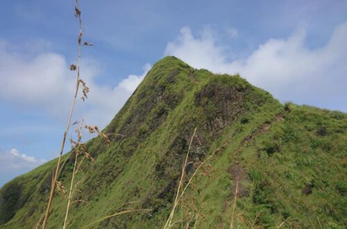
Mt. Batolusong has three summit namely Duhatan Ridge which stands at 454 MASL, Mapatag Plateau stands at 663 MASL and Rangyas Peak stands at 883 MASL. Mt. Batolusong is a great destination for hikers looking for a quick trip to the province. Hikers can leave Manila early in the morning, walk in the grassland, breathe fresh air, and be back at home before evening.
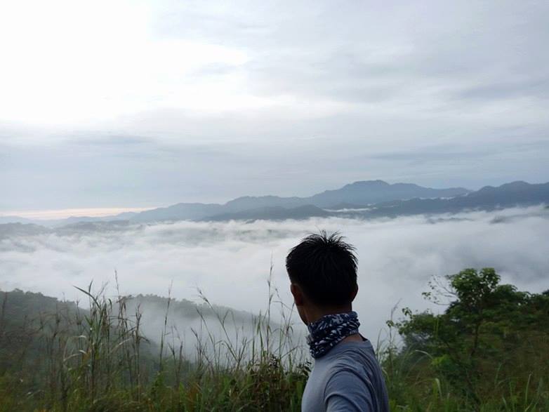
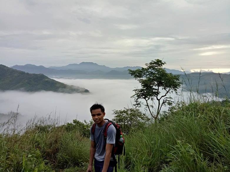
Mt. Batolusong is also famous for its incredible sea of clouds during the wet season. For this reason, many groups of hikers, campers, and even ordinary people drove into Mt. Batolusong early in the morning to be able to get a glimpse of its marvelous sea of clouds and feel the cool wind.
The Tagalog word Batolusong means “rock tool”. Bato means “rock” and Lusong means “tool for processing rice grains“. Collectively side by side makes up the name Batolusong. On the other hand, Mt. Batolusong is usually compared to Mt. Sembrano due to the fact that the two mountains have likeness, especially in the green grassland slopes. Besides, Mt. Batolusong is well known for its Batanes-like grassland slope.
Name: Mt. Batolusong
Difficulty: 3/9
Jump-Off: Barangay San Andres, Tanay, Rizal
Hours to summit: 3 hours
Features: Grassland slopes and marvelous views of the Sierra Madre mountain range.
My trip to Mt. Batolusong
I miss the mountains and I’m itching to do another day hike near Manila. It was in October 2016 that I decided to join an organized tour going to Mt. Batolusong. I followed the itinerary in the group chat and I arrived at our meetup place in Farmers Plaza, Cubao around 2 am. Then our van heads to our destination and left Manila at 2:45 am.
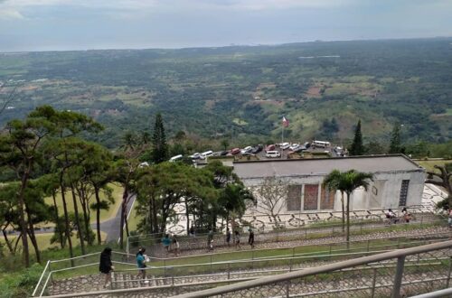
We arrived at the jump-off point of Mt. Batolusong in Barangay San Andres at 4:15 am. Our group registered, secure the guide and have a quick breakfast near the barangay hall. After that, we started the hike at 4:50 am. Since it’s weekend, we saw many hikers too who want to summit Mt. Batolusong.
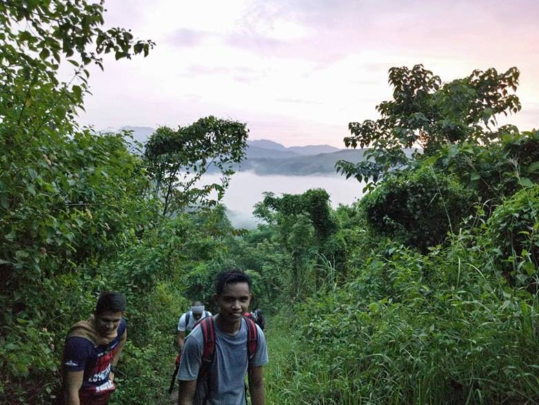
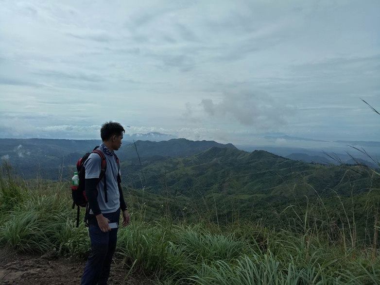
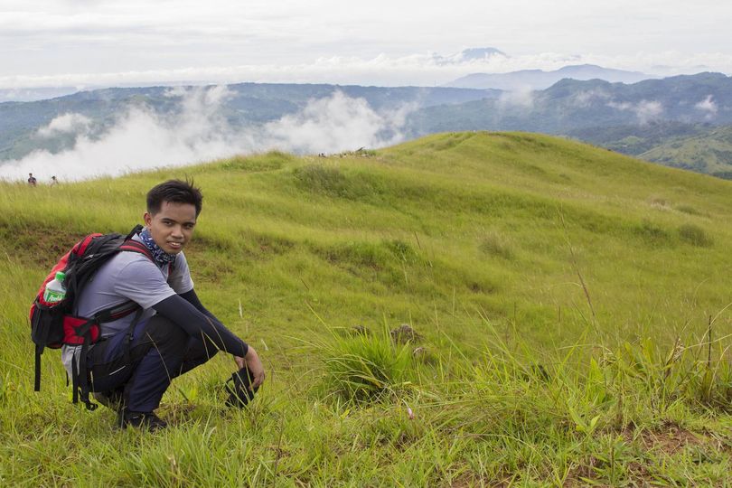
The initial portion of the trail is relatively easy on flat ground. We pass through local houses, rice fields and we do some stream crossing. Along the trail, we found a water source. We refill our bottle then we continue hiking. Then the trail becomes continuous ascending on moderate-shaped stairs until we reached the Duhatan Ridge. We saw the sea of clouds forming in the Duhatan Ridge. According to our local guide, Duhatan Ridge is the name of the ridge because there are Duhat trees that grow in this pleasing ridgeline.
Then we continue hiking at a moderate pace heading to Mapatag Plateau. The trail going to Mapatag Plateau is so relaxing and refreshing, it is like I’m walking in the park. The cool weather also contributed to our group pace.
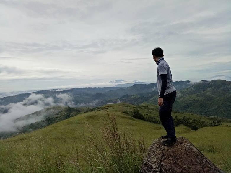
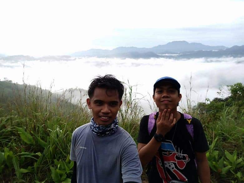
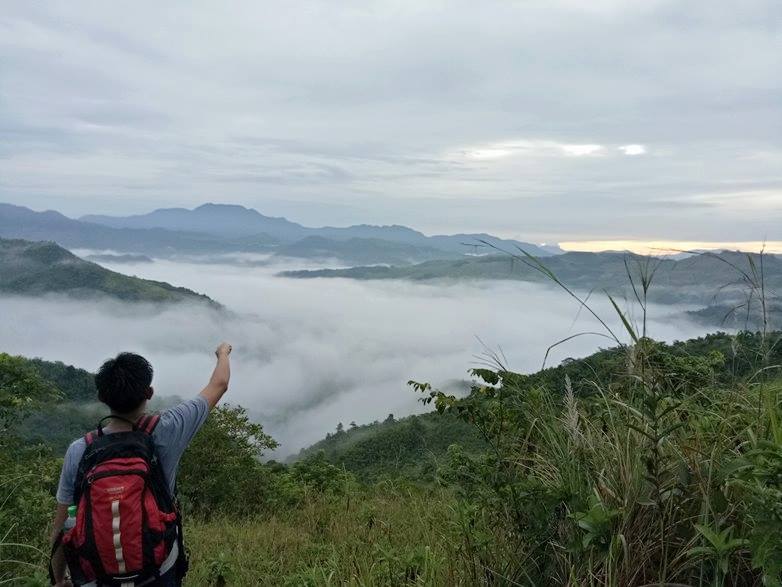
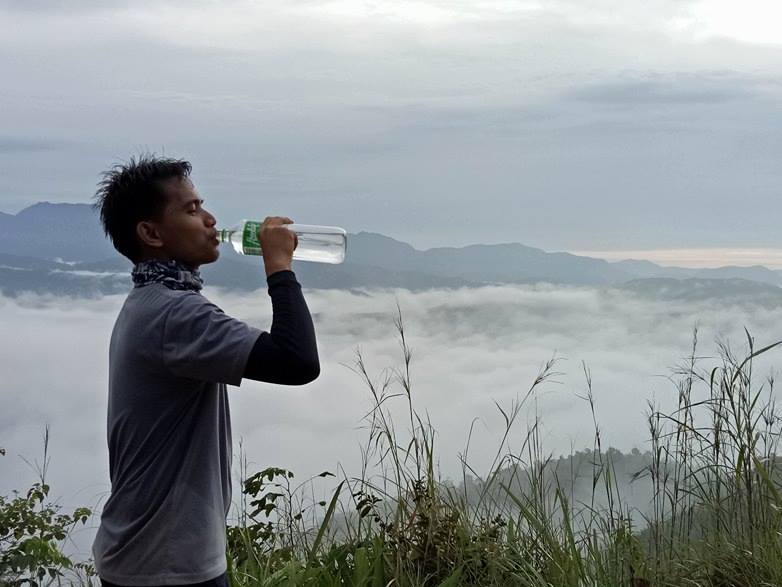
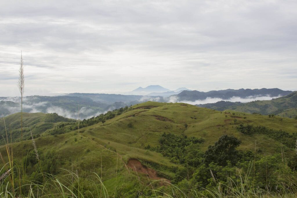
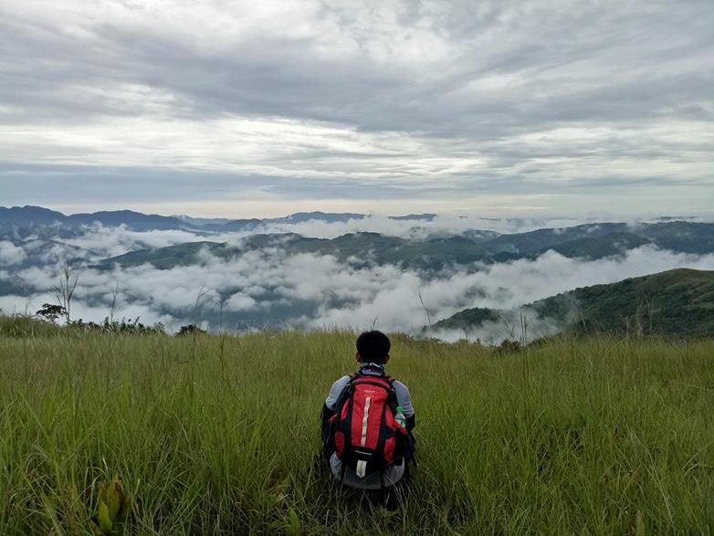
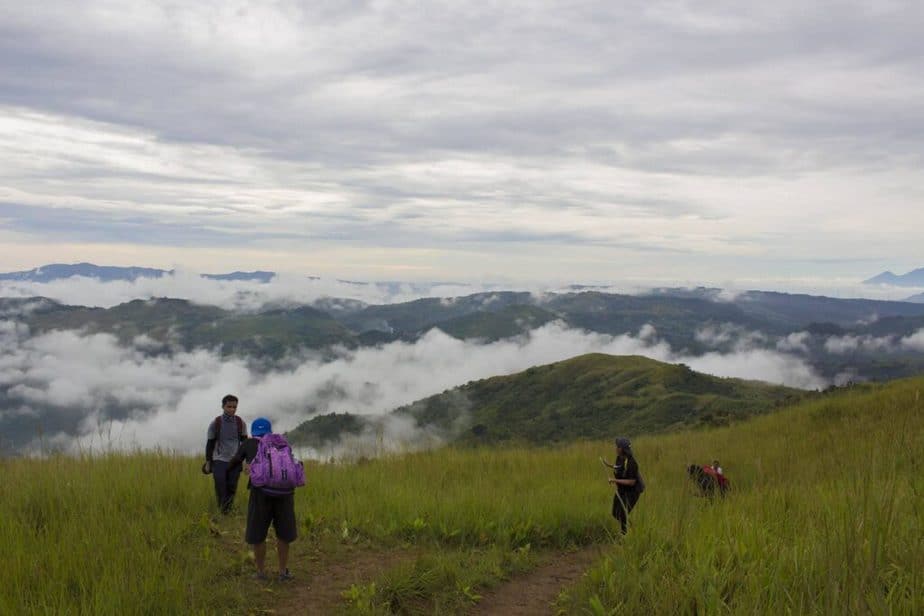
After forty-five minutes we reached Mapatag Plateau around 6:30 am. The view is great and amazing. We witness a beautiful sea of clouds, the impending Sierra Madre mountain range, and the perfect sunrise. The lush green slope of the mountains, the stunning sunrise, and the cool wind makes our group super happy at the grassland. It was one of the most memorable places in my life because it was my first time seeing the sea of clouds.
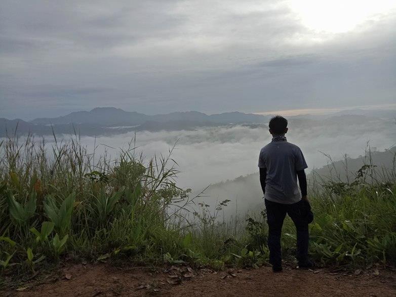
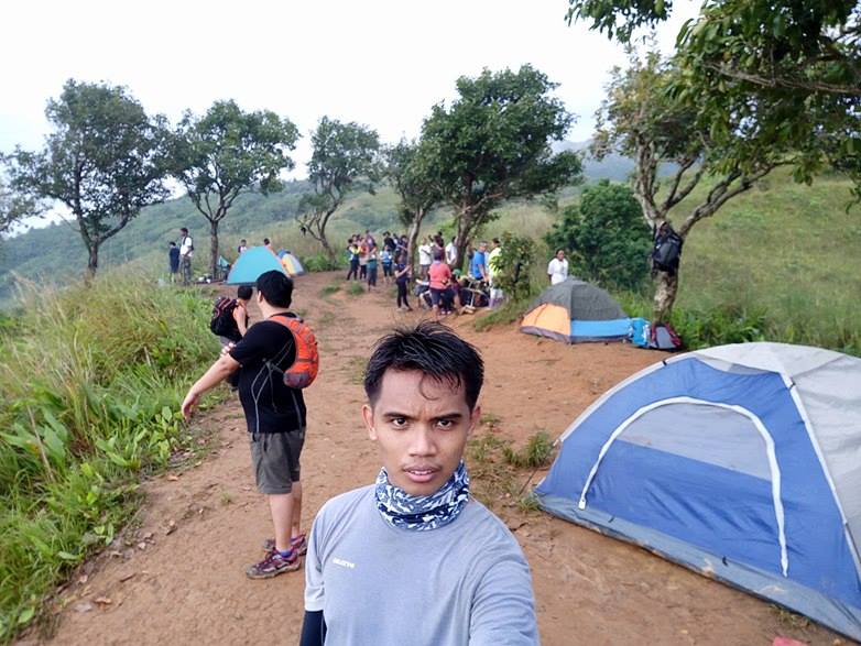
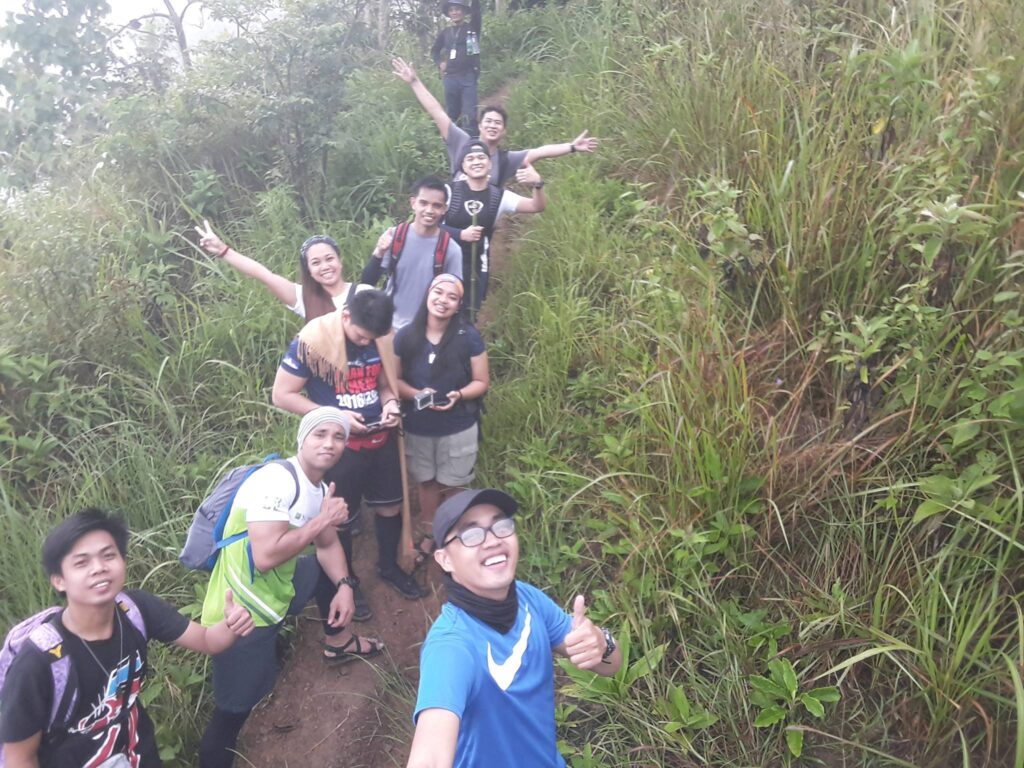
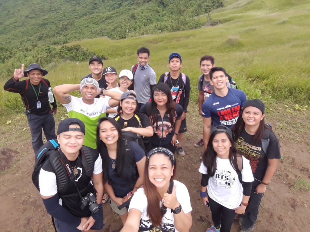
Also in this place, we saw several hikers inside their tent having breakfast, we thought they do overnight camping in the mountain. We take several pictures and then we take a quick rest. Also, we have our group pictures and we take time to appreciate the view of nature. At the back of my mind, I could willingly waste my time and I wouldn’t mind staying there all morning because the place is so peaceful.
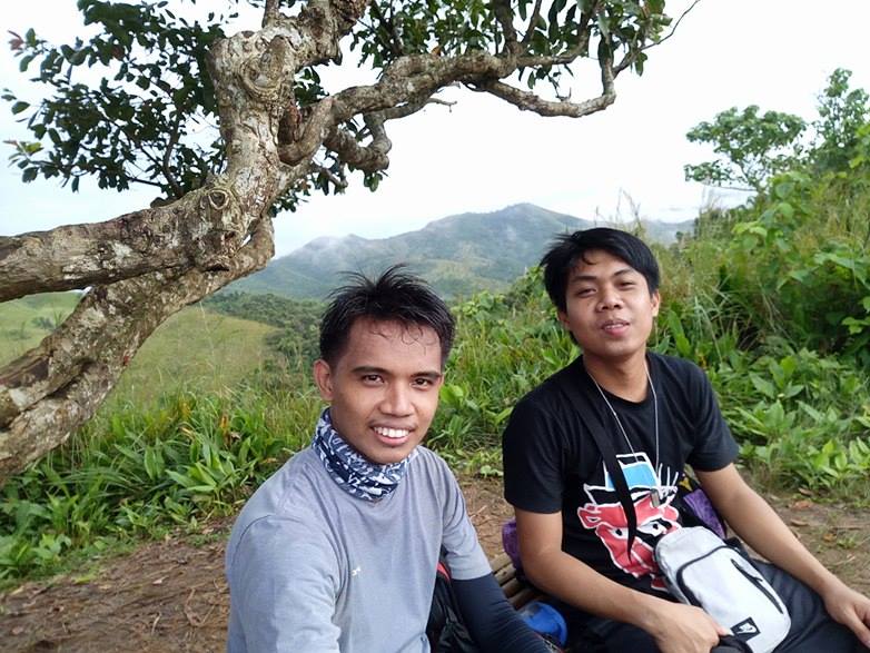
In addition, It’s been a long time since I’ve been in the mountain and for me, this is what I really need after busy city life. For the most part, it is our golden hour to savor the view, the great wind, the delightful grassland, and the surroundings. We stayed at the Mapatag Plateau for almost one hour. We were so lucky to have a good tour guide who was not always in a hurry and he was very patient with us.
At the Mapatag Plateau, we can already see the last summit which is the Rangyas Peak. It makes our group really excited. So after thirty minutes of resting in the bamboo seat and taking pictures, we continue the hike.
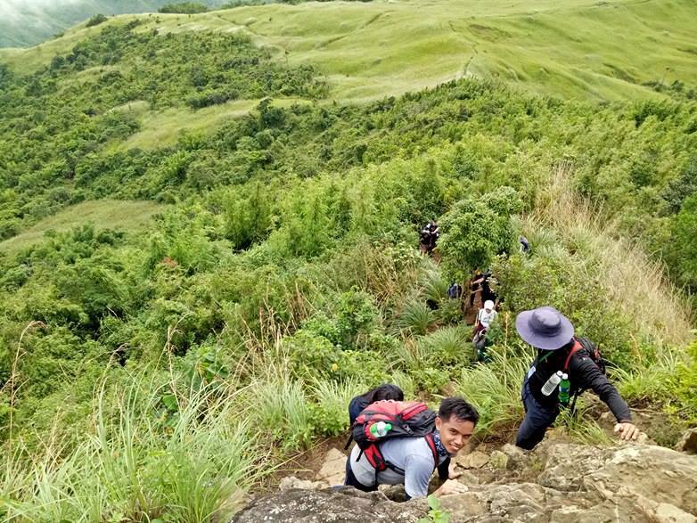
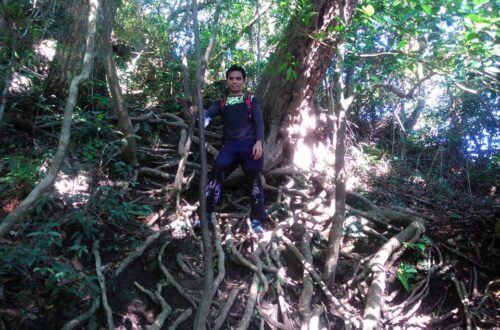
We pass a wooded area surrounded by bamboo stands, and later our group had to scramble up a steep rocky wall to reach the summit. In my opinion, this is the most technical part of the entire hike. We need to be very careful with our steps for about five minutes in wall climbing. Also, the wind is very strong at that time and we need to wait for each other turn.
Finally, we reached the summit. It is worth the sweat. The view is astounding. Also, the weather is excellent. I can clearly see some southern Tagalog mountains such as Mt. Banahaw and Mt. Cristobal. I can also see the beautiful layers of the mountains and the Susong Dalaga Peak. We lost our tiredness because of the refreshing wind and cool weather. Then some of the members shared their trail food and we have some thoughts about why we do hiking.
After thirty-five minutes, our group decided to descend going to our side trip which is Kay-ibon Falls. We noticed there’s an alternative way to descend from the summit instead of going through the rocky part. Then later we do backtrail and some of the group members trail run in the Mapatag Plateau. On the other hand, I just walk like a normal person appreciating everything in between the grassland.
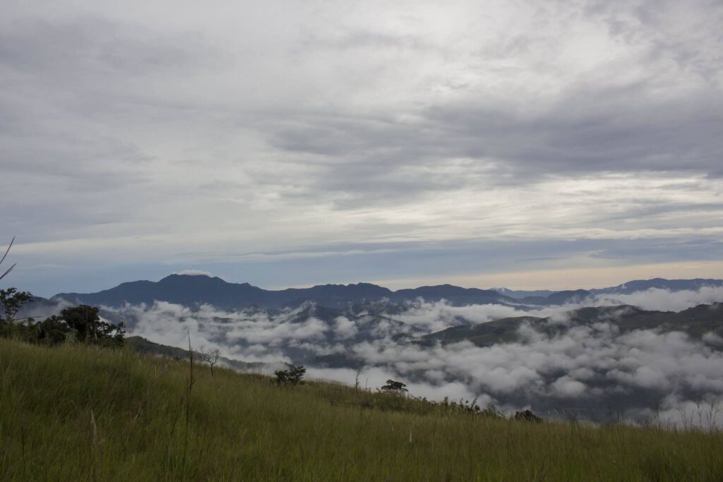
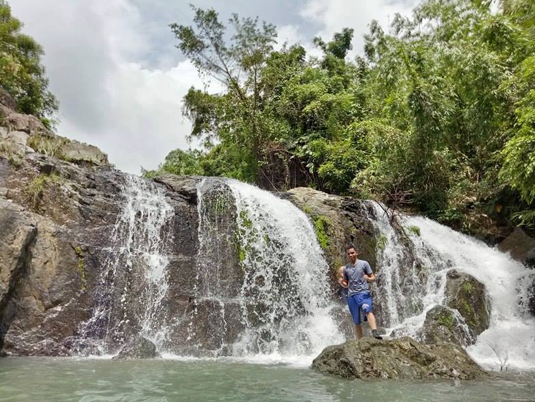
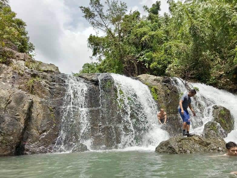
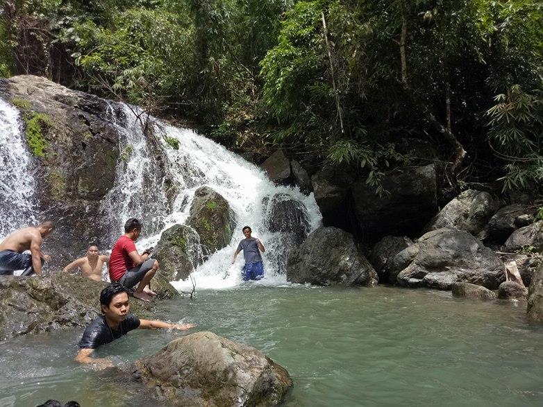
Furthermore, as we go down the mountain the weather becomes cloudy and it favors us since there are no trees and shades in the grassland. Later our group passed through some rolling slopes and eventually we reached Duhatan Ridge. At around 10 am when we reached Kay-ibon Falls. We rest, regroup, refresh and swim in the cold and refreshing water. Indeed, swimming after a tiring and sweaty hike is true happiness.
After forty minutes in the falls, our group decided to continue walking towards the jump-off point of Mt. Batolusong. Later we ride a tricycle going back to the jump-off point where our van is waiting for us. We reached the barangay at 11 am. We take a quick rest and we wash up. Later our van departs Tanay going back to Manila.
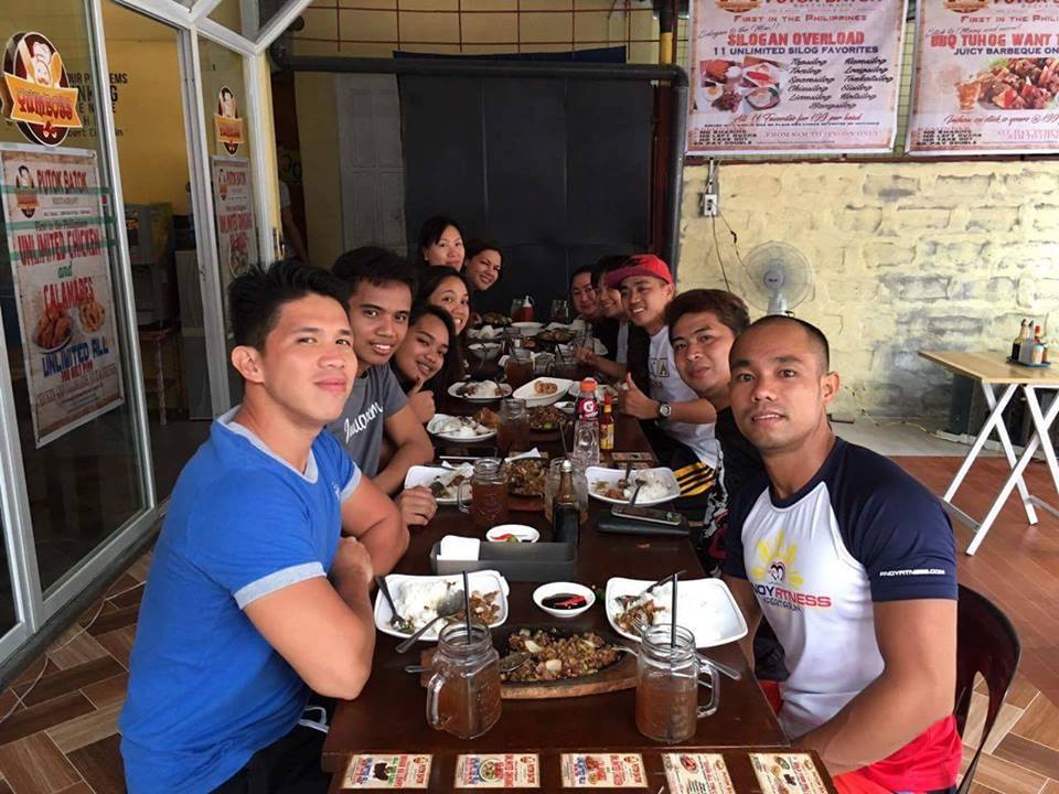
Our group decided to make a stopover and have an early dinner at YumBoss Putok Batok restaurant in Antipolo. When we are fully satisfied, we go inside the van again and later came back to Manila safe and sound. Indeed, it was another great hiking experience for me. Special thanks to the Trek Hunters group for organizing the Mt. Batolusong day hike.
My hiking experience in Mt. Batolusong made me realize that even though I am not getting any younger, I will still hike once in a while. On the whole, my adventure to Mt. Batolusong sums up this quote: “In every walk with nature one receives far more than he seeks.”
Sample itinerary to Mt. Batolusong (Dayhike)
2AM – Assembly, meet up
2:30AM – ETD going to Mt. Batolusong jump off point
5AM – ETA jump-off point. Registration, secure guide, breakfast, and final preparation
5:30AM – Start hiking
7:30AM – Arrival at Duhatan Ridge
8AM – Mapatag Plateau
8:30AM – Arrival at the summit (Rangyas Peak)
9:15AM – Start the descent
10:30AM – Kay-ibon Falls. Swim.
11:30AM – Mt. Batolusong jump-off point, wash-up
1PM – ETD going back to Manila
4PM – ETA Manila
Sample itinerary to Mt. Batolusong (Overnight)
Day 1
10AM – Meetup
10:30AM – ETD going to Barangay San Andres, Tanay Rizal, lunch
2PM – ETA Mt. Batolusong jump-off point, register, and secure guide
2:30PM – Start hiking
4PM – Arrival at Duhatan Ridge
4:30PM – Arrival at Mapatag Plateau. Set up camping tent
5:30PM – Dinner and socials
8:30PM – Lights out
Day 2
5AM – Wake up call, breakfast
6:30AM – Sunrise viewing
9AM – Start descent
10AM – Arrival at the jump-off, wash-up
11AM – ETD going to Manila, lunch along the way
3PM – ETA Manila
Things to bring on your visit to Mt. Batolusong:
2 liters of water
Trail food
Pack lunch
Flashlight
Camera
Extra money, clothes, and slipper
Trash bag
Personal medicine
Jacket
Umbrella
Toiletries
Valid ID
Gloves for the rope section (optional)
Sun/rain protection (hats, cap, scarf, sunblock, sunglasses, raincoat, etc.)
Reminders and Tips:
- Mt. Batolusong is a minor climb and it’s good for beginners. I highly recommend it to the newbies who want to try hiking and experience a minor climb.
- Pack light as much as possible. Bring only the necessary things on the hike.
- Parking spaces are available near the barangay hall of San Andres.
- Always observe the Leave No Trace principle. Don’t throw your trash anywhere. Bring your own trash when you go down to keep the mountain clean. Please carry out what you carried in. Always be a responsible hiker and camper. Garbage in, garbage out.
- Start the hike early in the morning around 4 am to witness the sea of clouds and to avoid too much exposure to the heat of the sun.
- During the dry season make sure to bring an umbrella or cap because Mapatag Plateau has no trees that offer shade. The entire hiking takes about five to eight hours.
- Mt. Batolusong can be very crowded during the weekends and holidays.
- Hiking to the summit can get cold but when going down the mountain it gets hot due to less shade.
- The wash area at the barangay hall is limited only so be patient and wait for your turn.
- Make sure to wear appropriate hiking shoes or sandals. The mud is no joke during the wet season. Don’t forget to waterproof your important things. Also, pay attention to the weather forecast and announcement before you hike Mt. Batolusong.
- Cellphone signal is present in Mapatag Plateau.
- There are two stores along the trail where you can buy mineral water and some snacks.
- Getting a local guide is required before starting to hike. You can just walk in but it’s better if you already have contact with the local guide there.
- The registration fee is 100 pesos per head and the tour guide fee for a day hike is 750 pesos for a group of 5 people.
- Strictly 1:5 ratio of tour guide/hikers, 1000 pesos when you are a group of 7 people and that is for dayhike. For overnight climb 1250 pesos per tour guide, 1:5 ratio of tour guide/hikers.
- For a tour guide in Mt. Batolusong, kindly contact Mhel Borja thru his cellphone number – 09072922314.
- Last but not least, the parking fee is 20 pesos.
How to Go to Mt. Batolusong
By commute
- From Cubao, ride a jeep going to Cogeo Gate 2
- Then from Cogeo Gate 2, ride a jeep in the terminal going to Barangay Sampaloc
- From Barangay Sampaloc, ride a tricycle going to Barangay San Andres, Tanay, Rizal. Tell the driver to drop you at the barangay hall.
By private car
Drive on Katipunan Avenue, then proceed to Marcos Highway. Drive until you reach Barangay San Andres, Tanay, Rizal. Then stop at the barangay hall.
Note: For convenience, you may download the Waze app and pin the Barangay San Andres Welcome Marker or just enter the arch and drive to Santa Ines road then proceed to the barangay hall near the basketball court and registration hall.
Time flies and all of us are growing older. But let us keep hiking. Our bodies may age, but the mountains will keep our spirits young and free. Overall, I hope this Mt. Batolusong hiking guide and reference has been helpful to you and inspired you to try. Moreover, don’t forget to share this with your friends or groups if you ever plan on doing the Mt. Batolusong day hike too. Hope to see you on the trail. God bless you in all your future travels and hiking adventures. Thanks for reading.
Jervis Ergino
Hi! I’m Jervis Ergino, the digital content creator behind Hike to Mountains, a travel and hiking blog in the Philippines. This blog is dedicated to helping people know more about the best hiking and tourist destinations in the Philippines.