Patapat Viaduct
Background
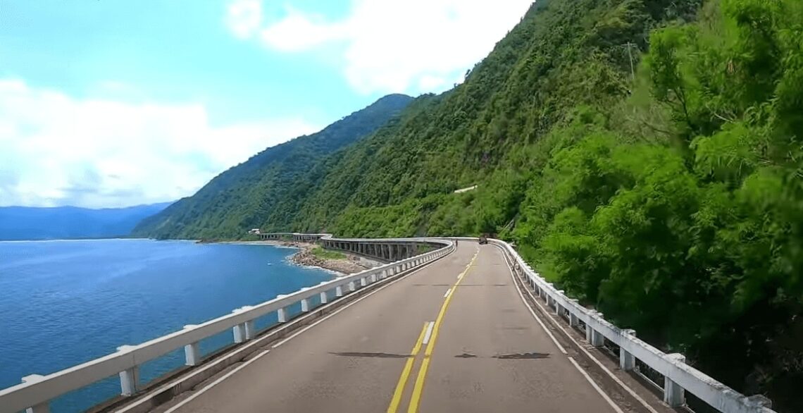
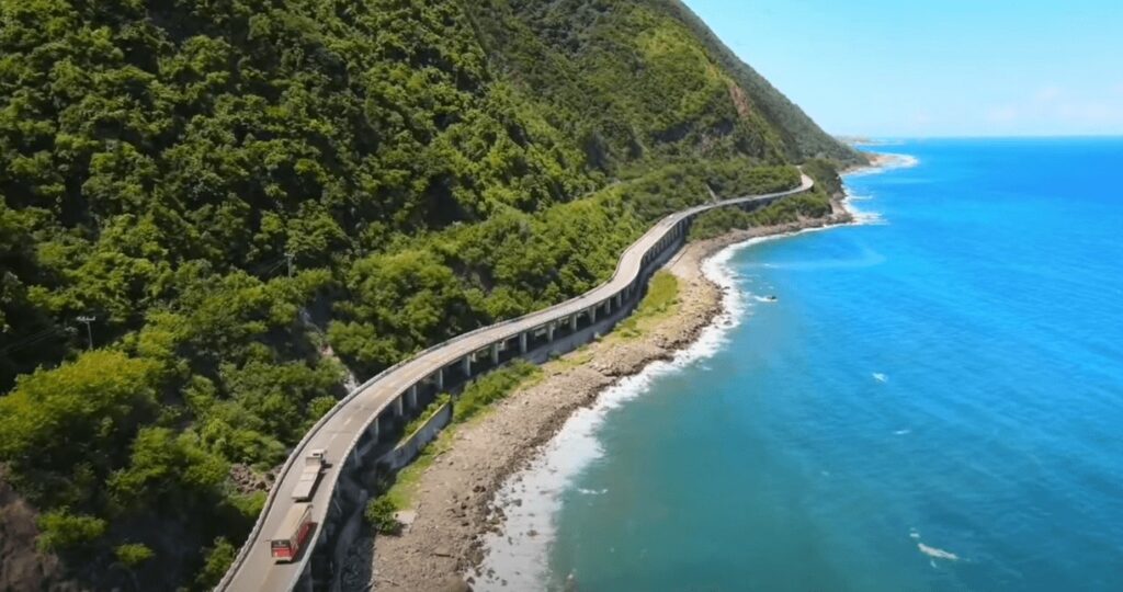
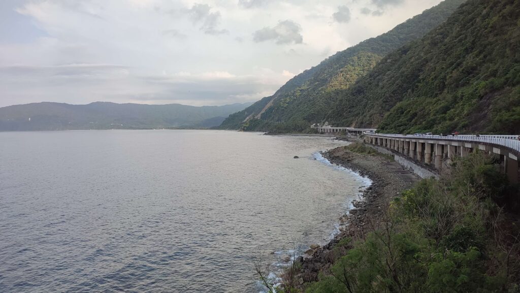
Patapat Viaduct is a concrete elevated coastal bridge located in the municipality of Pagudpud in the province of Ilocos Norte. It rises along the Pagudpud coastal mountains that curve through Northern Luzon. Patapat Viaduct has an elevation of 31 meters above sea level and it has a length of 1.3 kilometers which connects the Maharlika Highway from Laoag to the Cagayan Valley region. Also, it has a width of 31 feet, a load limit capacity of 15 metric tons and it can last up to forty-five years since it was built. Patapat Viaduct is well known for its beautiful coastal view of Pasaleng Bay and is the fourth longest bridge in the Philippines. It is dubbed by many foreign tourists as the French Riviera of the Northern Philippines.
According to its past history, former President Ferdinand Marcos Sr. contemplated the construction of clustered roads and long bridges to facilitate travel between mountain ranges, rivers, and seas across the Philippines. He has a broad vision and goals to improve the economy of the Philippines. Hence he planned a long-term project and implemented it between the Cagayan Valley region and Ilocos Norte during the 1980s because in the past decades, it would take travelers one, two, or more than three days to travel to another province because there were no paved roads. Patapat Viaduct was constructed by Hanil Development Co. Ltd. under the overall management of DPWH (Department of Public Works and Highways). It was completed and opened to private vehicles in October 1986.
As the years go by, the two-lane single-carriageway is an important bridge that connects the gaps between cities and municipalities in Ilocos Norte and Cagayan which definitely help travelers to go to the northernmost tip of Luzon Island smoothly and fast. Instead of counting days, traveling to these places only takes a few hours. Furthermore, it solved the problem of landslides in the region and offered motorists a wonderful view of the seas and mountains.
Presently, the Patapat Viaduct is one of the popular tourist attractions in the Northernmost tip of Luzon Island and it is maintained by the national government and the DPWH. Motorists and travelers coming from different parts of the Philippines stopped here for a brief moment just to have a gorgeous stretch view of the Patapat Viaduct as it is one of the most scenic destinations in Ilocos Norte. Moreover, on a very clear day, Fuga Island and Calayan Island are visible to the naked eye. So if you love road trips then Patapat Viaduct should be on your travel bucket list.
Name: Patapat Viaduct
Location: Pagudpud, Ilocos Norte, Philippines
Features: a very nice view of Pasaleng Bay and the coastline of Pagudpud as well as the mountains on the other side
My trip to Patapat Viaduct
It was Saturday afternoon around 4:30 pm on a clear day when we drove towards Patapat Viaduct as part of the three days and two nights itinerary in the Ilocos region. This was the farthest point of our drive. Inside our van, I take a video to have a remembrance of the remarkable view while we pass along the Patapat Viaduct. Afterward, the driver park the van on the side of the road. The moment we step our foot on the beautiful bridge around 5 pm I found that the place was really a perfect postcard and the seascape is just picture-perfect. The scenery is enthralling and it was really nice to see the 4th longest bridge in the Philippines and hang out with people who like to travel also.
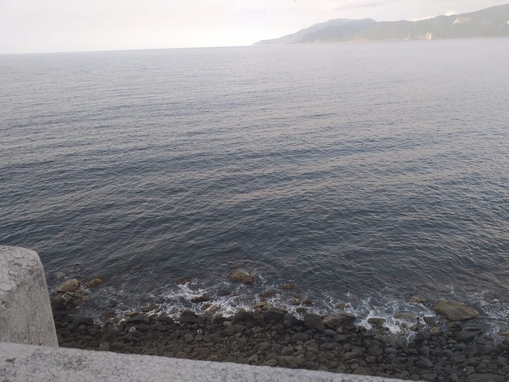
A simple walk along this bridge is very ideal for a weary tired soul after a very long road trip coming from Metro Manila. I feel like I’m abroad while enjoying the refreshing sight. It’s like hitting two birds with one stone. For this reason, we take numerous photos and videos to capture the stunning rocky shoreline, huge waves, and the panoramic view of Pasaleng Bay as well as the gorgeous snake shape bridge which connects the Ilocos Region and the Cagayan Valley Region. As we stay, we catch the breeze, enjoy the fresh air, and noticed that the view of the sea from the viaduct is super spectacular.
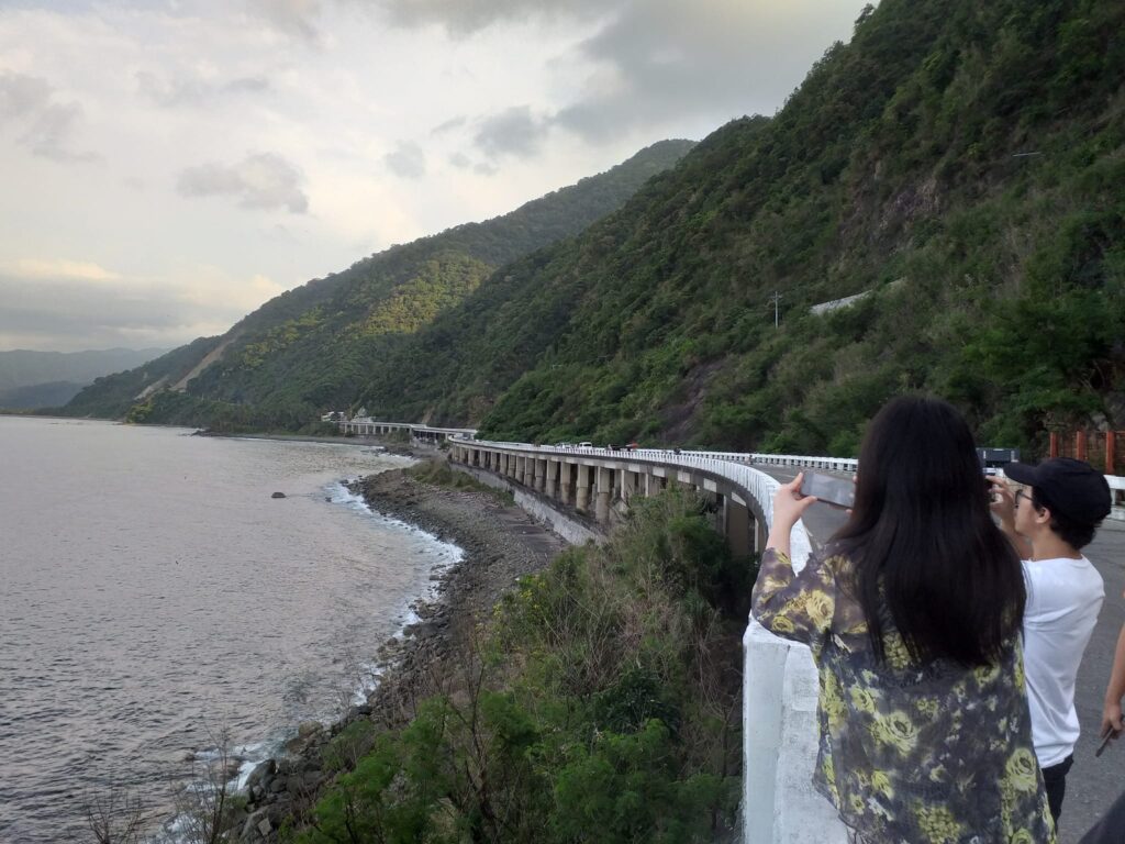
From my perspective, many car drivers as well as bikers and motorcyclers alight in this place to savor the breathtaking view of the seas and mountains. As we wait for others to have a solo picture at the gorgeous Patapat Viaduct, some of the group members buy ice scramble with toppings of chocolate syrup and some sweets from nearby vendors on the other side of the road to satisfy their cravings. Also at that time, I noticed some tourist fly their drone camera to have a stunning view from above the aesthetic bridge and to marvel at this engineering feat. It is where the mountains meet the seas.

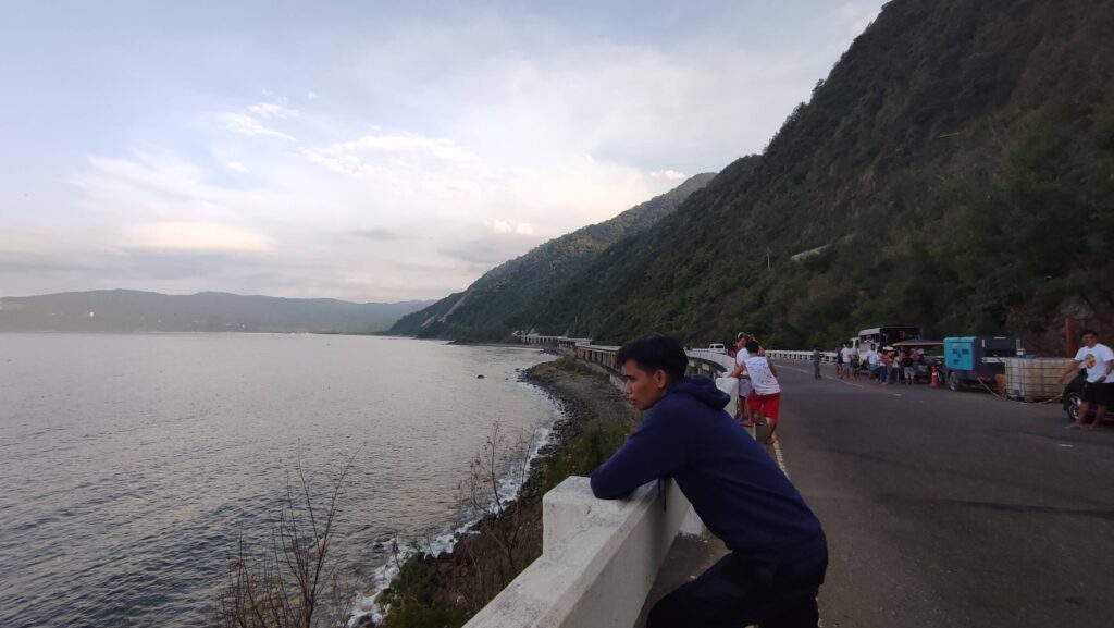
Then after taking individual pictures, we decided to have a group picture near the edges as the view encompasses most of the white-fenced road and the rocky shoreline below it. But before we have a group picture, we have to be aware of the incoming vehicles from left to right because it’s still a functioning open road and some vehicles tend to speed by at any given moment. So the moment we noticed that there were no vehicles coming in we finally have our memorable group picture taken by our beautiful tour coordinator named Precy. Without a doubt, Patapat Viaduct is the perfect stopover for nice scenery and it’s one of the most spectacular bridges I’ve ever seen so far.

Then I said to myself that this place is really like the mountainside trail in Greece or in some parts of Europe in the movies I watched before. It is one of the best coastal highways in the Philippines as it offers beautiful scenery with the cold sea breeze on our faces. I feel so relaxed and calm and all the negativity in my life just passed away instantly. Moreover, our van driver tells a joke that we can even see Batanes Island as well as the neighboring country Taiwan from a distance.
We stay at the Patapat Viaduct for nearly twenty minutes and we enjoy every minute that passed because at the end of the day, we have our Instagrammable pictures taken at the northernmost roadway of Ilocos Norte that will surely last a lifetime. I thanked God for the privilege to see this bridge in person. Overall, my trip to Patapat Viaduct sums up this fantastic quote “Reward yourself once in a while, take your time, and enjoy your travel”.
How to Go to Patapat Viaduct
By commute
- From Laoag City in Ilocos Norte, ride a GMW bus that is bound for Cagayan province.
- Then tell the bus conductor to drop you off at Patapat Viaduct. The bus fare cost 125 pesos and the travel time is two hours. Note: be early at the bus terminal especially in the morning as the bus gets easily full.
By private car
- Open your cellphone and pin Patapat Viaduct on Google Maps or Waze app.
- From Laoag City drive your car along the Pan-Philippine Highway (AH26) until you reach the Patapat Viaduct. Note: if you don’t have a car then I highly recommend you join a package tour going to Ilocos Norte.
There you have it, sightseer. No road is long with good company and the world is a beautiful place when you’re exploring it with your favorite person. Overall, I hope that this blog made you want to visit Ilocos Norte and see the most iconic bridge in Northern Luzon. Enjoy your trip and have fun.
Jervis Ergino
Hi! I’m Jervis Ergino, the digital content creator behind Hike to Mountains, a travel and hiking blog in the Philippines. This blog is dedicated to helping people know more about the best hiking and tourist destinations in the Philippines.