Mt. Pico de Loro Climb Guide (Itinerary + Tips)
Introduction
Mt. Pico de Loro is located in Cavite province and it’s one of the most well-known mountains in the Philippines. It provides mountaineers and tourists a sensational view of the South China Sea as well as Cavite and Batangas province. Mt. Pico de Loro has a height of 688 meters above sea level or 2257 feet. It is the highest point in Cavite. The northern half of the mountain lies within the municipality of Maragondon while the southern half of the mountain lies within the municipality of Nasugbu in Batangas province.
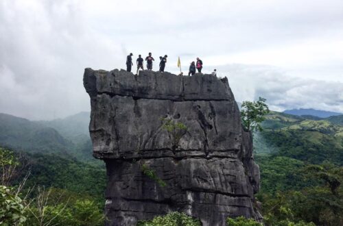
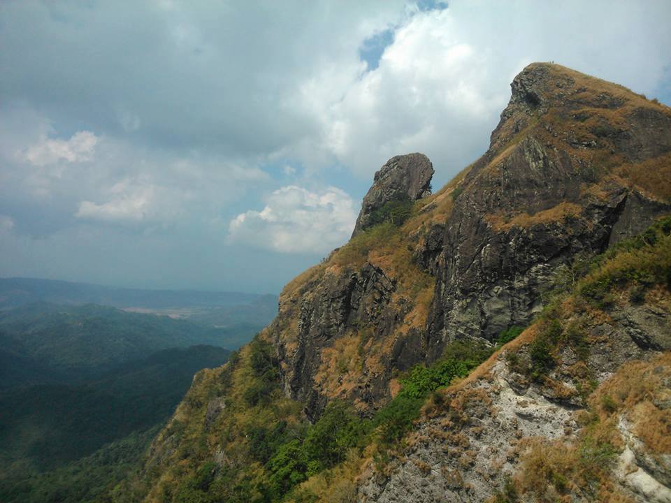
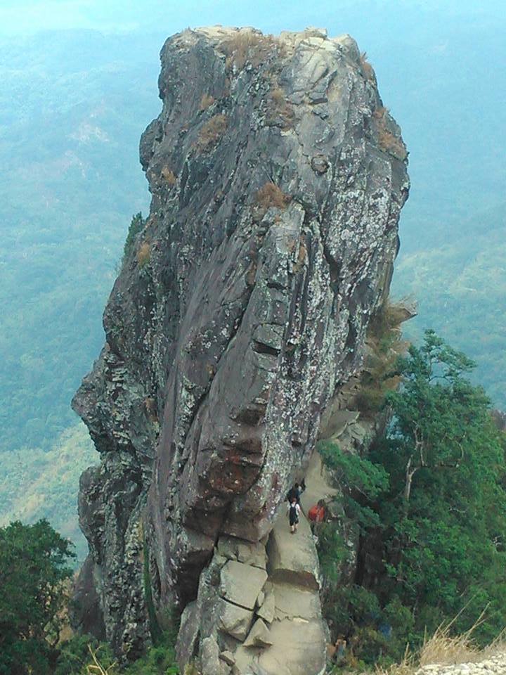
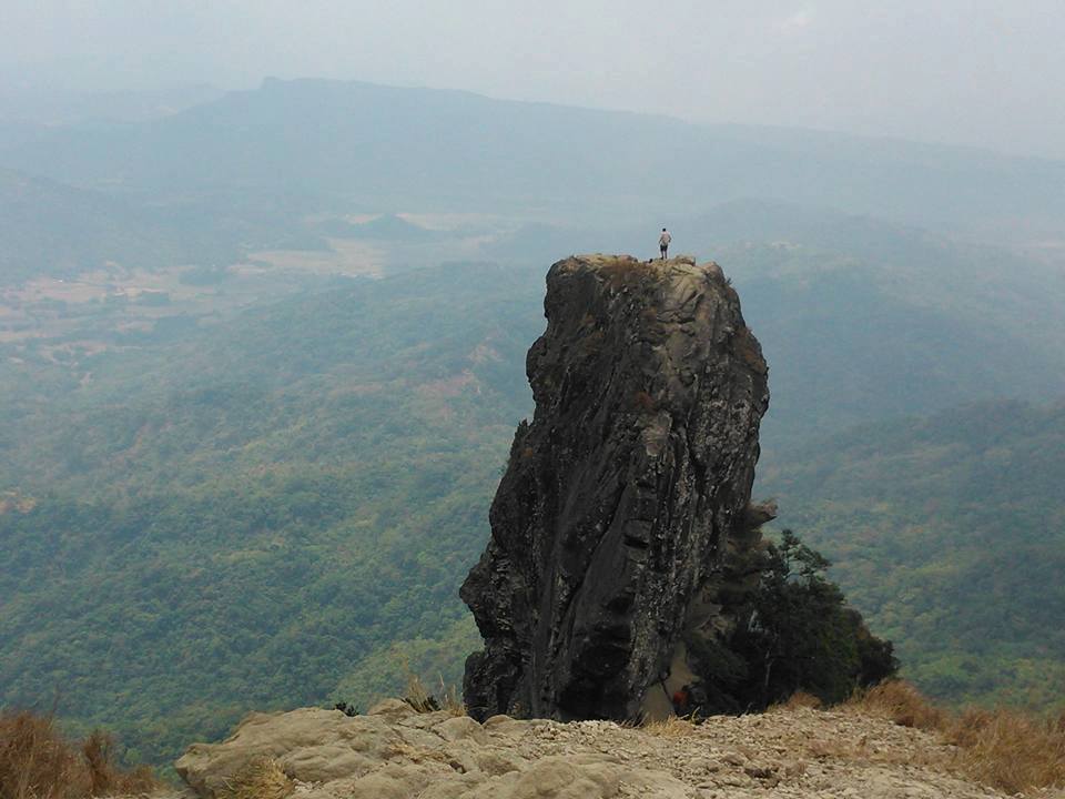
The monolith of Mt. Pico de Loro is a 50 feet high single pillar of stone standing near the summit. Climbing this monolith requires a bit of bouldering and rappelling but is something to be proud of by the hikers once they step on the top of the rock peak. Hikers will reward themselves with a priceless and memorable view that will last a lifetime.
According to its past history, Mt. Pico de Loro has been a dwelling place of Andres Bonifacio who is the father of the Philippine Revolution. Emilio Aguinaldo the first president of the Philippines recommended that Andres Bonifacio should be exiled at Pico de Loro. However, for some reason, his generals countermand him and they recommended Andres Bonifacio be executed at Mt. Tala. Hence, this demonstrates that the name Pico de Loro was around the Spanish colonial period in the Philippines.
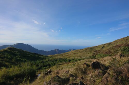
Pico de Loro means Parrot’s Peak. It was said that the mountain was named as such due to the pointed peak that looks like the shape of a parrot’s peak from far away and it is frequently used by the seafarers as an indicator to turn in the east direction in order to get to the historical Manila Bay and Corregidor Island. Presently, Mt. Pico de Loro or Mount Palay – Palay National Park is one of the nicest day hikes near Metro Manila and it’s one of the most visited mountains in the Philippines in the past decades.
Name: Mt. Pico de Loro
Difficulty: 3/9
Elevation: 688 MASL
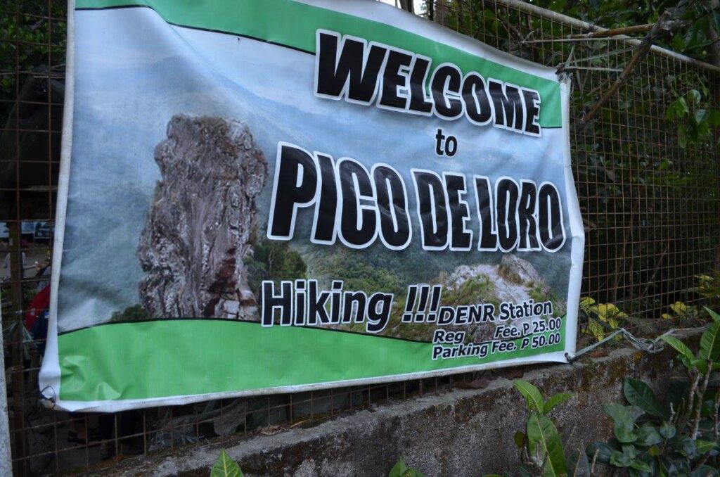
Jump-Off: DENR Station, Magnetic Hill, Ternate, Cavite, Philippines
Hours to summit: 2.5 to 3 hours
Features: tropical forest, peculiar apex, and sensational view of Cavite plains and the South China Sea
My trip to Mt. Pico de Loro
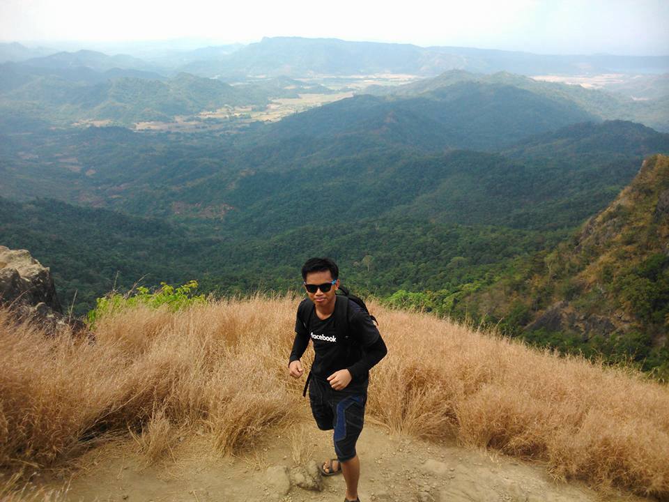
It was April 2016 when I decided to make a solo trip going to Mt. Pico de Loro. I arrive at the DENR registration area around 8 am after having a long bus ride, jeepney ride, and tricycle ride. I started the climb around 8:15 am after negotiating the guide fee and getting a local guide.
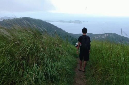
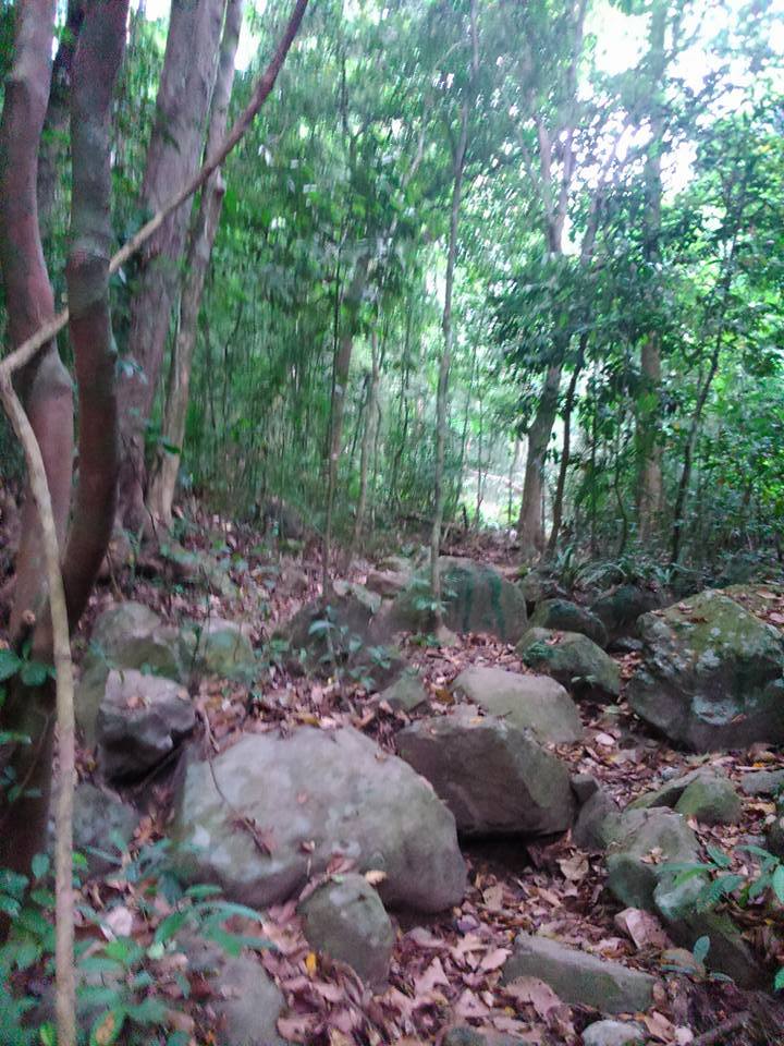
The initial footpath of Mt. Pico de Loro runs on a small creek which is composed of large and small slippery disperse rocks. Even though I wear Sandugo trekking sandals, I always slipped as I move forward on the trail because maybe this is only my second mountain to ever set my foot on. I think I lack hiking experience and this makes my movement so slow. Nevertheless, my local guide is very understanding and kind to me.
He even showed me the proper technique on how to land my foot as I walk on the stony trail. Afterward, we climb an array of constant ascending trails which last for nearly forty-three minutes. For this reason, I was already exhausted and gasping but my local guide gave me the motivation to continue to climb. We reach halfway through Mt. Pico de Loro past 9:30 am. At this point, I take a long rest to revitalize my tired body. I eat one fresh banana and drink my Gatorade inside my big backpack.
When I felt a bit energetic after the much-needed rest, we continue the assault going to the summit. In my perspective, the scaling became more and more strenuous as we pass through massive roots sticking out from the earth’s surface and eradicated trees blocking our way. Nonetheless, the weather become cooler and we managed to reach the campsite of Mt. Pico de Loro after twenty-five minutes.
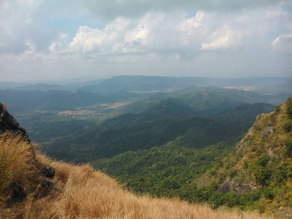
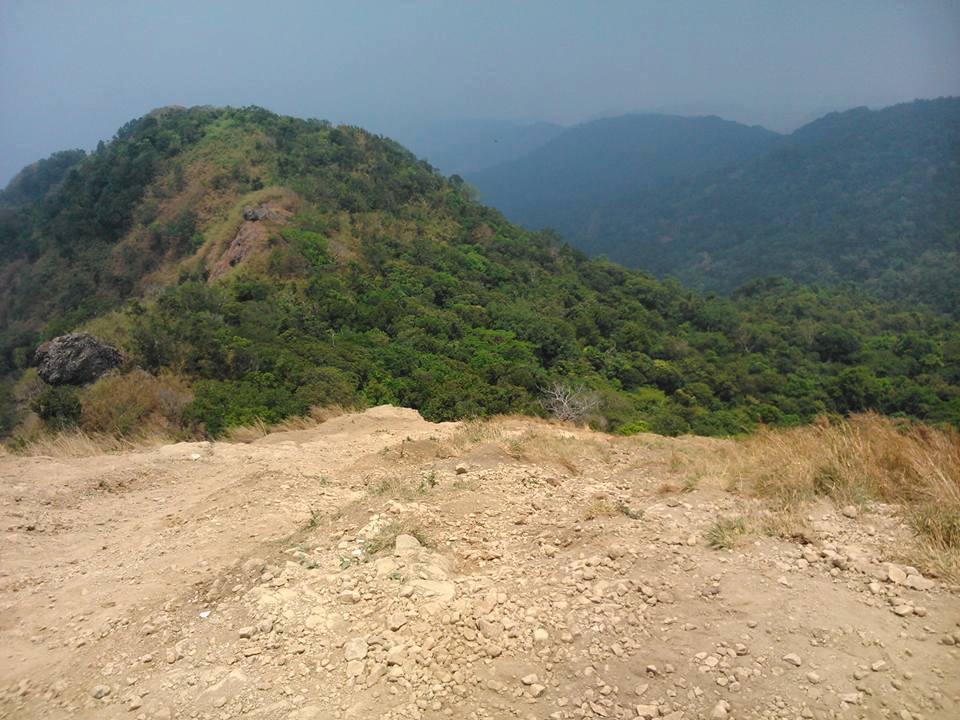
At the campsite, I saw a mini store that sells a variety of juices and cold drinks. I took the opportunity to buy some local goods and foods to refreshen my drained body. After that my local guide led the way to explore the campsite. Then I realized that the campsite is so wide and the view from nearby is staggering. I can see the wide lush green of the Cavite province and its remarkable coastline.
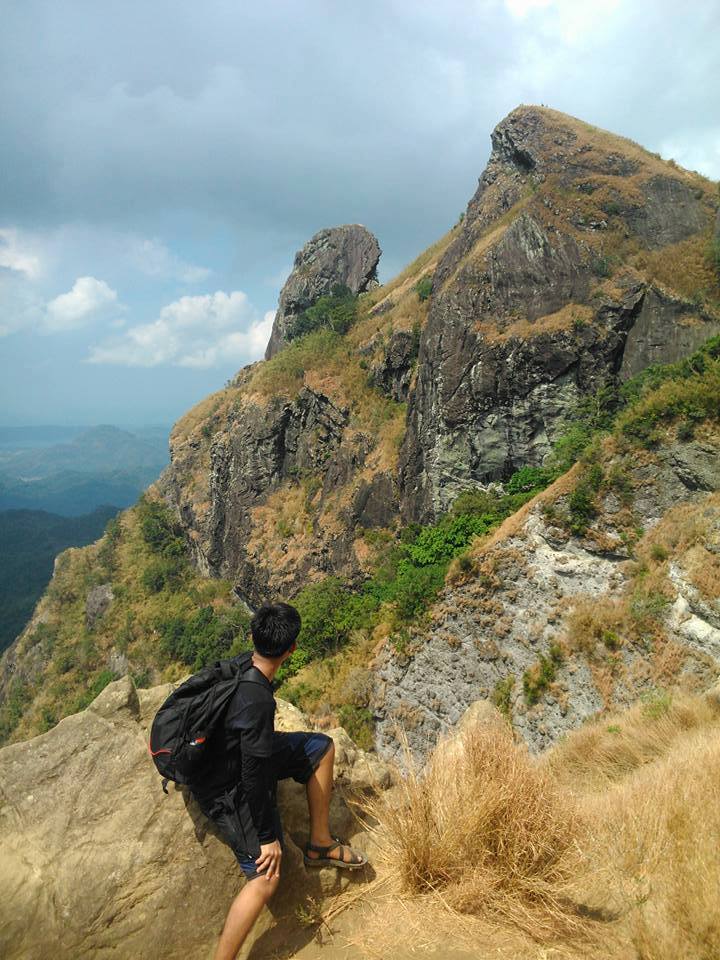
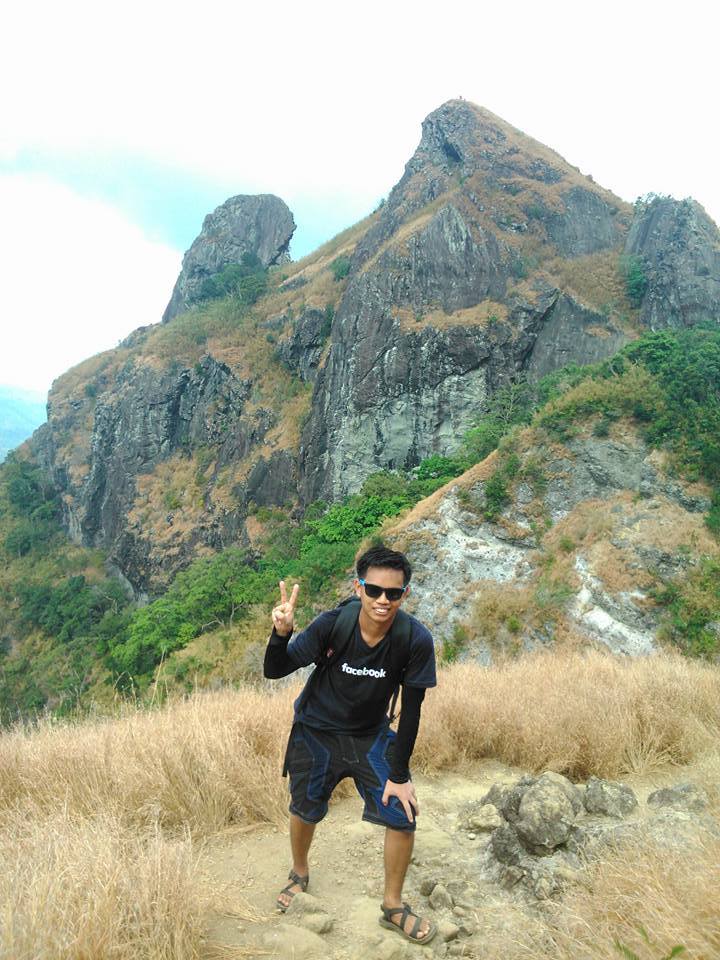
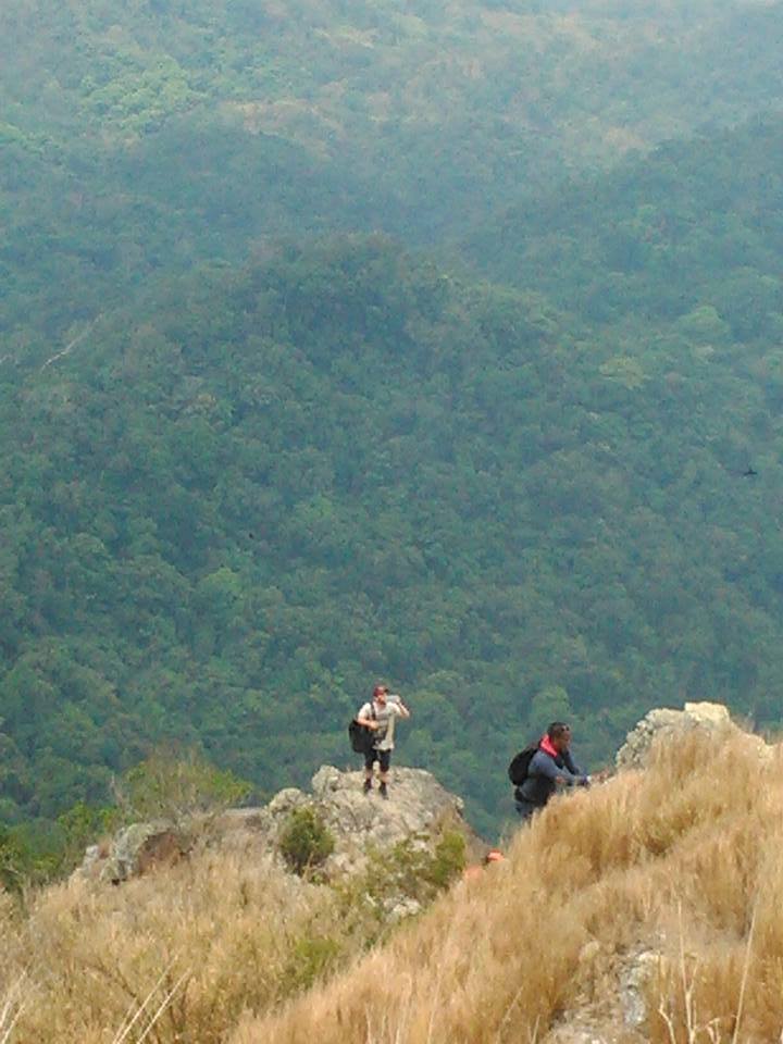
In addition, to the right side, I can see the bald towering summit and monolith of Mt. Pico de Loro impending from the background. As a result, I told my guide to take amazing pictures of me as a remembrance of the astounding view of the summit and monolith of Mt. Pico de Loro. We stayed at the campsite for nearly thirty-five minutes. Then after checking the time on my mobile phone, without further ado, we resumed the hike past 11:15 am.
The footpath we are trekking is so steep, precipitous, and slippery. Even so, I hold on to the oversize roots to continue moving forward on a wide difficult trail. Midway through my ascent, I can see the tricky cliffs on both sides of the mountain. For this reason, my knees are trembling because of fear and nervousness.
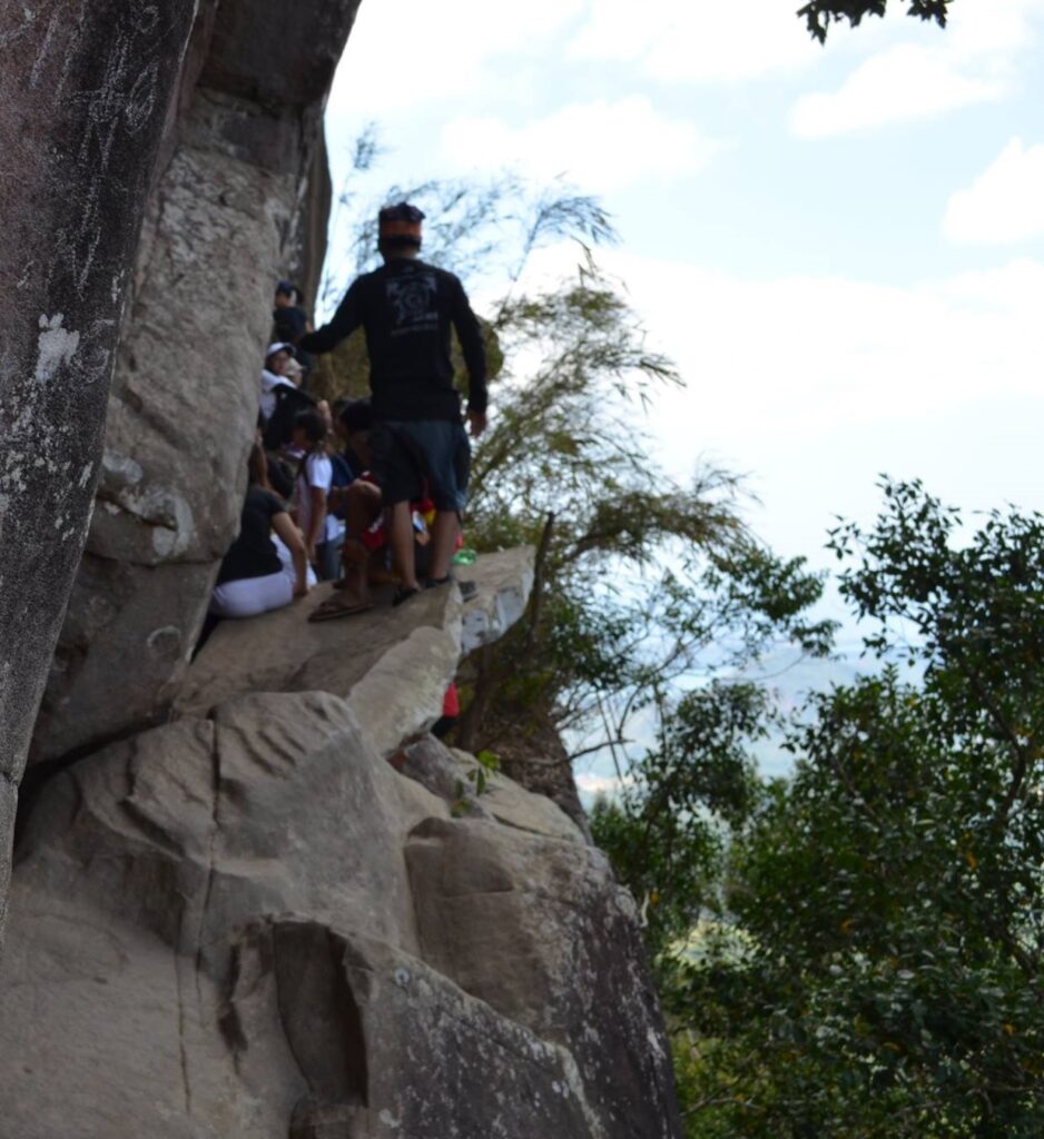
Nonetheless, after a few more minutes, I finally reach the flat ground at the top of the mountain wherein my knees stop trembling because I saw many hikers taking pictures and sharing ideas with each other. Then my guide told me that this is not the real summit because the summit is still 90 feet away. So I continue the assault on a dusty trail and I hold on to whatever small rocks protruding from the soft earth to have a good balance as I go up.
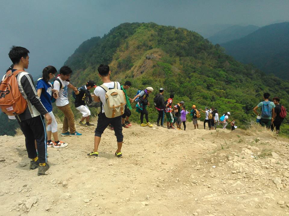
Then I saw many hikers going down and small stones with dust falling my way which made the hike more difficult for me. However, after my strong determination to reach the apex of the mountain, I finally made it to the summit of Mt. Pico de Loro. I was very glad at that moment because I accomplish one of the great things in life. Then I saw other mountaineers celebrate their journey on the top of the mountain by shouting, joking, and taking unstoppable pictures.
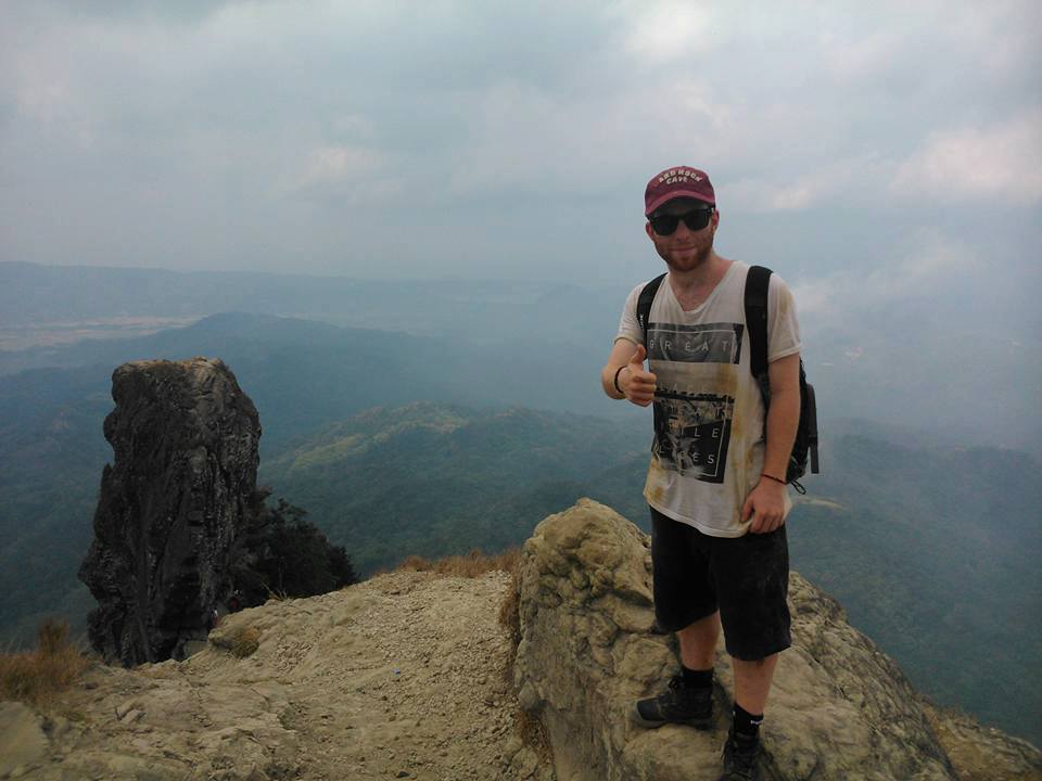
We stayed at the summit for twenty minutes to savor the beautiful scene. At that time I meet a male foreigner coming from the United States of America. He told me and my guide to take pictures with him. After that, we decided to pursue climbing the treacherous monolith of Mt. Pico de Loro. First, we need to go down from the summit passing the sheer rugged cliff. Along the trail, sometimes I need to sit on the rocks and use my two legs to be able to reach another area to land on and to be able to move down because my knee starts trembling again.
The guide and the foreigner waited for me for a little while. Then a few more minutes, I finally reached flat ground near the base of the monolith. I look up to the summit of Mt. Pico de Loro and I never thought I have to courage to descend. We rest for three minutes before we continue the climb. Then my guide gave me a signal to start climbing again. This time I pass by one of the most difficult sections of the monolith. I pulled myself using a rope through a tight 80-degree abyss to get to the next safe landing area.
In my opinion, if one wrong mistake happens then it will lead to a horrible accident. Even so, I conquered my fear of heights and I managed to get to the monolith of Mt. Pico de Loro without any injury or bad things that happened. My guide told me that I have a mentality that doesn’t give up in any situation. For this reason, I was so encouraged and ecstatic when I heard him say that line. Reaching the apex of the monolith or Parrot’s Peak is such a fulfillment to me because it measures my agility and my determination in the final slog.
Once again I reward myself by breathing the fresh air from above, the cool sea breeze, and taking lovely photos of the amazing landscape below. The ambiance is superior and it’s definitely worth the trip. I stayed at the monolith for fifteen minutes. Afterward, it’s time to descend. I scramble my way through a scary cliff again for a moment. Then I reached the base of the monolith after several minutes of a steep descent.
I drink water and we continue our way going back to the summit and campsite of Mt. Pico de Loro. We did a backtrail. When we reach the wide campsite I immediately order some food as my lunch. After done eating, we resumed the descent going back to the jump-off point of Mt. Pico de Loro. Then I said to myself that this mountain has a lot to offer because of its natural beauty, abundance, and nice atmosphere.
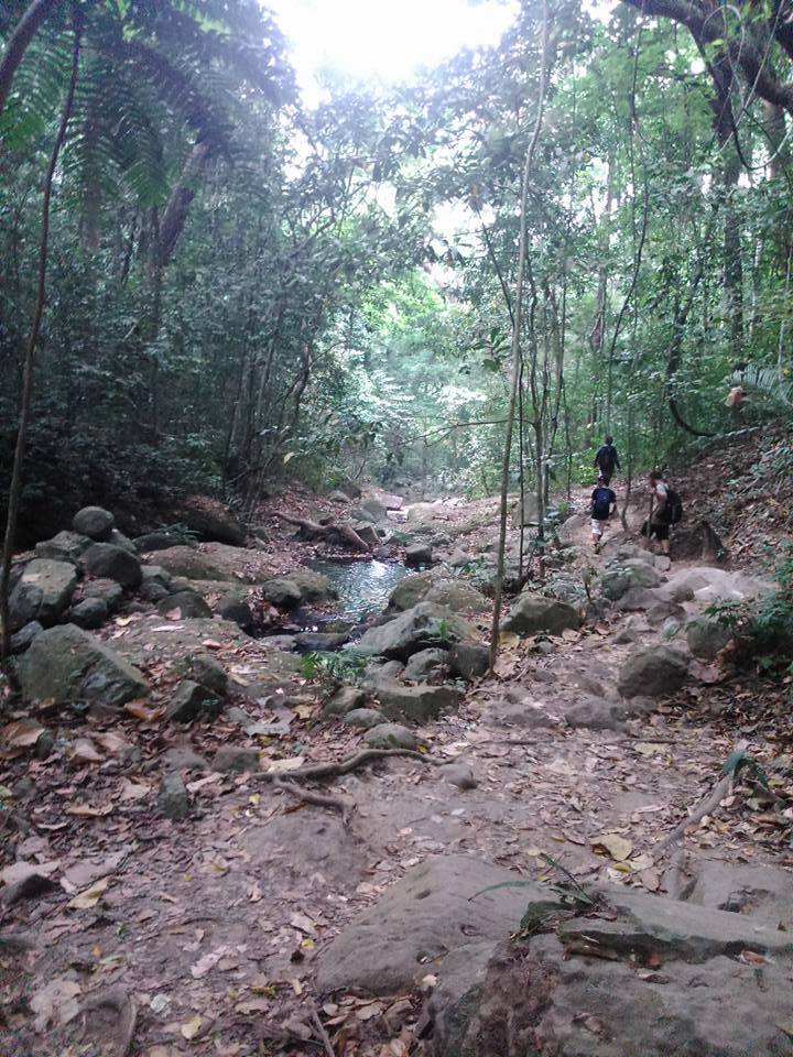
While hiking I can see birds singing at the top of the trees, monkeys roaming around, orchids hanging on the colorful branches, and fruit-bearing trees such as coconut and mangoes. One thing I like about Mt. Pico de Loro is that is such a cool climb because much of its trail is covered with a lot of trees and plants. We reach the DENR jump-off point around 2:45 pm and we changed clothes. After that, I give thanked my local guide.
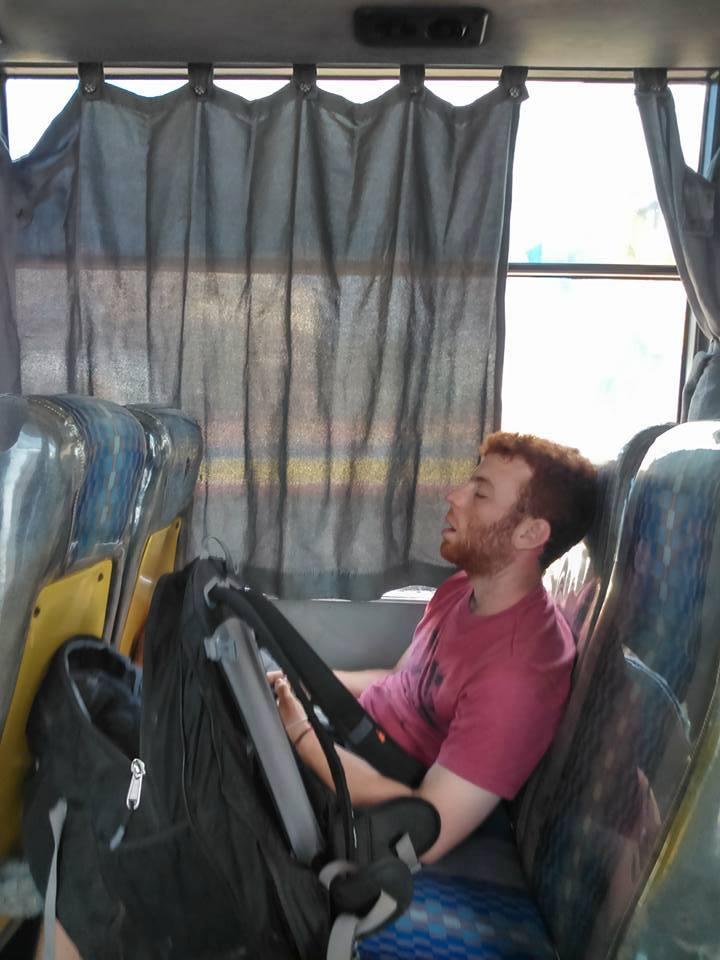
From there, I and the foreigner agreed to ride a tricycle to lessen our expenses. Knowing that the foreigner doesn’t know the way to go back to Metro Manila, together we ride an airconditioned bus. I saw him sleep on the bus because he was so tired. It was late in the afternoon when we arrived at Metro Manila intact and unharmed. It was an awesome adventure. Mt. Pico de Loro is the second mountain I conquered in the Philippines.
Sample 1 Day itinerary to Mt. Pico de Loro
4:15AM – Assembly near the PITX bus terminal
5AM – Ride a bus going to Naic, Cavite
7:30AM – Ride a jeep going to Ternate, Cavite
7:40AM – Ride a tricycle going to the DENR registration and jump-off point
8:30AM – Start trekking
9:50AM – Base camp, rest, and picture taking
10:30AM – Resume hiking
11:10AM – Summit of Mt. Pico de Loro
11:40AM – Climbed the monolith
12:40PM – Start descent
3PM – Back at the jump-off point
3:15PM – Ride a tricycle going back to Ternate, Cavite
4:05PM – Ride a bus bound to Pasay City
6:30PM – Arrive at Pasay City
Note: the above itinerary is subject to changes without prior notice.
Things to bring on your visit to Mt. Pico de Loro:
1.5 liters of bottled mineral water or any rehydration fluids
Pocari Sweat or Gatorade drink (optional)
Pocket money
Camera and mobile phone
Extra set of clothes and shorts
Slipper, hiking sandals, or hiking shoes
Trail food like banana chips, tuna, trail mix, hard-boiled egg, chocolate, candies, fresh fruits, and preferred brand of chips
Cap
Toiletries such as tissue, toothbrush, soap, and shampoo
Arm sleeves
Off mosquito repellent lotion (optional)
Sunscreen (optional)
Whistle (optional)
Trekking pole (optional)
One valid government-issued ID
Reminders and Tips:
- Mt. Pico de Loro is open to all tourists and hikers coming from different parts of the world.
- For scheduling and online booking of the Mt. Pico de Loro dayhike, just visit this page https://mppmngnp.com/. Also for contact information and other details about the climb please visit the official Facebook page of MPPMNGPL (Mounts Palay-Palay–Mataas-na-Gulod Protected Landscape) – https://www.facebook.com/picoPAMB.
- After you successfully book online, you must bring onsite your complete summary of your online booking for verification purposes.
- Mt. Pico de Loro is a beginner-friendly mountain that has a total trail length of six kilometers and it runs on a well-established trail.
- Getting a tour guide is required especially if it’s your first time hiking Mt. Pico de Loro. A tour guide can be found at the DENR registration area.
- Please be reminded that no walk-in is allowed. In addition, overnight camping is strictly prohibited.
- If you’re a seasoned mountaineer you can do a traverse day hike which starts from the Ternate DENR registration area and ends at the municipality of Nasugbu in Batangas.
- It takes an average of three hours of hiking in order for the hikers to get to the summit and monolith of Mt. Pico de Loro.
- Please follow the mountain rules and regulations at all times. Staying overnight and doing rock vandalism is not allowed. Bringing deadly weapons or any alcoholic drinks is strictly prohibited by the management. Also, smoking and vaping inside the mountain are strictly prohibited.
- There are no lipa, rattan, or blood leeches inside the mountain trail.
- The registration fee or entrance fee in Mt. Pico de Loro is 200 pesos per head to be paid onsite. Meanwhile, for foreigners, the entrance fee is 300 pesos per head which include the use of amenities.
- The parking fee for private vehicle range from 50 pesos up to 300 pesos.
- Renting a tricycle from Ternate going to the DENR jump-off point cost 200 pesos.
- Mobile signal is mostly present throughout the whole trail with the exception of the summit and monolith area.
- After finishing the climb you can have your favorite meal at Lolo Claro’s Restaurant in the Maragondon branch or Naic branch.
How to Go to Mt. Pico de Loro (by commute)
By commute
- Ride a passenger bus or jeep bound to the PITX bus terminal in Paranaque City.
- From PITX terminal, ride an airconditioned bus going to Naic, Cavite
- From Naic municipality, ride a jeep going to Ternate municipality
- Then from Ternate, ride a tricycle bound to the Mt. Pico de Loro registration area. The tricycle fare is around 150 to 200 pesos and it’s suitable for three people only.
There you have it day-tripper. We need to start now before it’s too late because adventures make you smarter, feed your dream, build your confidence, and most importantly forged new friendships. Altogether I expect this Mt. Pico de Loro climb guide has been accommodating to you and to your circle of friends. Stay safe and I hope to see you on the trail.
Jervis Ergino
Hi! I’m Jervis Ergino, the digital content creator behind Hike to Mountains, a travel and hiking blog in the Philippines. This blog is dedicated to helping people know more about the best hiking and tourist destinations in the Philippines.