Mt. Pinagbanderahan + Bantakay Falls Climb Guide
Introduction
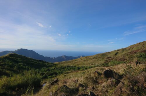
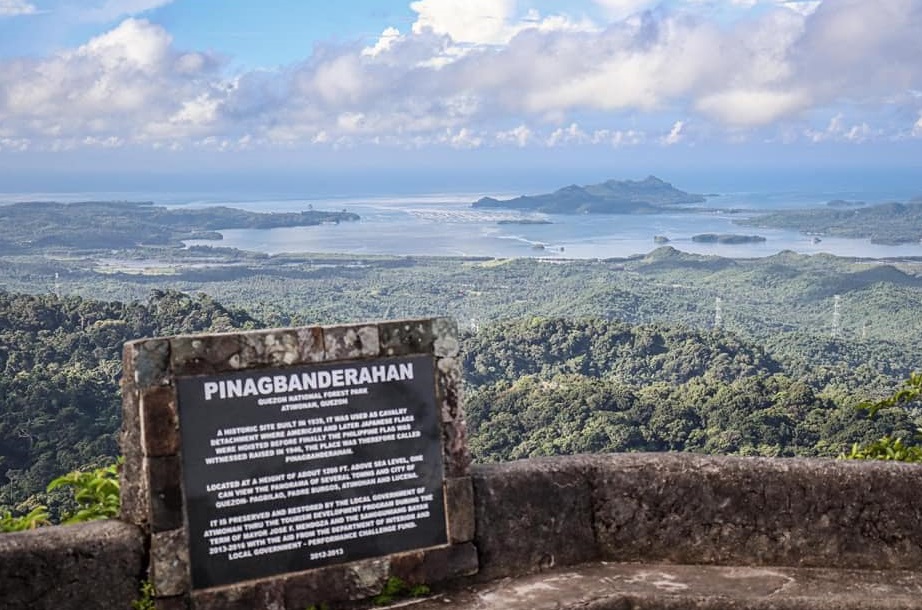
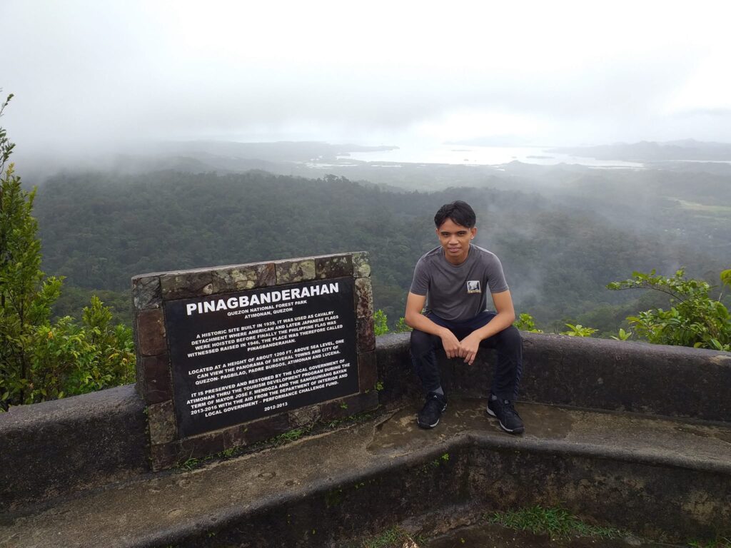
Mt. Pinagbanderahan is a historical mountain located in the municipality of Atimonan in the province of Quezon. It has a height of 365 meters above sea level or 1200 feet. Mt. Pinagbanderahan offers visitors and tourists a panoramic view of several towns and cities of Quezon such as Atimonan, Pagbilao, Tayabas, Lucena, and Padre Burgos. Also from the top of Mt. Pinagbanderahan, visitors can see the beauty of Mt. Banahaw, the islands of Marinduque as well as the Pagbilao Bay, Tayabas Bay, and the island of Borawan.
According to its history, Mt. Pinagbanderahan is a historic site built in the year 1939 during the American colonial period in the Philippines. It was used as a cavalry detachment where American and later Japanese flags were hoisted before finally the Philippine flag was witnessed raised in the year 1946 after the second world war, the place therefore called Pinagbanderahan. “Pinagbanderahan” is derived from the Tagalog word “bandera” or flag in English, because in this mountain the flags of the three countries that have witnessed our colorful history are waved. Fast forward, it is preserved and restored by the Local government unit (LGU) of Atimonan with the help of the tourism development program during the term of Mayor Jose Mendoza and the Sangguniang Bayan in the year 2013 up to 2016 with the help coming from the Department of Interior and Local Government (DILG) – Performance challenge fund. Presently, Mt. Pinagbanderahan is part of the Quezon Protected Landscape governed by the National Integrated Protected Areas System (NIPAS). This protected landscape covers approximately 938 hectares spanning much of Quezon province. It was first established as Quezon National Forest Park by former President Manuel Luis Quezon on October 25, 1934, thru Proclamation No. 740. So if you want to know a piece of the glorious history of the Philippines, then Mt. Pinagbanderahan is the perfect mountain to hike.
Name: Mt. Pinagbanderahan
Difficulty: 1/9
Jump-Off: Barangay Malinao Ilaya, Atimonan, Quezon, Philippines
Hours to summit: 1.5 hours
Features: lush greenery and historical site
My trip to Mt. Pinagbanderahan
I’ve never set foot in Quezon province and I want to see the beauty of Mt. Pinagbanderahan as well as Bantakay Falls. For this reason, I joined a well-coordinated day tour going to Quezon. It was Saturday evening when I left my house and ride a taxi going to one of the pick-up points of our high-roof van. It was about 11:55 pm just on time when I arrived near the Mercury Drug in the Greenfield District. After that our high-roof van started rolling toward Atimonan.
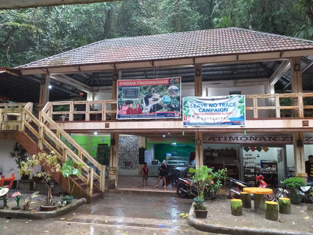
It takes five hours and twenty minutes of road trip until we arrived at the registration and jump-off point of Mt. Pinagbanderahan around 5:20 am. Then I found it was raining heavily during that time and there was no sign that the rain will stop. As a result, I felt like I just wanted to sleep and stay in the van for a long period of time. Even so, after a few minutes, I have to go outside to see the whole area of the jump-off point and to have our name registered.
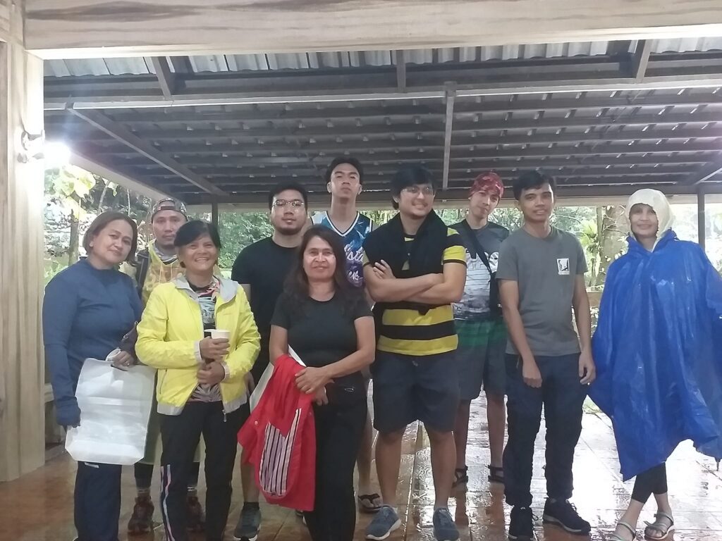
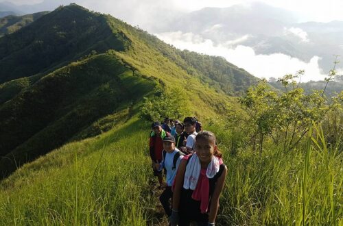
It was around 7 am when we had a short orientation about the do’s and don’ts while hiking Mt. Pinagbanderahan. After that our three teenage tour guides named Barren, Jonalyn, and Shairyn were introduced to us and we have our group picture taken. After some of the group members were already suited in a raincoat, we start hiking at 7:35 am and I noticed that the initial part of the trail is covered in lush densely green forest which is so enticing. The forest is well-preserved by the locals and kudos to them for naming the trees inside the forest and their scientific names.
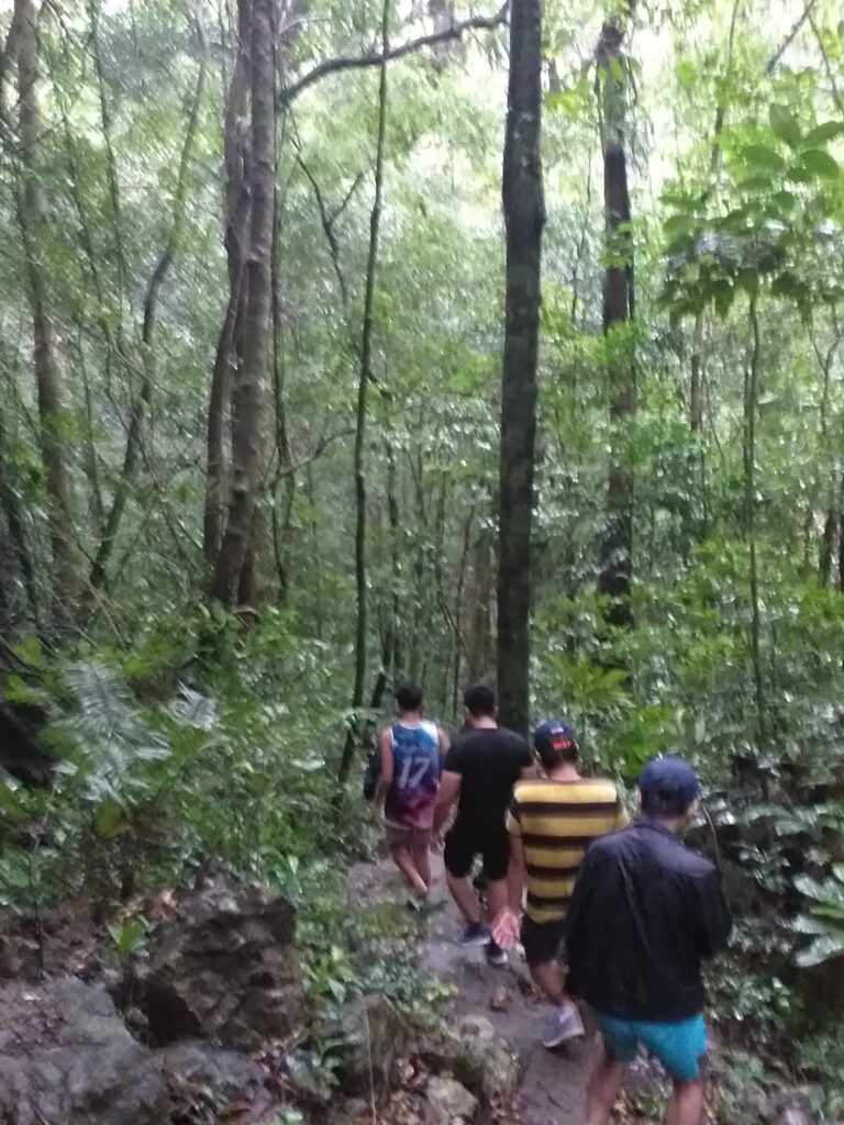
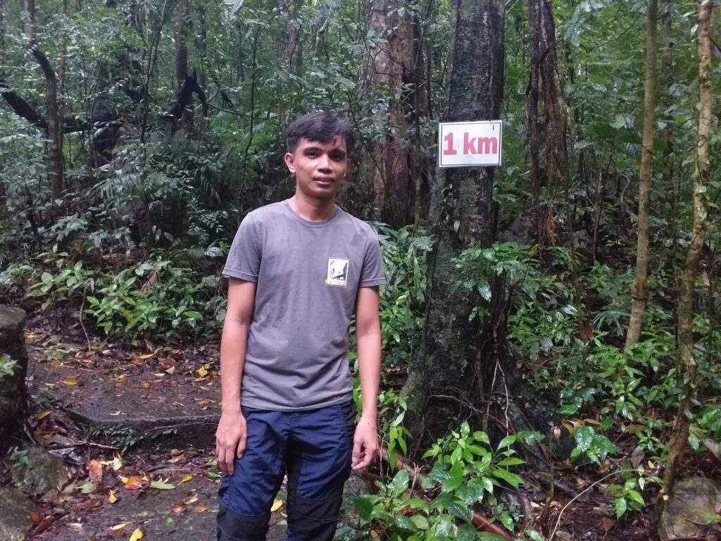
I also noticed that the ligas plant is abundant along the trail and while walking inside the forest, I can even hear a lot of recognizable sounds coming from birds and insects. At 7:54 am we reached the one-kilometer signage and from there we take solo pictures. Then we reached a unique rock formation so we have our group picture taken.
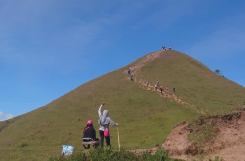
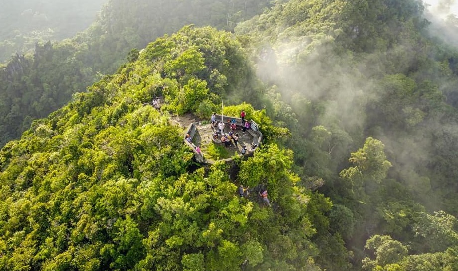
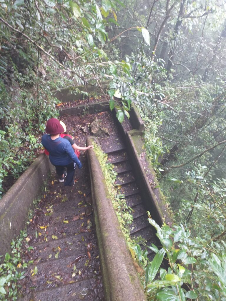
After that, we passed a concrete staircase that leads us to the first viewing deck. We take a long rest at the small resting station just 500 meters away from the summit of Mt. Pinagbanderahan. At this point, we share funny stories and talk about the mountains we climbed before and the upcoming long holiday in April.
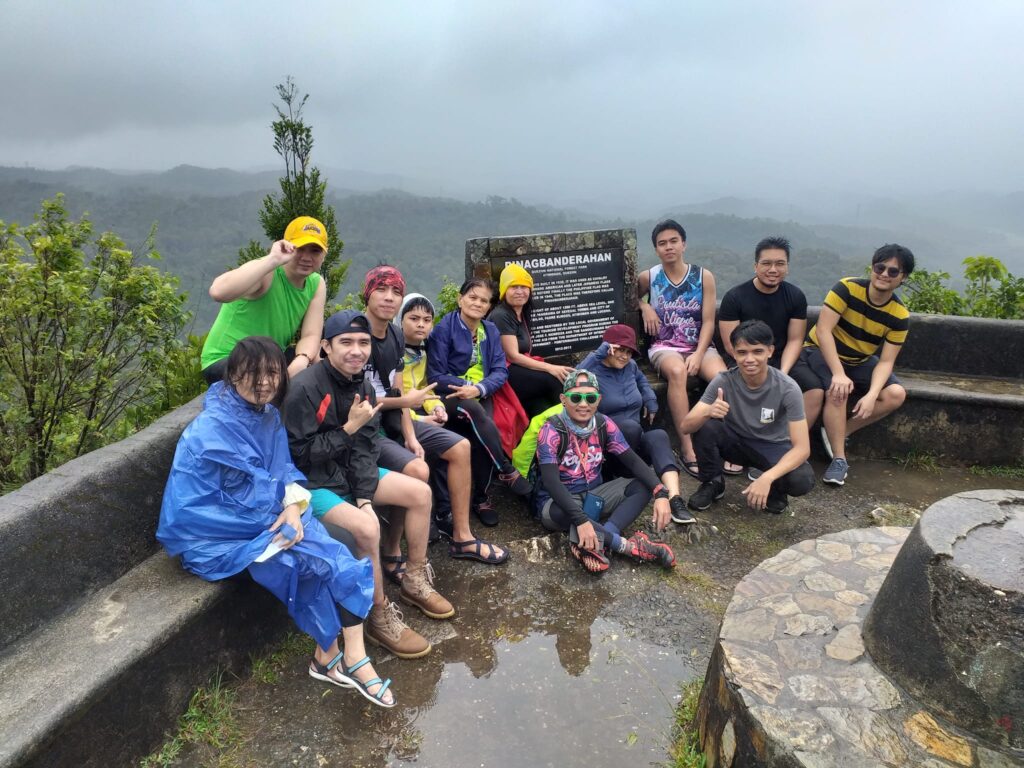
We reached the summit of Mt. Pinagbanderahan at 8:51 am and we are so lucky that we have a decent clearing for a small period of time even though it was still raining and windy because of amihan monsoon. For this reason, we take solo pictures and group pictures with the summit signage of Mt. Pinagbanderahan. Undoubtedly, the mountain played an important role in our history and we stayed at the summit for twenty-four minutes as we enjoy the cool breeze of air and the 360 degrees view of Quezon which include Mt. Banahaw.
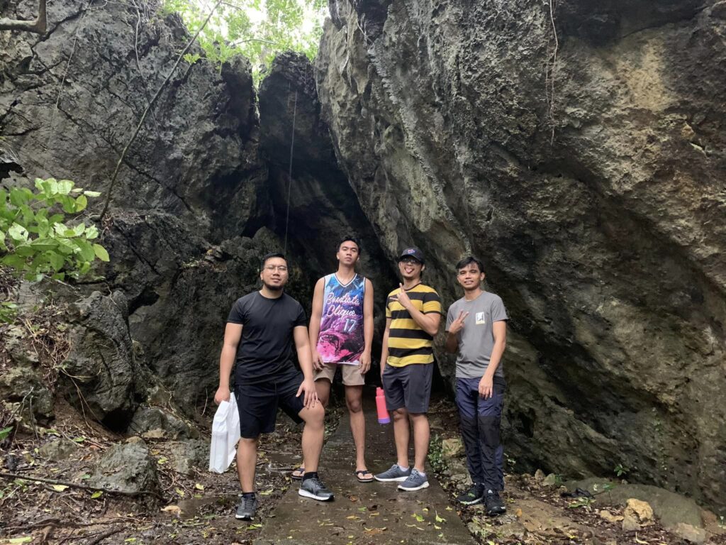
We start descending downstairs around 9:15 am and I describe Mt. Pinagbanderahan as a mountain inside the vast national forest park. Then our guide points us to some caves that are open in the past years, it is believed to be the hideout of Filipino guerillas during the Japanese occupation of the Philippines in the 1940s. Nonetheless, it was closed now because of erosion caused by typhoons.
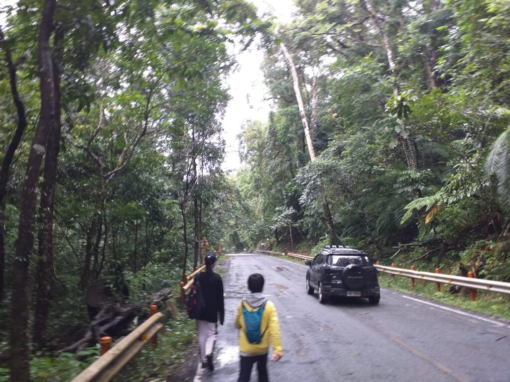
It only took us forty-five minutes of descending to reach the Pan-Philippine Highway or the Old Zigzag Road which marks the end of the trail. As a result, some of the group members take solo pictures on the highway as there are only a few vehicles that pass by during that time. Afterward, we headed to our high-roof van and change clothes.
Then our van headed toward the registration point of Bantakay Falls. Near the registration, we took an early lunch, and our meals our fish, chicken, and pangat laing with rice. While eating I found out that one of the group members who are 61 years old and a female already climb Mt. Apo. She even told me that the cost of hiking Mt. Apo coming from Manila is 20,000 pesos which includes the airfare and a side trip to Samal Island. Also, we found out that the child with him is only nine years old and has asthma and she told us that hiking will greatly improve his health condition and make him immune.
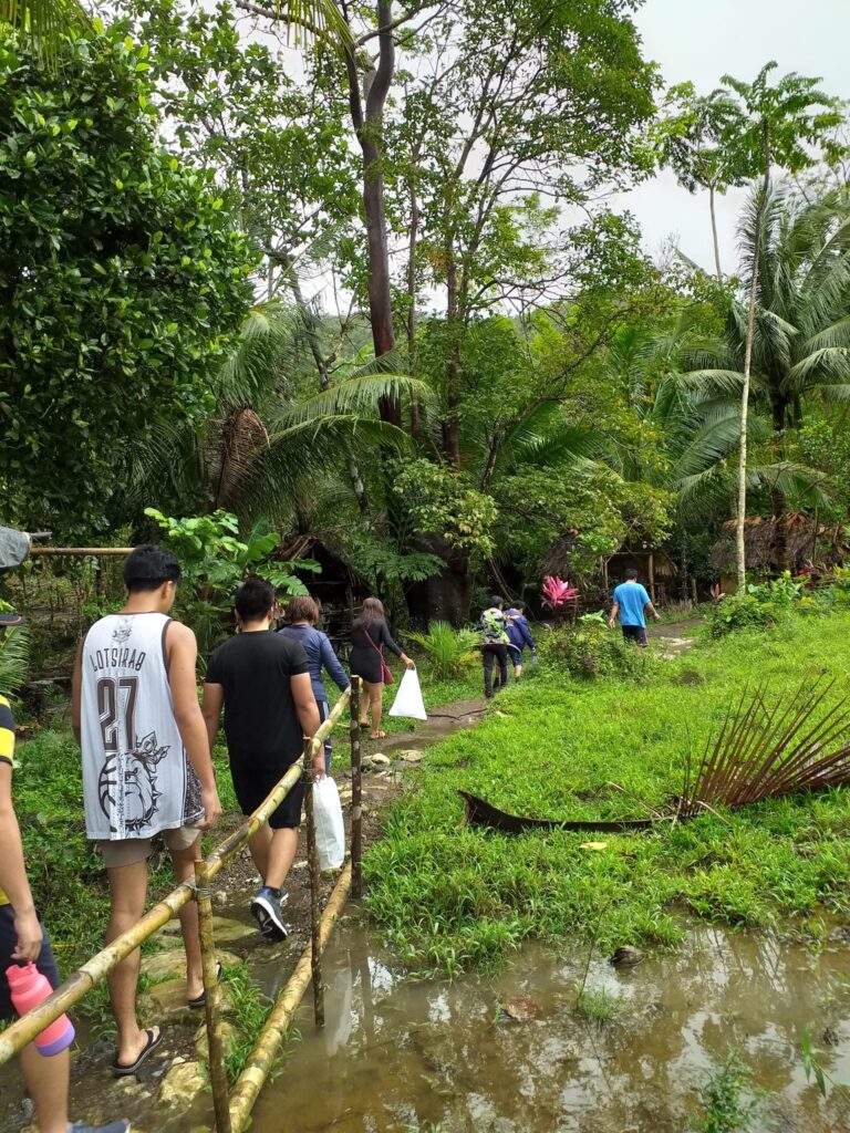
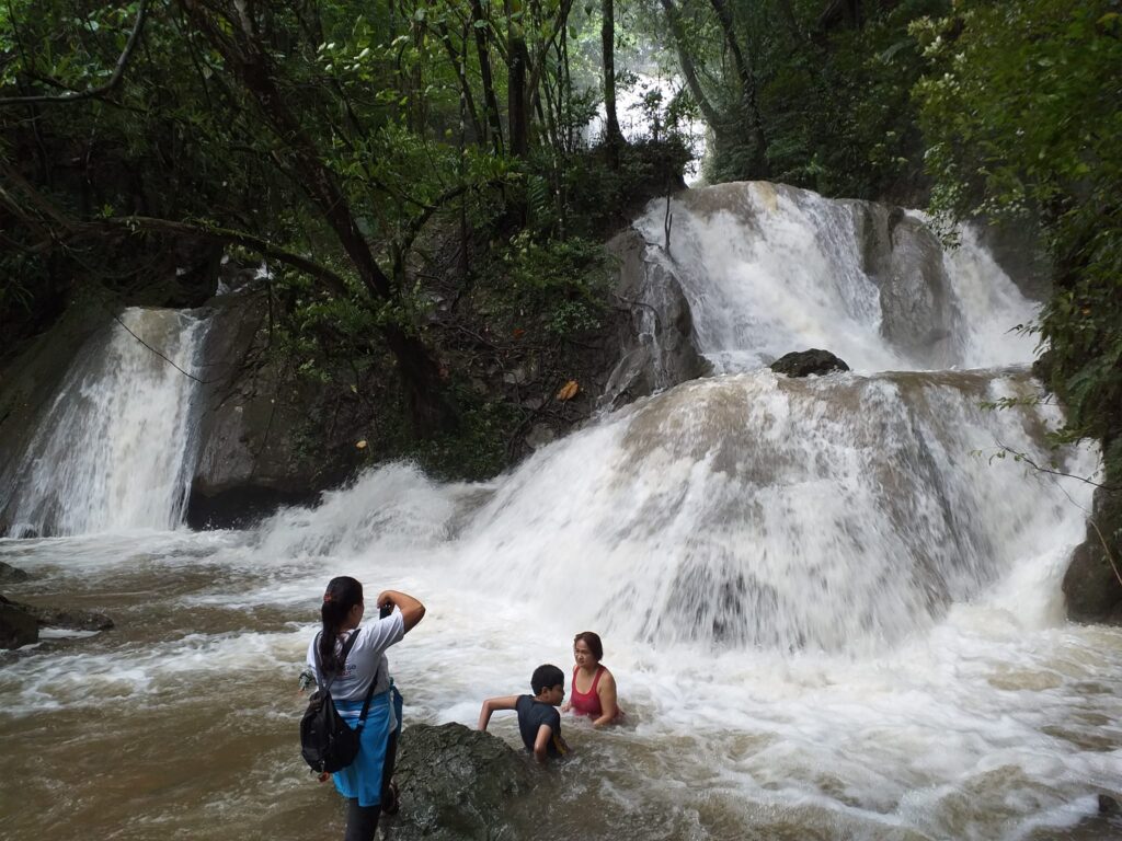
After our lunch, our van proceeds to the jump-off point of Bantakay Falls and later we started to trek. It only takes us fifteen minutes to reach the cottage where we can have a great view of the soaring falls. Even though the water current is a little bit strong because of the rain, some of the group members did swim and trekked toward the upper section of the falls to have a much more scenic view. According to our tour guide named Joel Ramon, Bantakay Falls has a height of 100 feet or 31 meters. It is often called by many locals the hidden falls of Atimonan. In my perspective, Bantakay Falls is an ideal place for family getaways and groups of friends.
Later Joel told us that there are two ghosts in Bantakay Falls, one is a boy and one is a teenage girl and we will only see the ghost if we have a third eye. Regardless, we have a drinking session at the cottage because one of the group members brought out two bottles of red horse beer. We talk about our best experiences in hiking the mountains in Luzon. He even shared with me the reasons why he always does road biking, motorcycling loop, and climbing mountains during the weekend. One of the reasons is to forget the love of his life who just recently passed away.
We leave Bantakay Falls around 1:43 pm and later we have a notable bathing experience in the field. Later our high-roof van started rolling going back to Metro Manila. Along the way, we have a stopover to eat delicious goto and bulalo around 5:45 pm. It was 8:20 pm when we drop off at EDSA Estrella near the Petron gasoline station and what a catchy weekend adventure it was. Overall my trip to Mt. Pinagbanderahan sums up this life quote “When you’re looking for peace, nature is always the answer”.
Sample itinerary to Mt. Pinagbanderahan and Bantakay Falls
12AM – Assembly at the designated place
12:30AM – Departure going to Atimonan
5:30AM – Arrive at Quezon Protected Landscape, register and take breakfast
6:45AM – Start hiking
8AM – At the summit of Mt. Pinagbanderahan, rest and take photos
8:30AM – Start descending
9:20AM – Back at the jump-off point, logged out
9:40AM – Going to Bantakay Falls tourism information center
11AM – Early lunch just beside the tourism information center
12:15PM – Proceed to Bantakay Falls jump-off point, start trekking
12:32PM – At Bantakay Falls, swimming time, chill and relax
3PM – Back at the jump-off point, tidy up
4PM – Going back to Metro Manila, buy yema cake and dinner along the way
9:35PM – Home sweet home
Things to bring on your visit to Mt. Pinagbanderahan:
500 milliliters (mL) of bottled water or tumbler
Extra shirt and short
Handkerchief or small towel
Trail food like biscuits or a chocolate bar
Swimming attire if your group has a side trip to Bantakay Falls
Personal medicine
Toiletries
How to Go to Mt. Pinagbanderahan
By commute
- From the Cubao bus station terminal in Quezon City, ride a passenger bus bound for Lucena, Quezon province. Tell the bus driver or bus conductor to alight you at Lucena Grand Central Terminal. The estimated travel time is around three to four hours and the bus fare is 270 pesos and above.
- Then from the Lucena Grand Central Terminal, ride a passenger van bound for Atimonan and drop off at Quezon Protected Landscape. You can also tell the driver that you will be heading to Mt. Pinagbanderahan’s jump-off point. The van fare is 120 pesos and above.
Note: Alternatively, you can ride an A&B Liner bus at the PITX terminal in Paranaque City and tell the driver to drop you off in Barangay Malinao Ilaya in Atimonan.
By private car
- Pin the Quezon Protected Landscape on your Waze app. Just go straight from Lucena – Pagbilao then you will see the Quezon National Agricultural School (QNAS), there are two roads ahead and you need to turn left.
- Then the next option you choose is the Old Zigzag road, but you can also go through the New Zigzag road. Just go straight until you reach the foot of the Quezon Protected Landscape in Atimonan.
Reminders and Tips:
- Mt. Pinagbanderahan is a minor climb that has a difficulty of 1/9 and it’s ideal for beginners because it has a trail length of only 2 kilometers from Quezon Protected Landscape jump-off point up to the summit. The total trail length is 4 kilometers which are back and forth. In addition, the trail is well established and for the most part, it is cemented and easy to navigate.
- For a tour guide in Mt. Pinagbanderahan, kindly contact Barren thru his Globe number – 09162554736. On the other hand, for a tour guide in Bantakay Falls please contact Joel Velasco Ramon at his cellphone number 09155774347.
- At the jump-off point, you can buy a typical Filipino breakfast food such as tapsilog, tocilog, longsilog, bangsilog, sisilog and porksilog which cost 100 pesos. Also, you can buy Atimonan express, afritada, pinakbet, laing, pinangat and giniling for only 80 pesos each. The variety store also sells bottled water, snacks, souvenirs, delicacies, and coffee.
- The tour guide fee in Mt. Pinagbanderahan is 300 pesos and it’s suitable for a group of five people. On the other hand, the tour guide fee in Bantakay Falls is also 300 pesos, and it’s good for six people. Getting a tour guide to go to the falls is required because the trail going to the falls is deceptive. Note: rates are subject to change without prior notice.
- There is no water source along the trail of Mt. Pinagbanderahan so better bring enough water.
- Don’t leave any trash along the trail and always keep the place clean.
- Bantakay Falls is located at Barangay Santa Catalina in Atimonan and it’s just twenty minutes away from Mt. Pinagbanderahan jump-off point. To go there, tourists can either walk or ride a tricycle going to the registration point of Bantakay Falls.
- No tourist whether local or foreign is allowed to desecrate or carve the stones, or trees that can be seen inside the tourist destination.
- All tourists are also reminded to take care of their important equipment such as wallets and cell phones because if it’s lost, it is not the responsibility of the barangay tourism office.
- For all those who do not know how to swim are reminded not to go into the deep part of the water in Bantakay Falls. Also, it is no longer allowed to practice diving in the higher part of the falls for safety.
There you have it, backpacker. The world is a book and those who do not travel read only a page. All in all, I hope this Mt. Pinagbanderahan day hike guide has been helpful to you and to your groups. Keep exploring and thank you for reading my blog.
Jervis Ergino
Hi! I’m Jervis Ergino, the digital content creator behind Hike to Mountains, a travel and hiking blog in the Philippines. This blog is dedicated to helping people know more about the best hiking and tourist destinations in the Philippines.