Mt. Tuwato Dayhike Guide
Introduction
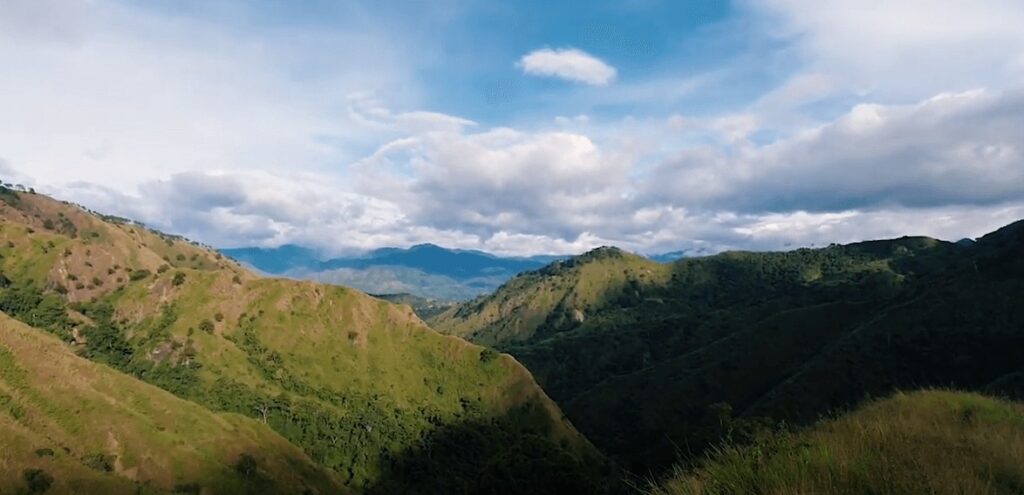
Mt. Tuwato is considered by many as one of the most difficult mountains to climb in the Philippines and it’s located in the municipality of Cervantes in the province of Ilocos Sur. It has a difficulty of 9/9 and has a trail class of 2 to 5 with free hands and feet as the climbing method. Mt. Tuwato has an elevation of 1720 meters above sea level or 5643 feet. It offers seasoned and experienced mountaineers unforgettable river crossings, craggy ridges, steep assaults and cliffs along the footpath, and the windy climate at the monolith and at the summit with the tremendous view of the Ilocos region. The Ilocano word Tuwato means “dragonfly” in English and “tutubi” in Tagalog dialect. The mountain was named as such because the dragonfly is a common sight along the super-long trail of Mt. Tuwato.
Name: Mt. Tuwato
Difficulty: 9/9
Jump-Off: Barangay San Luis, Cervantes, Ilocos Sur
Features: fantastic view of Ilocos Sur mountains and highlands, knife edges, ridges, pine-forested trail, grassland, and multiple river crossing
My trip to Mt. Tuwato
In the past few days, I saw someone posted in the mountaineering group about the Mt. Tuwato dayhike this upcoming Sunday. So I was intrigued about the mountain and searched on the internet about what it feels like to climb this mountain and I found out that Mt. Tuwato is very proportionate to the mountains in the Southwestern Tagalog region including Mt. Halcon and Mt. Mantalingahan in terms of difficulty. I’ve never done a dayhike event with a difficulty of 9/9 so after several days, I decided to join the dayhike event because I want to try and experience it and I considered it as my year starter climbs in 2023.
It was Saturday afternoon around 5 pm when our van started rolling towards the province of Ilocos Sur. After nearly eight hours of night road, we arrived at the registration point of Mt. Tuwato in Barangay San Luis in Cervantes. We have a brief orientation about the mountain trail and after that, we leave in the van some of the things that we don’t need in the climb proper. Then one of our mountain guides leads a short prayer and after that, we started the hike.
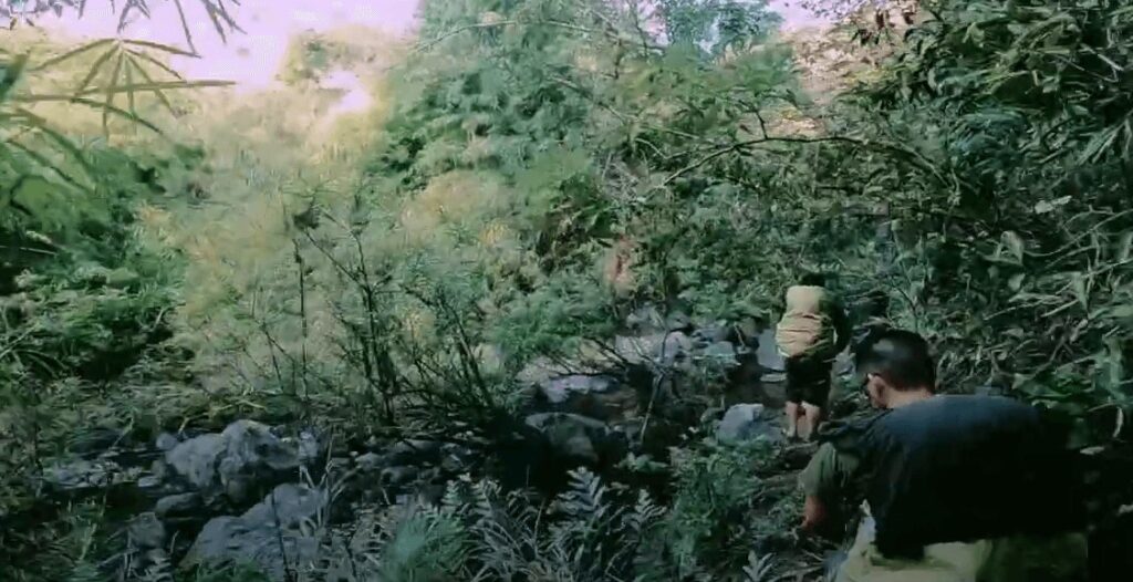
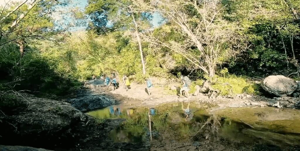
The initial trail runs on a straightforward flat ground followed by several river crossings that need to be done. Luckily we have good weather on that day and the water in the river is shallow. Even so, we need to be very careful with each step we make because much of the trail is composed of slippery rock and mud.
Around 6 am when we had our breakfast at camp 1 and at this time I have a short conversation with the other group members. I found out that most of them are experienced hikers and they already climb mountains in the Mindanao regions such as Mt. Apo and Mt. Dulang-Dulang. For this reason, I have a good vibe with the group I joined and I learned so much from them. We resume our hiking at 6:30 am and after two hours of hiking, we reach the last water source which is situated before the campsite around 8:37 am. At this point, we regroup and drink water to rejuvenate our bodies.
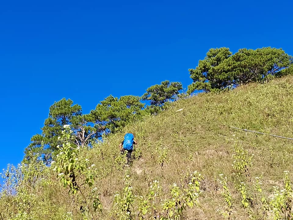
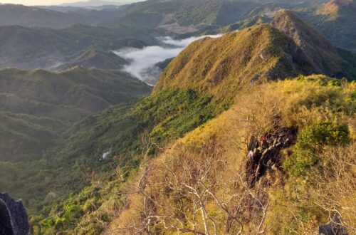
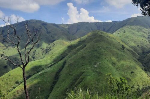
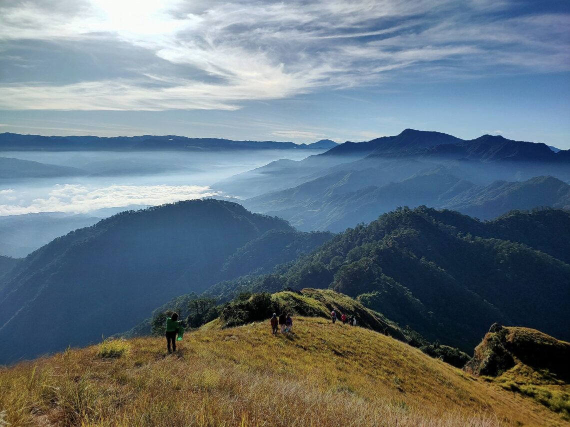
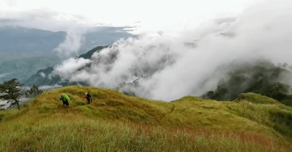
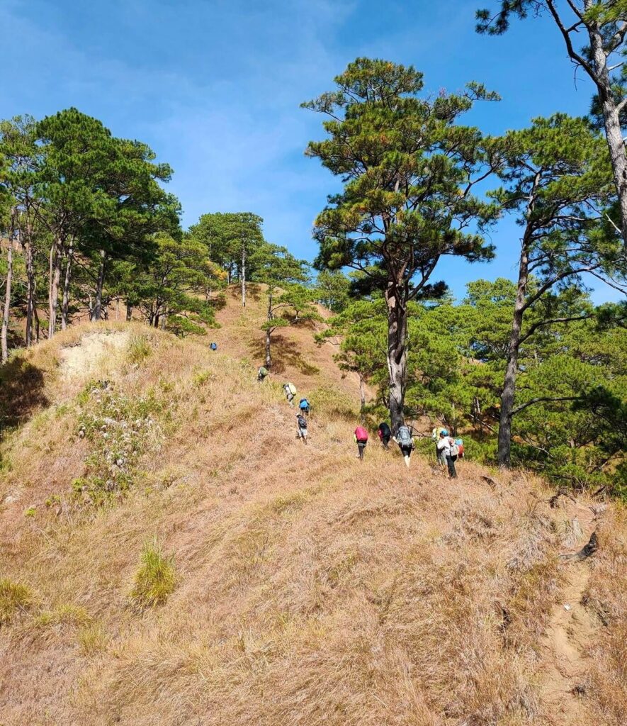
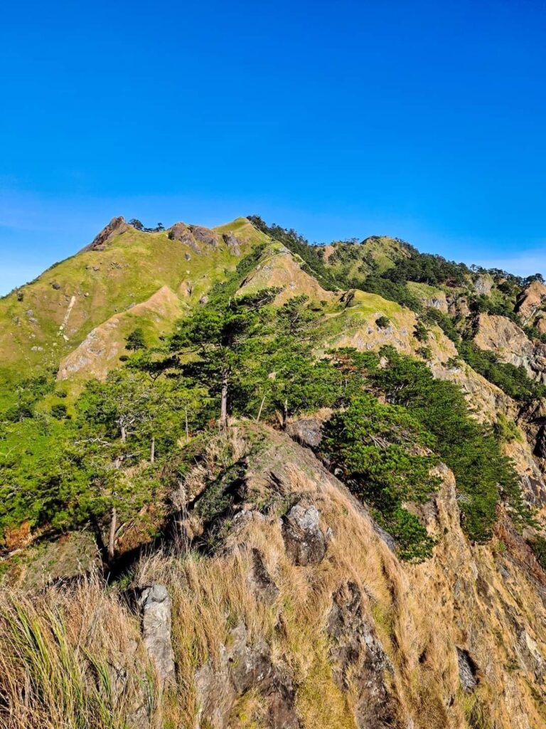
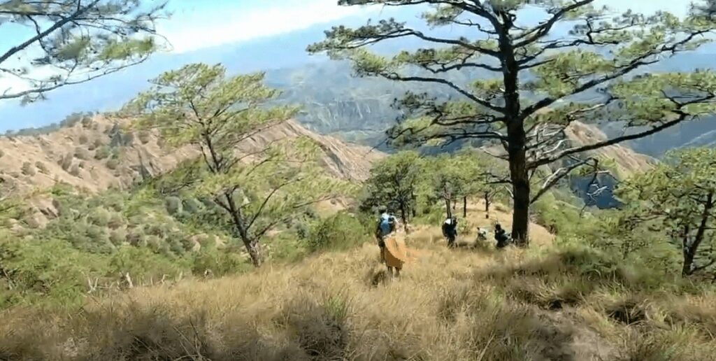
Then as we continue hiking for nearly an hour we reach the numerous open ridge part and knife edge of Mt. Tuwato. Luckily I have no fear of heights but this is the kind of trail where Saint Peter waves at the ground while feeding chickens. For this reason, we have no protection against the direct heat of the sun and I feel a super hot feeling in my groin but nevertheless, we have an astounding view of the surrounding mountains and environment. It was past 11 am when we reached the grassland part and at this time I was so tired already because of the continuous steep ascending.
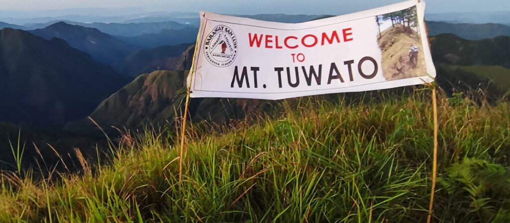
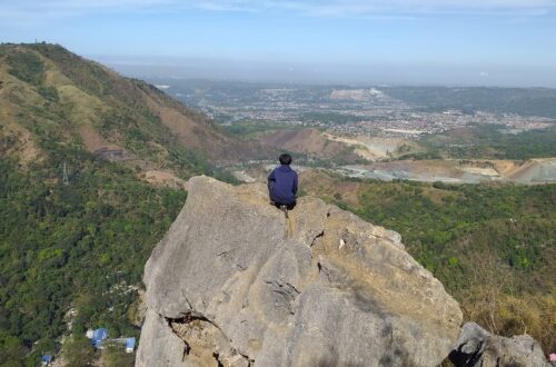
Then at 12 pm, we have taken our lunch at peak 3 of Mt. Tuwato. I eat my packed lunch consisting of egg, hotdog, and rice together with a Gatorade grape drink. After our lunch, we resume our hike and an hour later we reach the summit of Mt. Tuwato. The feeling at the top of the mountain is indescribable. It was awesome and I considered it my greatest achievement so far this year.
At the summit, I can see the towering Mt. Pulag, Mt. Namogoian, Mt. Namandiraan, and a portion of Sigay municipality and Candon City in the province of Ilocos Sur. We enjoy the cool wind blowing and the majestic view from above. Without a doubt, our group has a surreal feeling. Then a few minutes later our group started descending because we need to follow the given itinerary.
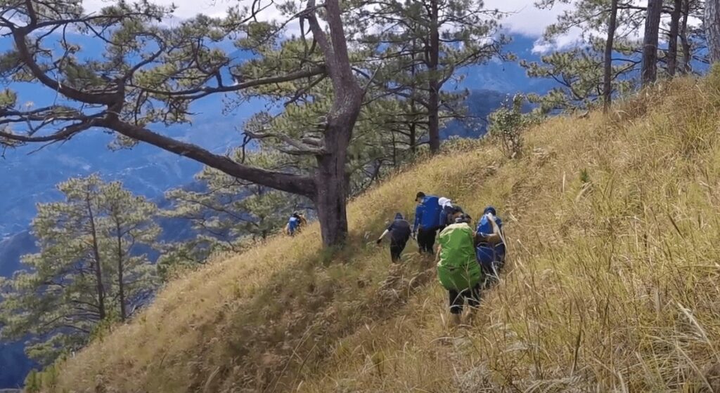
On the way down at some point, we need to use the GPS (gapang para safe) technique as we stare down between life and death. Also, I feel like the descending portion is infinite maybe because we have very slow pacing but nevertheless, we reach the last steep portion past 6 pm. Some of the group members wanted to give up already but they knew the only way to go back home is to continue hiking. Also, one of the group members named Ray gave us a motivational speech and positive thinking while hiking. On the other hand, from my perspective, the Mt. Tuwato trail is very much similar to Mt. Pulag Akiki Trail in Benguet because of the abundance of tall pine trees on the steep mountain trail.
We finish the entire hike around 10 pm and all of us our drained already. Even so, the next day we arrive at Metro Manila safely and sound. I thank Lord for keeping us safe throughout the whole climb and road trip. Also, I thank the local government units of Cervantes and our tour coordinator that made this hike happen. The overall experience is great and I will never forget this climb for the rest of my life as I considered it one for the books and the ultimate endurance hike.
Sample itinerary to Mt. Tuwato
Day 0
4PM – Meet up and assembly within Metro Manila
4:30PM – Departure going to Cervantes, Ilocos Sur
Day 1
1:45AM – Arrive at Barangay San Luis, registration, orientation, and last-minute backpacking
2:20AM – Start hiking
9AM – Ridges, knife edge, and grassland
11:30AM – Lunchtime
1:30PM – At the summit of Mt. Tuwato
2PM – Start descent
10PM – End of hiking, tidy-up
11:30PM – Departure going back to Metro Manila
Things to bring on your visit to Mt. Tuwato:
Pocket money
Packed lunch and trail food
2 to 3 liters of water bottles
Extra set of clothes
Towel
Hiking shoes and pants
Umbrella
Flashlight with extra battery
Smartphone and camera
Jacket
Knee support (optional)
Gloves (optional)
Poncho (optional)
Reminders and Tips:
- Mt. Tuwato is a major climb and has a total trail length of 23 kilometers and it’s not suitable for beginners in the hiking scene.
- The shower fee is 20 pesos and getting a climb certification after the hike cost 50 pesos.
- Always follow this principle while hiking. Leave nothing but footprints, take nothing but pictures, kill nothing but time, and keep nothing but memories.
- Discipline is the key to successfully climbing this mountain. Before the climb, make sure you do long walks, jogs, and conditioning of the mind and body to be healthy and strong.
For the most part, there’s no internet in the mountain but I promise you’ll find a better connection here. On the whole, I hope this Mt. Tuwato day hike guide has been helpful to you and your groups. Have a great day and enjoy hiking.
Jervis Ergino
Hi! I’m Jervis Ergino, the digital content creator behind Hike to Mountains, a travel and hiking blog in the Philippines. This blog is dedicated to helping people know more about the best hiking and tourist destinations in the Philippines.